I posted this episode on September 2nd but somehow it disappeared into the void, how embarrassing. Funnily enough it fits between day one, en route at last, and day three, Farina, which you may have read.
***
Day two of the Great Inland Expedition of 2016 would entail driving along the Goyder Highway.
Whilst this might sound like something that could be fixed by putting iodine in the salt, the name commemorates the surveyor George Goyder. The colony of South Australia was founded in 1836 as a free settlement, no convicts transported here! It was to be the very best of British, no unemployment and no crime. The new colony started without police force or jail. Nowadays most South Australians live in Adelaide, are extremely cultured, have double barelled surnames and an intense urge to save the planet with renewable energy. The remaining few are unemployed drug addicts who keep friends and relatives in barrels whilst collecting their unemployment benefits.
The settlers had big ambitions but soon realised that whilst they had a huge area to play with not much of it was fertile.
Explorer Edward Eyre was commissioned to find out what lay to the interior, and ambitious settlers moved out hoping that rain would follow the plough. All too often it didn’t. In 1865 Mr Goyder, the then Surveyor-General of the colony, was asked to map the boundary between those areas that received good rainfall and those that did not. After riding an estimated 3200 km on horseback he submitted his report and map to the state government. The map showed a line of demarcation, the areas north of which being those Goyder judged “liable to drought”, with the areas to the south deemed arable. He discouraged farmers from planting crops north of his line, declaring this land suitable only for light grazing.
The line is essentially the 250mm(10 inches) isohyet. It can be determined on the ground by inspection of the vegetation, north of the line there is mainly salt bush, south of the line is mallee scrub (mallee trees being slender multi-stemmed eucalypts).
Years with good rains led settlers to move north, subsequent droughts broke their hearts and brought them back. The ruins of abandoned farm houses dot the South Australian countryside.

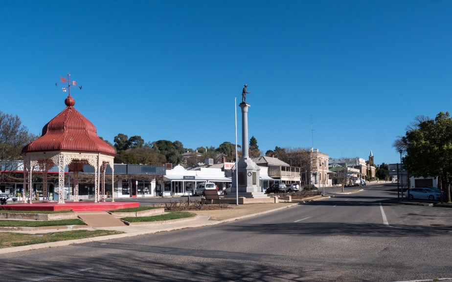
We stopped at Burra, a very picturesque town that started out as a single company mining town exploiting a large copper deposit. The mine began operations in 1848 and was largely worked out by 1877 although it operated occasionally until 1981. This was our chance to buy fresh food. Whilst the lovely Gayle shopped I ran around with the camera …


Here we parted from Goyder’s highway which runs northwest from to Crystal Brook. We would head pretty much due north into the arid zone our destination a classic example of drought versus dreams … Farina.
