In the footsteps of giants.
The Dutch started the process of mapping the coast early in the 1600s as the Dutch East India Company sought to extend its profits and increase its influence. Willem Janszoon on the good ship Duyfken got the process started in 1606 sailing south of New Guinea and reaching the eastern shores of the Gulf of Carpentaria. He was followed in 1623 by Jan Carstenszoon with two vessels, the Pera and the Aernem. Their findings failed to impress the Company bosses who decided not to deploy further resources in that direction.
Notice that I always refer to mapping rather than discovery. That neatly sidesteps the fact that people had been living in the gulf country for thousands of years prior to Europeans showing an interest. There is an open question regarding the Macassan trepangers who sailed from Sulawesi in search of “edible holothurians” AKA trepang, sea cucumbers, bêche-de-mer or sea slugs. Interaction with the locals brought about some exchange of language, genes and perhaps germs and was underway before the poms began their colonisation. Did they tell the Dutch where to look or did the Dutch tell them where to go? None of the parties left a written record of how and when trepanging started.
Written history recommences when the English come on the scene and get antsy about the French poking around the remoter parts of the continent. Enter Matthew Flinders and the first recorded circumnavigation. In 1802 Flinders in the Investigator charted the Gulph shores. You can read his account on the Gutenberg Project website for free at https://gutenberg.net.au. He had the Dutch charts with him and found that he had a lot of tidying up to do. As well as the surveying he also took a keen interest in the birdlife …
“Birds were rather numerous the most useful of them were ducks of several species, and bustards and one of these last, shot by Mr. Bauer, weighed between ten and twelve pounds, and made us an excellent dinner. The flesh of this bird is distributed in a manner directly contrary to that of the domestic turkey, the white meat being upon the legs, and the black upon the breast. In the woody parts of the islands were seen crows and white cockatoos; as also cuckoo-pheasants, pigeons, and small birds peculiar to this part of the country. On the shores were pelicans, gulls, sea-pies, ox-birds, and sand-larks; but except the gulls, none of these tribes were numerous.“
A Voyage to Terra Australis Vol 2
By the end of the voyage the map looked like this …
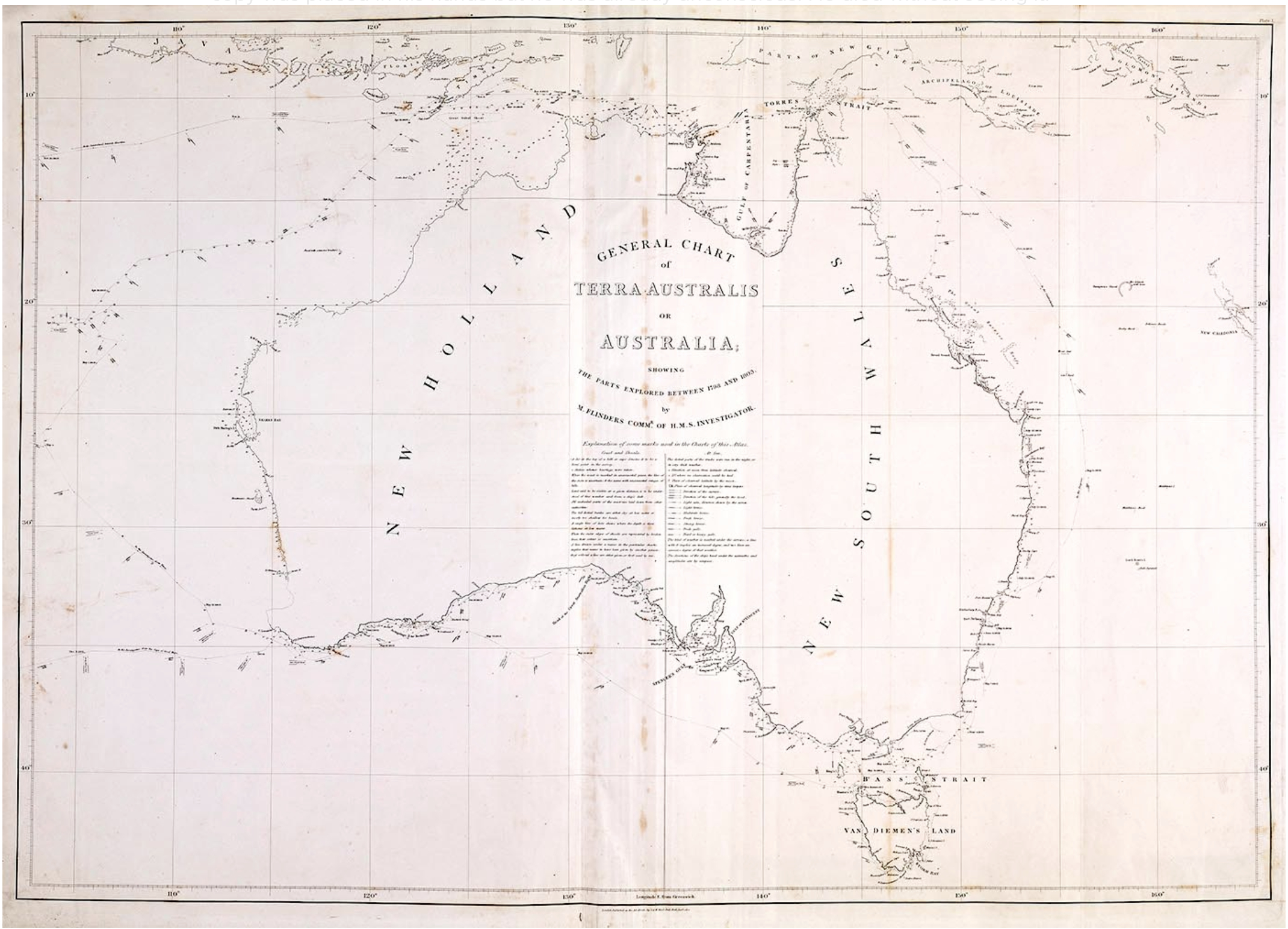
and note the name “Australia”. The word first appeared in print on a world map in a German astronomical treatise published in 1545. It is unknown if Flinders knew this and adopted it or coined the word anew. Certainly he popularised it so either way it is to him that we should give thanks for our name.
The Gulf was left to itself for a while. Meanwhile King in HMS Mermaid surveyed the Kimberley region and also found a suitable place for a settlement north of present day Darwin. A colony was founded at the second attempt in 1838 at Port Essington. It would be abandoned in 1849.
In 1841 attention swung back to the gulf when J. Lort Stokes in the Beagle refined some of Flinders work and discovered the Albert River which he ascended in a longboat for a considerable distance. He was impressed with the grazing prospects on the banks.
With the seaside sorted it was now time for a land based expedition to find where to put the hotels and ice-cream parlours and establish a route for the cattle to reach the rich grazing lands. First out of the blocks was the enigmatic Ludwig Leichhardt leading a private expedition. He gets a mixed press. Sometimes portrayed as a hero sometimes as a bit of a nutter. He was from Germany via England. He had studied at university but never received a degree, continued a study of natural history and botany in England and France again without gaining formal qualification. He and his party with one exception had little or no experience in the Australian bush. He was volatile and involved in at least one fist fight in the course of the expedition.
At the last minute the party was joined by John Gilbert a distinguished ornithologist and collector who did know what he was doing. Unfortunately he died of a spear wound along the way.
The party sailed to Moreton Bay then set off overland in October 1844. Leichhardt arrived in Port Essington on 17 December 1845 after traveling roughly 4800km. The return journey was by ship. He received a hero’s welcome. He went on to lead two more expeditions neither of which was a great success. The second was quickly abandoned due to illness. The outcome of the third is unknown – no one returned to tell us. It may have ended somewhere in the Great Sandy Desert.
Next up was Augustus Charles Gregory. His party sailed from Moreton Bay in August 1855 around Cape York and west past the then abandoned Port Essington to the Victoria River not far from the present day town of Timber Creek NT and the WA border. After exploring south and west he headed east across the gulf pretty much retracing Leichhardt’s steps. Along the way he found a river that Leichhardt had misidentified as the Albert and was kind enough to name it the Leichhardt River. Gregory went on to a very distinguished career.
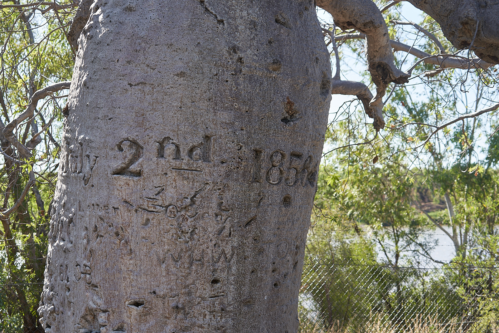
There is a Boab at Gregory’s base on the Victoria river bearing an inscription. Sir Ferdinand Jakob Heinrich von Mueller, Australia’s most famous botanist described and named the species Adansonia gregorii in honour of his leader. So it truly is Gregory’s tree.
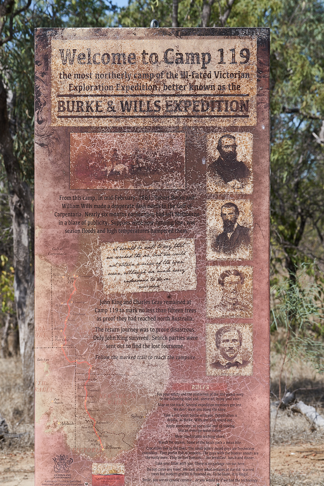
In 1861 Burke and Wills on their expedition north from Melbourne crossed the tracks of these parties on the east side of the gulf.

Mueller also introduced Blackberry to Australia. Spreading it around to provide food for people lost.
Great work on the history of the Gulf.