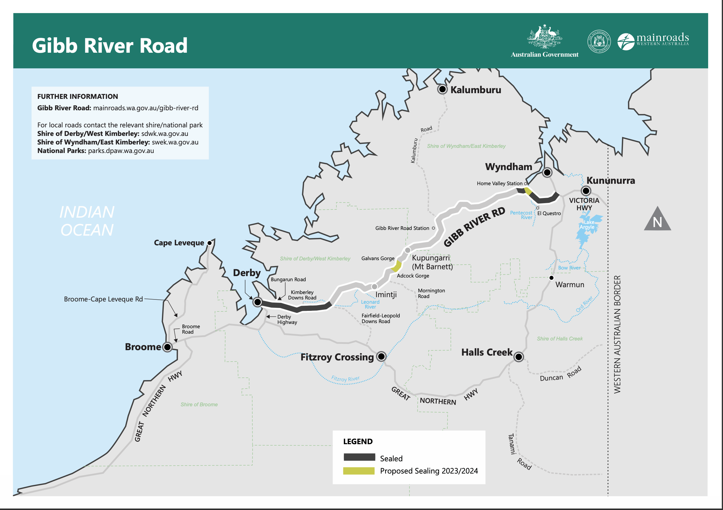
It was time to head west on the infamous Gibb River Road. It is a great adventure, 647km of mostly unsealed, corrugated track. If you are considering traveling it for the first time Main Roads WA have some good advice for you.
The best way to prepare a caravan is to take a tent. If that is not an option then you will find out just how honest the salesman was when he told you about the off-road capabilities of that shiny new van.
Heading west the fun begins at the Pentecost River. It is quite wide. There is no bridge. The “road” surface is rocky. The depth of the water varies and there may be crocodiles. Two pieces of good advice collide in this situation. Never drive through water of unknown depth – walk it first. Don’t enter the water with Estuarine Crocodiles. Be patient, someone else will give it a go before long. If they walk it have the camera ready. When they drive watch carefully.
The next sizeable river is the Durack, usually deeper but not as wide. Between the two your beer cans will rub through, eggs will shed their shells and your teeth will rattle in their sockets. It pays to wear a sports bra, yeah, boys too. You must have a screw loose. More than one. Guaranteed.
Durack RiverBoabs
Our destination was Ellenbrae where we caught up with good friends who were working there.
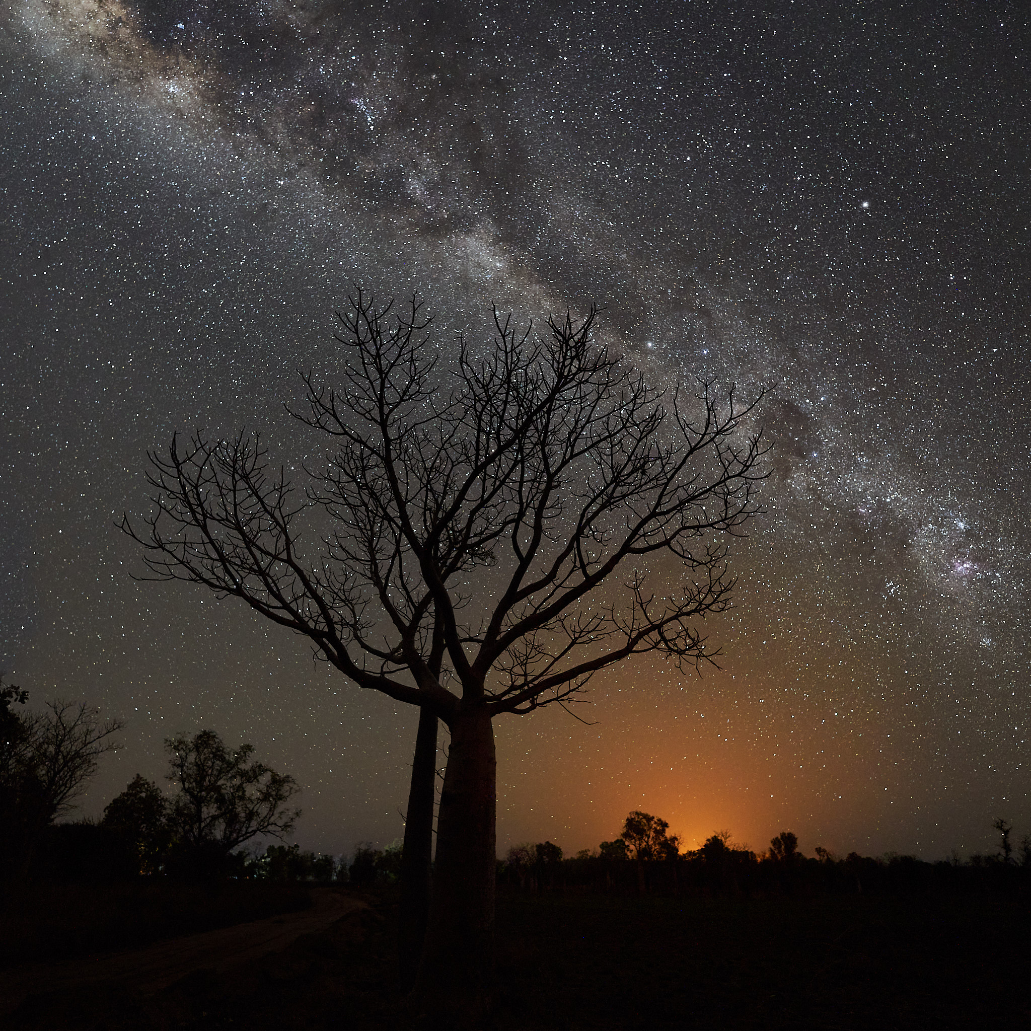
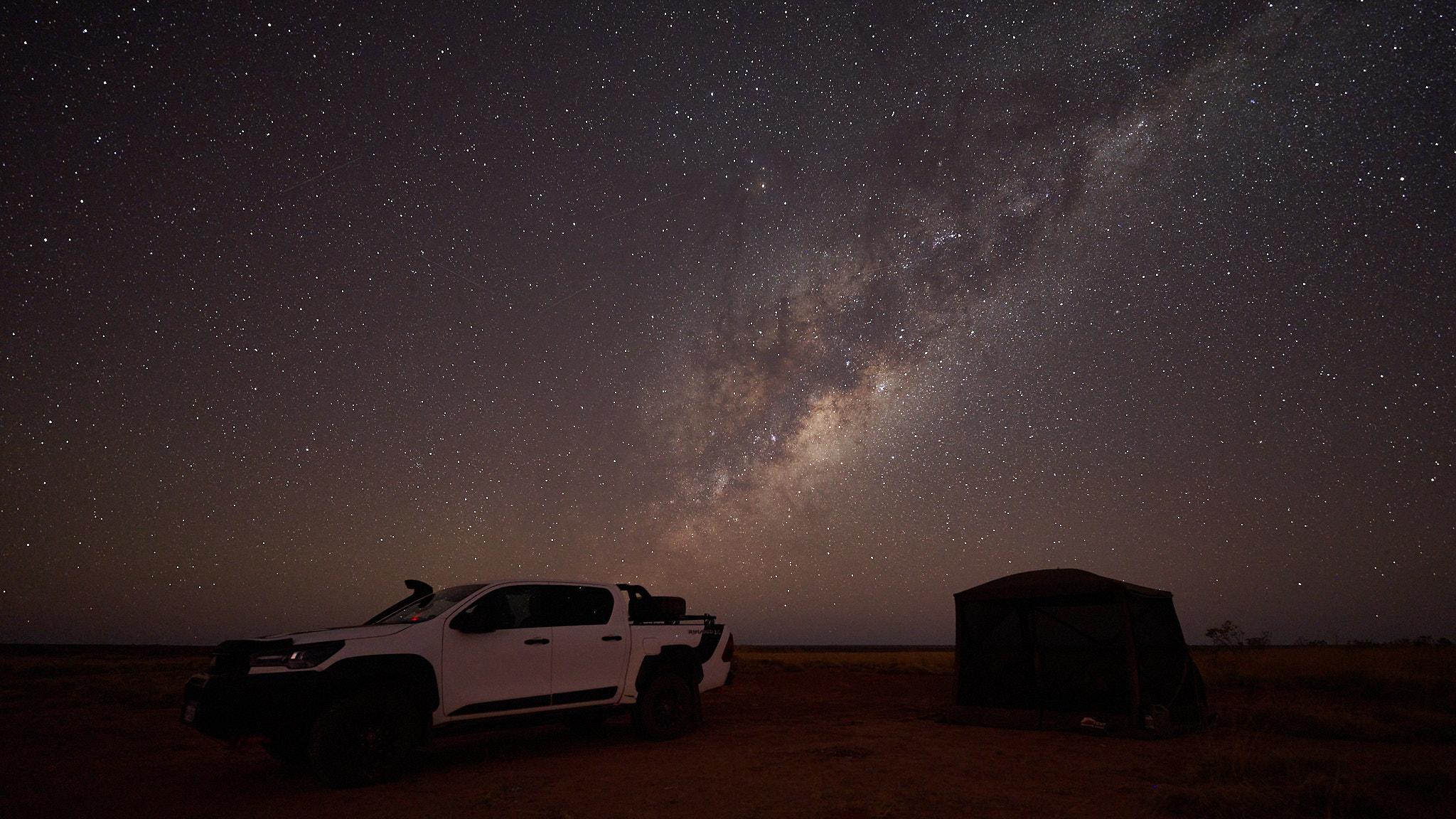
It has long been my ambition to shoot the milky way with Boab trees as the foreground. There are some beauties around Parry’s. I had chosen the timing of the trip to keep the moon out of the equation. I was not expecting the country to be on fire. Early in the dry season is a good time for managed fuel reduction fires, so called cool burns. Rumour had it that someone thought they were really cool and enthusiastically lit a whole bunch more. So I had to contend with a lot more ambient light than I expected. Somehow I coped.
The stops so far have been one night stands – way points with benefits. Parry’s is a destination.
Broome has no duck pond in the park and no sparkling brook to walk beside. Just as Eskimos have many words for snow Australians have numerous endings for the phrase that starts with “as dry as …” mostly impolite. Except when it’s flooded Broome is as dry as any of these things. Parry’s Lagoon is a different story.
Parry’s Creek Farm is near the small town of Wyndham. It’s surrounded by the Parrys Lagoon nature reserve and unlike the nature reserve is dog friendly. It is a favourite destination and the first stop where we stayed a few days. If the word resort conjures up a vision of Piña Coladas (whatever they are) from the swim up bar forget it. But there is a pool, also a restaurant which serves a good meal. The service was excellent.
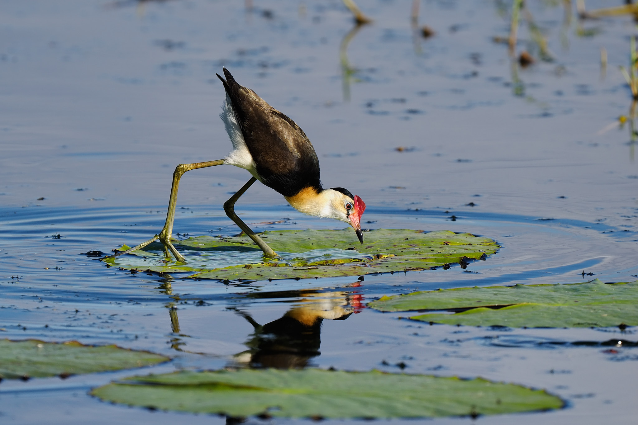
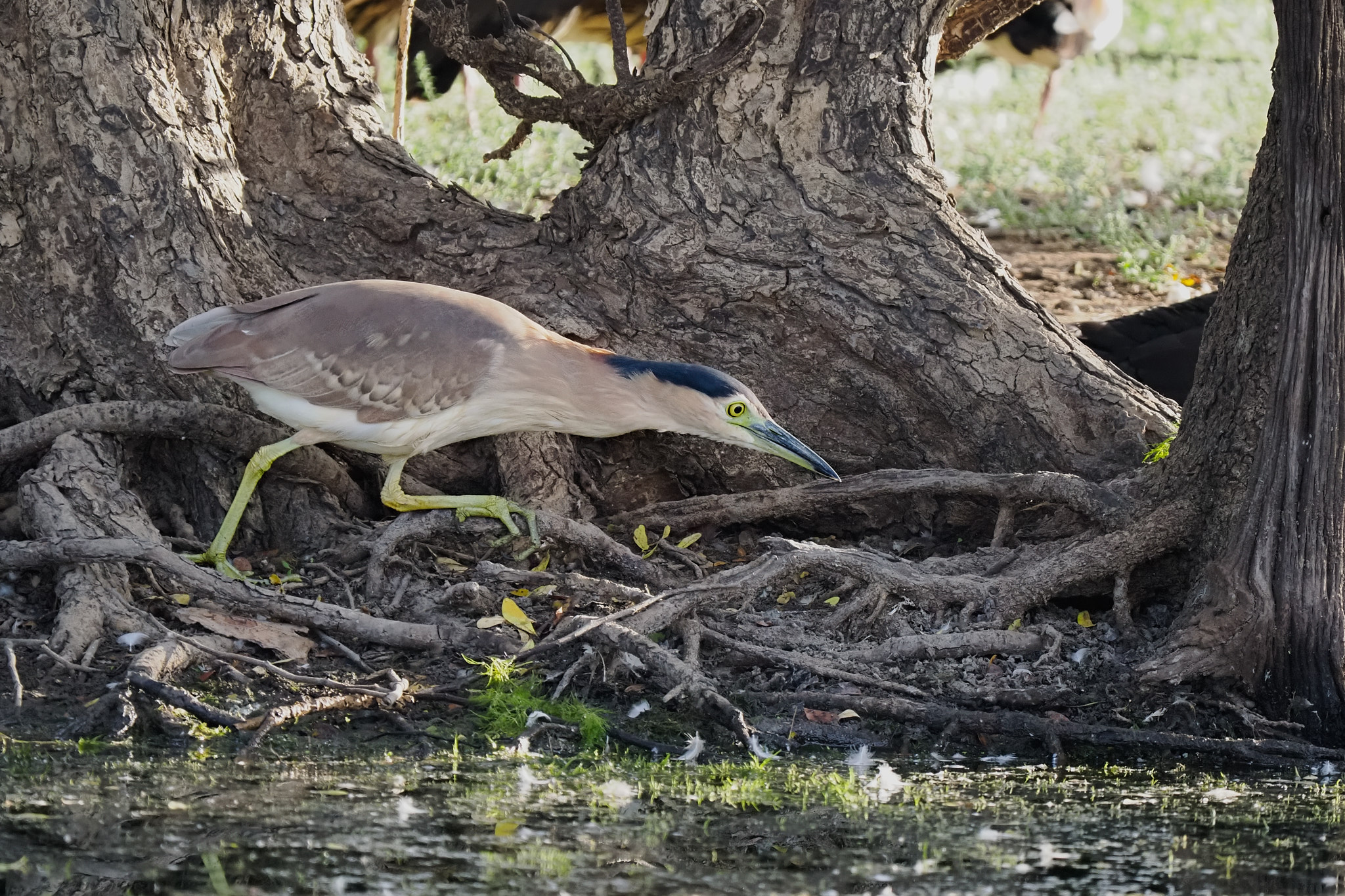
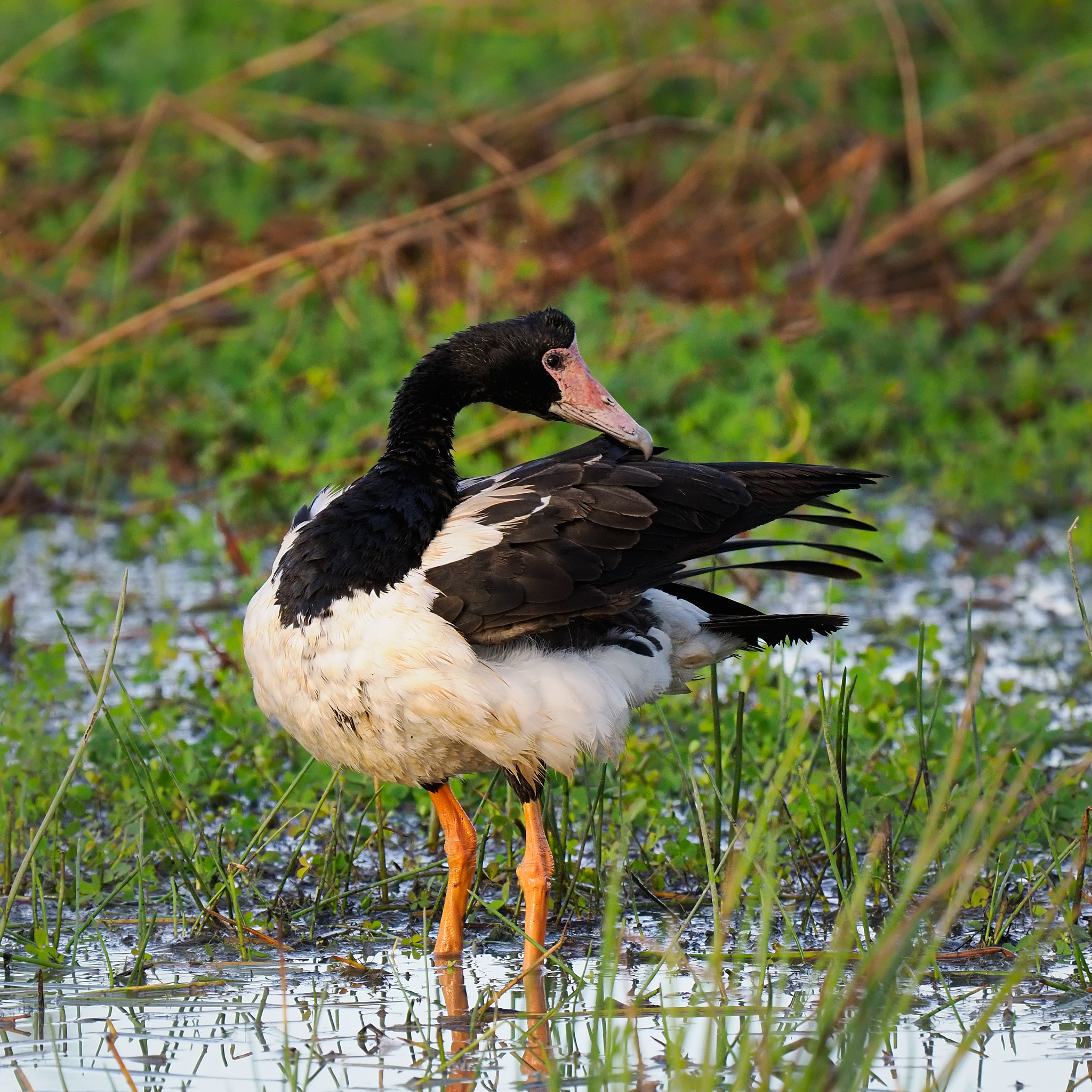
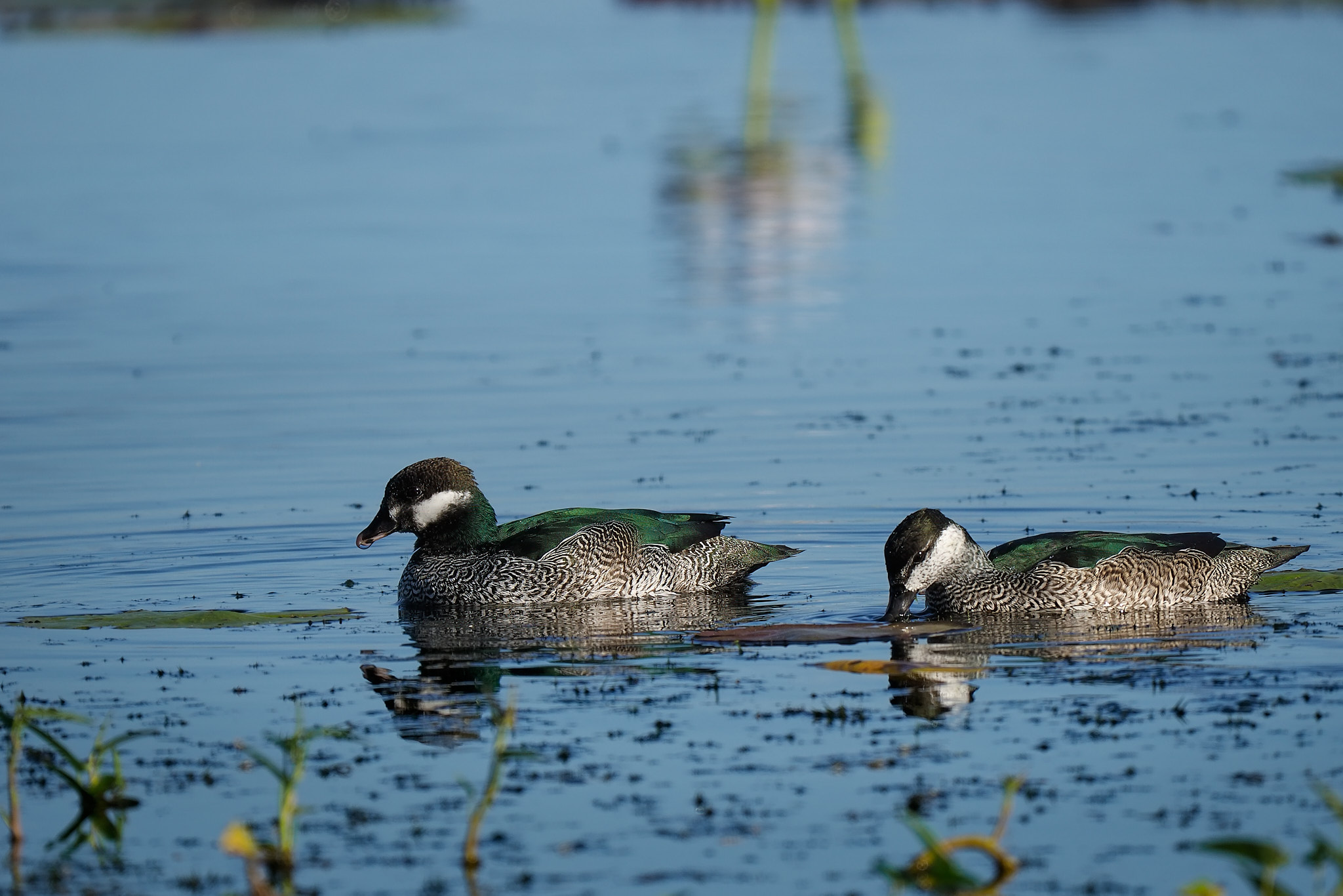
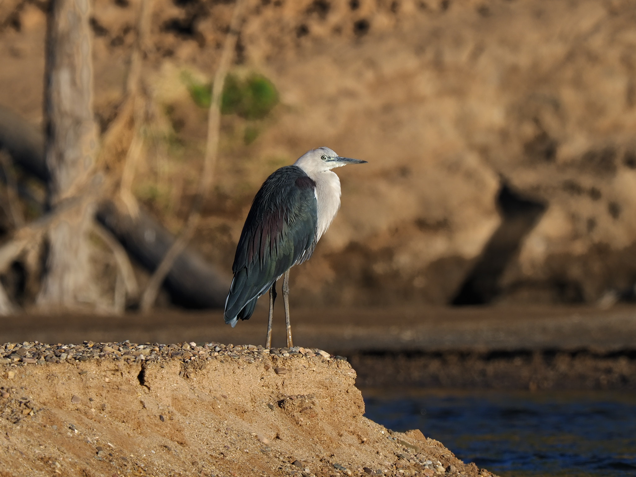
In the reserve you can visit Telegraph Hill for some WW2 history and some nice Boabs. Then continue to the bird hide at Marlgu Billabong to boost the bird list.
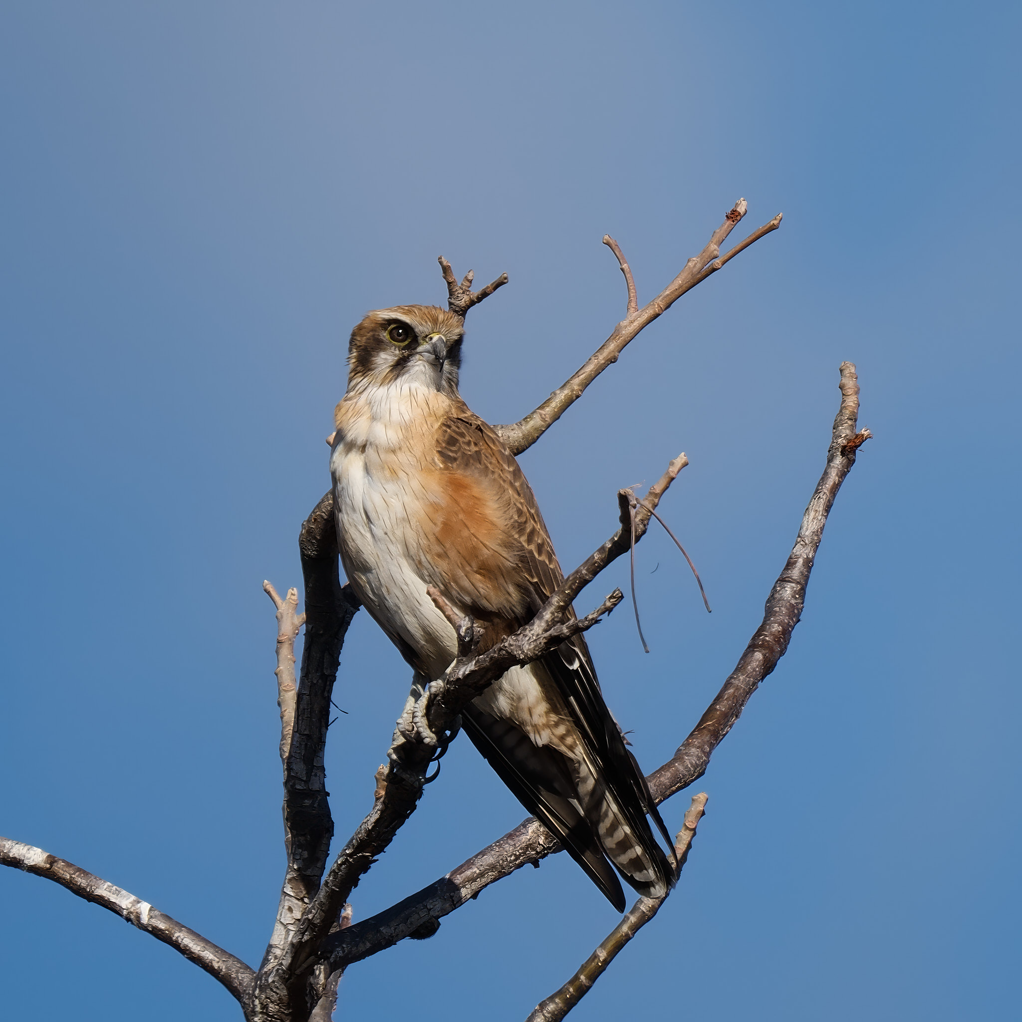
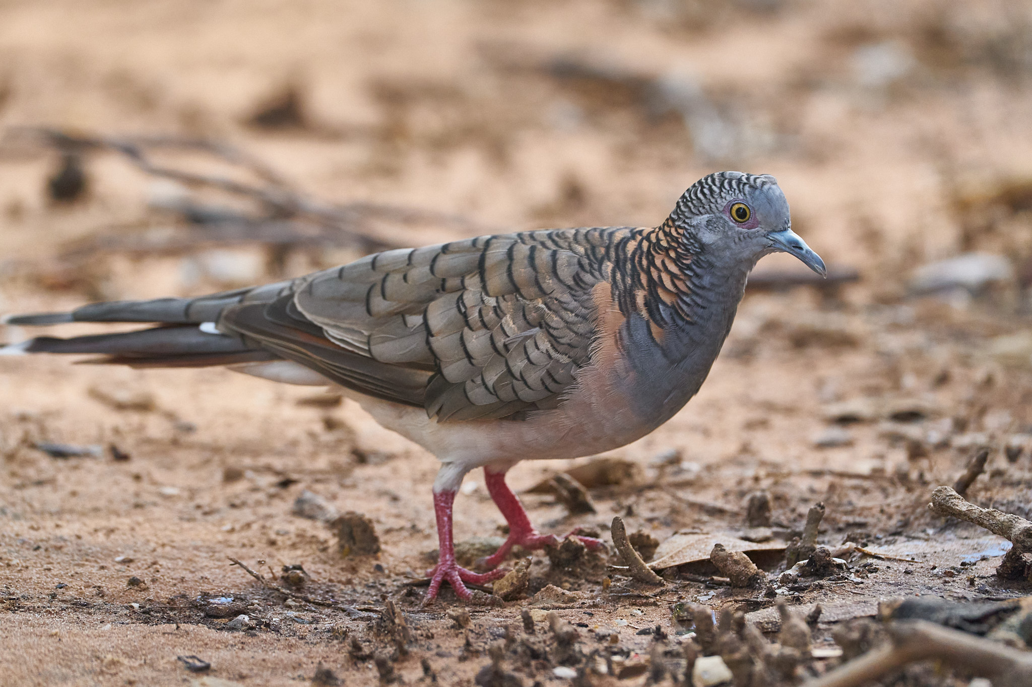
Australian SwamphenGlossy IbisComb-crested JacanaComb-crested JacanaPied HeronNankeen Night HeronNankeen Night HeronMagpie GooseRadjah ShelduckGreat EgretPlumed Whistling DuckGreen Pygmy-goosePied HeronNankeen Kestrel
There is a smaller billabong on Parry’s Creek Farm as well. It is surrounded by a small patch of rain forest. Some pleasant walks radiate from the camping area with more wildlife watching potential.
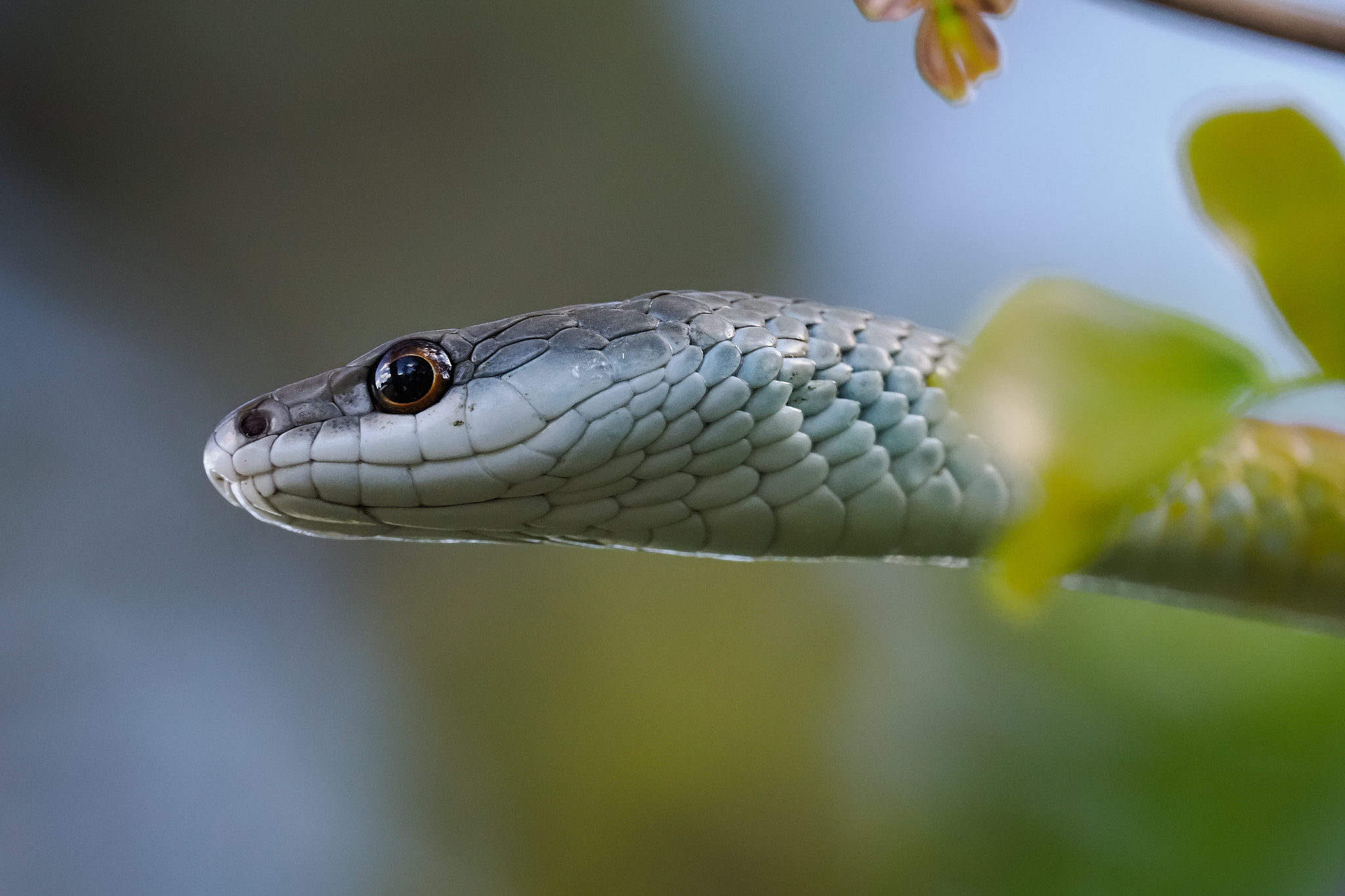
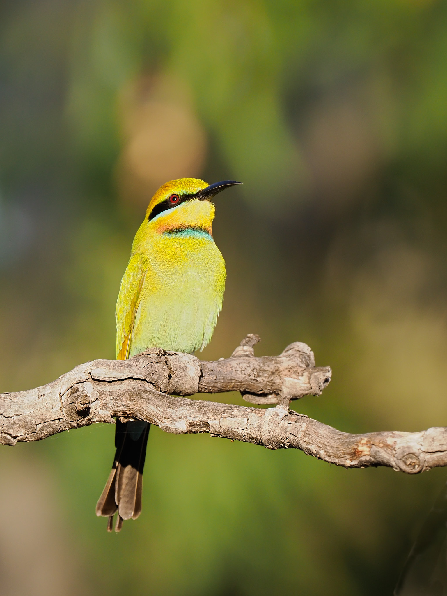
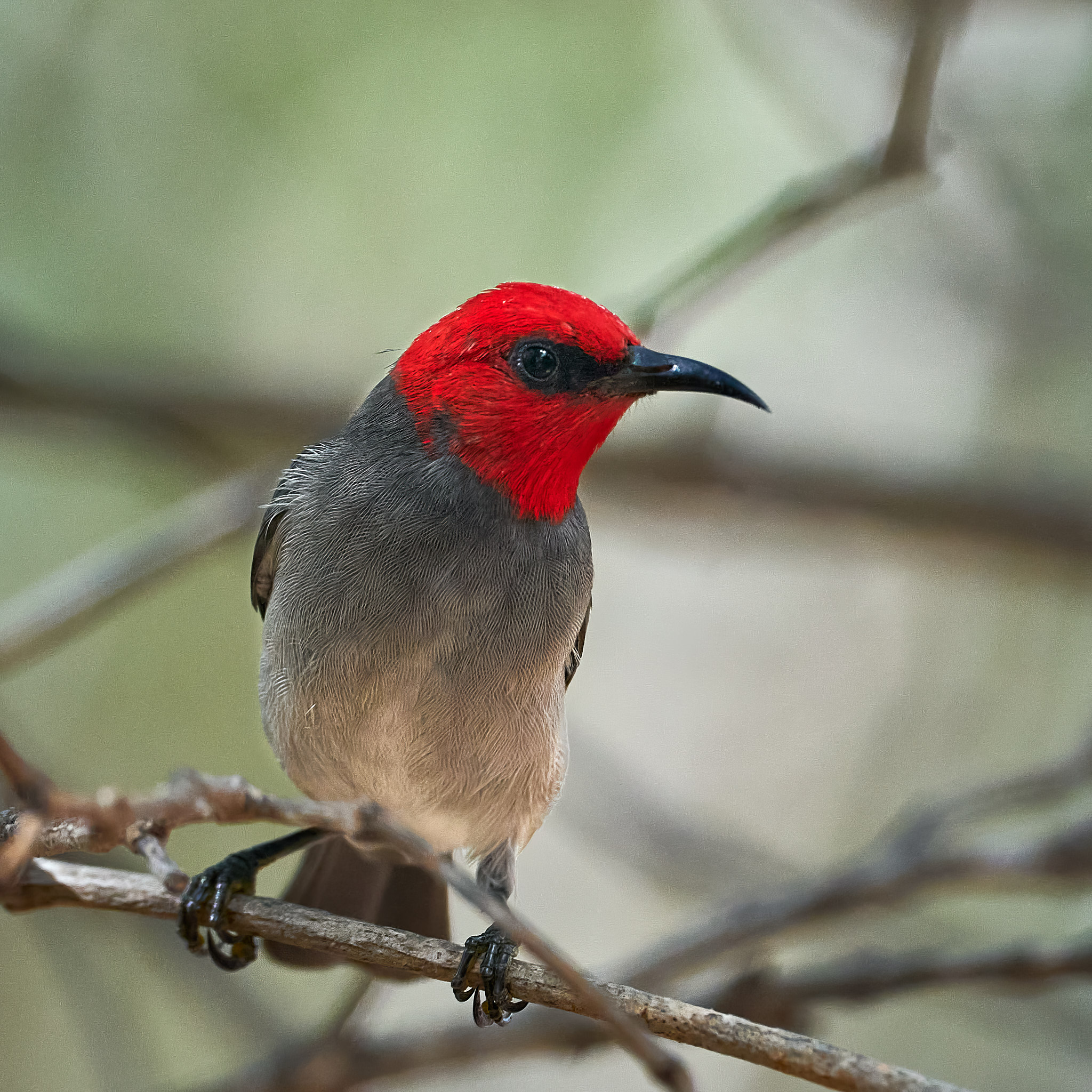
Common Tree SnakeCommon Tree SnakeRainbow Bee-eater
Up next. Nightfall brings a new suite of possibilities …
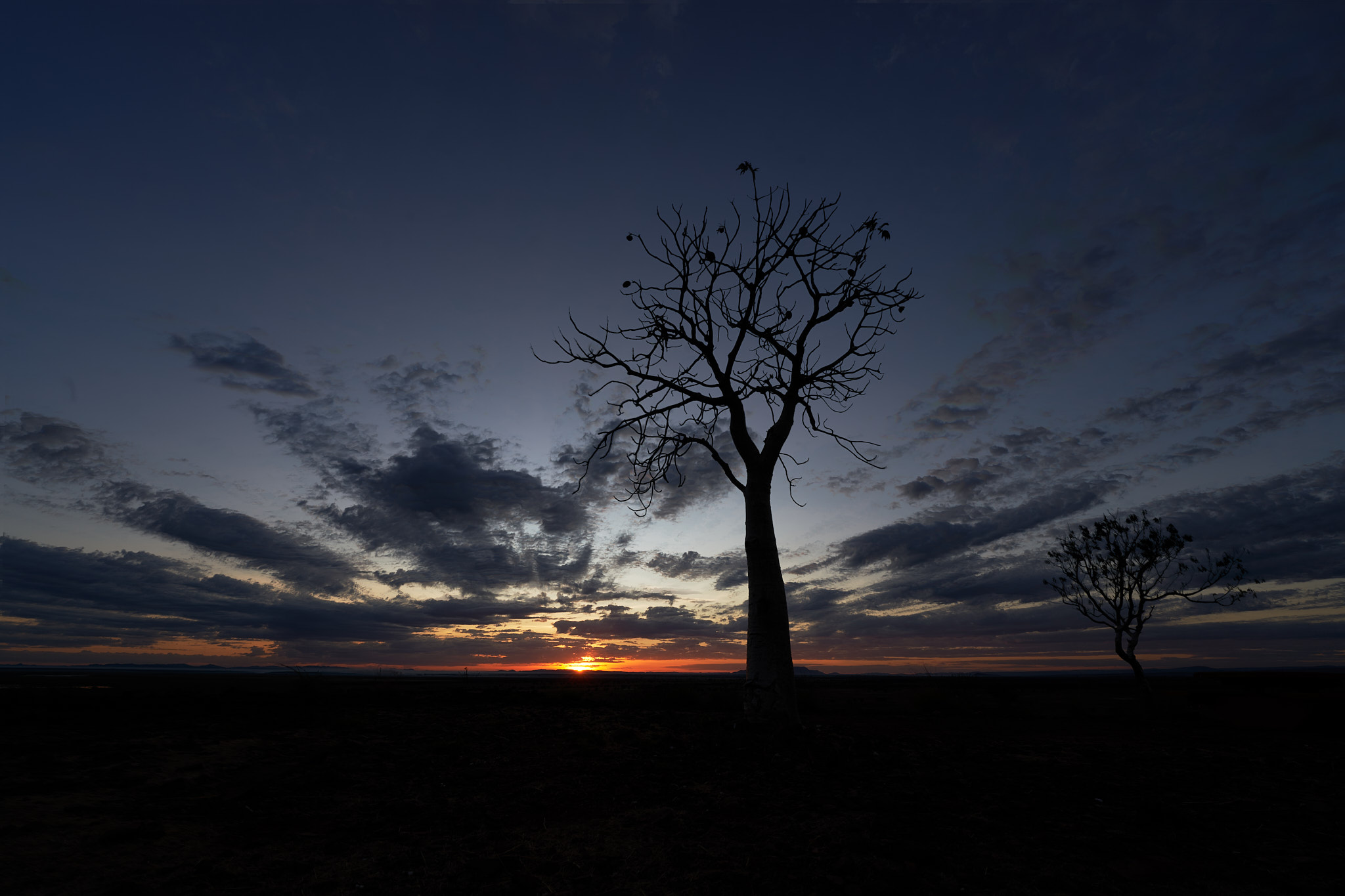
The start of our trip corresponded with the new moon. I was keen to take advantage of the dark sky. At Larrawa I found a nice spinifex foreground. The following night we stayed at the Leycester rest area and I found a few skinny young Boabs not far away. Some bonus lighting was provided by a passing car.
Leycester rest area is a 24 hour free camp with toilets, a dump point and rubbish disposal. It’s adjacent to a very beautiful spot on the Ord river and it’s only a hop skip away from the Bungle Bungles turn off. Given all of that and the time of the year it’s no surprise that it was packed. The river bank sites are the first to go.
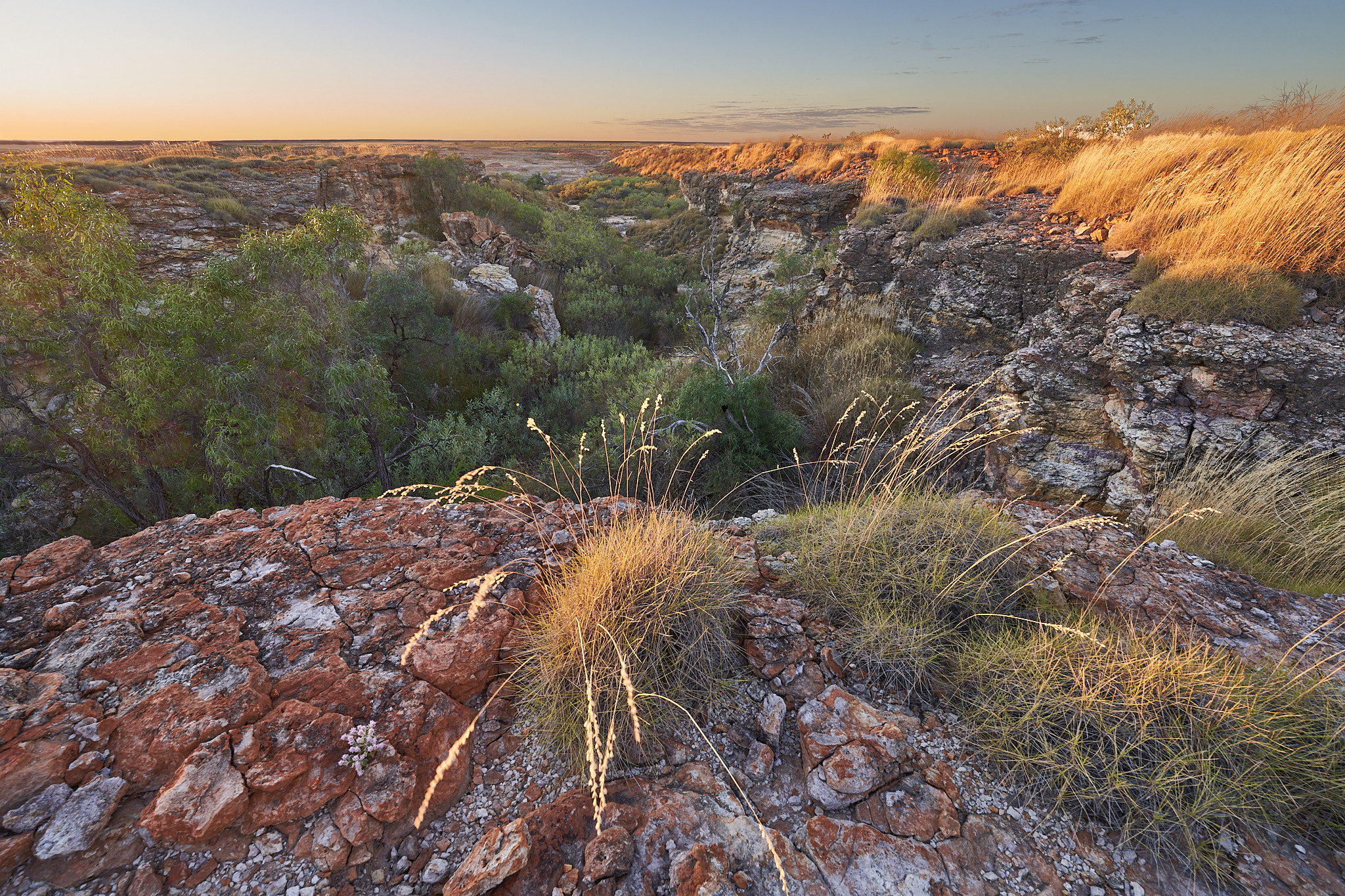
Larrawa Station is 146km east of Fitzroy Crossing. The camp ground is 4km off the Great Northern Highway. We were there early and chose our spot. Is was pretty full by the end of the day, a basic but very pleasant site.
A walk of about one and a half kilometres brings you to Christmas Creek. Boabs and cattle are the highlights along the way. The first creek bed was dry, the second one contained a nice billabong. Both channels would be running a banker at Christmas given that our southern Christmas is a summer event and summer is the wet season up here. Come in winter.
The billabong was the place to find the birds.
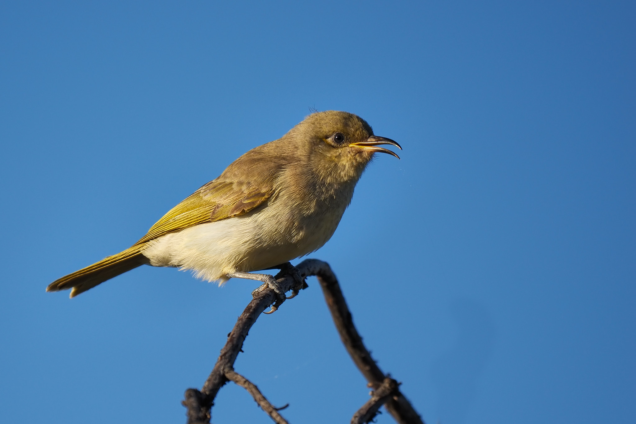
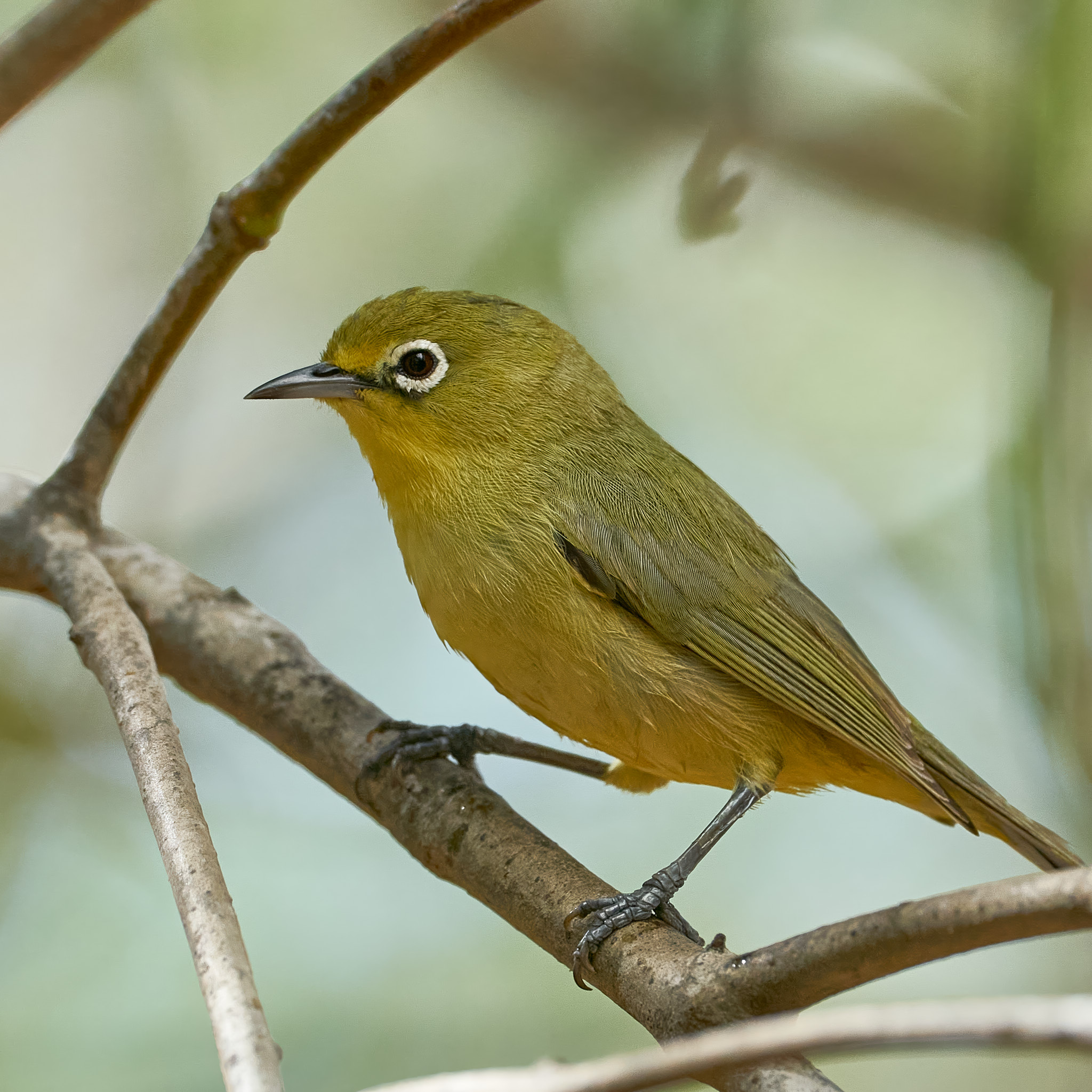
Brown HoneyeaterPainted FinchPainted FinchSacred Kingfisher
First night was at Fitzroy Crossing. It has a nice new bridge, speedily built after its predecessor was destroyed by flood in the big wet of 2022/23. It also has a bad reputation for hostile natives, stones thrown at vehicles and theft from vans and cars. The Fitzroy River Lodge is a very lovely caravan park on the banks of the river. We enjoyed our stay, experienced no hostility whatsoever and wouldn’t hesitate to stay there again.
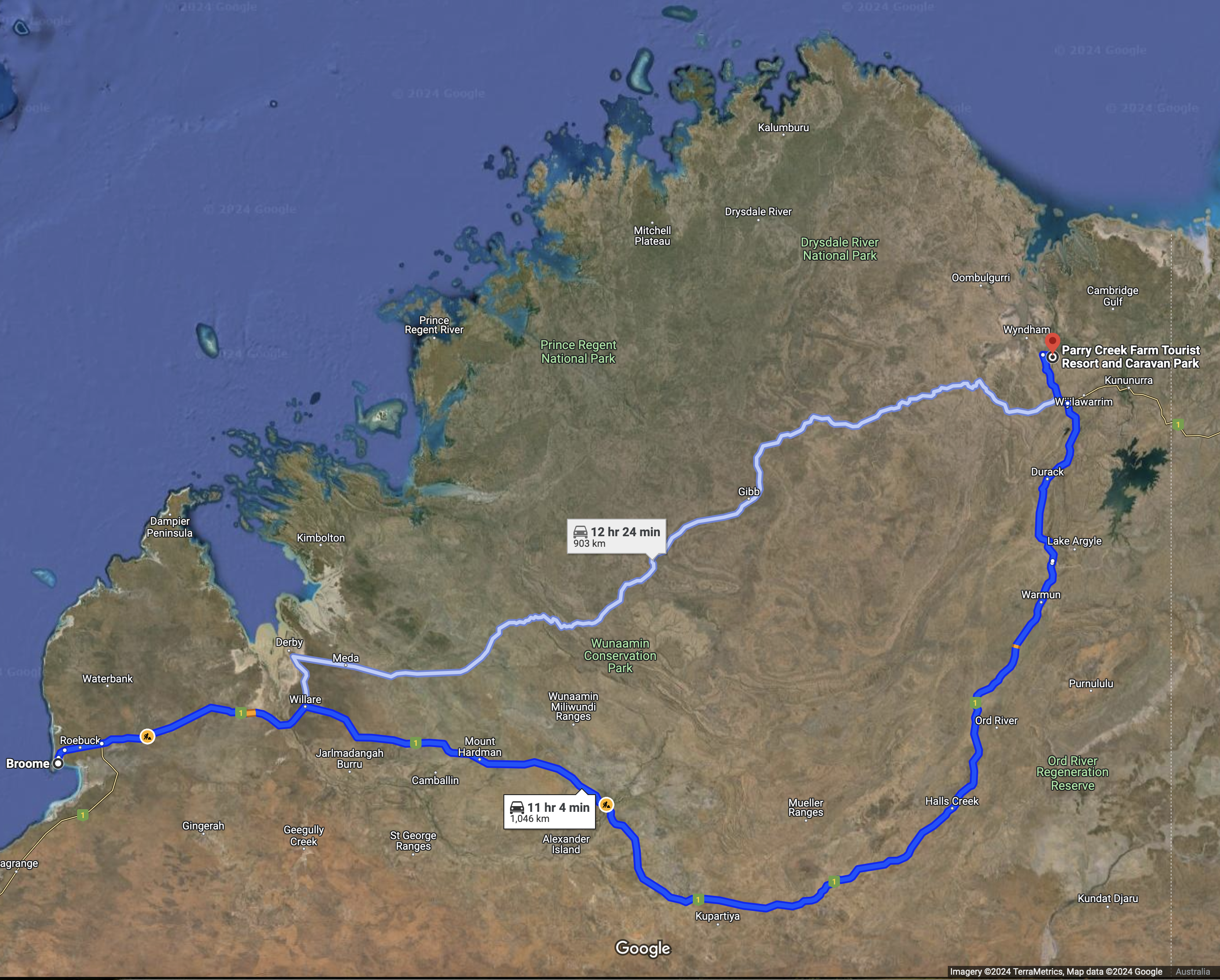
Safely home in Broome after an anticlockwise circuit of the beautiful Kimberley. We caught up with good friends and our little caravan survived the notorious Gibb River Road but not entirely unscathed.
With additional running around we traveled 2400km, saw 116 species of birds and took a few thousand photographs.
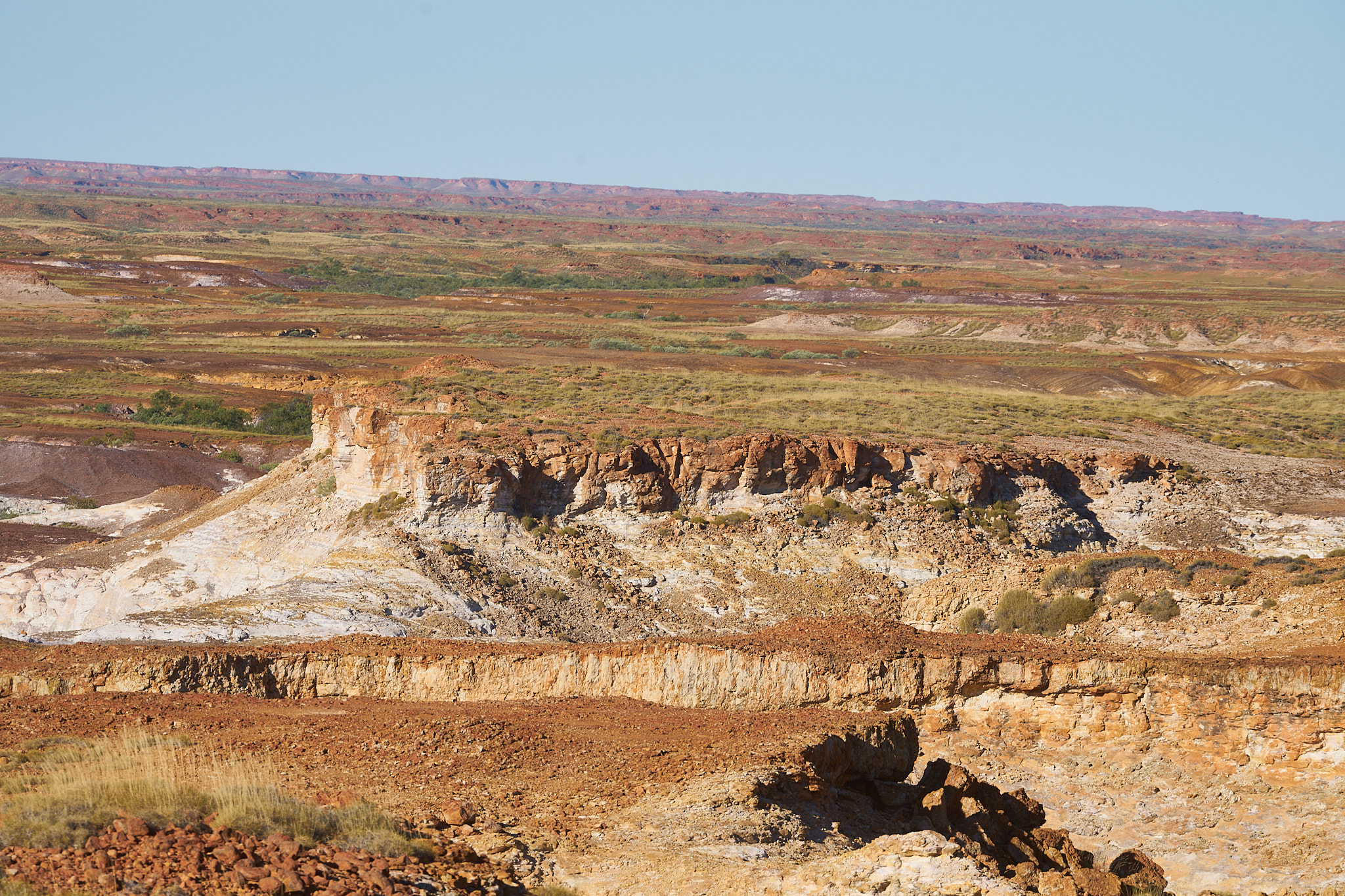
The Kimberley Craton is one of the oldest chunks of Australia. It collided (very slowly) with the Northern Australia Craton during the Paleoproterozoic era, 2.5–1.6 billion years ago. Sedimentary basin formation and time then conspired to produce the sandstone gorges and rocky ranges that make this area one of the most visually splendid in all of Oz.
And Boabs. There may be photos of Boabs (when I catch up with the editing).
I know, I know. I said goodbye and I’m still here. Don’t you hate that. This post was in the works. I didn’t think I’d have it ready but I’ve worked deep into the night. So here it is. Goodbye. I’m off to the KImberley.
The story begins in July 1999 when some 4WD’ers found a bicycle and some camping gear on a lonely sandy track in the Great Sandy Desert.
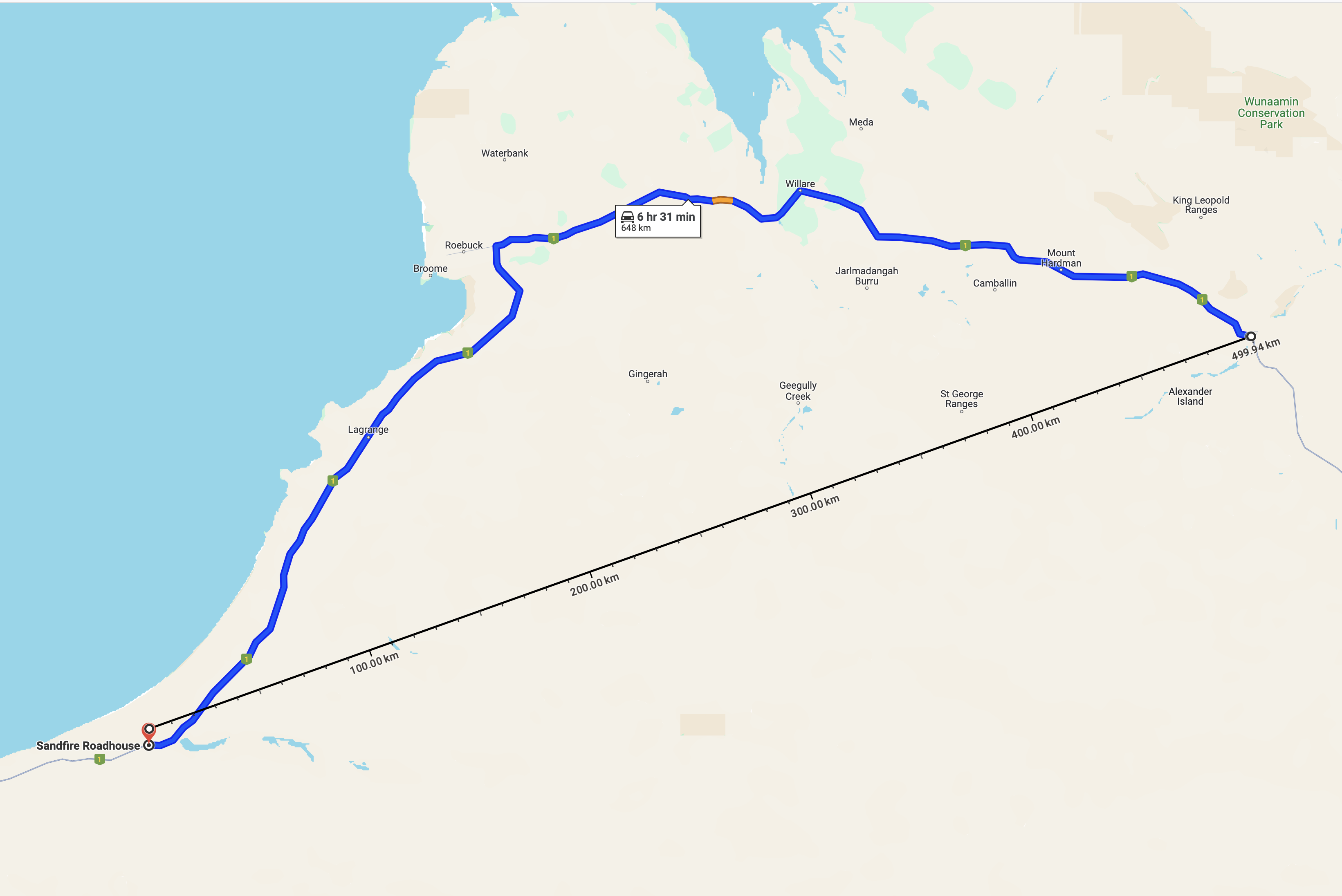
Once the first mystery was solved a search began for one Robert Bugucki, a fire fighter from Alaska who had set out to cycle across the Great Sandy from the Sandfire Roadhouse to the small town of Fitzroy Crossing. There is a bitumen road from one to the other. It takes a gentle curve around the desert. Google suggests 35 hours of peddling time should do the trick. However our Robert had chosen the short cut. 500 km as the crow flies, nothing but desert in between. What could possibly go wrong?
Broome police began a search. The initial finds were made about 50 km east of the highway. With the aid of Aboriginal trackers they covered another 150 km before their 4WD vehicles could go no further. The search continued from helicopter. And was then abandoned. Mr Bogucki’s girlfriend was said to have told the police that he may have been hiding from them in order to extend his time in the wilderness for spiritual reasons. He was a very religious man.
At that point Mr Bogucki’s future depended on accurate navigation, stamina and his ability to find water.
Mr B’s parents thought more should be done and commissioned the 1st Special Response Group founded and headed by Vietnam and Gulf War veteran Garrison “Gunslinger” St. Clair. They flew in from the USA and talked up a brand new Desert Storm. Don’t misunderstand me, some of my best friends are American but …
The circus had come to town. The chain smoking (cigars, of course) fast talking St. Clair and his team plus bloodhounds (with little boots to protect their feet from the spinifex) got to work … and saved the day. Without ever finding anything. “We are from America and have come to show you how it’s done” didn’t go down all that well. Channel 9 News sent a crew to cover the search. I suspect largely to document the debacle and make sure that St. Clair’s failure occurred in the glare of a good Aussie spotlight. As the Aussies said in WWll “Over paid, over sexed and over here”. Friendly rivalry.
This seems like the right moment to insert the fact that in reality St. Clair had no military record whatsoever but had done time in the States for fraud. When that news broke Gunslinger countered that when you were involved in black ops the records were concealed. He was happy with who he was. But perhaps unhappy that his criminal record hadn’t been sufficiently concealed.
The Nine Network crew chartered a helicopter and headed to the 1st Special Response Group’s camp in the desert. On the way there the pilot spotted a blue bed roll in the scrub, landed and found with it a bible and some hand written notes. This news was radioed to the searchers who headed across country to the helo and confirmed that it all belonged to the missing man.
The News crew prepared to head back to Broome to get the news of their discovery out to the world. St. Clair readied his bloodhounds. On the flight back to Broome, however, the pilot saw Mr Bogucki himself in the scrub, landed and after the filming and interview was finished – a scoop is a scoop – flew him back to civilisation.
Robert Bogucki had spent 43 days and 42 nights in the wilderness, had found water – he was clutching some muddy liquid when discovered – had lost a lot of weight and was lucid. He was at least 200km from his destination. Indeed he was at least 200km from the bitumen in any direction he might choose. He would surely have died a very lonely death had he not been found. Instead he made a complete recovery. All thanks to a sharp-eyed helicopter pilot named Andrew Beaumont flying a routine charter.
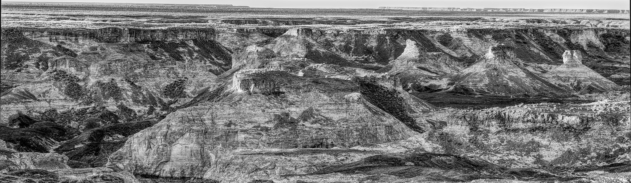
I haven’t been able to find exactly where Robert Bogucki was located but it was, I know, close to the gorge that I recently visited. Very tough country to walk in.
When I write about interesting places and I’m diligent in getting the posts up regularly my readership grows. If you’re new to these pages welcome, to my regulars welcome back. In either case thank you for coming.
I live in Broome. Top left hand side of the map of Oz. Many non Australians think that Australia is permanently hot and sunny. Broome is exactly that. Except when it’s pouring with rain. That happens in our summer … Occasionally.
About 15,000 people live here and we get plenty of visitors in winter because the truth is that Australia’s climate in more southerly regions is not warm and sunny all year round. Our tourists have barely thawed out by the time they get off the plane. We are about 10 days past the winter solstice. Today’s forecast maximum is 31°C (88°F) tonight’s minimum 16°C (60°F). It’s not going to rain.
There is just one road from Broome to the rest of Australia. About 35 km out it branches. Turn right for Perth, straight on for Darwin. Turn right and you’re heading south, the next town is Port Hedland, similar population, 610 km! Two road houses in between, negligible population. If you go straight on i.e. north-east you won’t get to a town as large as little old Broome until you get to Darwin, 1,871 km away. In between there are a few little towns that would struggle to qualify as hamlets elsewhere.
Why so few people? Because the country up here is permanently hot and sunny. Except when it’s pouring with rain. That happens in our summer … Occasionally. It’s a desert. Annual rainfall less than 250mm. Annual evaporation would be 3 to 4 meters if there were 3 to 4 meters available!
There are apparently ten deserts in Australia although I am unsure how they decide where one ends and another starts. The local desert is the Great Sandy Desert, a testament to the imagination of our forefathers (and yes, there is a Little Sandy Desert, you’ll recognise it when you see it. It’s only half the size. Also a Stony Desert). The Great Sandy (267,250sq.km) is our second largest (to the Great Victoria at 348,750sq.km).
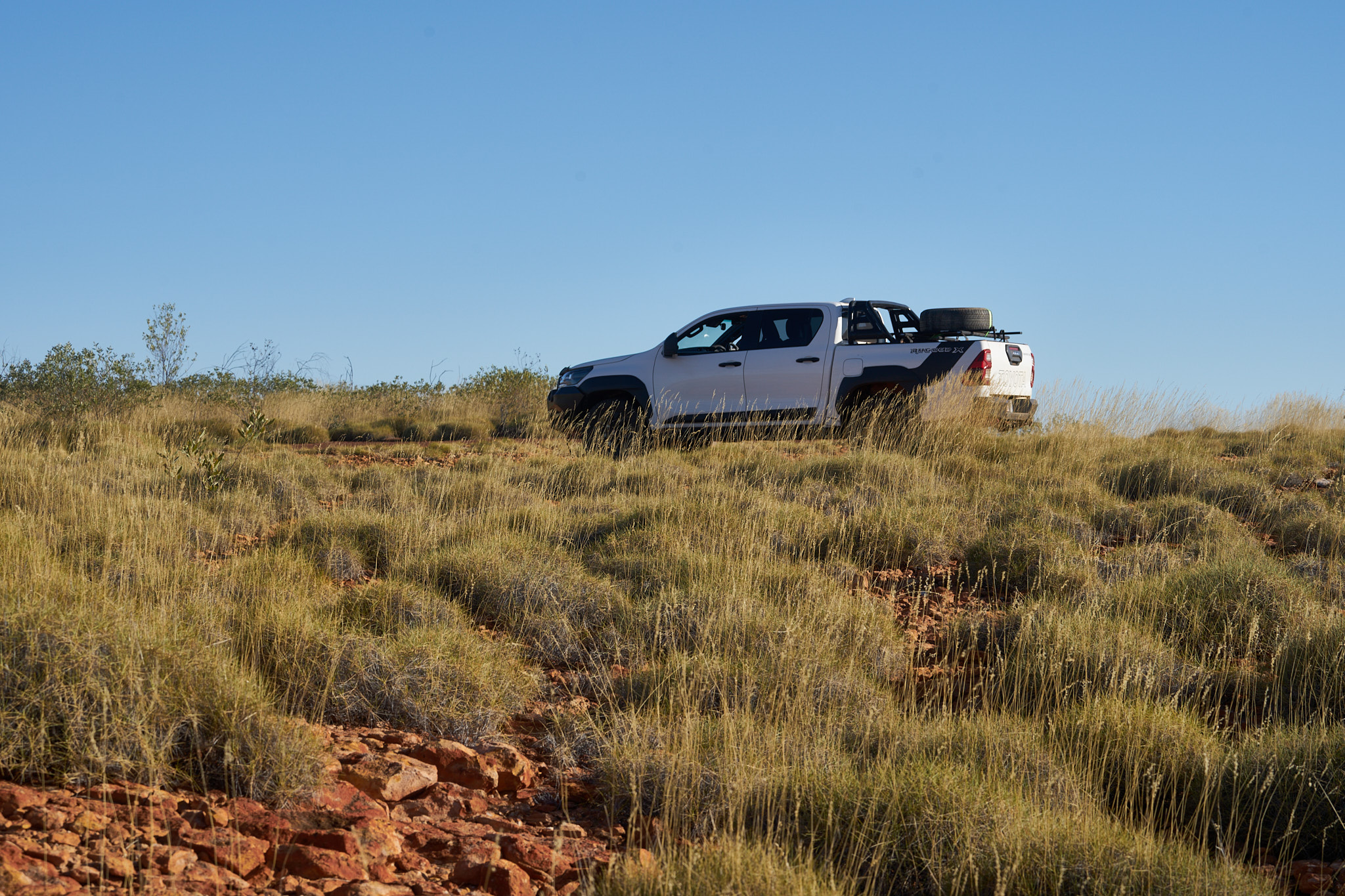
About 200 km from home via a very lonely sandy track there is a gorge that I have been meaning to visit. I went out there for a couple of nights last week, camped alone, in the spinifex, under the stars on the lip of the canyon. Very biblical, only 38 more nights to go. Can they be served cumulatively or do they have to be accrued in one go?
WallerooSpinifex Pigeon
Broome is the administrative capital of the Kimberley region (which is northeast of here before you get to Darwin). In my view it ain’t really the Kimberly until you get among the Boab trees (not just street plantings, real Boabs). Anyway, that’s where I’m going. If I get the chance to post along the way I might drop in a teaser otherwise I’ll subject you all to the photos when I get back in a couple of weeks. Ciao for now.
I’m not trying to get a good finish. I’m talking about the weather. Broome’s average rainfall in December, January and February is 441mm (a little over 17 inches). We’ve had just under 29mm so far. January was the third lowest rainfall total on record. It’s the slowest start to the Wet season in living memeory (Yes, Dr John, several years at least.)
A cyclone or a decent tropical low can deliver sufficient rain in a single event to put us back on track – we may yet be cut off by flood – it’s just that no such event has hit us yet. My garden plants have their tongues hanging out.
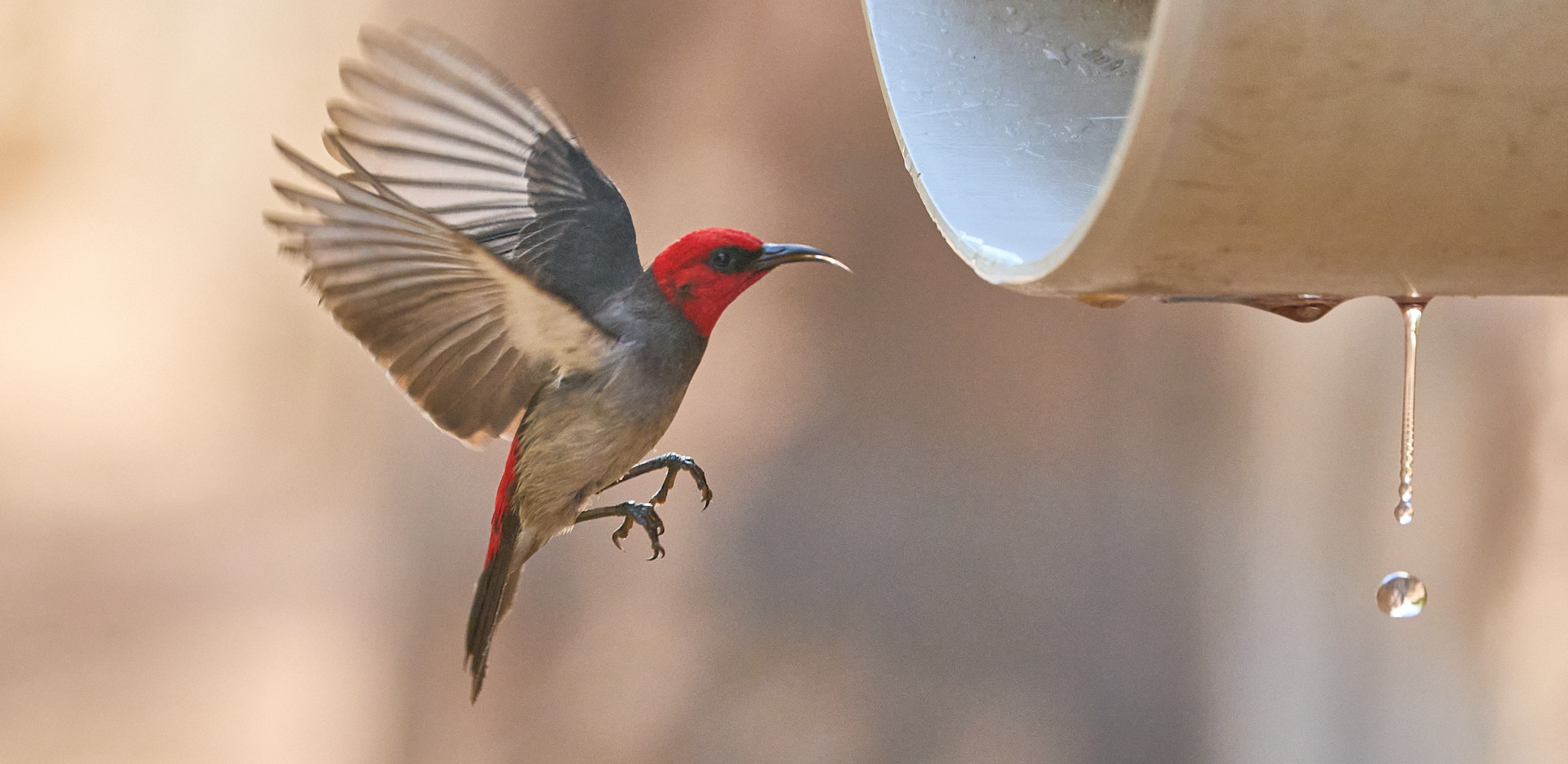
I know a place where an air conditioner serves fresh water straight into the mangroves. I was there this morning. The birds were queuing up.