The annual migration is well underway. We are currently camped by the Nanucarra River in the Pilbara, Western Australia. This may not be familiar to all of you, a map might help.
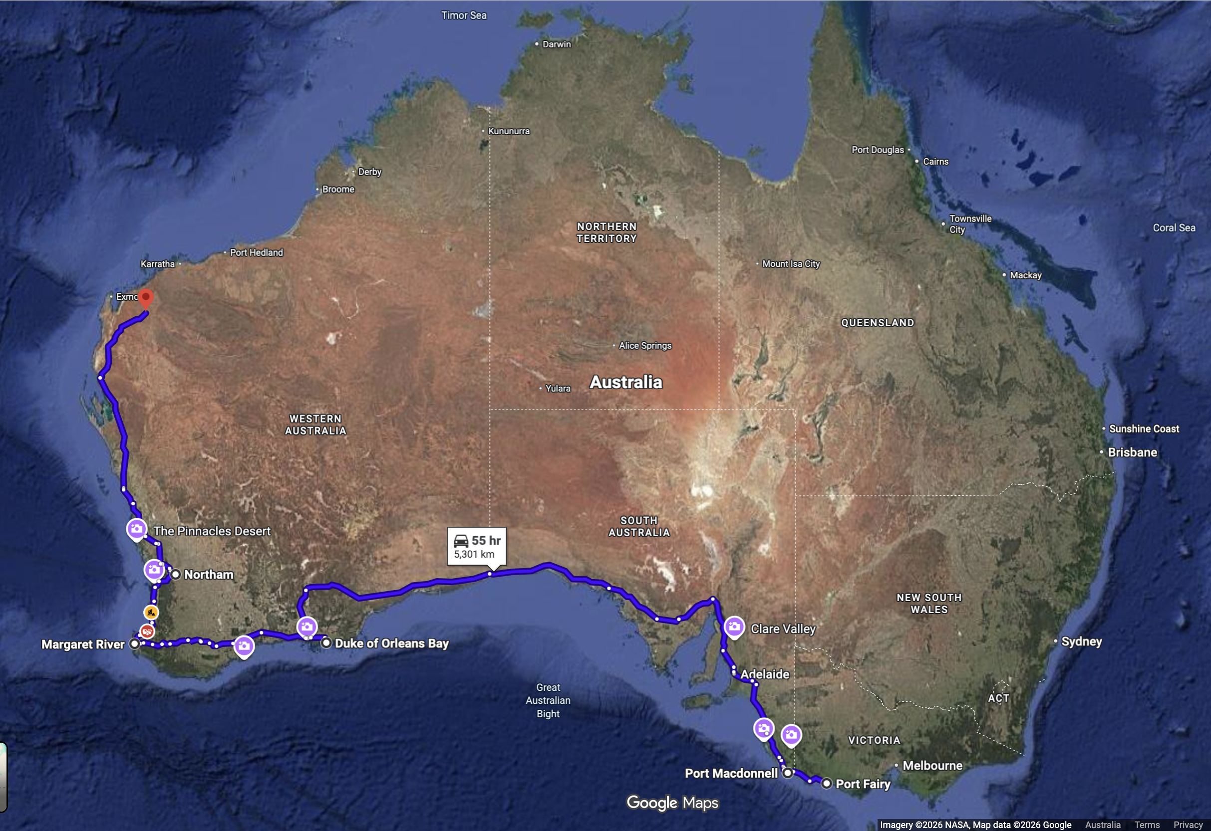
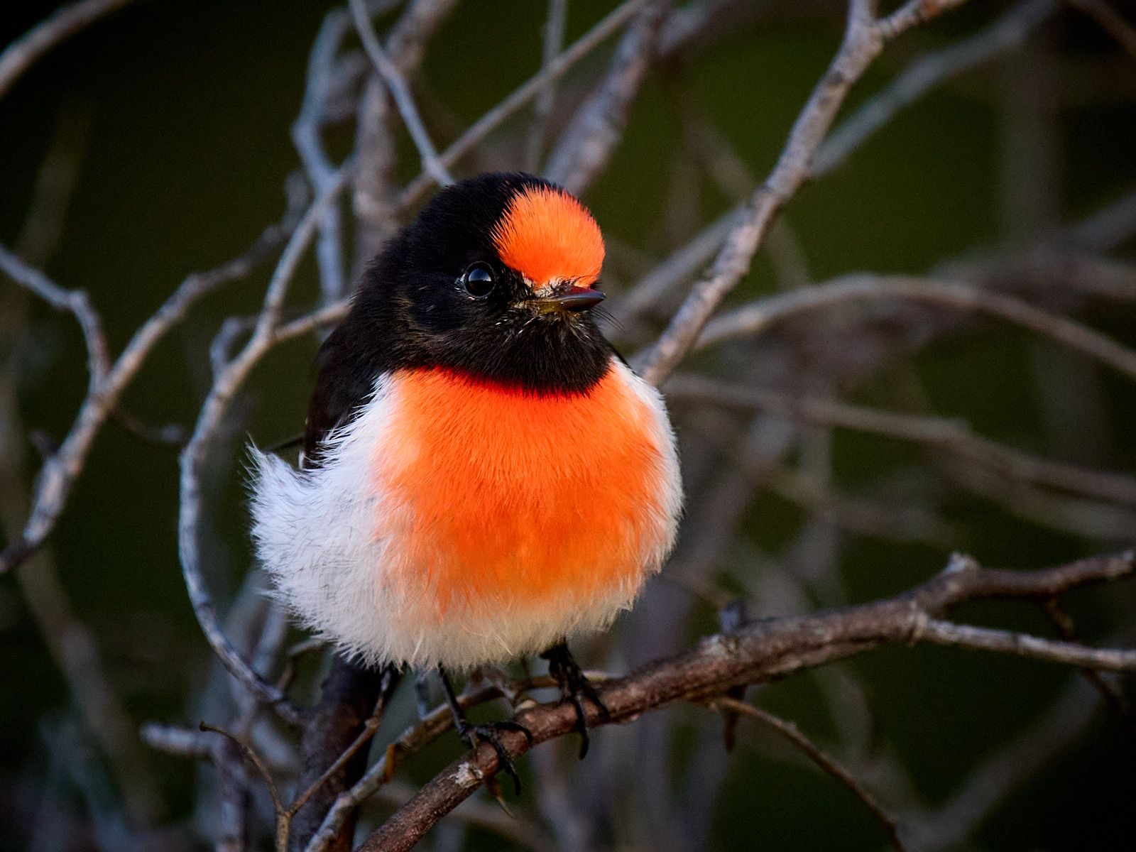
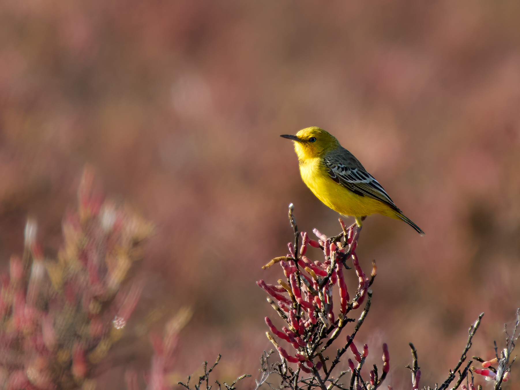
It shows that Port Fairy is 5,301km behind us along a reasonable representation of our route. Somehow we manged to do 7,407km to get here. Broome is 1100km to the north west and I’m sure we can inflate that figure as well. Back in Port Fairy the expected maximum temperature is 18°C. Eighty Mile Beach, our campsite tomorrow night is expecting 40°C. Our reward for enduring such horrors are birds like this which I photographed yesterday at the Murchison River.
Over two days. First night Timber Creek. 327 km, all sealed. Population 278 slightly more than half are Aboriginal. Augustus Charles Gregory and a party explored the area in 1855 and bestowed the name Timber Creek on one of the creeks. That was adopted for the name of the settlement when the opening of a police station put the “town” on the European map in 1898.
Gregory’s party included Baron Sir Ferdinand Jacob Heinrich von Mueller, a bit of a botanist. Well perhaps the most important of Australia’s pioneering botanists. It was he that described and named Adansonia gregorii, the Boab. (And for one of my faithful readers it was he that described and named the genus Macadamia.)
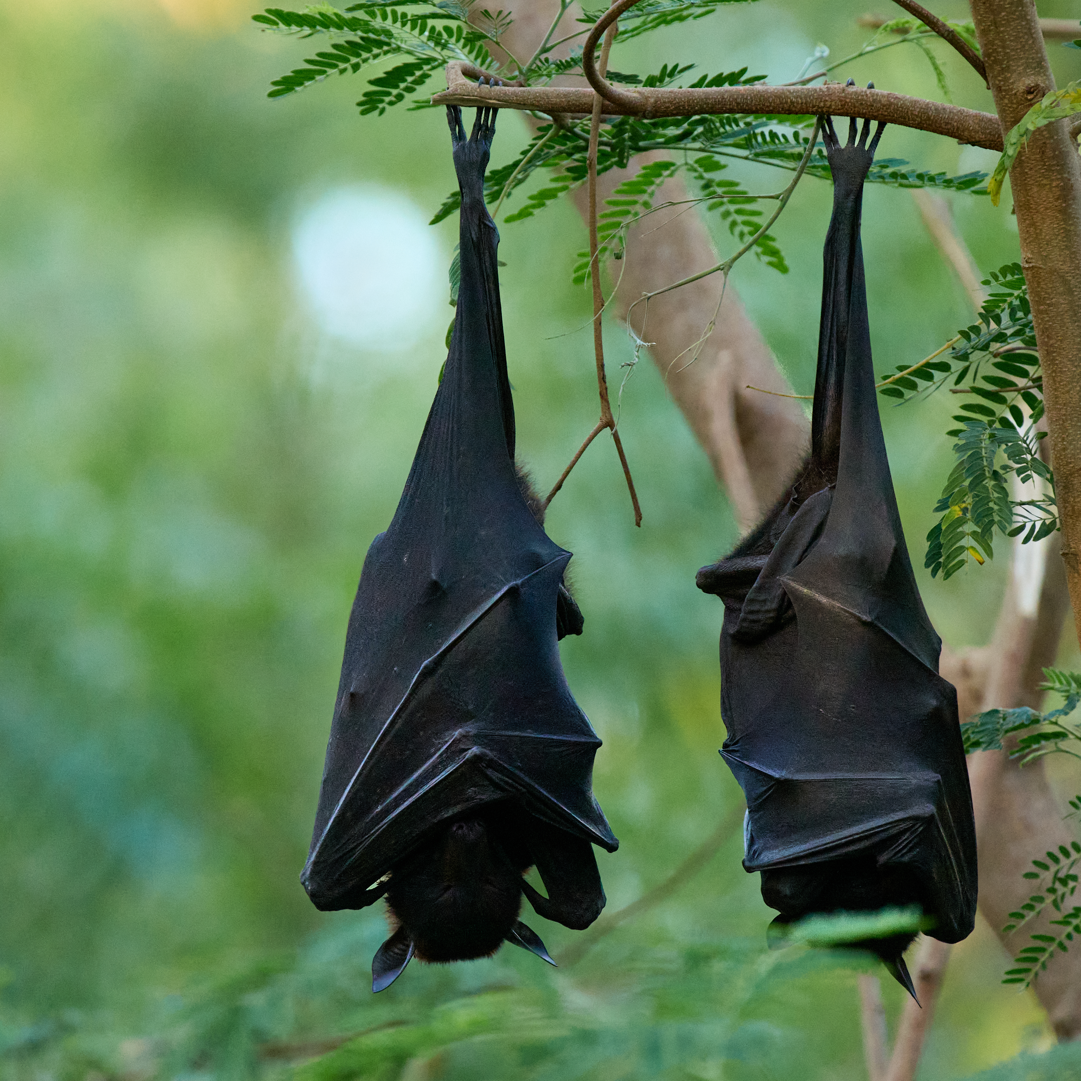
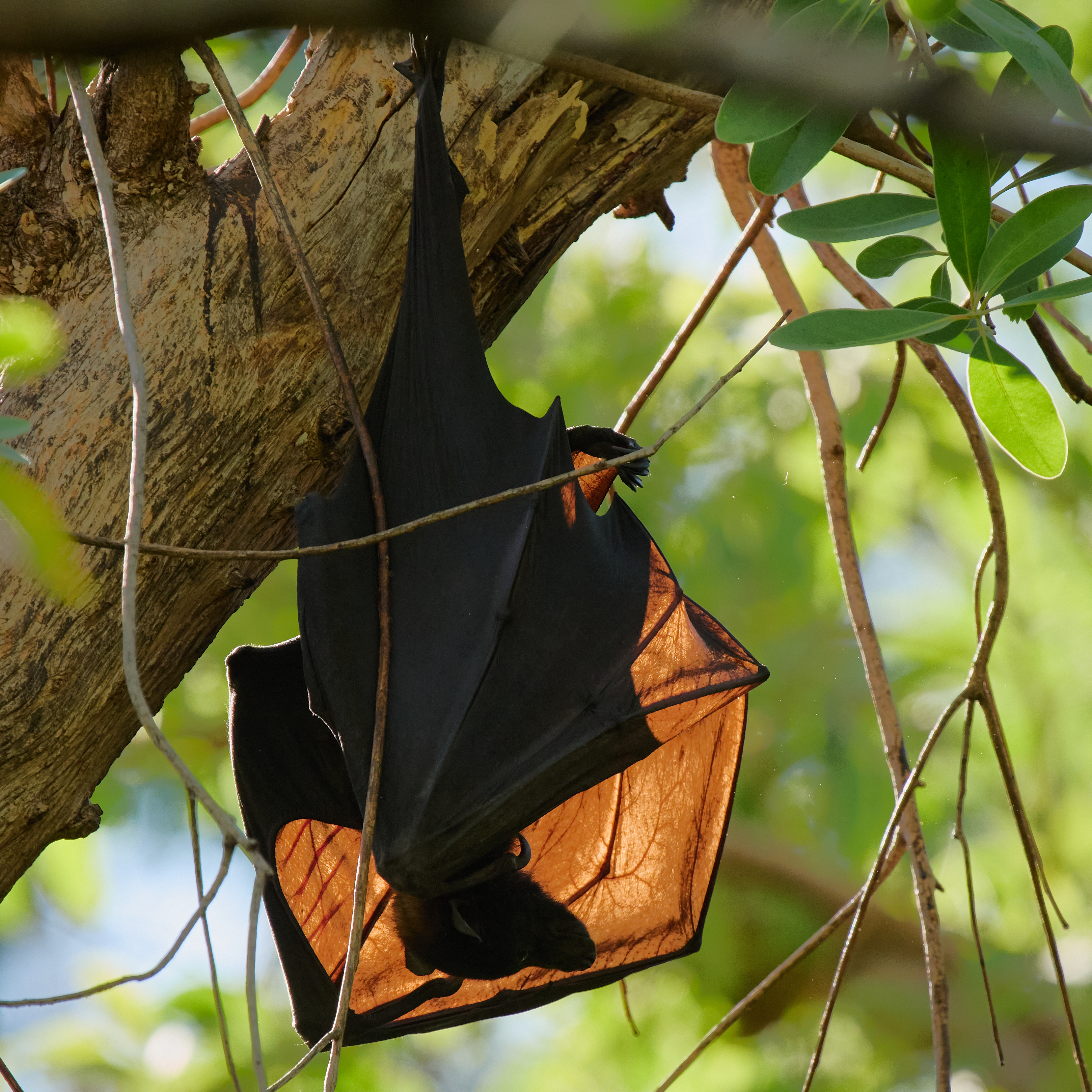
The camp ground is behind the well-stocked store. There is a swimming pool, a creek at the bottom of the garden and plenty of shady trees. There are freshwater crocodiles in the creek and a large Flying Fox camp overhanging the creek.
The camp ground, the airstrip, the race course and Policeman’s Point on the Victoria River are well known birding spots. The airstrip can be very productive but alas fire had been through and for the time being it will be quiet.
Timber Creek to Katherine is 289 km, all sealed. We are camped at Manbulloo (the local aboriginal name of the Crested Pigeon) about 10 km short of Katherine, on the bank of the Katherine River. The campsite is well shaded which is much appreciated as the temperature hits 37°C (98.6°F).
The most northerly town in Western Australia, population 941, slightly more than half Aborigines. Founded as a port to serve the Halls Creek goldfields in 1886, it kicked on on the back of meat processing and export until the 1960s. It’s now a pleasant sleepy hollow with some iron ore passing through the port.
The Wyndham caravan park gets a tick of approval. It doesn’t have quite the natural values of Parry’s Creek Farm but for an urban van park it is well above average. Spinifex Pigeons walking around the campsite can’t be bad! Gouldian Finch are also on the list but weren’t in evidence during our stay.
Parry’s Lagoon is one of my favourite wetlands and did not disappoint.
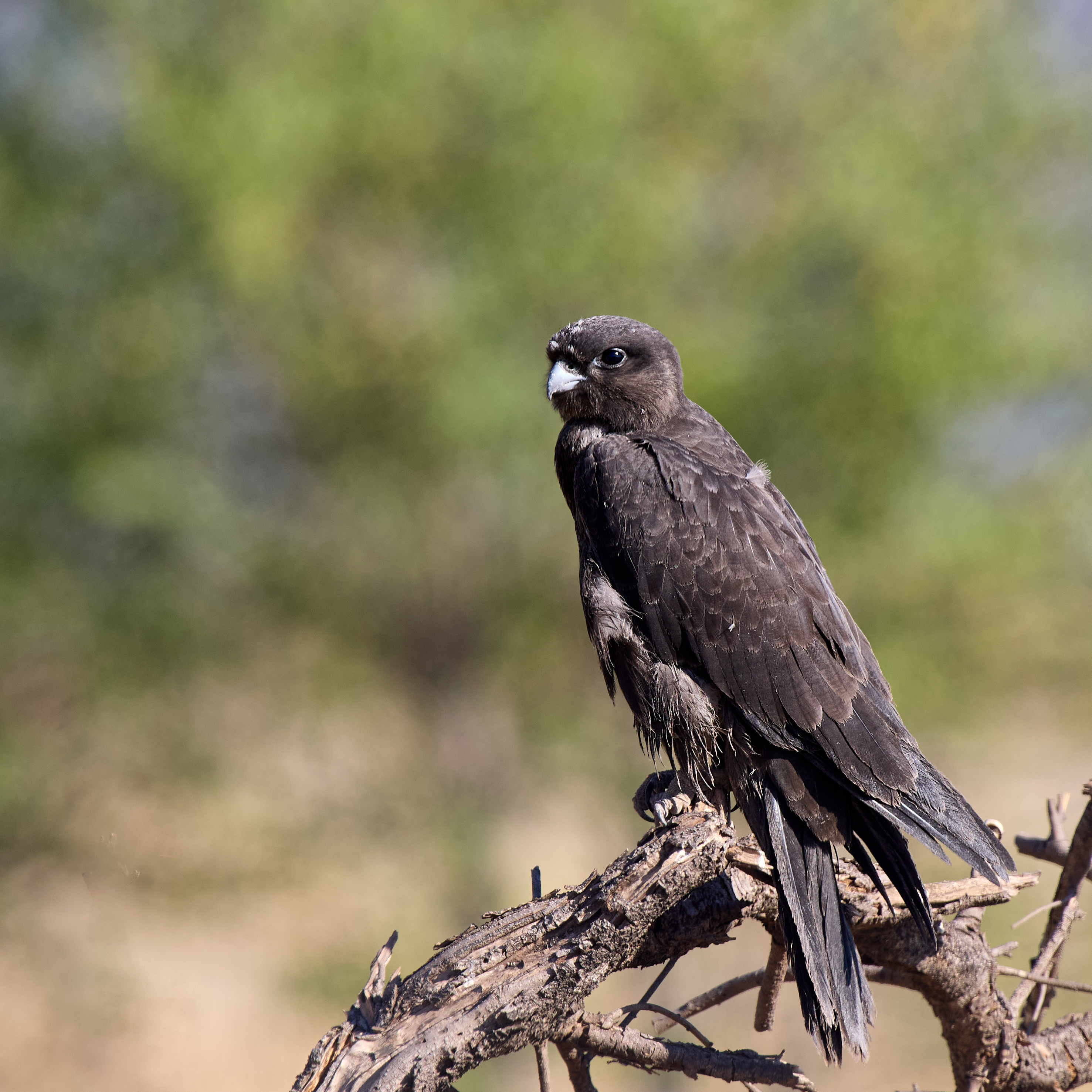
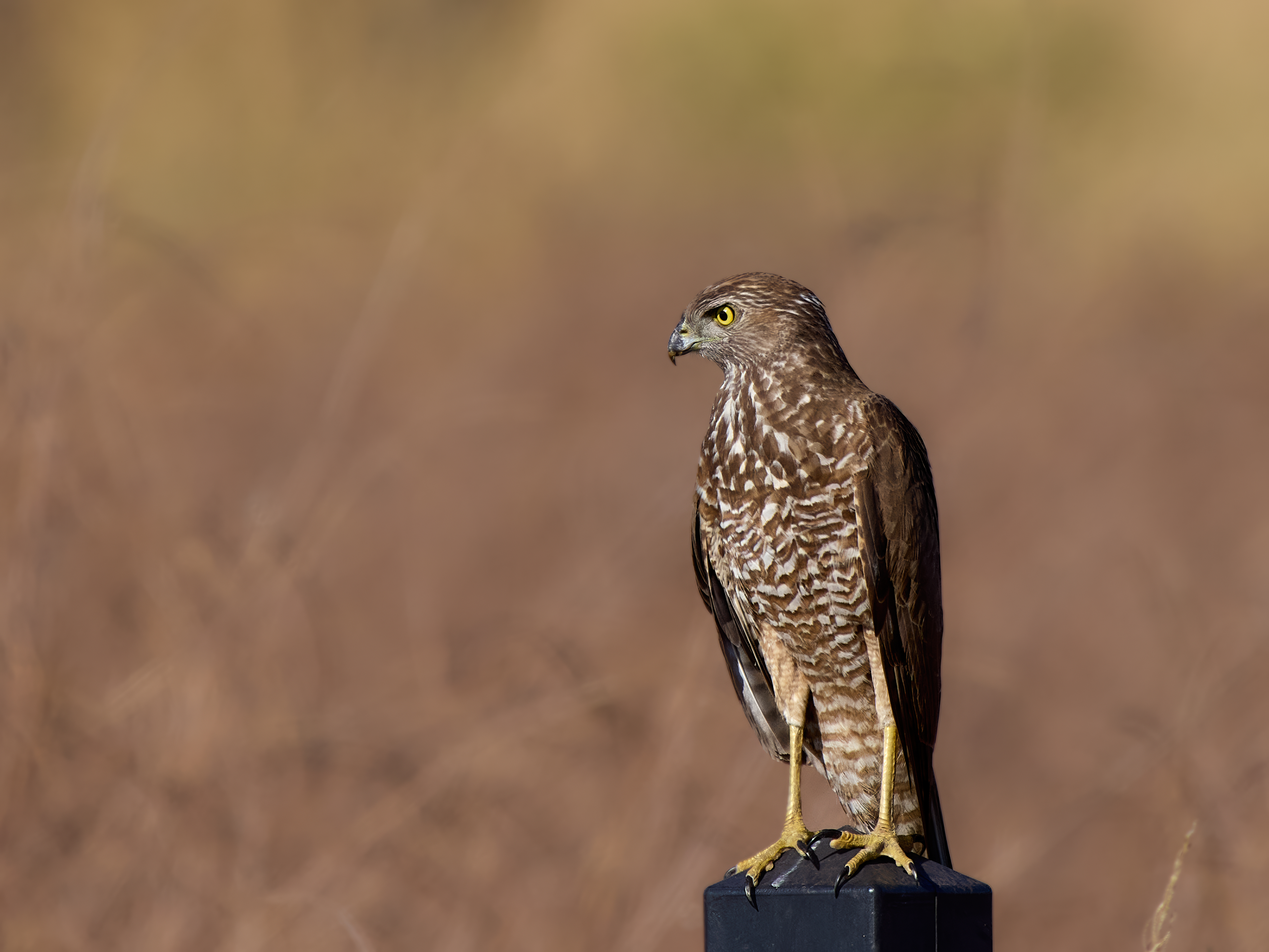
A couple of raptors gave me a chance with the camera.
Black FalconCollared Sparrowhawk
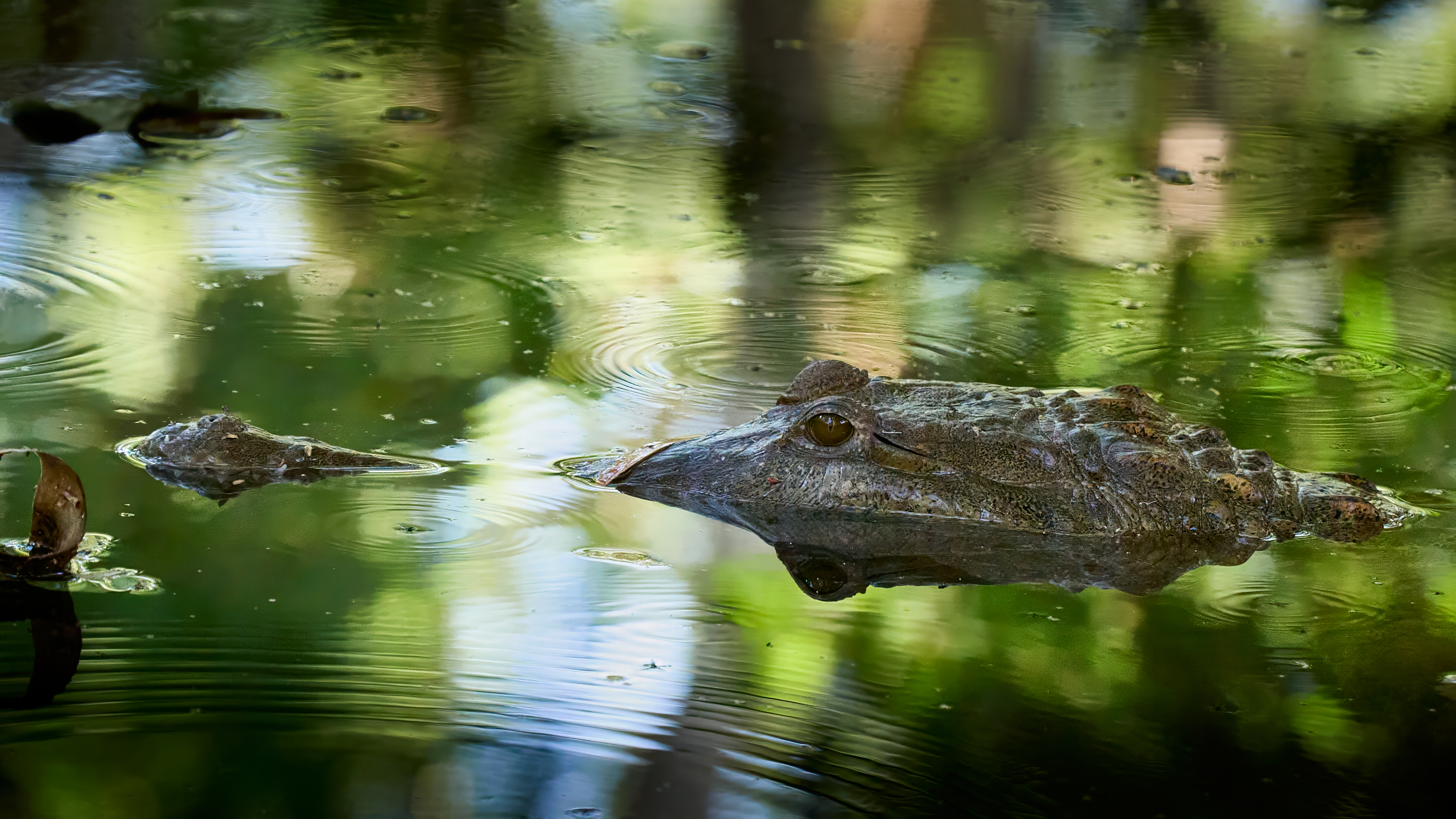
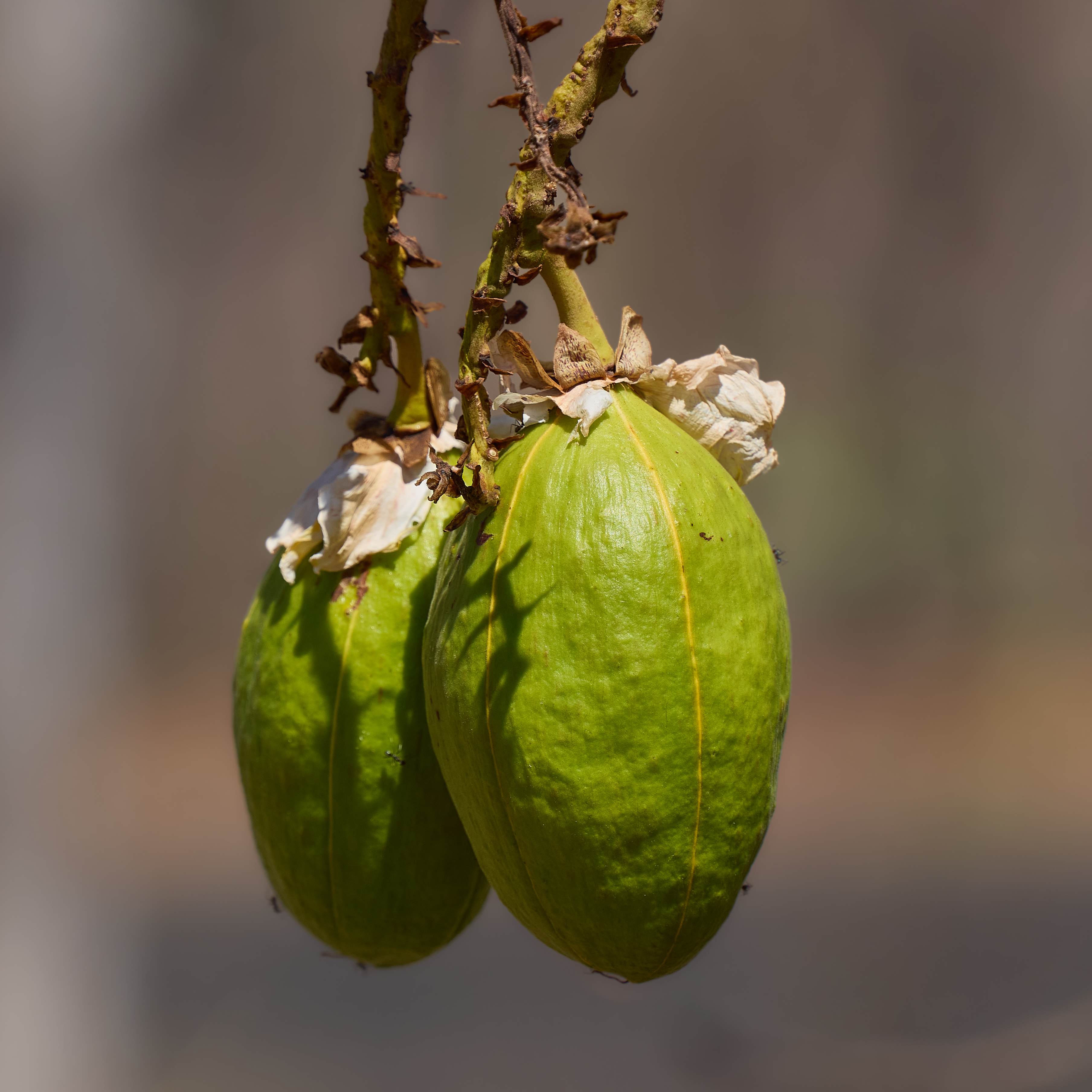
I mentioned the Kapok Trees in the last post. It’s not the real Kapok that was used to stuff pillows in the olden days. Its Cochlospermum fraseri, given the same common name because the seed pods are stuffed with similar cotton-like fibres. When the flowers are out it’s time to collect Freshwater Crocodile eggs, I don’t think the occupational health and safety officer will be impressed. It’s found in the Kimberley and Top End of NT. Large shrub to small tree.
480 km. Sealed all the way. Top temperature 37°C (98.6°F).
Like it says on the label, the Savannah Way runs through a lot of savanna. Today we saw some rugged ranges, plenty of impressive Boab trees and spindly Kapok Trees in brilliant yellow flower.
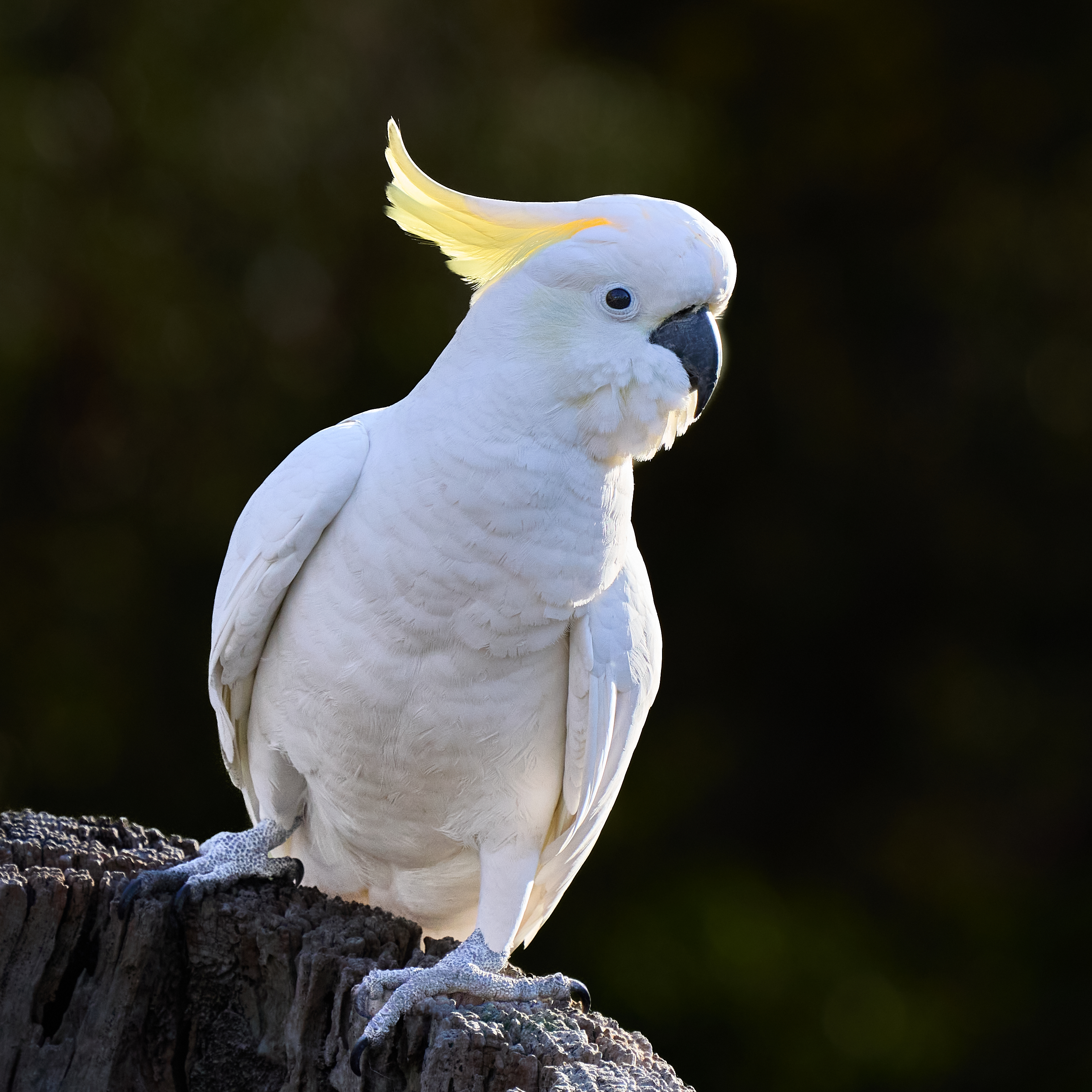
An Australian icon that you rarely see in Broome is the Sulphur Crested Cockatoo. Encountered one at Mary Pool.
Sulphur Crested Cockatoo
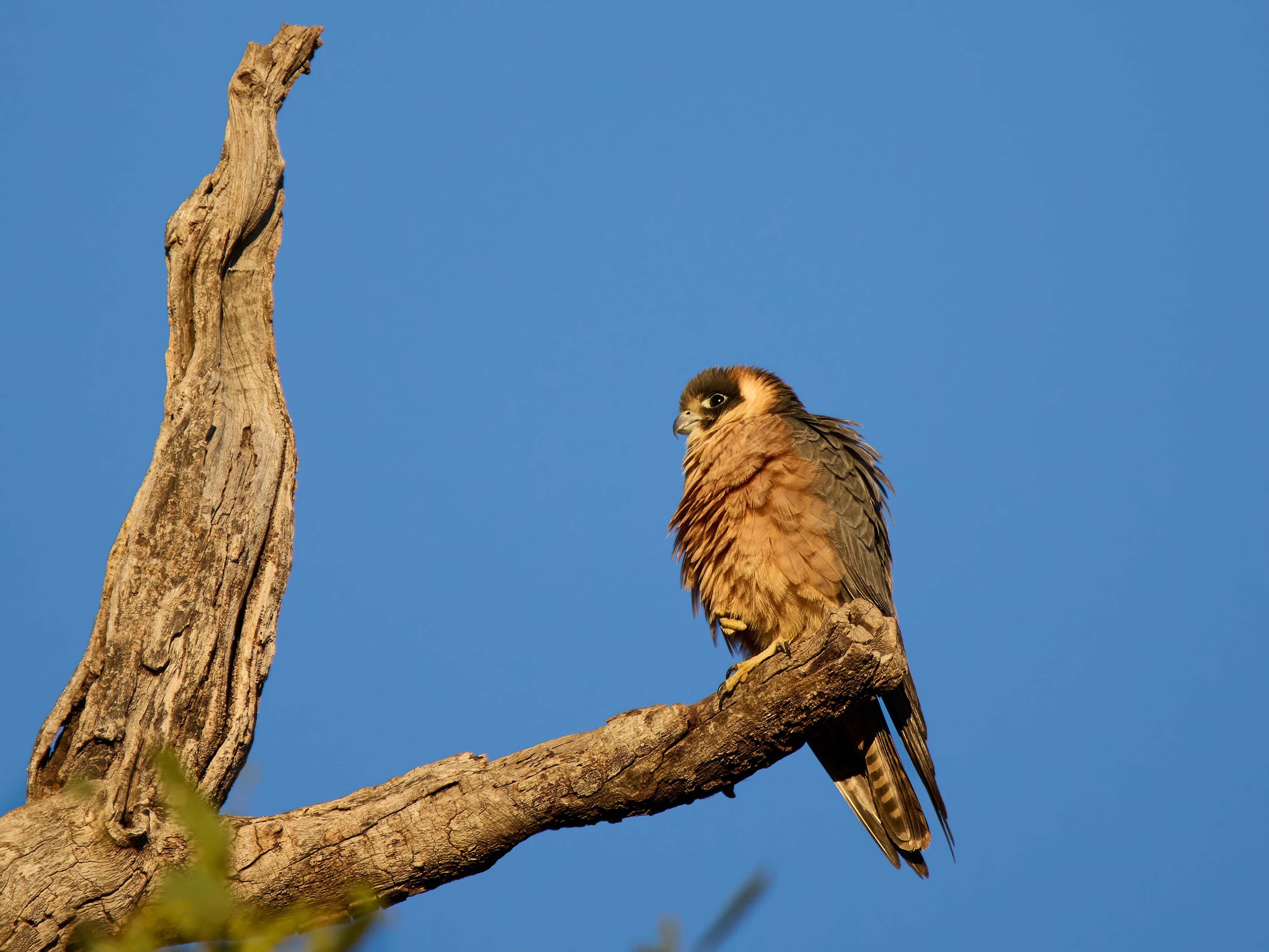
Open grassy woodland suits birds of prey. The most numerous today were the Whistling Kites (We are camped right under an occupied Kite nest). Also a Hobby, some Black Kites and a Black-breasted Buzzard.
Whistling KiteAustralian Hobby
We would normally be staying at Parry’s Creek Farm but unfortunately they have shut up shop. So its the Wyndham Caravan Park. We’ll stay two nights. Tomorrow holds a visit to Parry’s Lagoon.
The road trip is under way. Broome to Mary Pool, 580km. This late in the dry season the countryside is extremely dry. Vast swathes of bush have burned this year, the willy willies are black with soot rather than the standard light grey.
Top temperature today was 35°C (95°F).
The camp site is on the bank of a dry river. There is usually a sizeable pool here. At the moment that is completely dry. I did manage to find a puddle up stream by following some Corellas that were going in to land.
Yes, I feel the need for a road trip. Seems like ages since I finished the last one (goodness, is it 6 months already?). Sit here much longer and I’ll take root. Origin Broome, WA, destination Broome. Pick somewhere in between, say Port Fairy, Vic. We like Port Fairy and summers are coolish there. A loop then. How big a loop? Let’s go for the max. Anywhere special on the way?
The classic Highway 1 loop covers roughly 15,000 km (9,400mi). This is Australia, there will be any number of special places on the way, unavoidably. But there is one place the lovely Gayle and I have not visited. It’s been on proposed itineraries but the weather has denied us every time. In this dry, dry continent nothing stops outback traffic faster than rain. Borroloola, NT, population 755. Setting off towards the end of the dry we have a fairly good chance of making it this time. It’s not flooded at the moment. An early start to the wet, though, could soon fix that!
That determines the direction of travel. It will be clockwise again this time. The journey breaks down into four major legs. The journey across the top, Broome to Cairns, is the Savannah Way. It can be completed on sealed road but there are a couple of alternate sections. If Borroloola is included then it would be remiss not to include Hell’s Gate and then Burketown, 365km of corrugated suffering. Tape your beer cans so they don’t rub through. It gets easier from there to Normanton. At that point you choose to take the Burke Development Road via Chillagoe, once again shaking your teeth out of their sockets or the bitumen via Croydon. We’ve traveled both before and unless overtaken by a bout of masochism I suspect we will opt for the latter (and a soak in the Innot hot springs).
Before dropping into Cairns we will pause on the Atherton Tableland, our first opportunity for a flurry of new (for the year) birds. Then up to Cooktown.
The next leg is the east coast, but all in good time. First you will need to endure heart wrenching bulletins of the trip to Hells Gate.
On a more serious ornithological note, the fair city of Broome (population 15,000) looks out over Roebuck Bay, Australia’s most important site for the waders, outnumbering the humans many times over. In Australian (and English) usage waders are birds in the order Charadriiformes. Americans tend to prefer the term Shorebirds and if you say wader they think of herons and such and it’s possible they might have a point. Herons do a lot of wading. Some waders do no wading at all, not all shorebirds live on the shore, but most do. But I digress. The Broome Bird Observatory is the hub of considerable research into the charadriiforms. So it was that on 1st December 2002 members of the Australian Wader Studies Group were in the field (on the beach, actually) using cannon nets to catch birds.
Among the catch that day was an Australian Pied Oystercatcher. It was weighed, measured and closely examined. It was in its third year of life or older. Smart ornithologists can age first and second year Oystercatchers by their moult. It went from being an anonymous Oyk to Oystercatcher 101-07877. Thus if it were encountered again something would be learnt about its movements and survival.
I was not in the field with the AWSG that day in 2002 although I have enjoyed that privilege on other occasions. I was on Gantheaume Beach on the 11th of August 2025 when I met 101-07877. When it faced west I was able to make out the first three band numbers, when it faced east I was able to get the last three. I had no luck getting two numbers in between.
I reported my sighting to the Australian Bird and Bat Banding Scheme. They had records of two Pied Oystercatchers 101-XX877 but the other one is also carrying a coloured flag. Thus we know the identity of this particular little bird, found alive and well just 20km from where it was banded 22 years 8 months and 10 days earlier. Its age is now 25 years or more.
More specifically a little chat about the calendar game. Readers in for the long haul know all about the calendar game. For those not familiar with it, it starts on January 1st and you are in the game so long as you have seen more birds in the year than days have elapsed. If you fall behind the calendar you are out. So on January 1st at Taylors Scrape, ~70km from Broome, at 5.31 am I pressed the button “Start New List” on eBird mobile and the game commenced. By the end of the day I was safe well into February.
There is, in birding, a concept called the Big Year. It’s like a super calendar game where you chase all over a region of your own choice, twitch every rarity, get on every birding boat trip, visit every habitat, spend a fortune on travel, stay awake through every very long drive, sleep rough, eat poorly and pay no heed to your impending divorce.
The calendar game is more genteel. One endeavours to see ordinary birds in ordinary places. Travel will still be necessary and novelty will still be welcome. But it’s just a game.
So to summarise. A Big Year is for lunatics. A Calendar Game year is for under achieving lunatics, those of us who are past peak obsession.
So how is it going? I began the year with a big trip across the top of Oz and then south through outback Queensland and NSW to Victoria. On the 16th of March I was in Melbourne with 274 avian species on the list. 75 days in, 199 species ahead. The return trip to Broome was up through the red centre. Our overdue library books were returned to the Broome Public Library on the 18th of April. 309 species were in the bag, 108 days elapsed. The librarian was thrilled to hear that the buffer was holding steady around the 200 mark.
But of course it gets harder. Broome is a great place for birding. Every Australian birder really must get here. I’d rank it number two after Cairns and the Atherton Tablelands. And it is a place where the odd vagrant turns up. But they don’t rain down. Five months of local birding have added only 20 extra species. 249 days into the year 329 species up. The buffer is shrinking, failure beckons. It must be time for another road trip.
We are well into the dry now. The ground has dried out enough to venture out into low lying parts of Roebuck Plains, to Kidney Bean and Duck Lake. This is home to the Yellow Chat. They are beautiful and not easy to find elsewhere. I added it to the list this morning.
Experience one of Broome’s most magical natural events at the Fusion Moonrise, taking place on Sunday, 10 August. As the full moon rises over Napier Terrace, it aligns perfectly with the iconic Fusion sculpture located at the Carnarvon Street roundabout in Chinatown — creating a breathtaking visual that draws photographers, locals and visitors alike.
The moon is expected to rise at approximately 6:30pm, with its peak alignment above the sculpture occurring at around 7:10pm. This rare phenomenon only happens twice a year, making it a must-see moment that blends Broome’s rich cultural heritage with the beauty of its natural environment.
The photographer faces a few challenges. You cannot make the moon large by getting closer, the distance you can move your tripod is nothing by comparison with the distance from the lens to the moon. If you want the moon to be big in frame you must use a long lens. If you use a long lens and want to get the sculpture in the frame you must move back. The moon stays at the same angle (the distance you can move the tripod etc.) As you move back the apparent distance between the moon and the top of the tripod increases. If you want to bring the distance down you must move forward and use a wider lens. By the time the moon is just off the top of the sculpture it is tiny in frame.
The moon at night is very bright in the sky. The sculpture on the other hand is quite dull and not artificially lit. How dull varies depending on whether headlights are playing on it or not because only part of the street is closed to traffic. So a long and not entirely predictable exposure for the sculpture, shorter for the moon. You’d like them both in focus? Well good luck with that!
The only answer I can think of is … to Cheat! Take a few shots of the sculpture, choose the best. Take a good shot of the moon. The fusion occurs when you the merge the two.
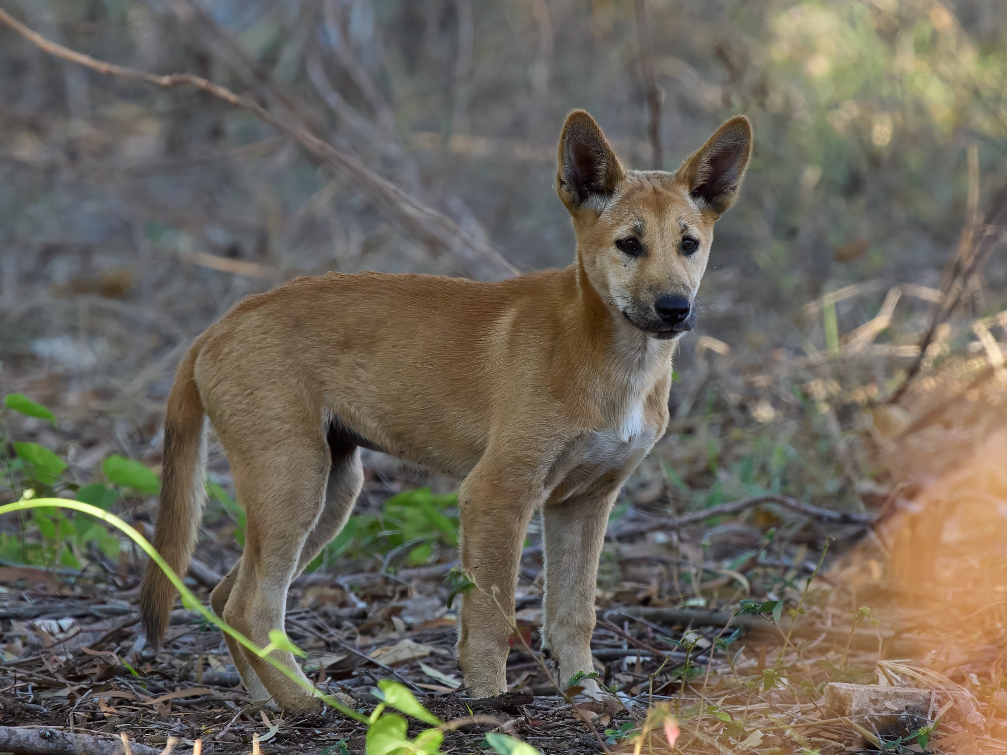
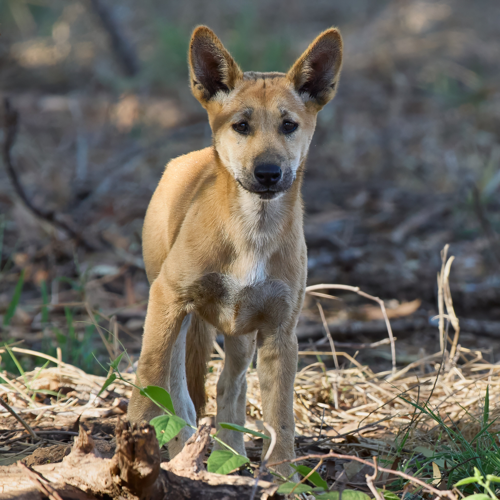
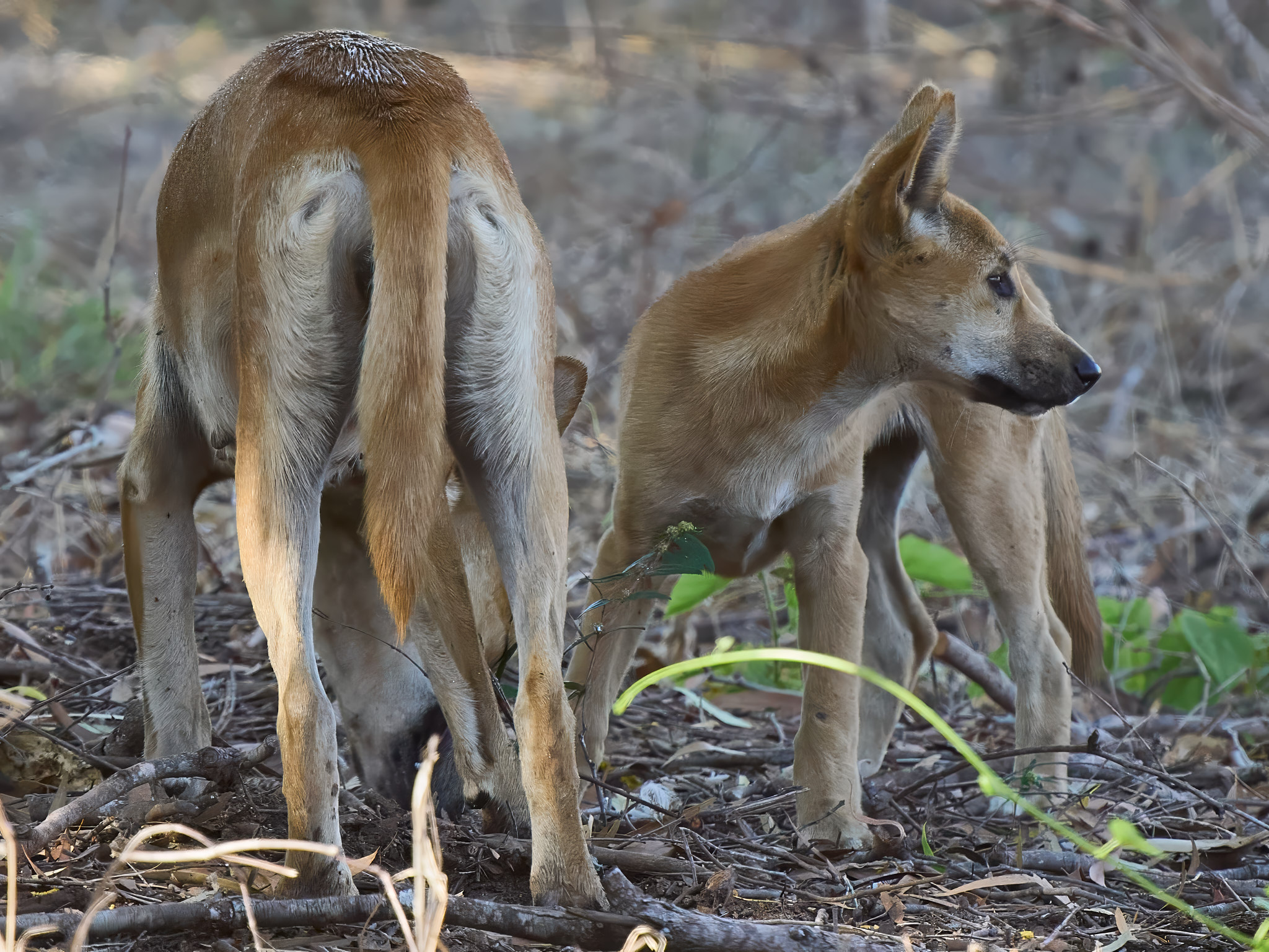
“My men saw two or three beasts like hungry wolves, lean like so many skeletons, being nothing but skin and bones”.
William Dampier recorded this observation from his voyage of 1699 and you can count the ribs on most wild Dingos without any trouble at all. How apt that I should take these photographs of mum and her pup on the Dampier Peninsula, not far from Cygnet Bay.
Magnificent though they are they are just domestic dogs although some people would make it much more complicated. Make it Canis familiaris dingo if you must but they belong fair and square in the dog clade along with all the other breeds. They came on boats, with people, about 3500 years ago and probably spread quickly across most of Australia, perhaps within a century. When the poms rocked up in Sydney in 1788 they found the aboriginal folk had companion animals which in the local language were called Dingos. They are also very capable of surviving in the bush without their companion animals which call themselves humans. Which means they have had a lengthy period being shaped by their environment rather than selective breeding. Hence the beautiful conformation. Built for power, agility and speed. I love’em.
On any other continent they would be considered mesopredators but since it’s the biggest predator we’ve got it is by default our apex predator. But give it its due, it can take down our biggest native herbivore, the Red Kangaroo, and a pack will give it ago with a horse or Water Buffalo if need.
Prior to the Dingo’s arrival the Australian mainland was home to the Thylacine and the Tasmanian Devil and of course since their arrival stupid white people have introduced cats and foxes. There is much debate as to the role played by the Dingo in the disappearance of the former and their influence on the latter. Toss into the mix the fact that Dingos and graziers don’t get along and our regulators have a difficult time working out just what to do with them. Yes they are considered native animals in all states. In most states they are protected inside National Parks and largely persecuted outside. In Western Australia they are not protected anywhere. Tasmania missed out on Dingos but you may import one provided you first get a permit. Once there the law regards it as a dog. You may keep one as a pet in Victoria. You must have a permit and you may not breed them except with another Dingo.
How did they cross the sea? The genetic evidence makes it very likely that Aborigines island hopped to Australia about 50,000 years ago and they have remained genetically distinct until very recent times. So I think we can dismiss the idea of a recent Aboriginal immigration bringing their hunting companions with them. However, Timor is just 500km from the Kimberley coast, Sulawesi about 1000km. At its narrowest point Torres Strait is only 150km wide. Sea levels 3500 years ago were little different from today.
Sulawesi was home to the Macassan sailors who were well documented seasonal visitors to Australia’s northern shores from at least 1700 gathering sea cucumber for sale to Chinese merchants. There is no shortage of possible origins of island hoppers a couple of millennia earlier who may have intentionally or unintentionally found their way to Australia with their pets on board. Pets that were sufficiently domesticated to share close quarters with people during the crossing.