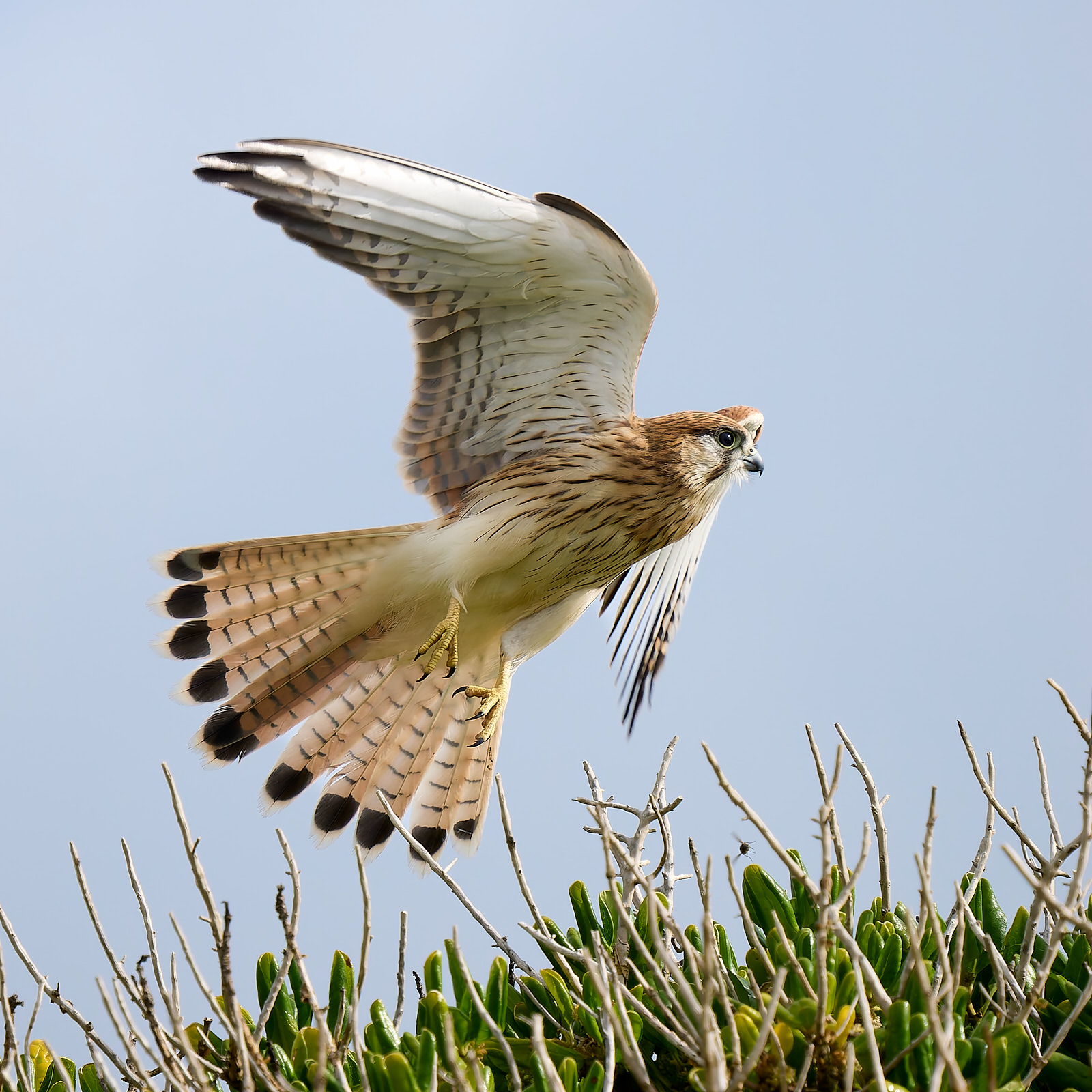
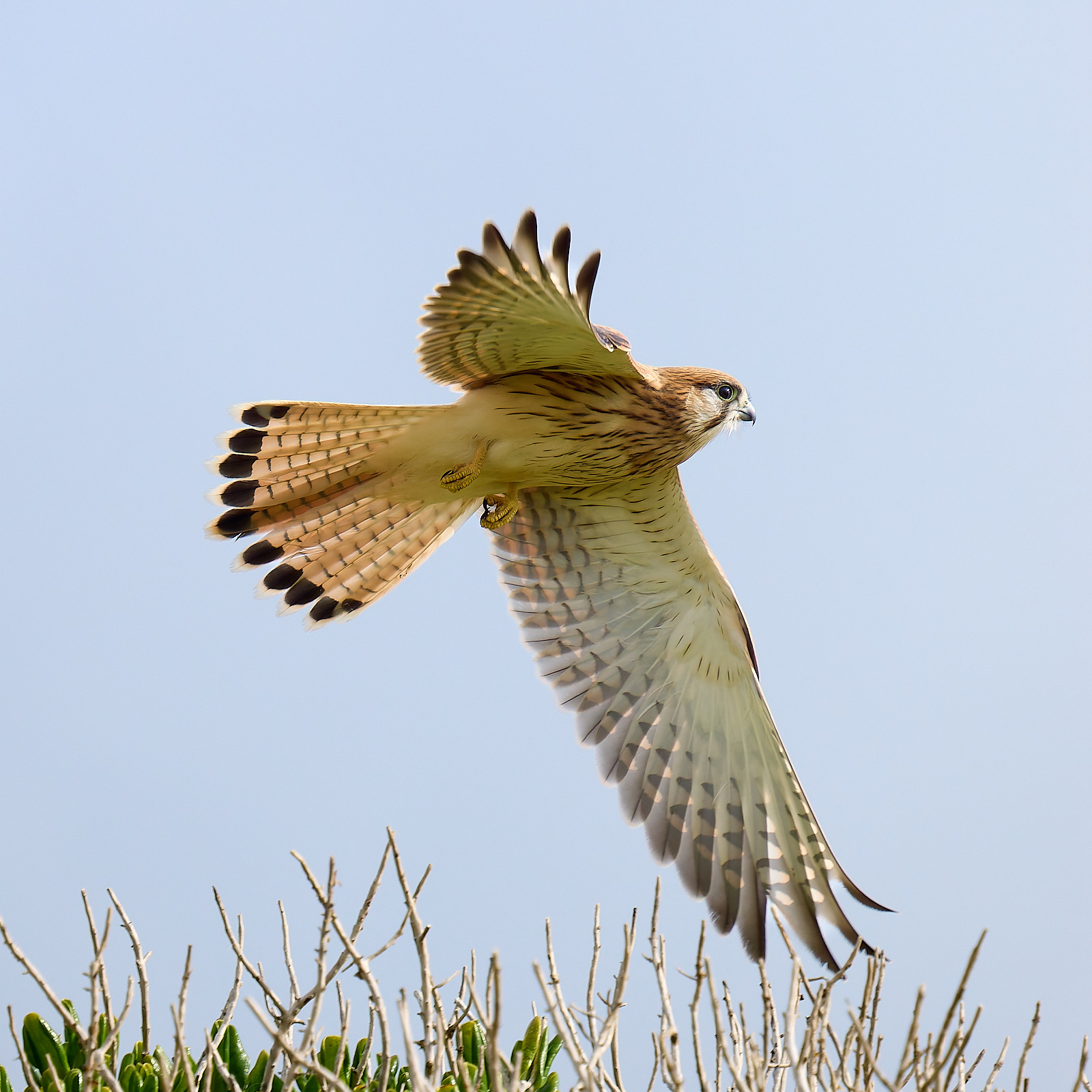
In old colonial times there was a cheap cloth imported from China and sold in Oz as Nankeen. You could have any colour you wanted so long as you wanted a reddish brown. In time it became a handy descriptor of reddish brown and found its way into the name of two Ozzie birds, The Nankeen Kestrel and the Nankeen Night Heron. These names have survived the attempts of august committees to erase them and I hope they endure forever.
The Nankeen Kestrel is found throughout Australia and further afield in the Pacific. It is one of two Australian raptors that are really proficient at hovering, the other being the Black-shouldered Kite. I encountered this one on Griffiths Island.
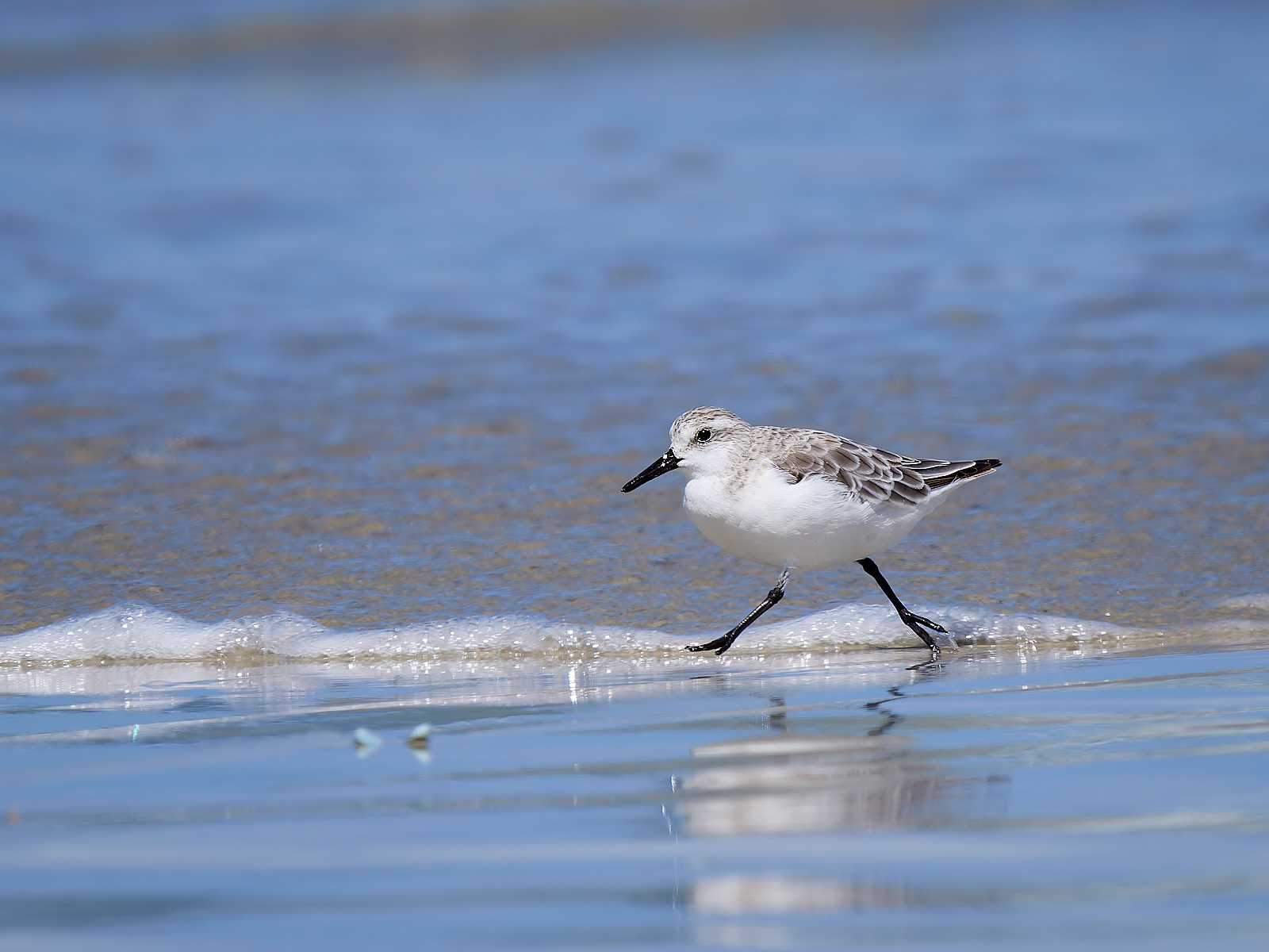
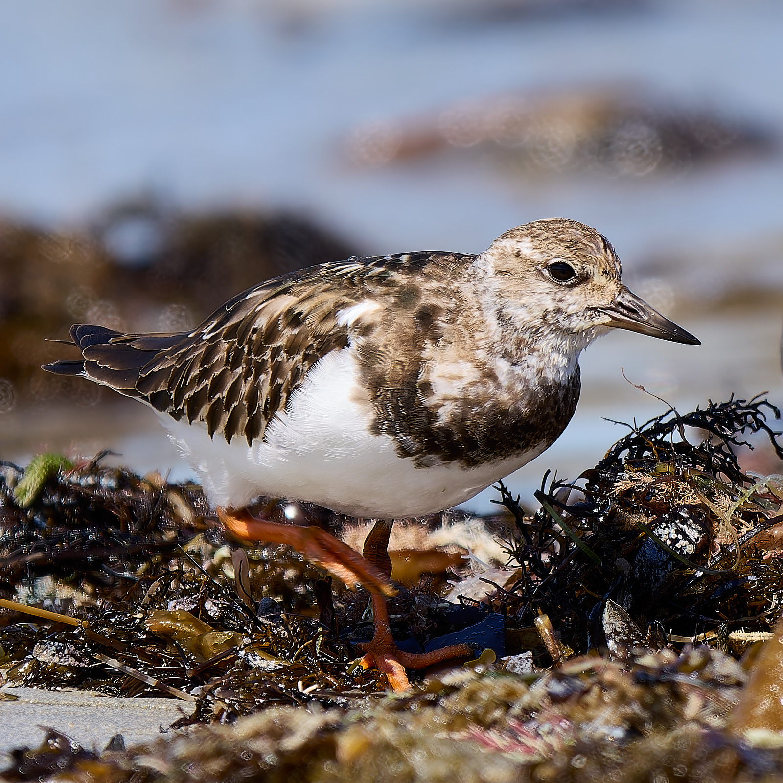
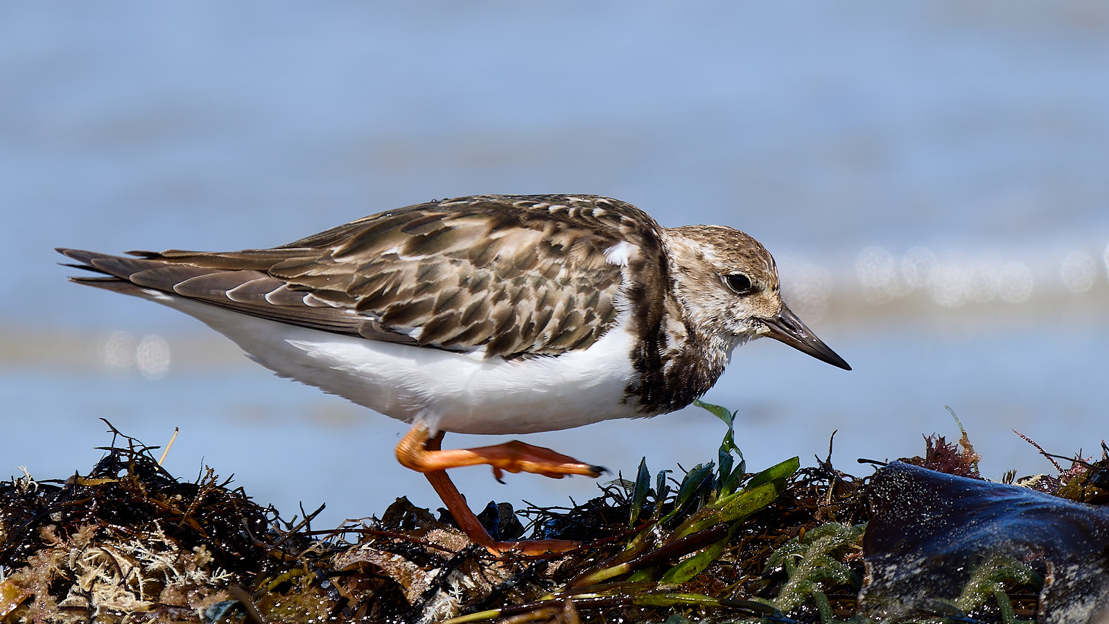
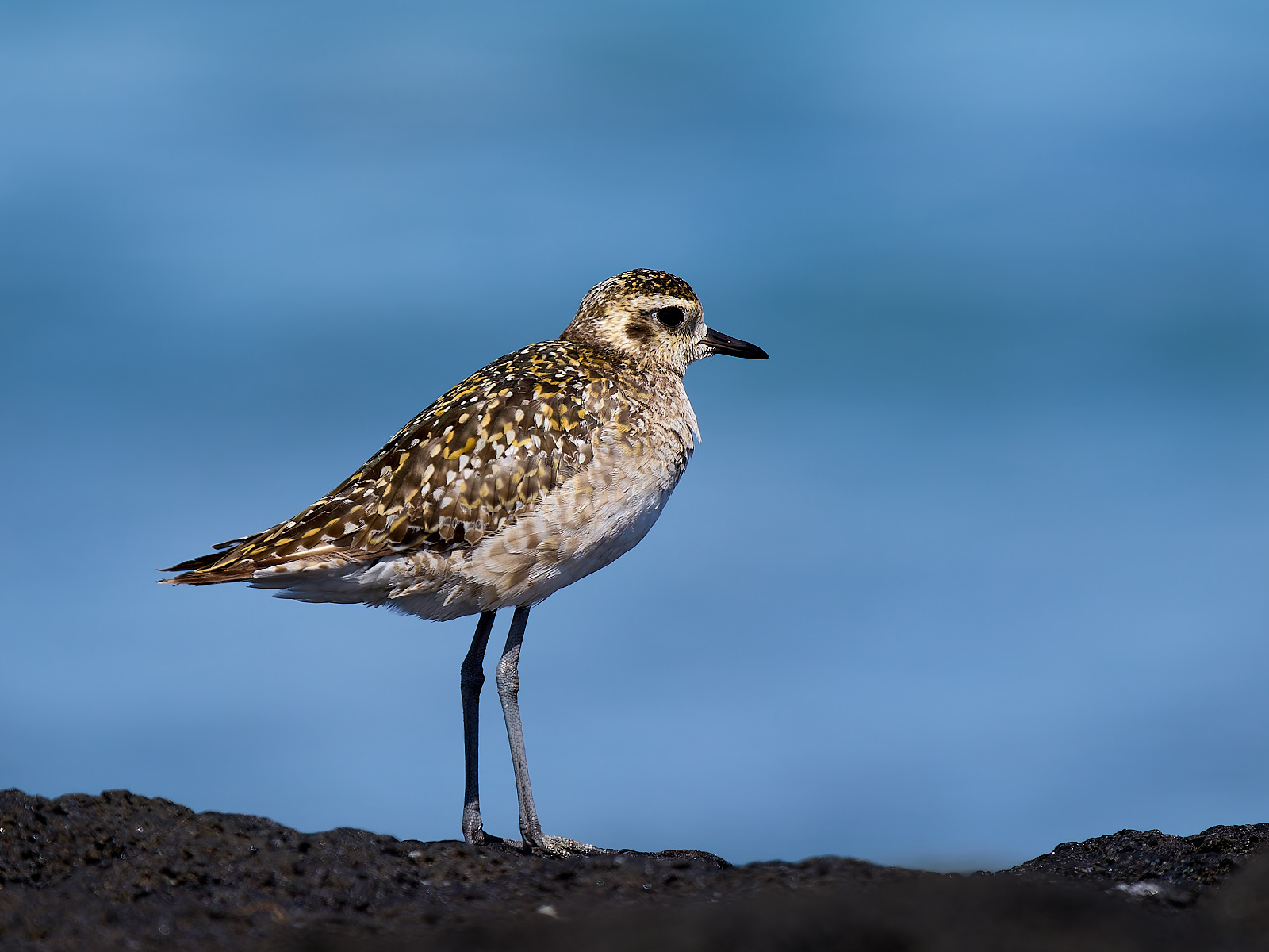
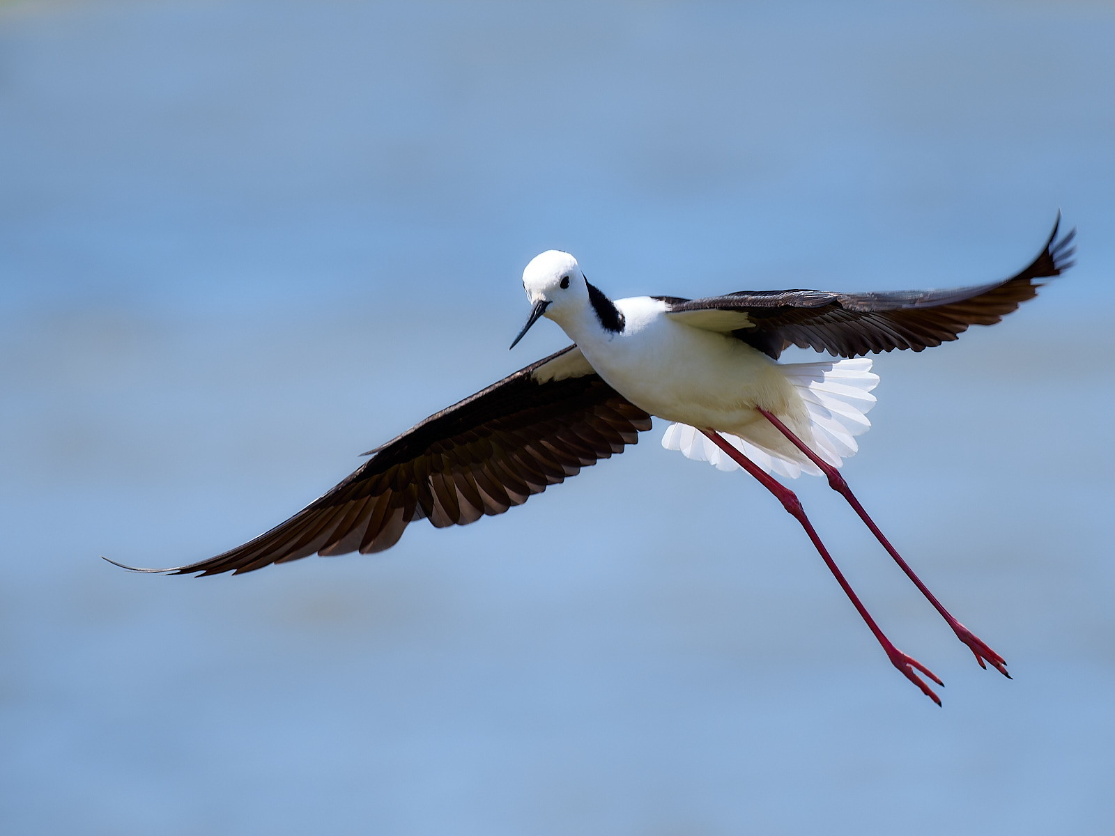
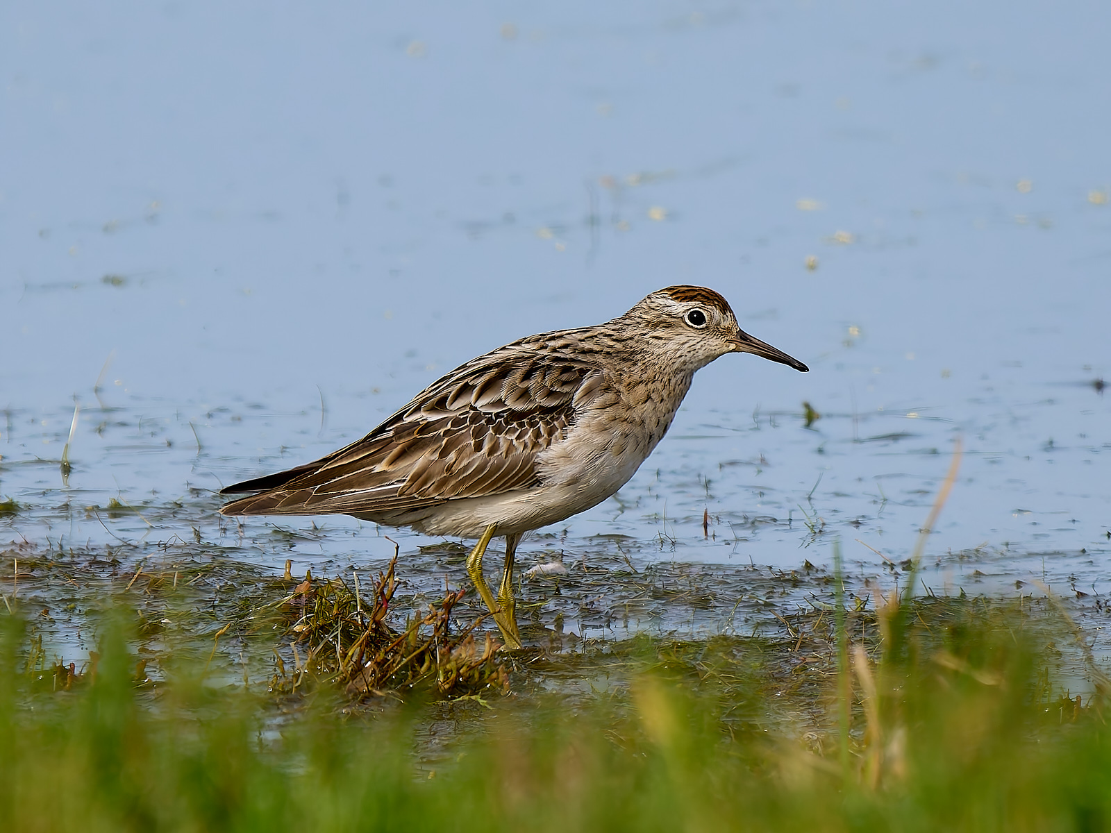
Roebuck Bay is undoubtedly the shorebird capital of Australia but Victoria has sufficient to keep the diagnostic skills in shape. As well, it often seems to me that they are more approachable down here. Summer is the time when the locally breeding species are reinforced by the migrants from the Arctic.
The photo above shows a Common Greenshank (not common around here, mate) that has come up nicely in black and white. Just as well, it was shot in awful light and looked shocking in colour! Below some other waders that I’ve found in the last couple of weeks.
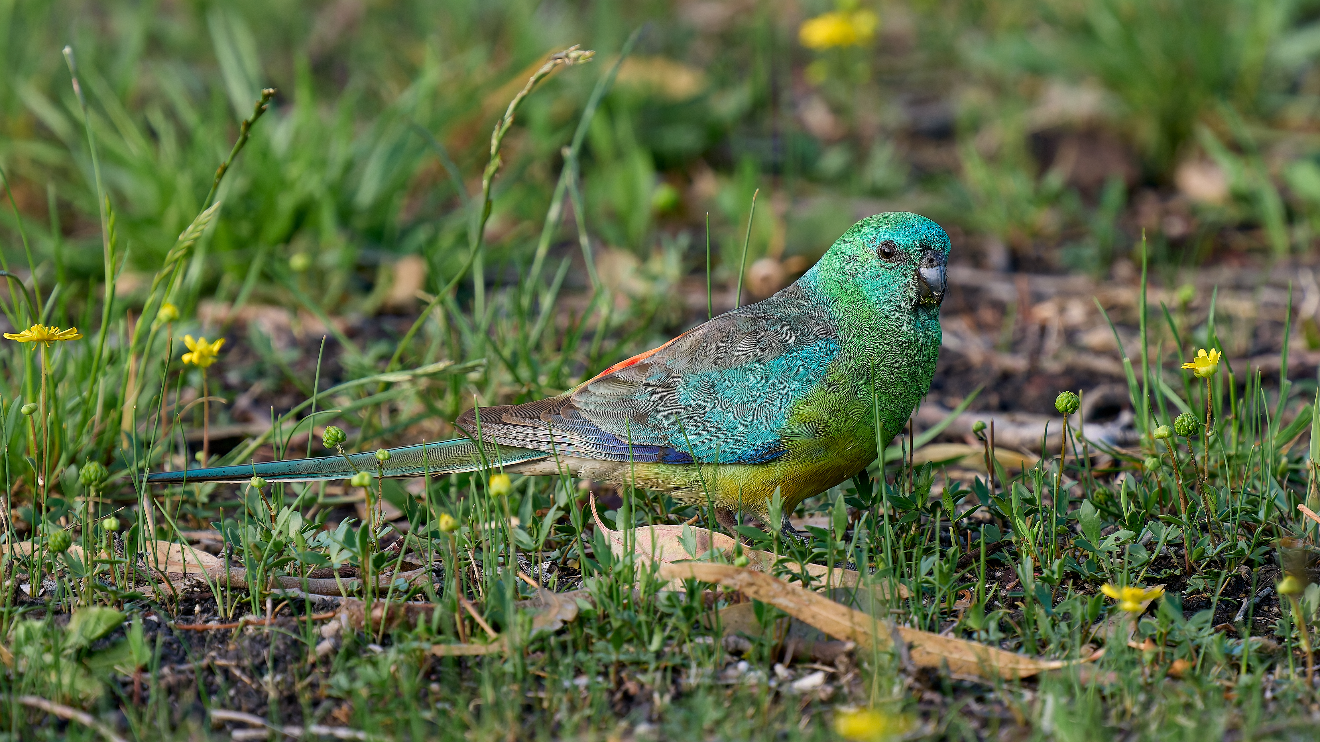
Richard of York gained battles in vain. A mnemonic for the rainbow, red, orange, green, blue, indigo, violet. The male Red-rumped Parrot would be a living rainbow if I could only find the indigo and violet. I’m sure there in there somewhere, maybe under UV light. Birds can see further into the UV spectrum than we can.
The Red-rumped Parrot, Psephotus haematonotus, is fairly common in open grassy habitats in South East Australia. It feeds on the ground. The female, sadly, is quite drab.
Back in Port Fairy now and one of the first birds I encountered was the other large Gull that is frequently found around Australia’s southern coast. Points of difference from the Pacific Gull in adults include
The bill looks less of a weapon
The bill has a red dot on the lower mandible only
The legs are a different yellow
No black band in the tail
A white margin around the black in the wing
Immature birds of both species have black bands in the tail, bill shape is then your best guide.
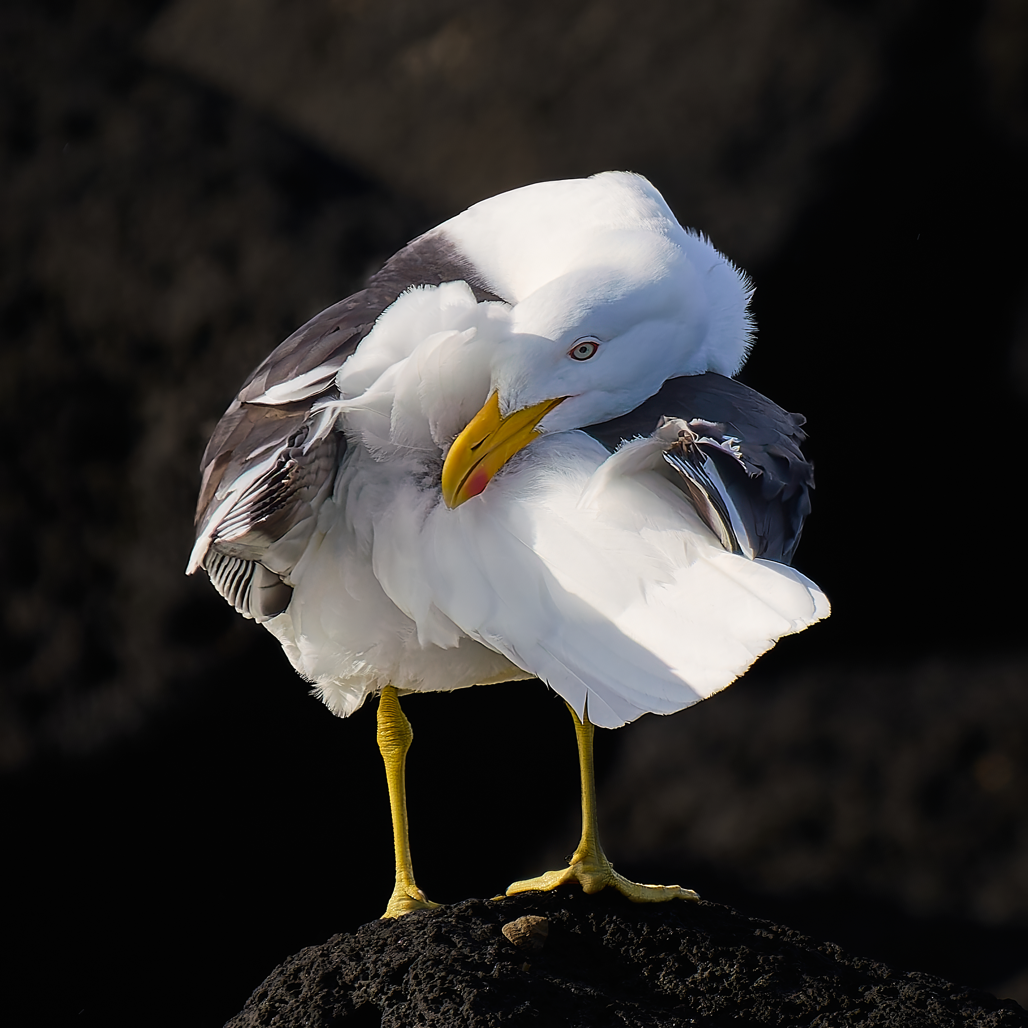
This guy had a vigorous bath then flew to the rocks to preen. Birds use their bill to distribute oil from the uropygial gland through their feathers.
I toddled down to Ricketts Point early, it’s good to get there before the dog walkers to the extent that you can. It was cold and very windy. I didn’t see a dog and indeed most of the birds were hunkered down, head into the wind, reluctant to fly. The exception was a young Pacific Gull that was not going to let the weather stop it from repeatedly dropping a mussel from a great height. It was at a bit of a distance and I’m not sure whether it succeeded in smashing it open or the wind carried it into the water.
When it found itself in need of a new mollusc it came quite close to me. I was able to photograph it coming in and while it tried to prise a mussel from a hollow in the rock. While I approved of its choice of mussel it didn’t work well for the gull. After a while it flew off with an empty beak to try further away.
It takes four years for a Pacific Gull to arrive at adult plumage and even then there may be some buff feather margins to give it away as a relative youngster. By my reckoning this is a second year gull. Back in March it would have been browner overall and the bill base would have been white. Now (November) the yellow parts have good colour but the bill tip is near black not red.
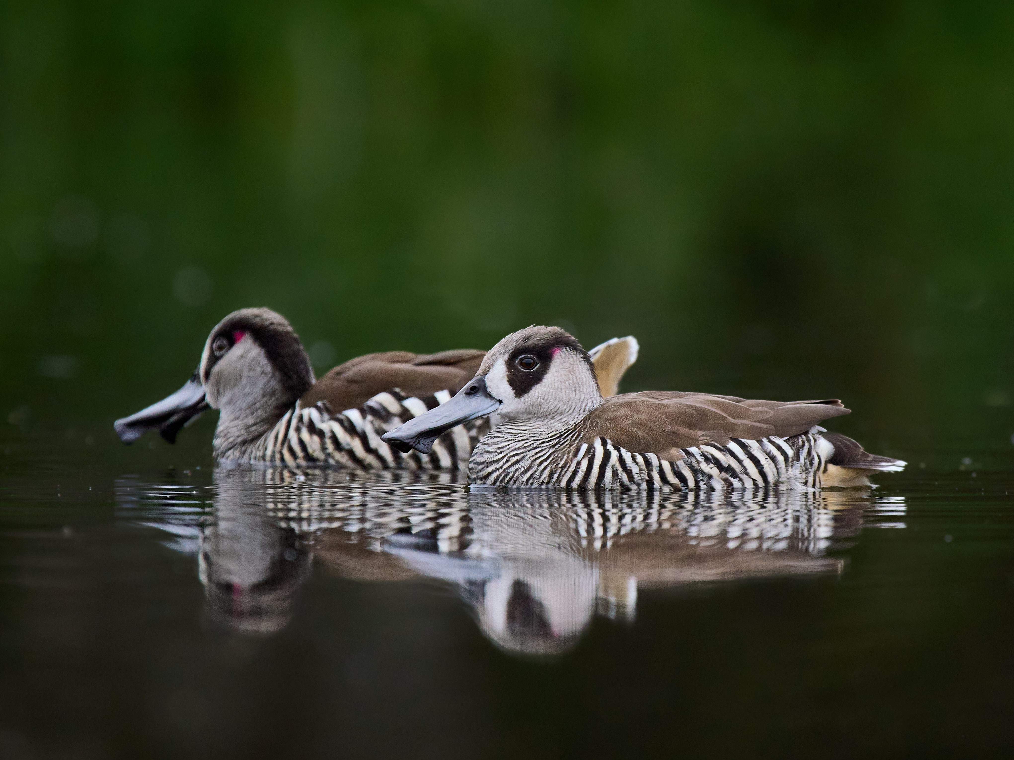
And when in Melbourne head to Braeside Park which is host to Freckled and Pink-eared Duck and even some Magpie Geese at the moment. Gentle light before the rain that’s now falling. A chance to lie in the wet grass and shoot contre jour at some Pink-ears.
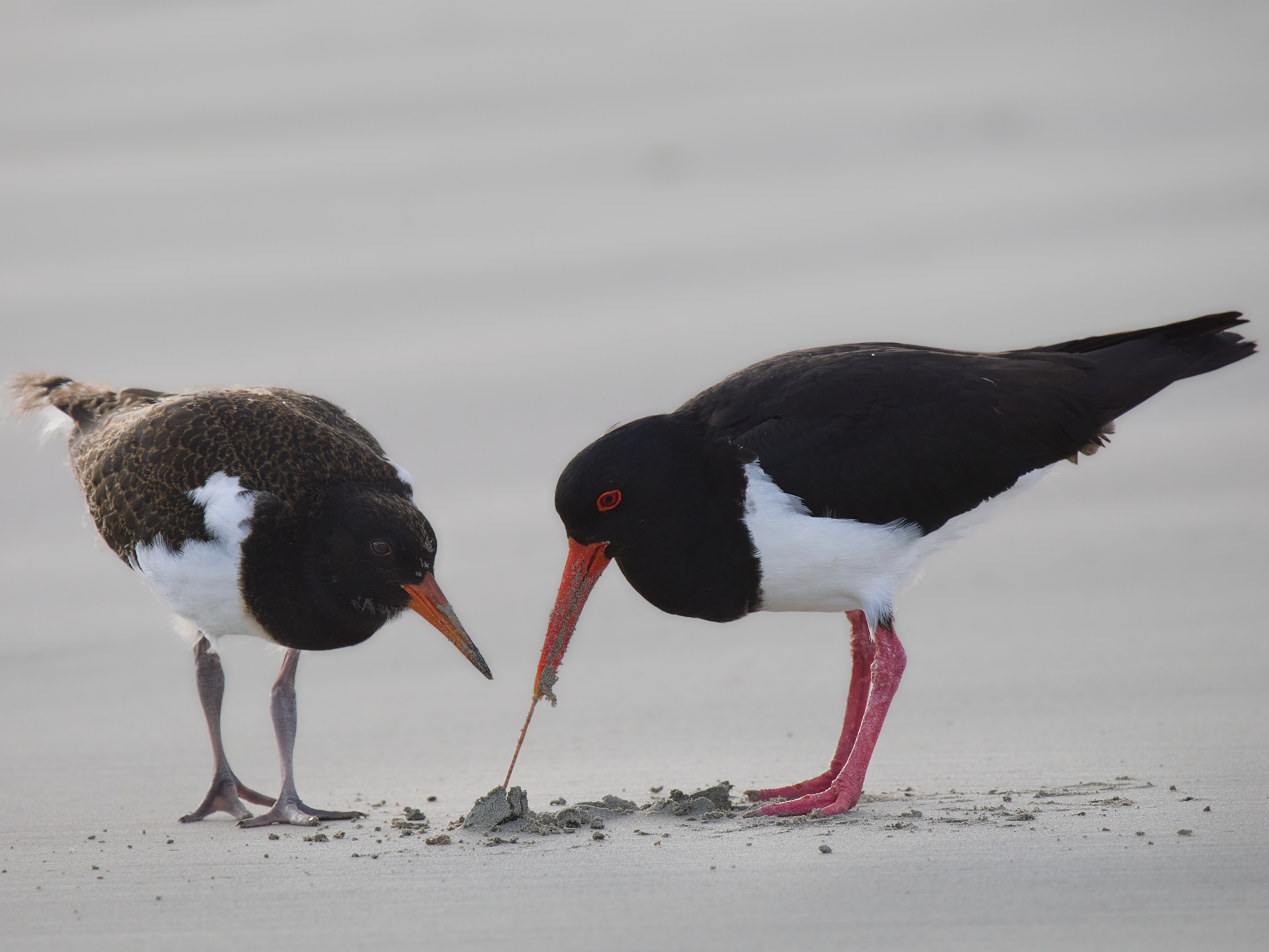
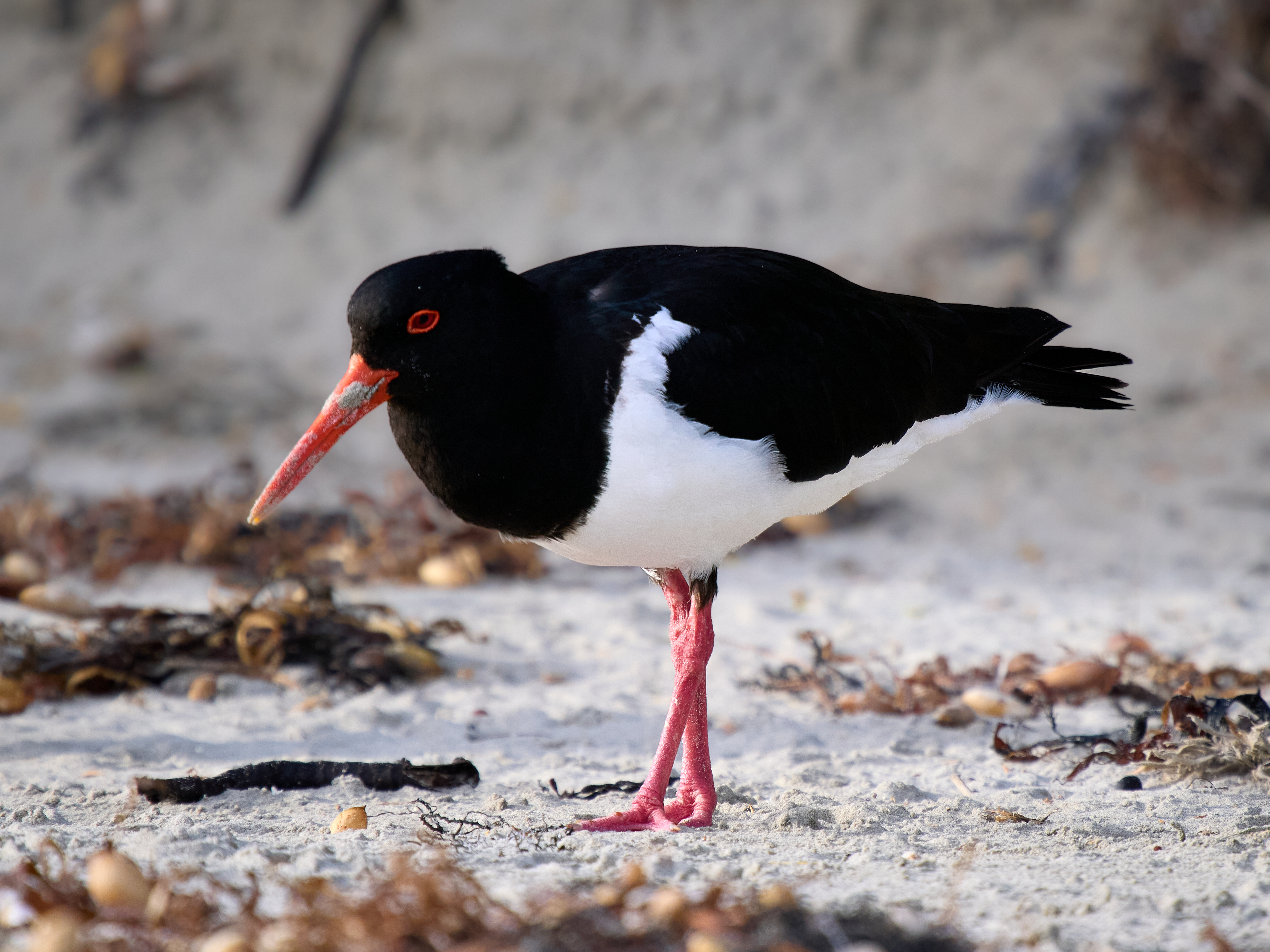
Junior is an Australian Pied Oystercatcher that hatched on Griffiths Island. You can tell this is a youngster by the brownish feather margins and relatively subdued colours on legs, bill and eye ring. He or she was probably one of two or three but there has been no trace of siblings over the last few days. Life is hazardous for young birds. Junior is probing for food for themself but is still very ready to accept food from its parents which are still a bit bigger.
When danger threatens Junior pretends to be a bit of seaweed while Mum and Dad run into the open and pipe up a racket, a distraction display.
Around the corner I came across L9. I last saw L9 three years ago and I’m pleased to see them still going strong. They were in a relationship back then but do not seem to be paired up presently. The Australian Bird and Bat Banding Scheme tell me that L9 was banded on 17th May 2011 and was 3 years or older at the time. (First and second year Oystercatchers can be aged by examination of the pattern of their moult). Banding occurred 288km away. They are now at least 17yrs old.
The migration to our summer feeding ground is complete. What we need now is for summer to follow us.
By my reckoning the distance the van has traveled from camp site to camp site is 8,727km. Add in the running around at the longer stops and the trip meter in the car stands at 12,350km. It took 55 days. The AOR Quantum+ performed well. Some minor maintenance was required and easily accomplished. It is now agisted in a paddock between here and Warnambool. Hopefully it will get some minor workouts during the summer. It has a small wound in its side courtesy of a narrow farm gate which will be fixed when I get around to it.
En route we caught up with good friends and family and visited some places that were novel and some old favorites. I thoroughly enjoy a good road trip and that was a great road trip.
Including the day before we left Broome and two days in Port Fairy I encountered 274 species of bird and the odd mammal and reptile, surprisingly few snakes. Spring in Victoria should soon fix that deficit.
Port Fairy is a coastal town of about 3,400 people. The south coast of mainland Australia was first put to commercial use by whalers and sealers out of Van Dieman’s Land (now Tasmania). James Wishart captain of the sealing ship The Fairy gave the place its name in 1828. John Griffiths established a whaling station on what is now Griffiths Island in 1835. We are staying in an old bluestone mill dating to 1860. It has been renovated since. It’s a two minute walk to Griffiths Island.
The town is packed to the rafters with heritage listed buildings and boasts the oldest pub in Victoria (so do a couple of other places so take that with a grain of salt). The port is suitable for fishing boats. Prior to the foundation of Melbourne and Geelong it was an important point of entry for settlers coming from the old dart.
Warrnambool is about 28km away and a much larger town (33,000 people). That’s where the commercial development went, leaving Fairy to be a quaint picturesque backwater.
When the Rainbow Bee-eaters and Rufous Whistlers head north for the winter so will we. At this stage our intention is to complete the loop around the coast.
Mallacoota is a visually splendid, isolated town with a resident population of 1,183 in the last census. It is situated on a lake system and surrounded by the forest of Croajingalong National Park. Summer visitors outnumber the locals, they come to fish, bird watch, hike and for the wild flowers. The town is 25km from the Princes Highway via a narrow winding road through the forest.
In late December 2019 a lightning strike in the national park started a fire about 60km from Mallacoota. There may have been 10,000 people in the town at that time. Strong winds and high temperatures were expected in the next few days. Many people left. There were still about 4,000 people there when the road out was closed on the 30th of December.
The fire reached the town on the 31st destroying some homes and businesses. The firestorm was so fierce and the smoke so dense that the small airport could not be used for evacuation or fire suppression. After the fire had passed the roads in its wake were unusable. The Royal Australian Navy commenced evacuation by sea on the 3rd of January.
That would have been a summer holiday never forgotten.
The forest has recovered well as Australian forests will but there are still charred trunks and many dead branches emerging above the canopy. We saw Grey Kangaroos and Red-necked Wallabies and were serenaded of an evening by a male Koala. Goannas were out and about and the birding was good. We spent five nights there before taking a couple of days to drive from the far east of the state to the far west.
Bell MinerCommon BronzewingEastern Grey KangarooMasked LapwingCaspian TernGreat Egret