Rwanda is quite a small country just south of the equator. It’s hilly, all of it is above 950 metres (~3000 feet) and in the west it’s positively mountainous. Mt Karisimbi is the highest point at 4,507 metres (14,787 ft). The Nile/Congo divide runs north south. About 80% of Rwanda is in the Nile basin, its contribution to the Mediterranean goes via Lake Victoria.
The divide crosses the Albertine Rift between Lake Kivu and Lac Edouard (shared between the DRC and Uganda). Edouard drains north to Lake Albert, collects reinforcements from Murchison Falls and gives rise to the White Nile.
Lake Kivu, on the other hand, drains to the south into Lake Tanganyika through the Ruzizi River. Lake Tanganyika then drains into the Congo River via the Lukuga River and heads for the Atlantic.

The source of the Nile fired the 19th century imagination in a big way. A rough and ready definition of “source” is the furthest point from the mouth where a river is still recognisably a water course, which might be a spring, a marsh or a lake. Uganda would have you believe that Lake Victoria is the source of the Nile, perhaps on the grounds that it doesn’t have Nile in its name until after it leaves the lake. The DRC could mount a similar claim to Lac Edouard. However there is a lot of river running into Lake Victoria. The Kagera River is the longest feeder, so which is its longest tributary? Burundians will tell you it’s the Ruvyironza, from Bururi Province, Burundi. But my money is on the Rukarara River from the Kamiranzovu Marsh in the Nyungwe Forest in Rwanda.
We drove past the marsh (where we had been walking a couple of days before) first thing in the morning, headed over the hills in the general direction of the capital, Kigali.
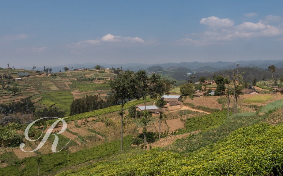
The journey gave us a little chance to see some real life in the countryside …
Our starting point is Gisakura with Lake Kivu in the distance. As you can see the road is of a good standard.
Before long we were passing tea plantations. This and coffee are important exports from Rwanda, tourism is another major earner of foreign exchange.

Much of the agriculture, though is subsistence farming. There are gardens on terraced slopes at every turn. It is a densely settled country, most of the surface area has been transformed by human activity. Many of the trees in the landscape are eucalypypts, fast growing and handy for construction and cooking fuel.
Most of the people have access to safe water supplies but the majority must carry it home from communal pumps.
When you meet children in Rwanda they will almost certainly ask you for money.
Because of the altitude Rwanda isn’t oppressively hot. There are two wet seasons and two dry seasons. In mid summer the sun is overhead the Tropic of Capricorn whereas in mid summer it is overhead … the Tropic of Cancer. No, it’s true.
It’s overhead Rwanda in spring and autumn, these are the wet seasons. June to September is especially dry, December to February less so.
By evening we were in Kigali but we stopped on the way at the National Ethnographic Museum. It is a well presented collection that follows the course of human society in Rwanda from stone age through the iron age to modern times. One striking absence is any mention of ethnicity.
Our tour there finished with a performance of drumming and traditional intore dancing.


Stirring rhythms and graceful movement.
