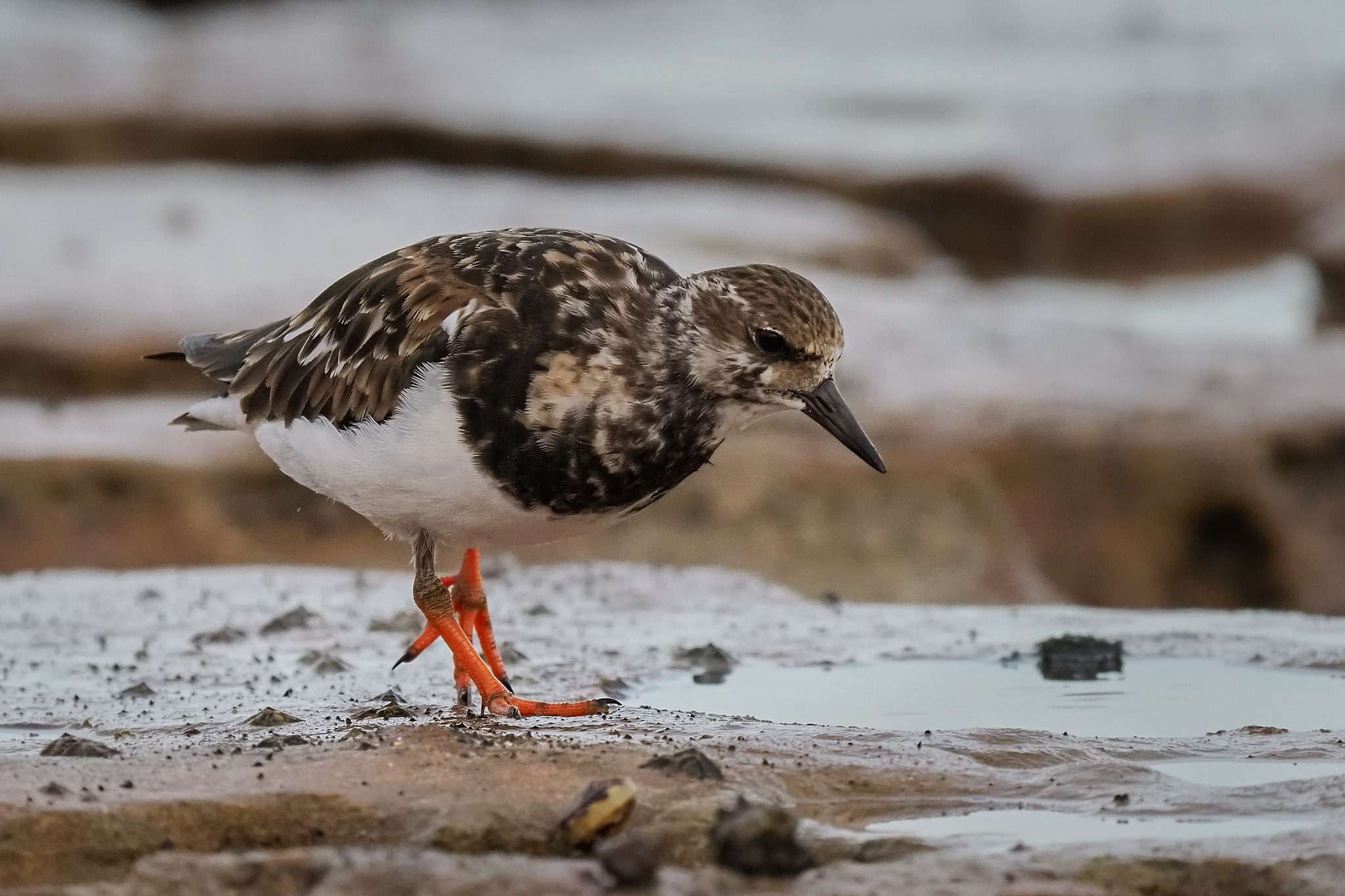
They are not especially uncommon but they do not permit close approach. The extra reach of the 150-400mm lens and the built in 1.25 teleconverter and some superb field craft has enabled me to get the best Ruddy Turnstone shots of my career. The field craft, I confess, consisted of sitting on a rock and being patient.
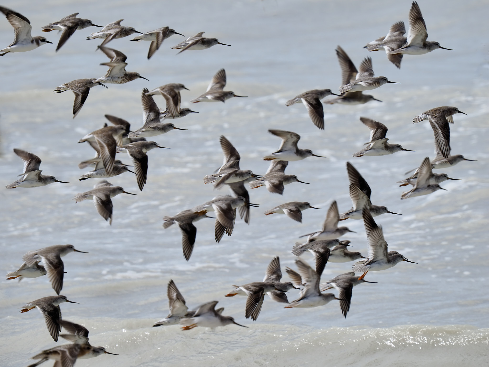
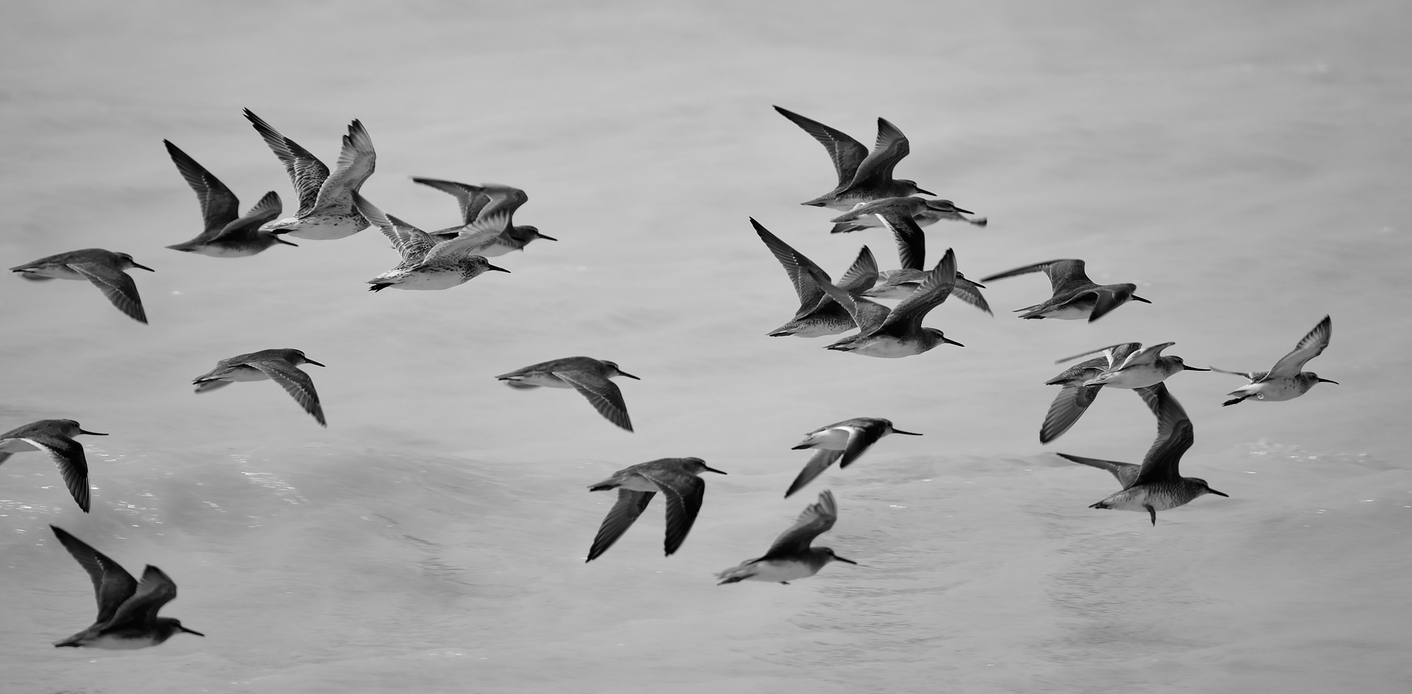
One of the features that make Broome famous is the sheer number of migratory shorebirds that visit Roebuck Bay. The big tides and extensive mudflats make it the best wader watching site in the country. Many of our visitors are getting ready for the long flight to their breeding grounds in the high latitudes of the northern hemisphere. Their priority is to feed up big to fuel the journey.
Over the next month a huge number will go but the bay will not be empty. There will still be any number of resident shore birds plus the younger birds of some migratory species that wait a year or two before making their first trip back to Siberia.
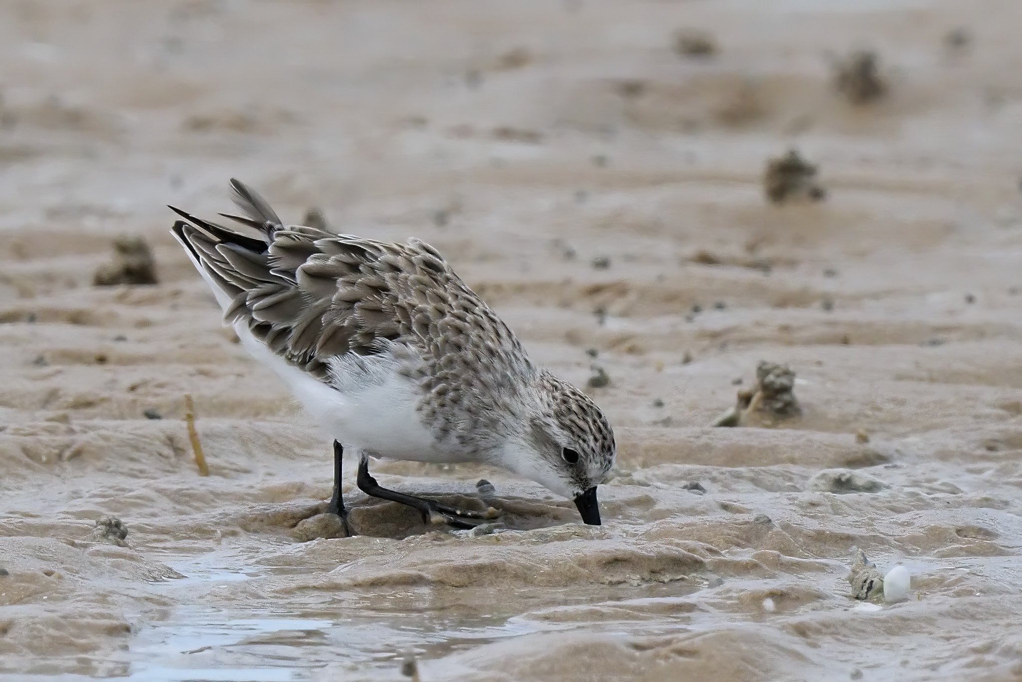
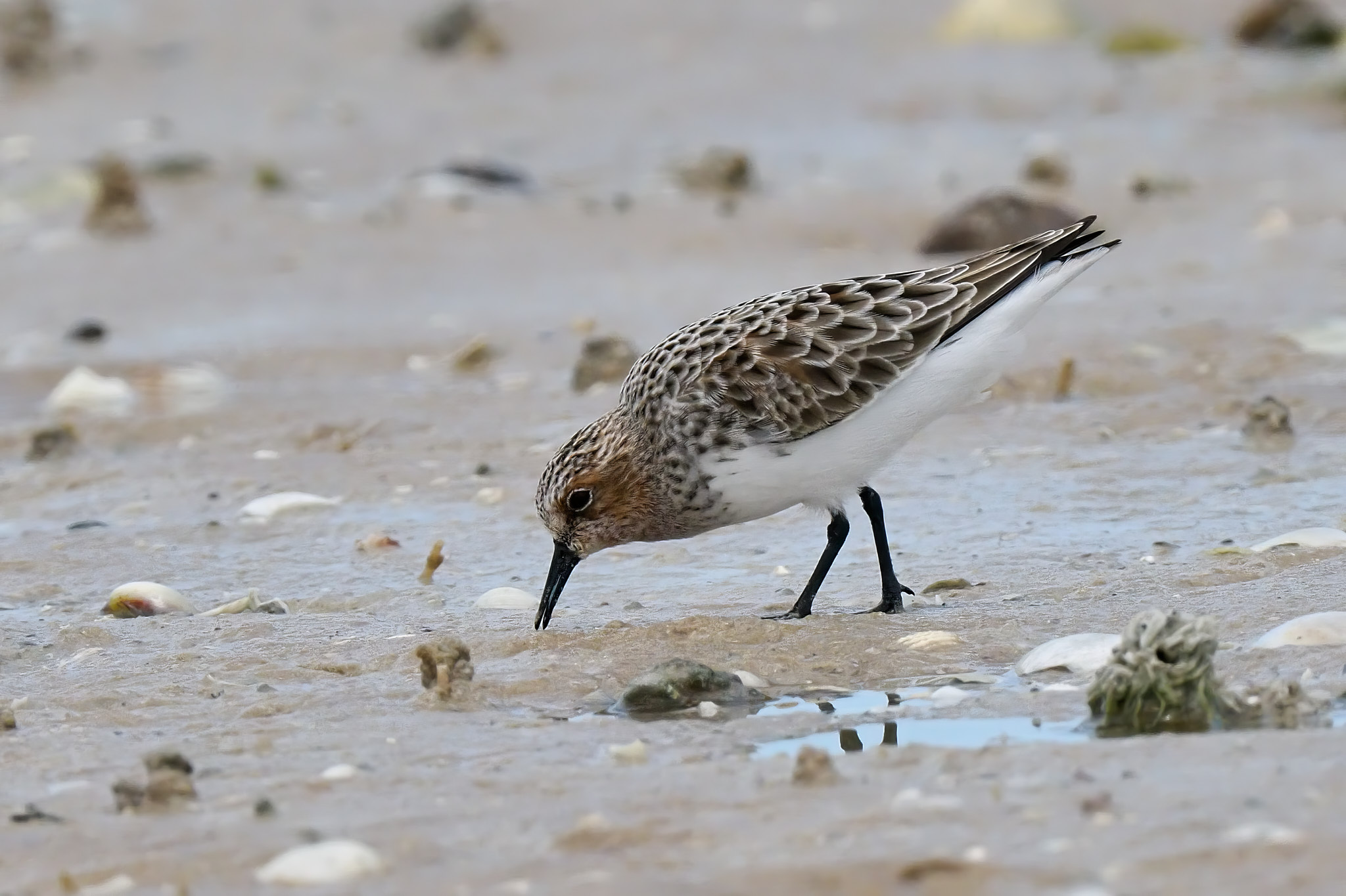
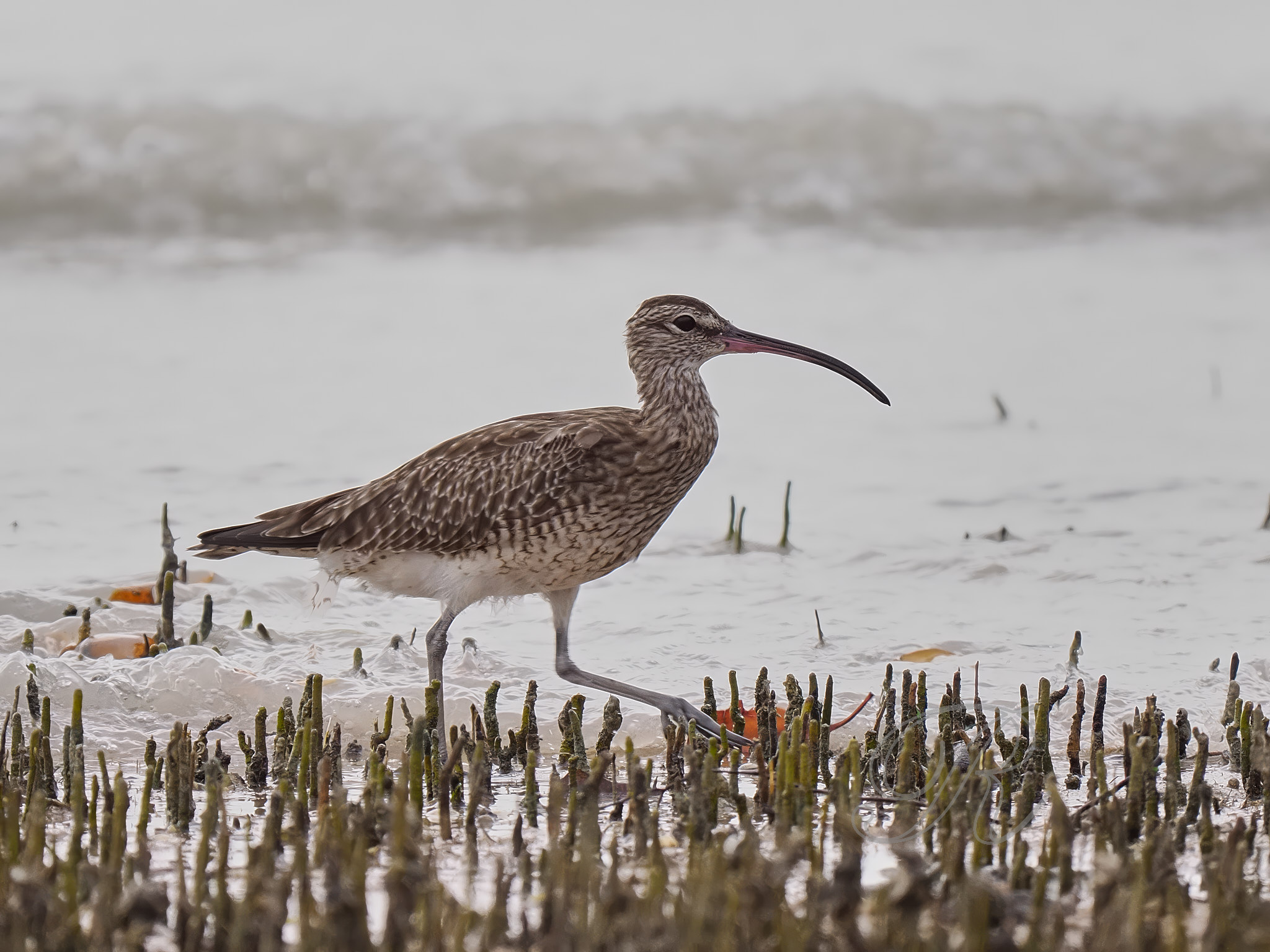
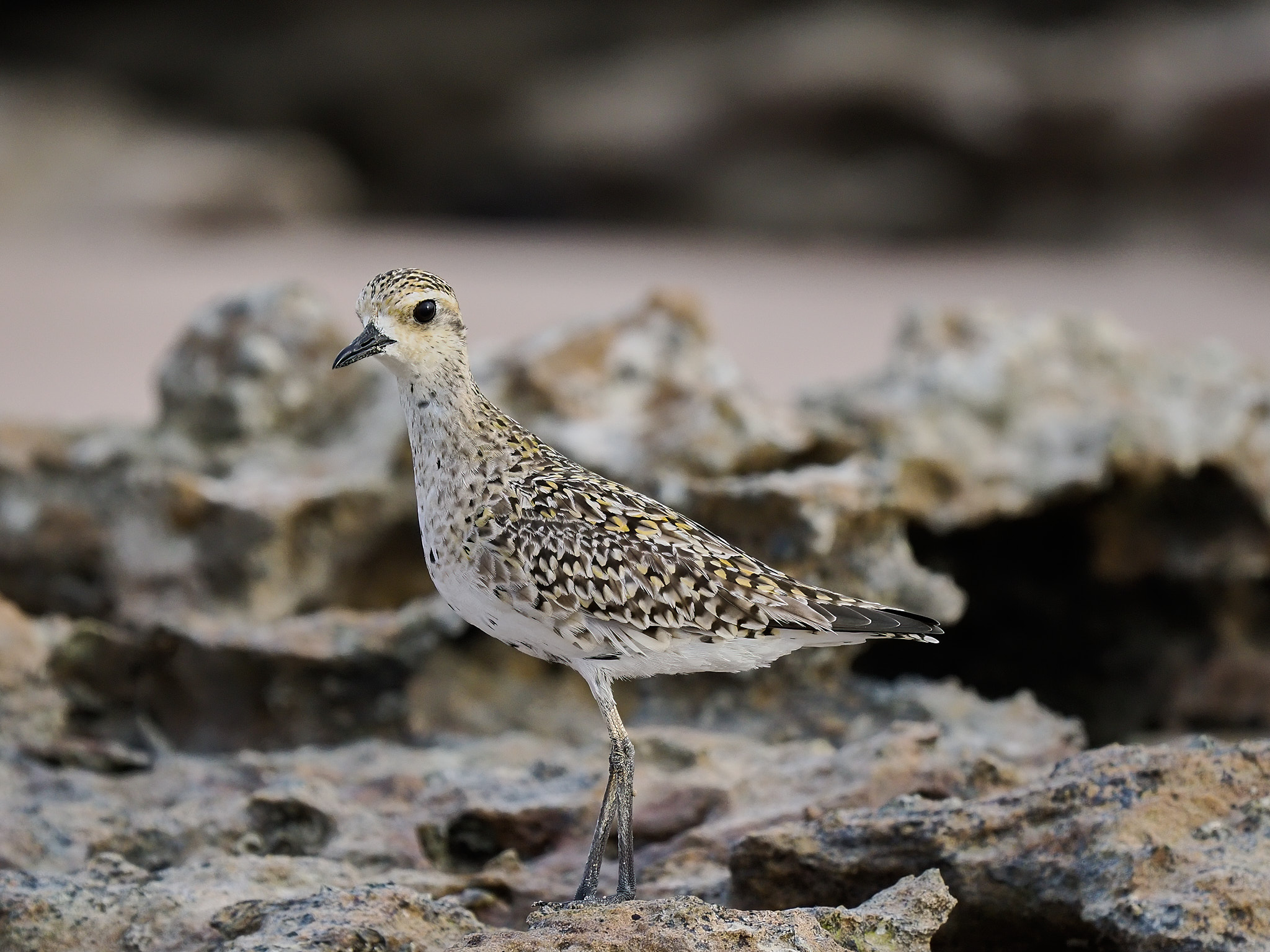
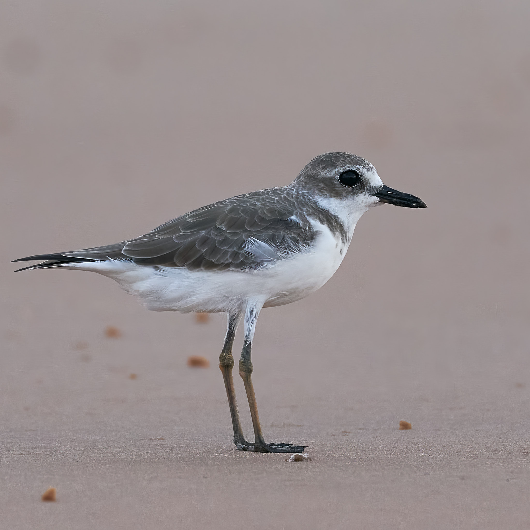
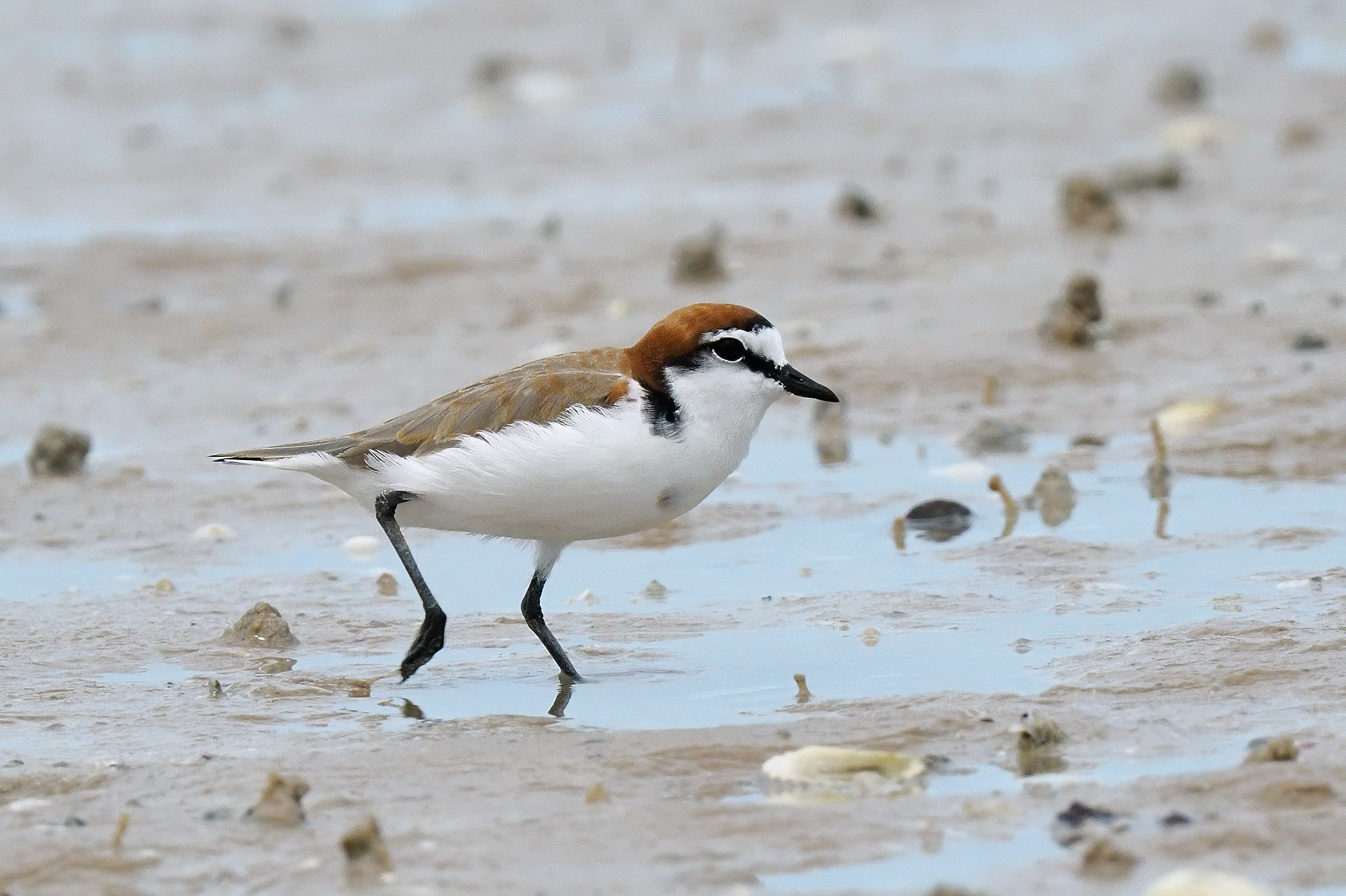
Red-necked StintRed-necked StintWhimbrelPacific Golden PloverGreater Sandplover
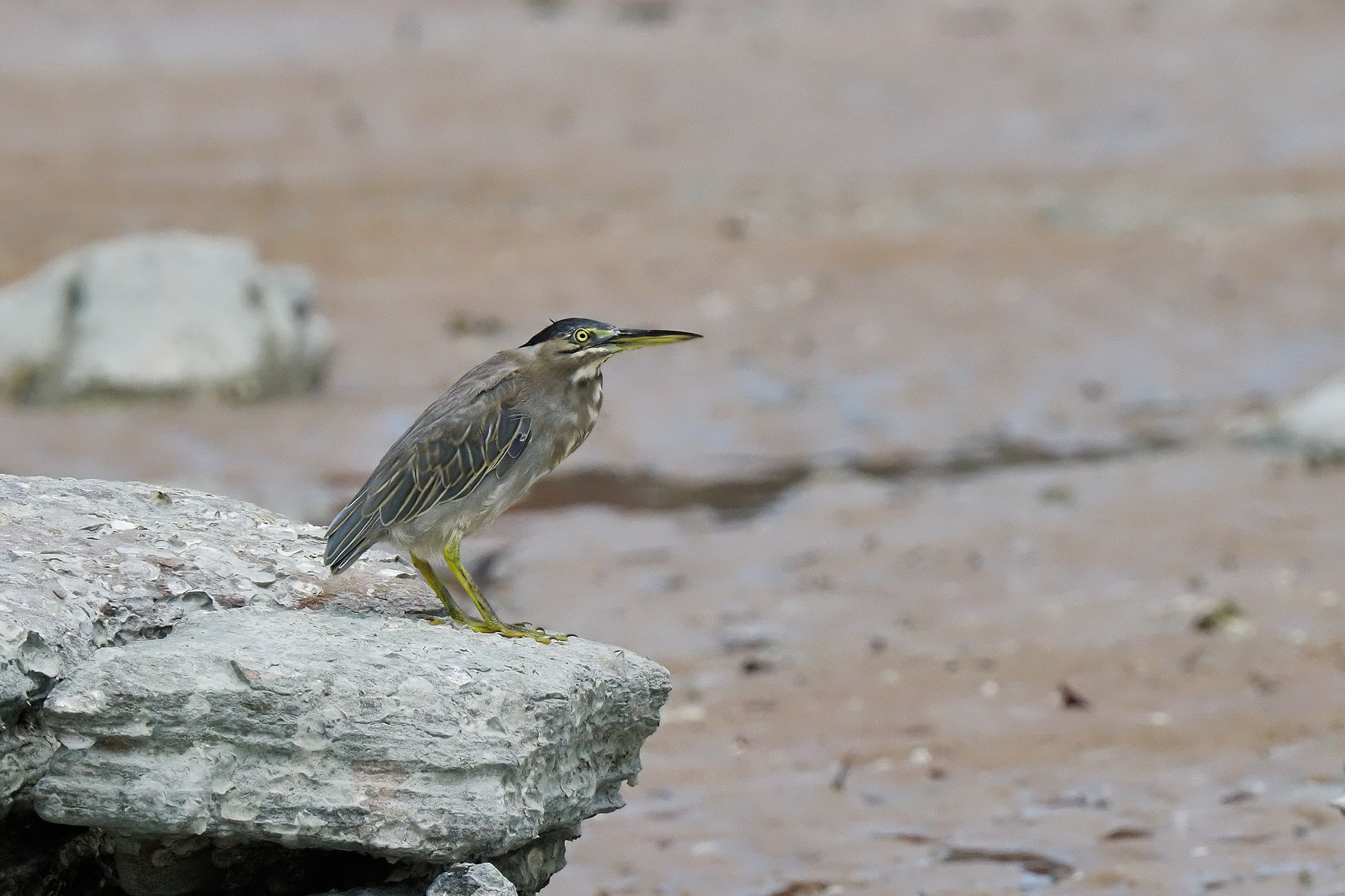
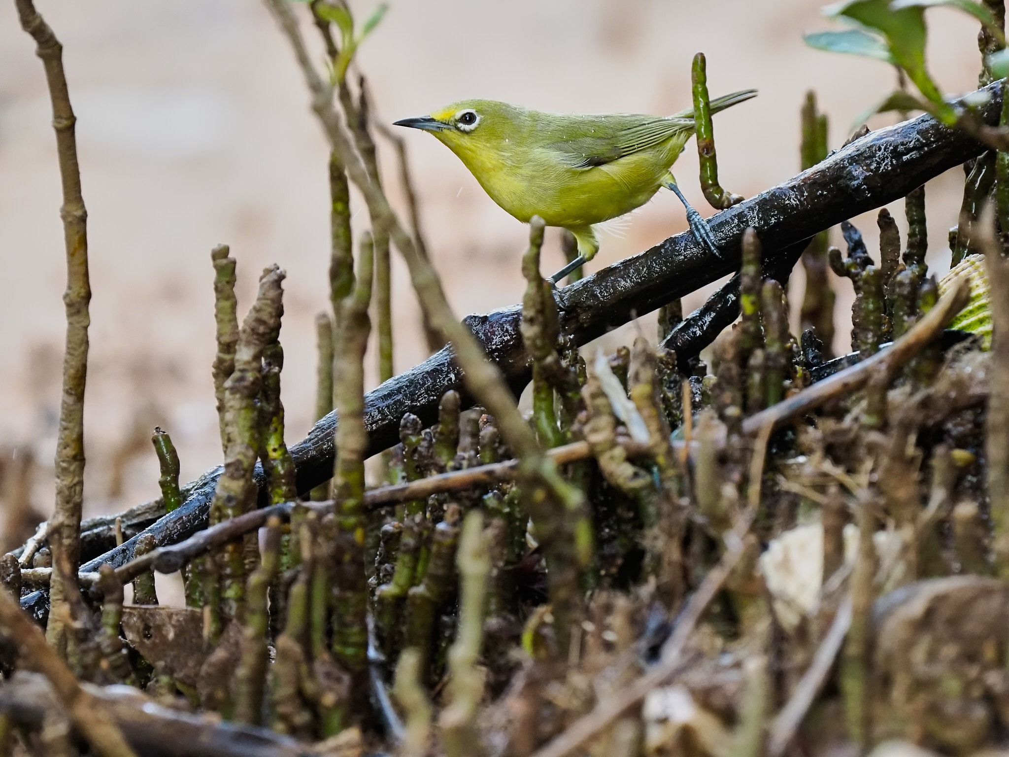
The bay is home to a number of birds that live and feed along the shore. Some are in the same order as the migratory waders, the Charadriiformes, but there are herons and egrets as well.
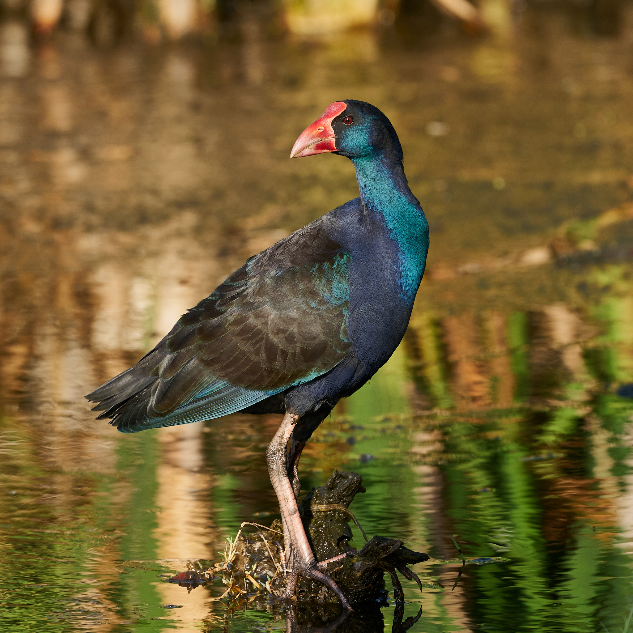
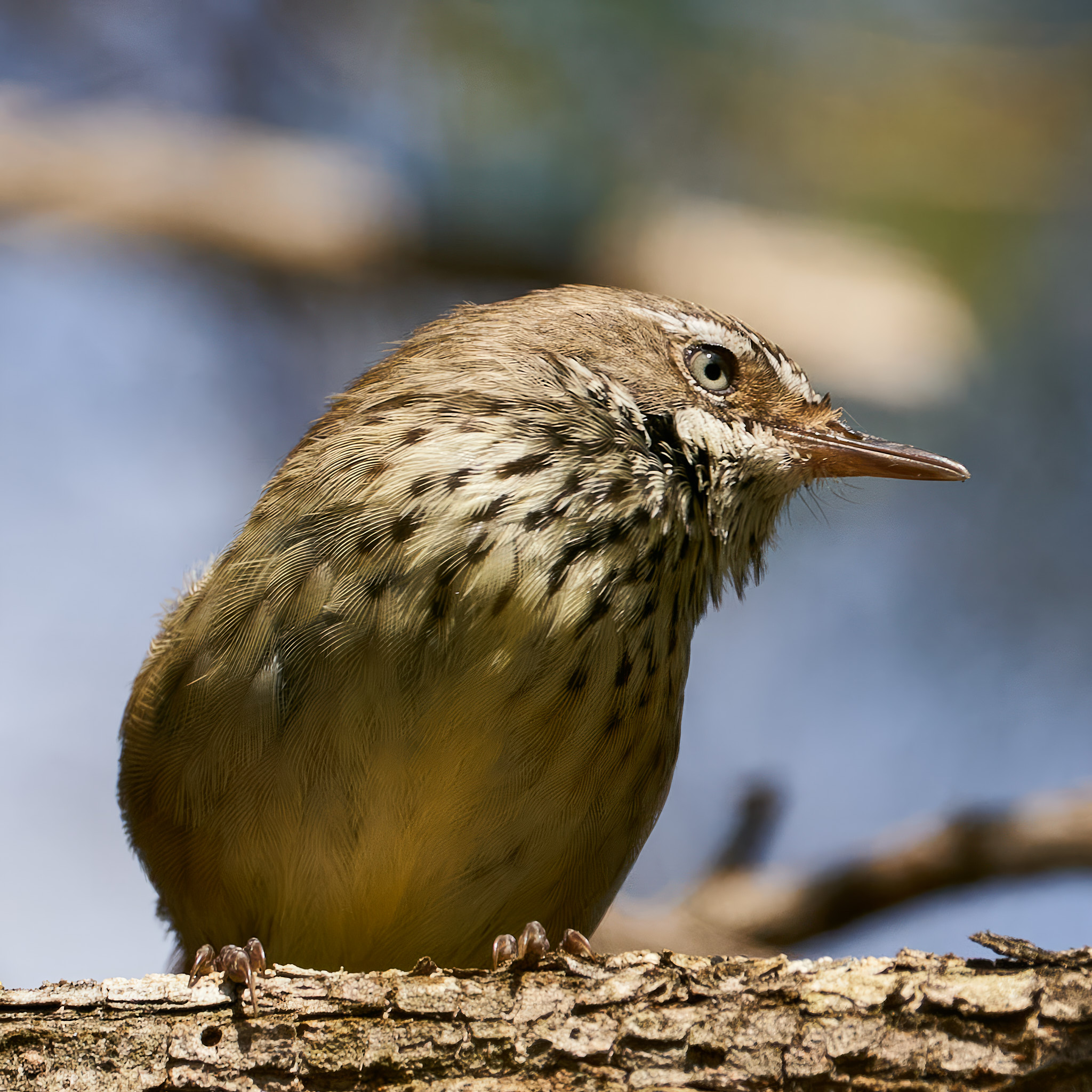
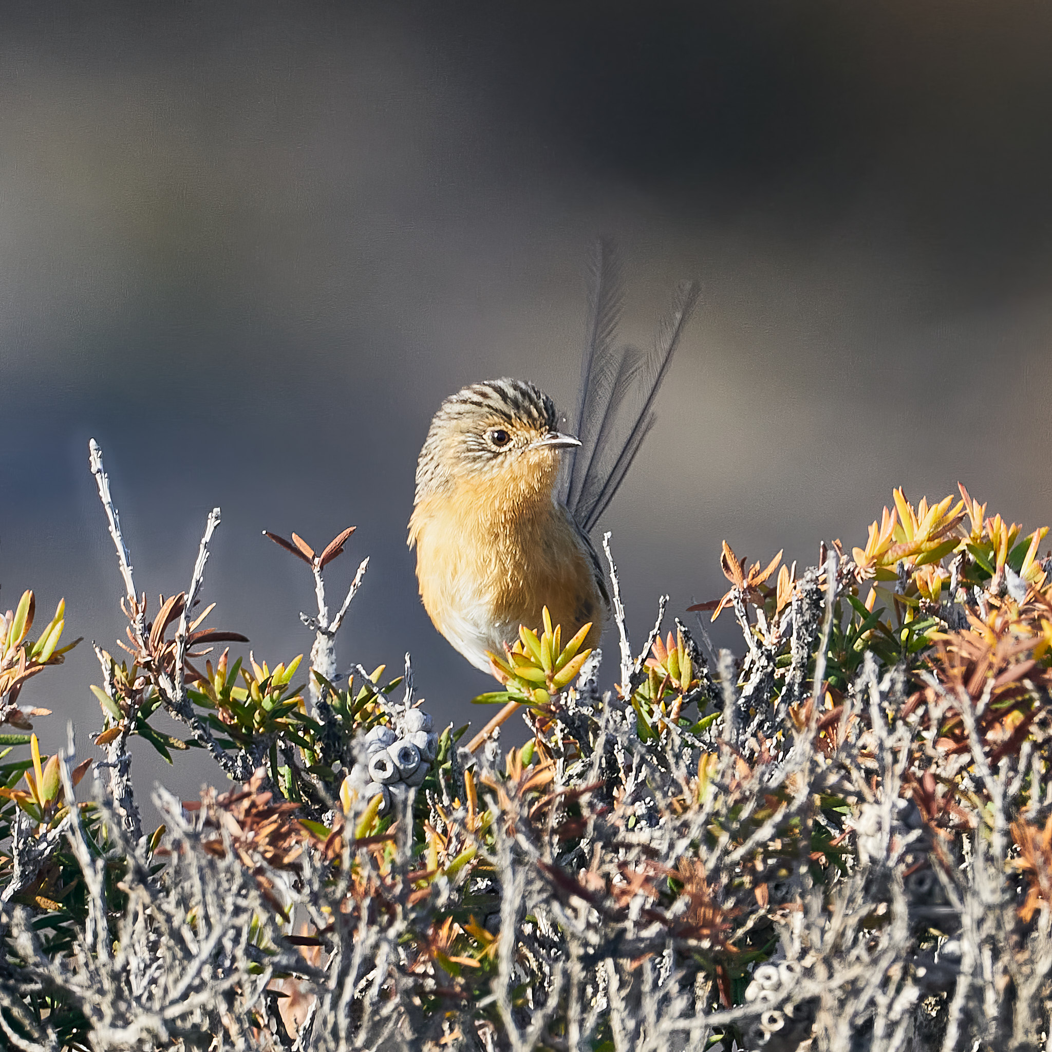
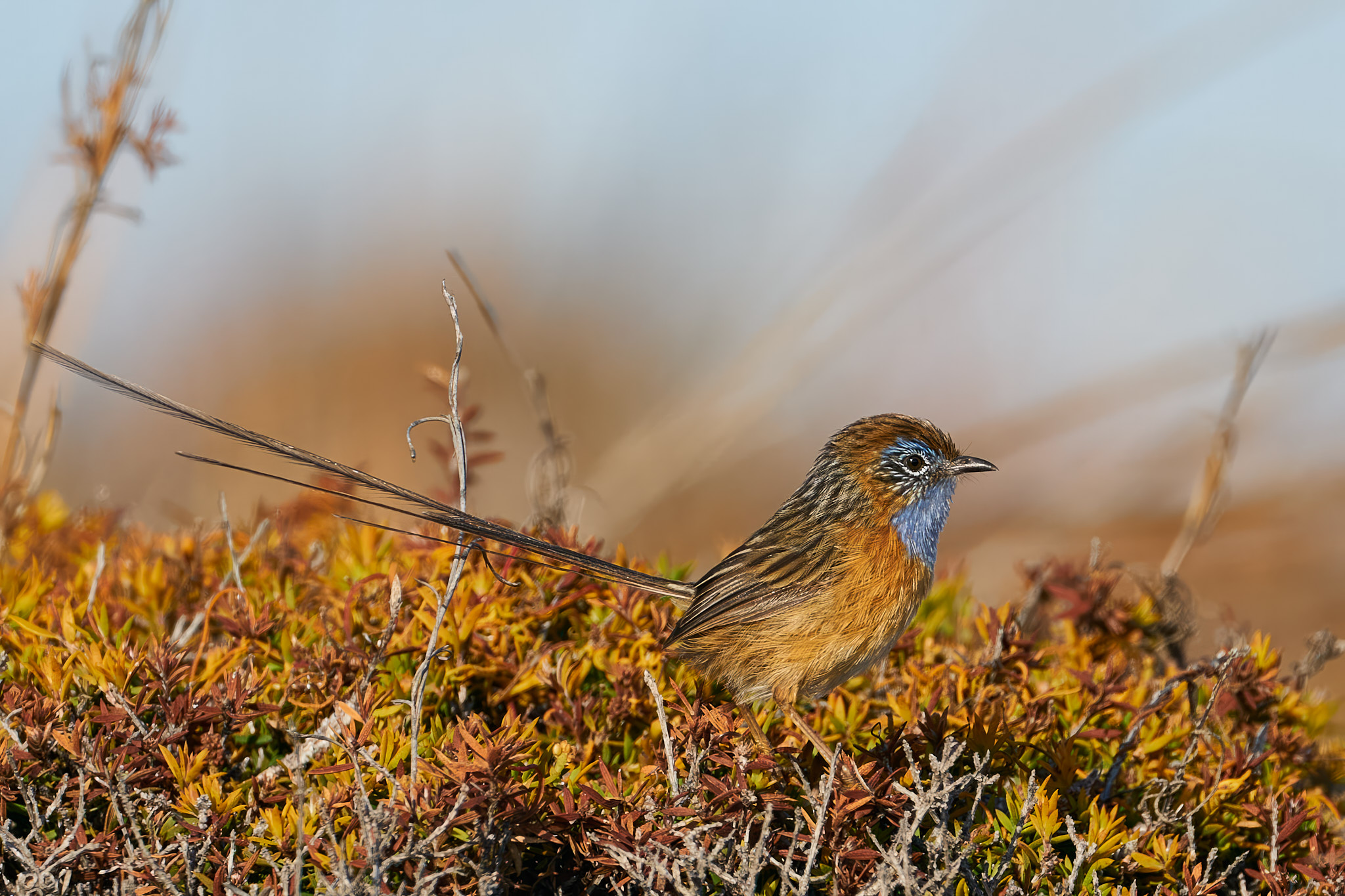
So, I’ve had the wife’s OM1 mark ii in my hot sweaty hands for a few days now. I am so in love … with the camera that is. I have been shooting with subject detection on and set to bird. I have set focus area to full. The results are impressive. This first gallery shows that if there’s a bird in the scene, no matter how busy the background is, the camera will find it.
If an eye is showing it will put a small square around it, if the eye is not in view or the bird is very distant it will put a frame around the bird. When multiple birds are in the frame each one will have its own box one of which will be highlighted. Why would you ever have more than one in a shot?
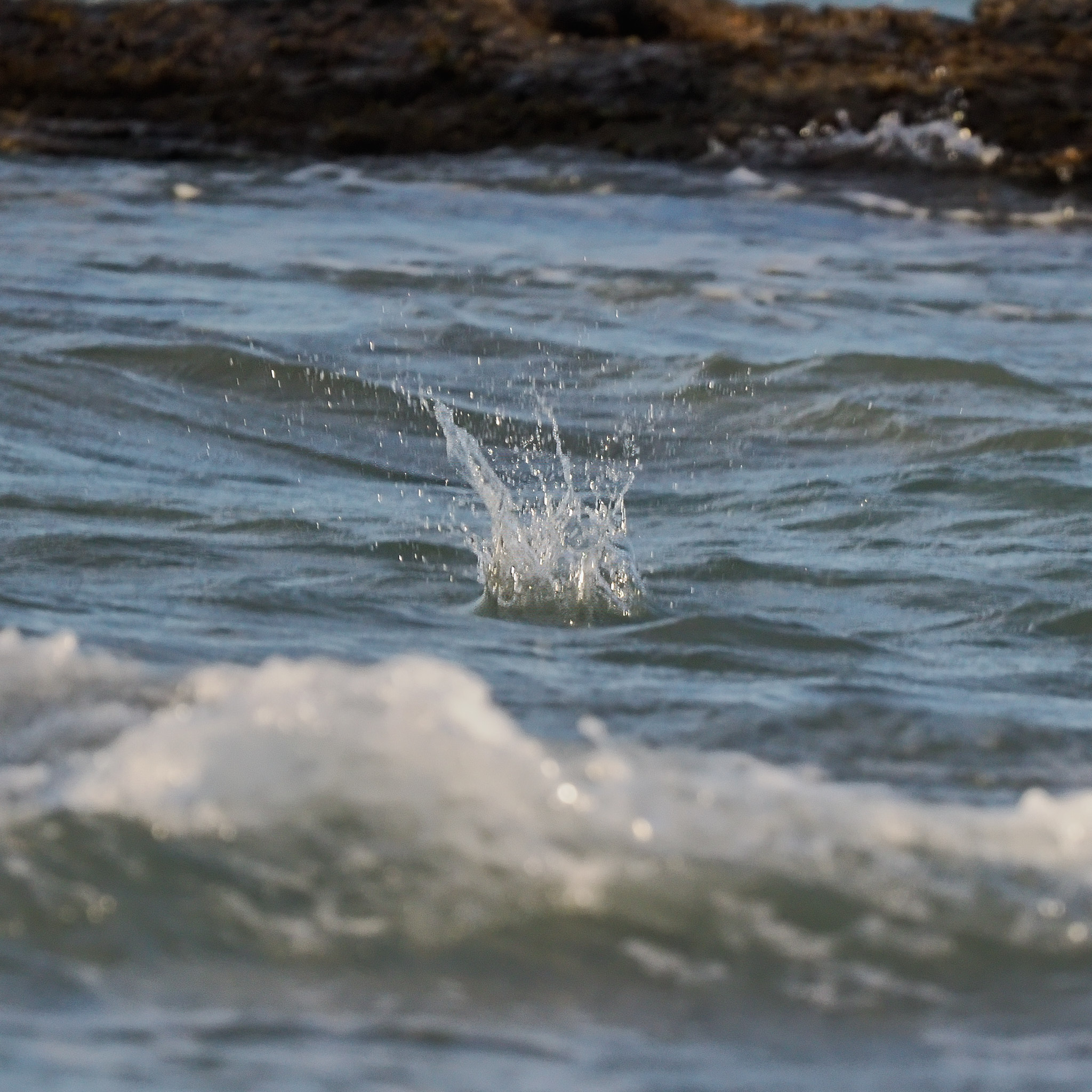
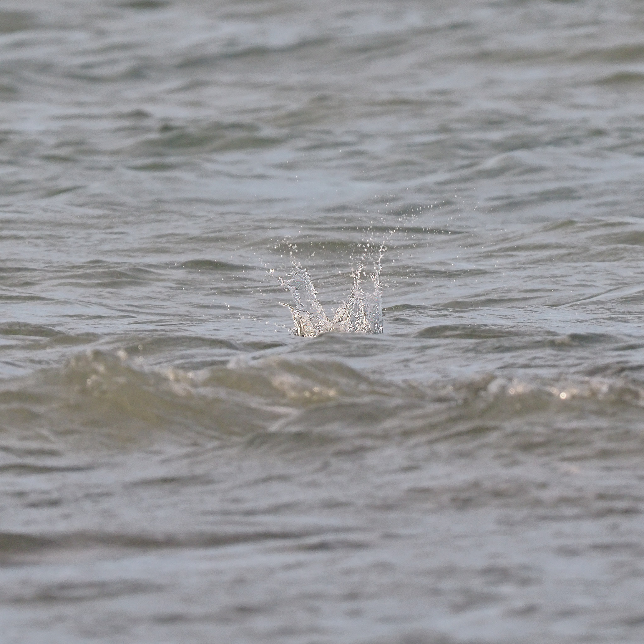
Can you fool it? Yes you can. Distance, poor light, no eye in the frame may lead to failure but not very often. It’s no longer necessary to switch to single point focus to find a bird in a bush. Does the focus stick if the bird moves? Little Terns fly along about 15m above the sea surface looking down. When they see their supper they dive. Focus will stick as long as you can keep the bird in the frame. In the example below focus is perfect all the way to the water. There are 17 frames between the splash and the bird reappearing. At 50 frames per second that’s 0.34 sec. In that time focus had been captured by a wave in the foreground.
Skill it seems is still required. The finger needs to come off at the water and then back on again for the bird’s re-emergence. (You’ve got a third of a second what’s the matter with you!)
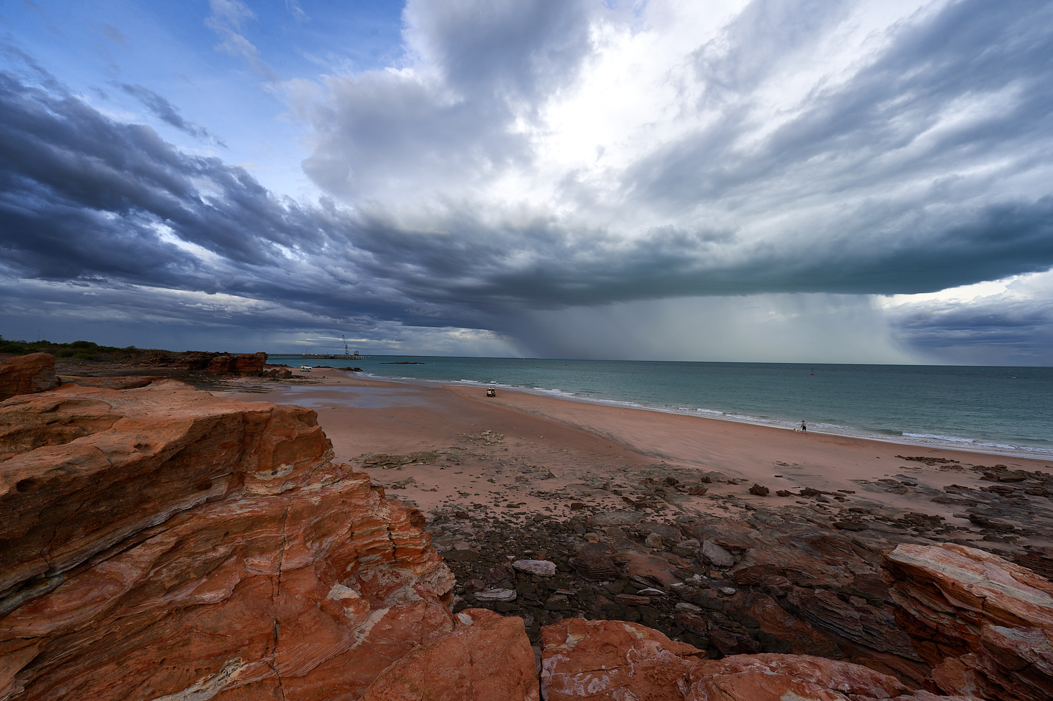
… has finally moved from above Broome. It had been raining all around us and, at last, it has dropped a couple of decent showers on us. The frogs were very happy this morning.
There has been enough cloud around to give us moody skies for a few days. The rainfall that you see over the sea moved fairly quickly ashore to drench the photographer. We must suffer for our art.
My wife doesn’t realise how lucky she is. I have bought her a brand new camera and lens. Not any old camera, an OM1 mark ii micro four thirds camera and the amazing (and expensive)150 to 400mm pro lens. In full frame camera terms that has the same reach as a 300 to 800mm lens but weighs about half as much. Very convenient for carrying about in the field. Superb in-body and in-lens stabilisation combine to make a tripod unnecessary. A flick of a lever adds an inbuilt extender that takes the reach to 500mm, equivalent of 1000mm in full frame terms. It has fast autofocus, bird and mammal recognition and pretty good low light performance. If she ever develops an interest in photography it will give her hours of pleasure. In the meantime I will familiarise myself with it so that I can help her manage its sophistication if the need arises.
Broome has no camera store it’s either online or telephone. A Perth shop seems the obvious choice – same state, same time zone, but Darwin is a fraction closer (1,871km as opposed to 2,045km) and rather than wait a couple of weeks for the mail you can have it sent by pony express. Actually Greyhound Bus. I am writing this to pass the time as I sit at the bus stop. Scheduled arrival is 3pm but there is water over the road along the way and in recent days the bus has been as much as two hours late. I could pick it up at the depot tomorrow but, child that I am, I can’t contain my excitement that long. I won’t post until I’ve got some photos to share.
The bus was on time to the minute. When I congratulated the driver she said that a bunch of screaming children made sure there was no hanging about. I flourished my consignment note and the parcel was in my hands.
I am at home now. Batteries are charging. According to the manual two and a half hours to wait. It will be dark by then. Sunrise tomorrow is at 05.45.
Just to be sure I was out and about at 5.30. Here’s a few examples …
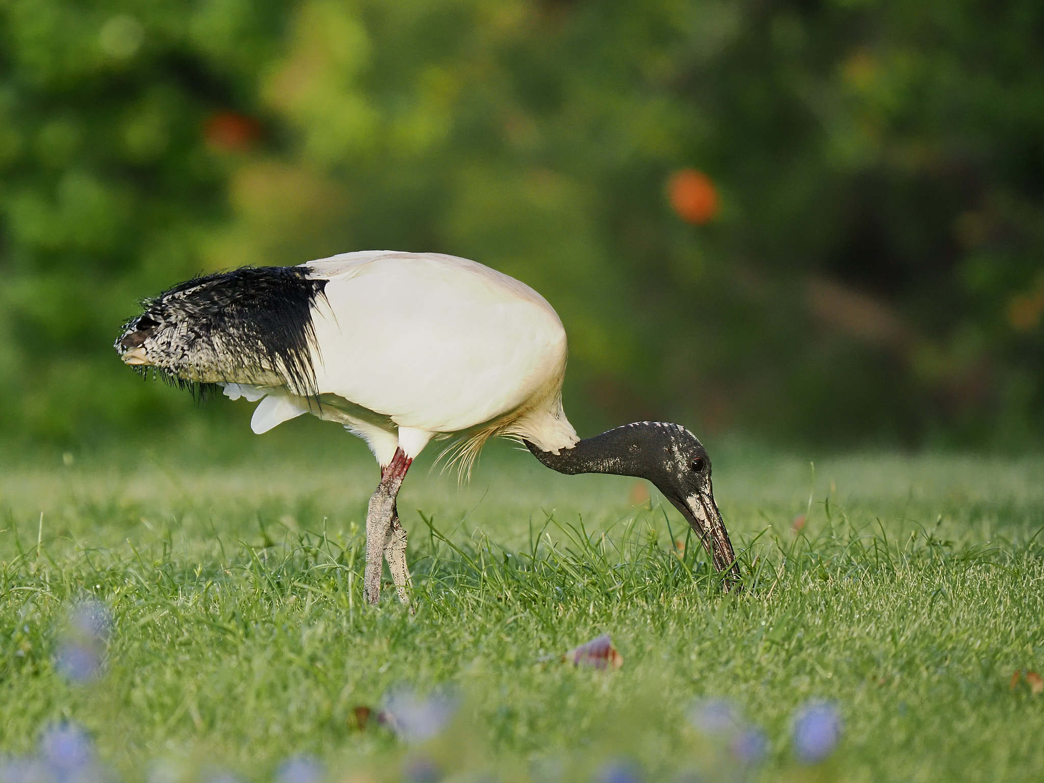
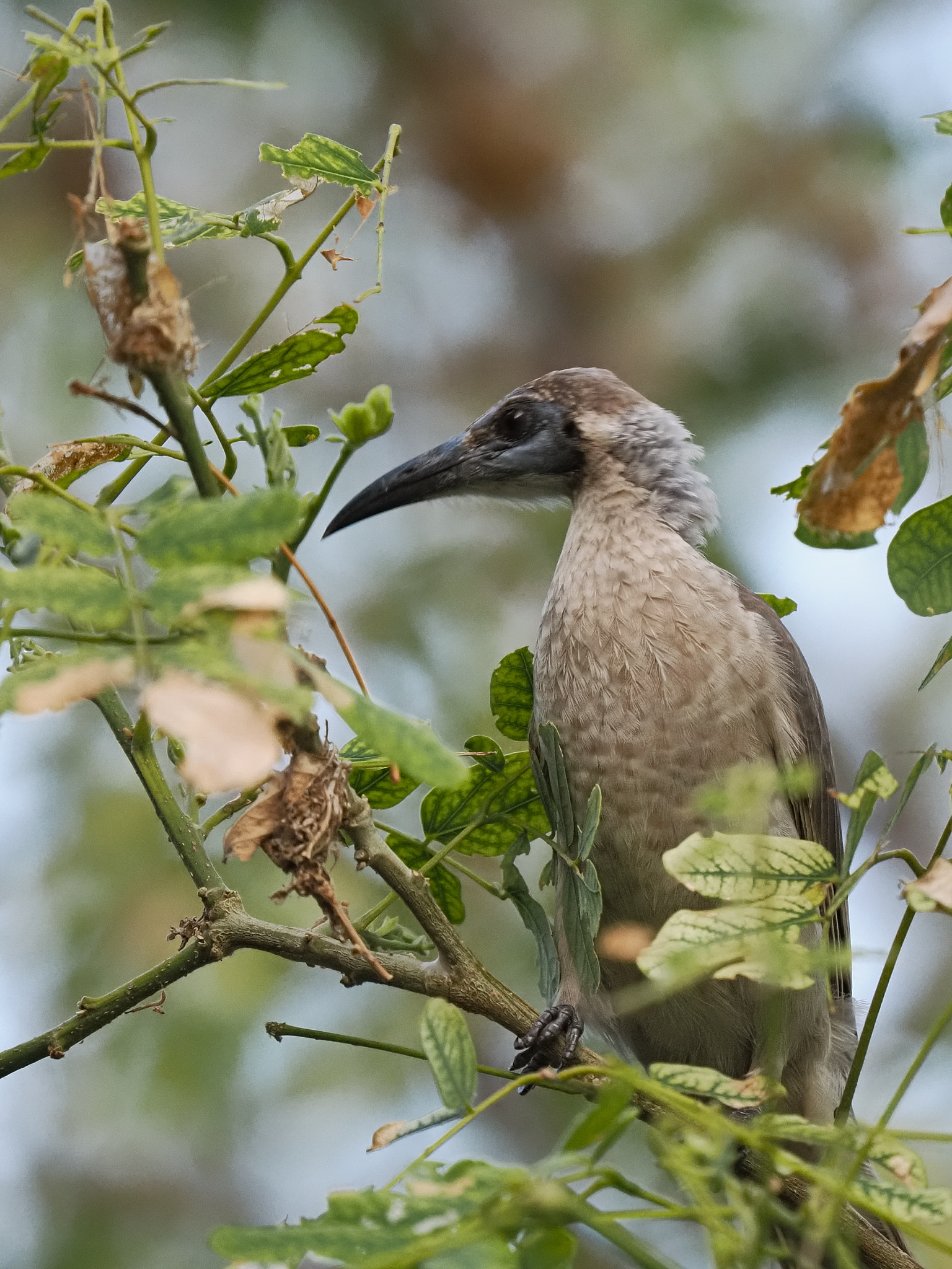
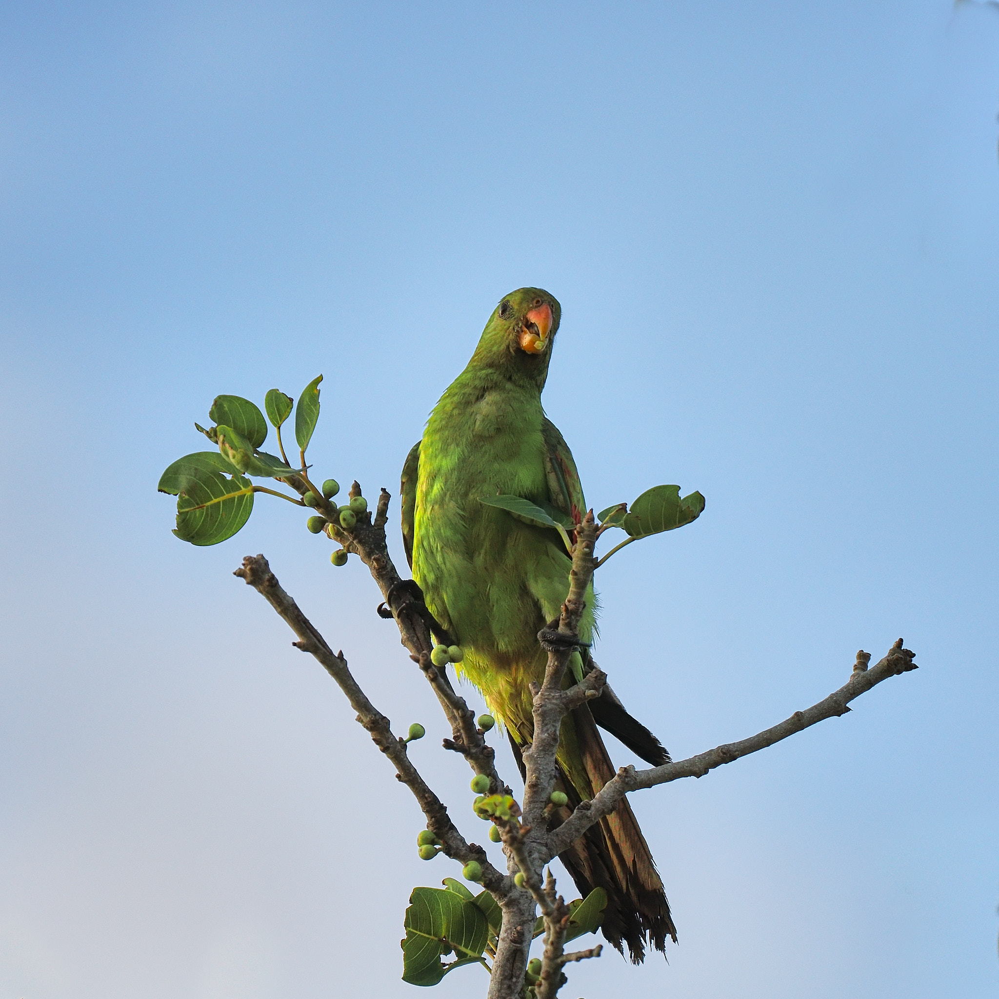
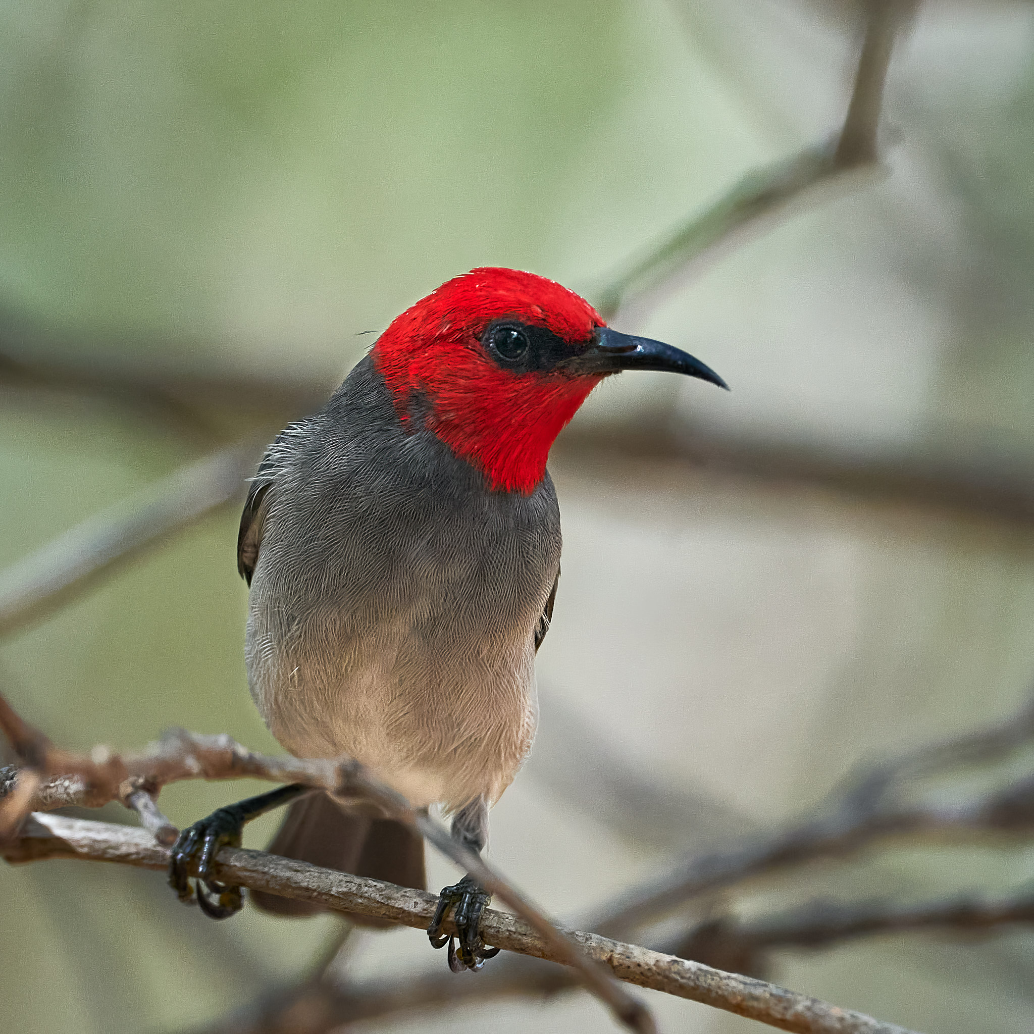
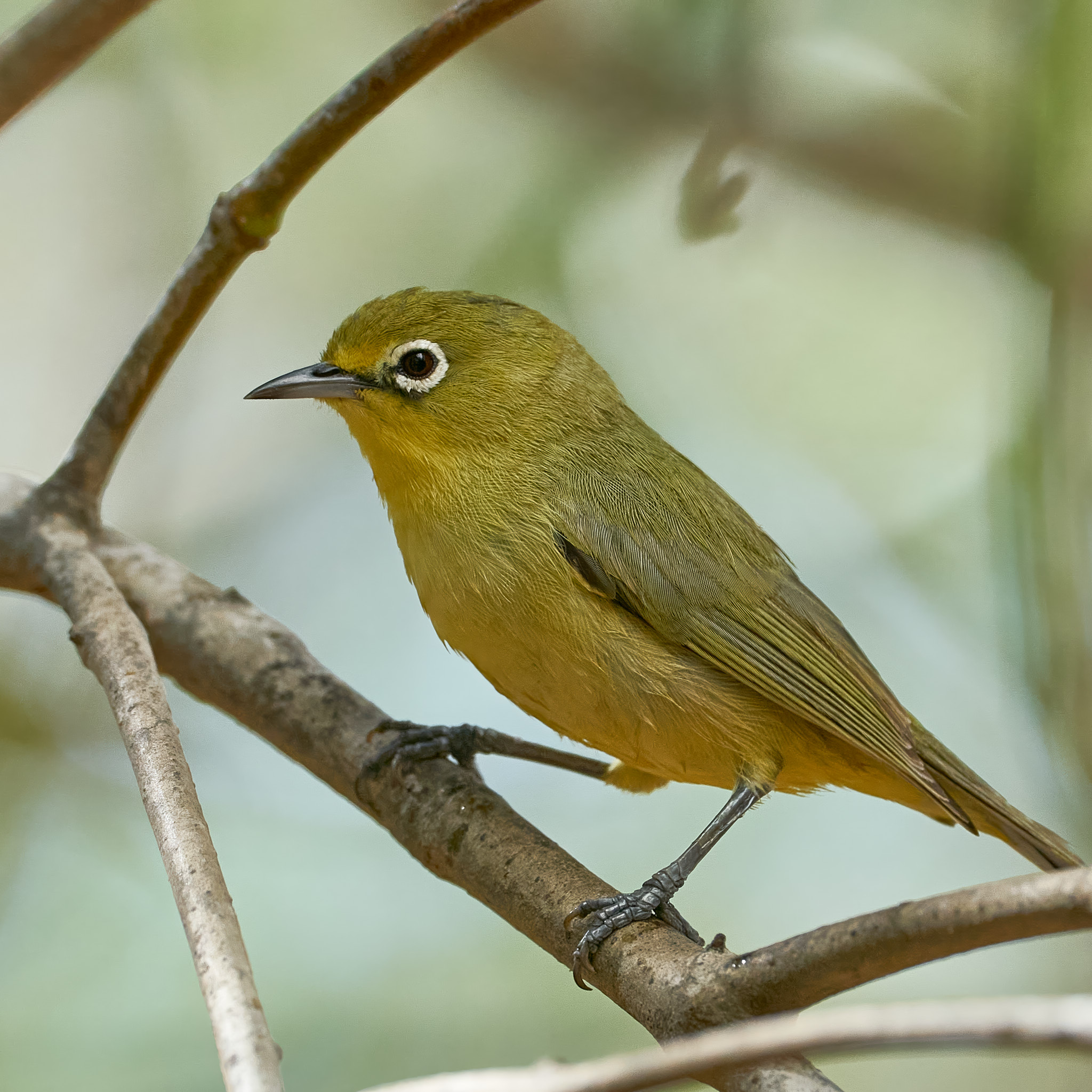
Australian White IbisLittle FriarbirdLittle FriarbirdLittle FriarbirdRed-winged Parrot
Most recent bird photos on the blog have been taken with a Sony 200 to 600m lens on a Sony A9. That’s a full frame camera. The extra reach on the new camera means that I will be cropping in less which is just as well as there are fewer megapixels on the OM1. It also means that I will have to pay more attention to composition because less cropping means less opportunity to recompose the shot. This sequence is all from the one photo. The first frame is as it was shot, the poor composition is evident. Cropping in gives a better image. Cropping in further eventually brings about an obvious drop in quality …
Don’t think of this as a review. I need to work my way around the various shooting options, with enough practice I may get to be as good as the camera. Then I will be in a position to give an opinion.
When the moon and the sun are in line high tide is really high and low tide is as low as it goes. These are spring tides, even in summer, autumn or winter. It’s got nothing to do with the season. Seven days after a spring tide the sun and moon are at right angles, tides are moderate. These are neap tides.
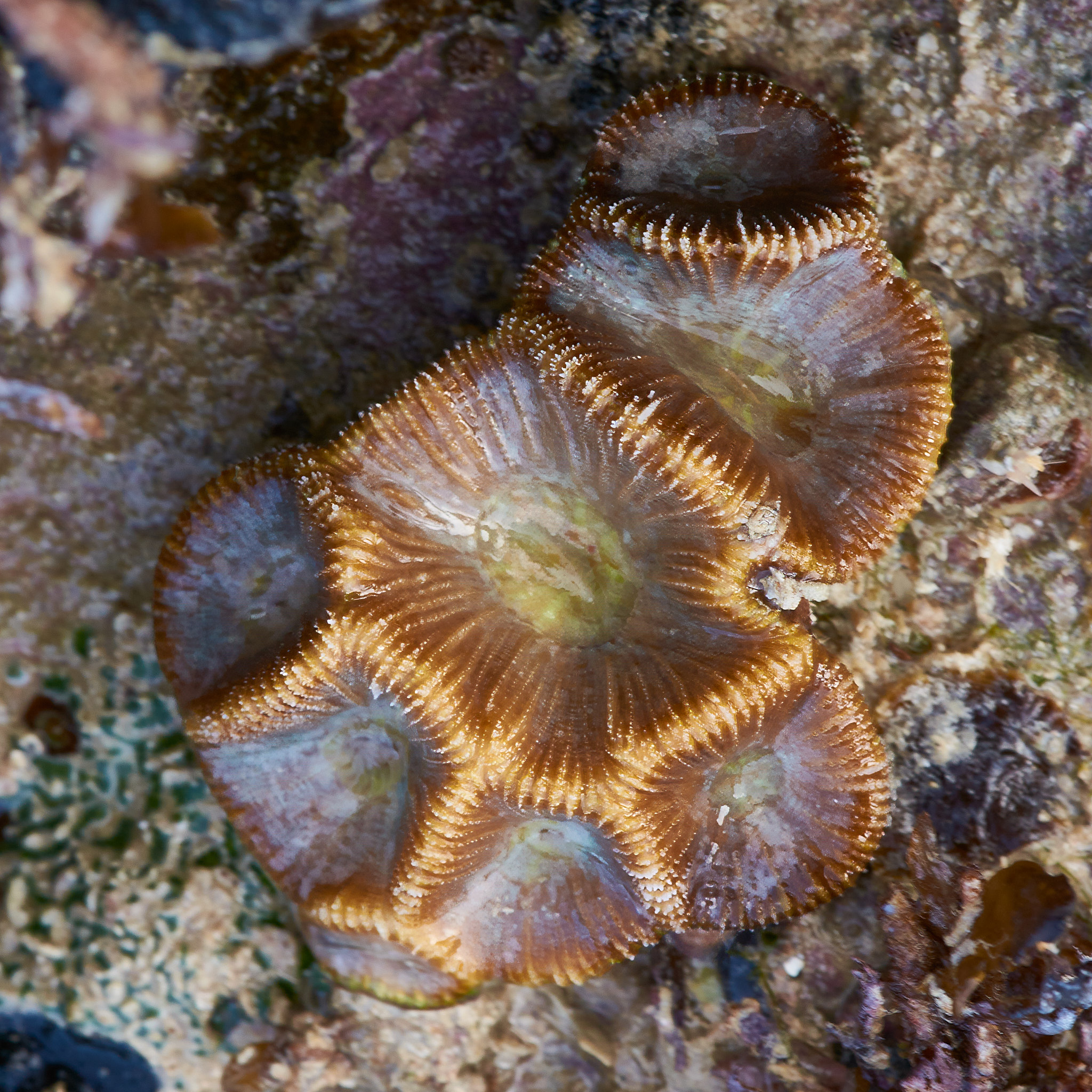
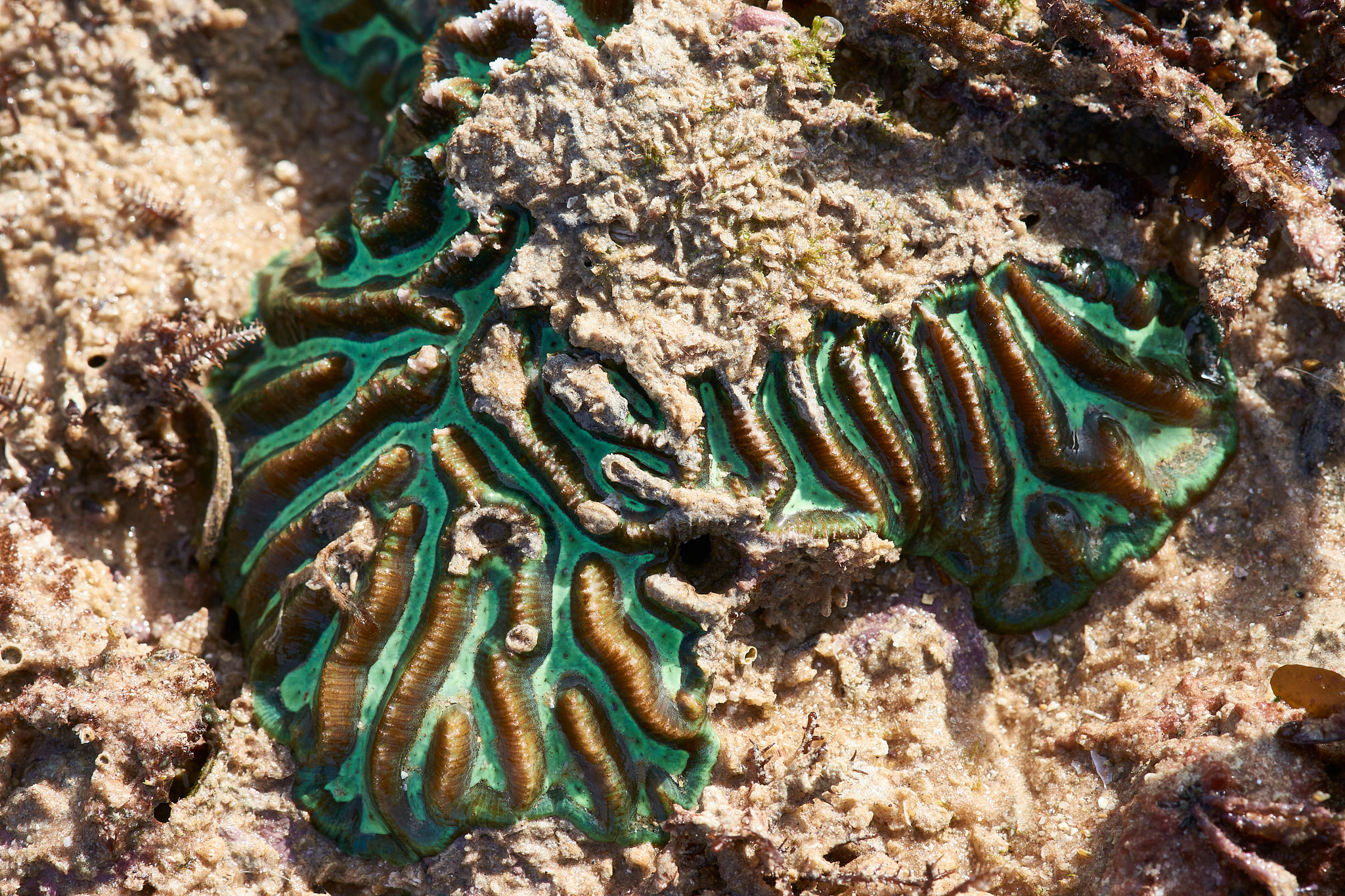
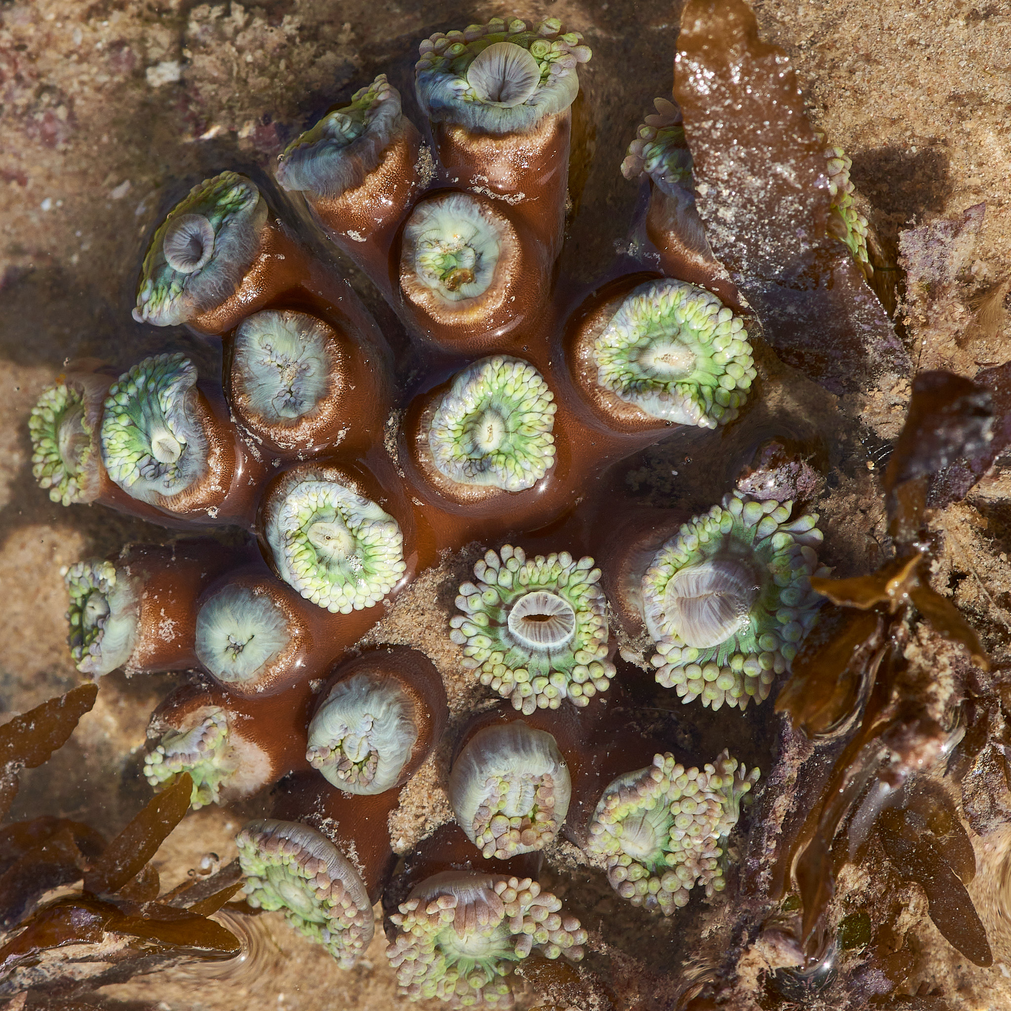
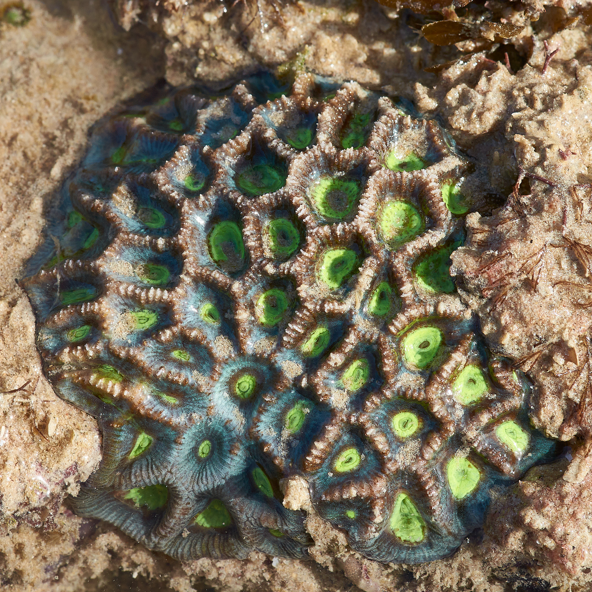
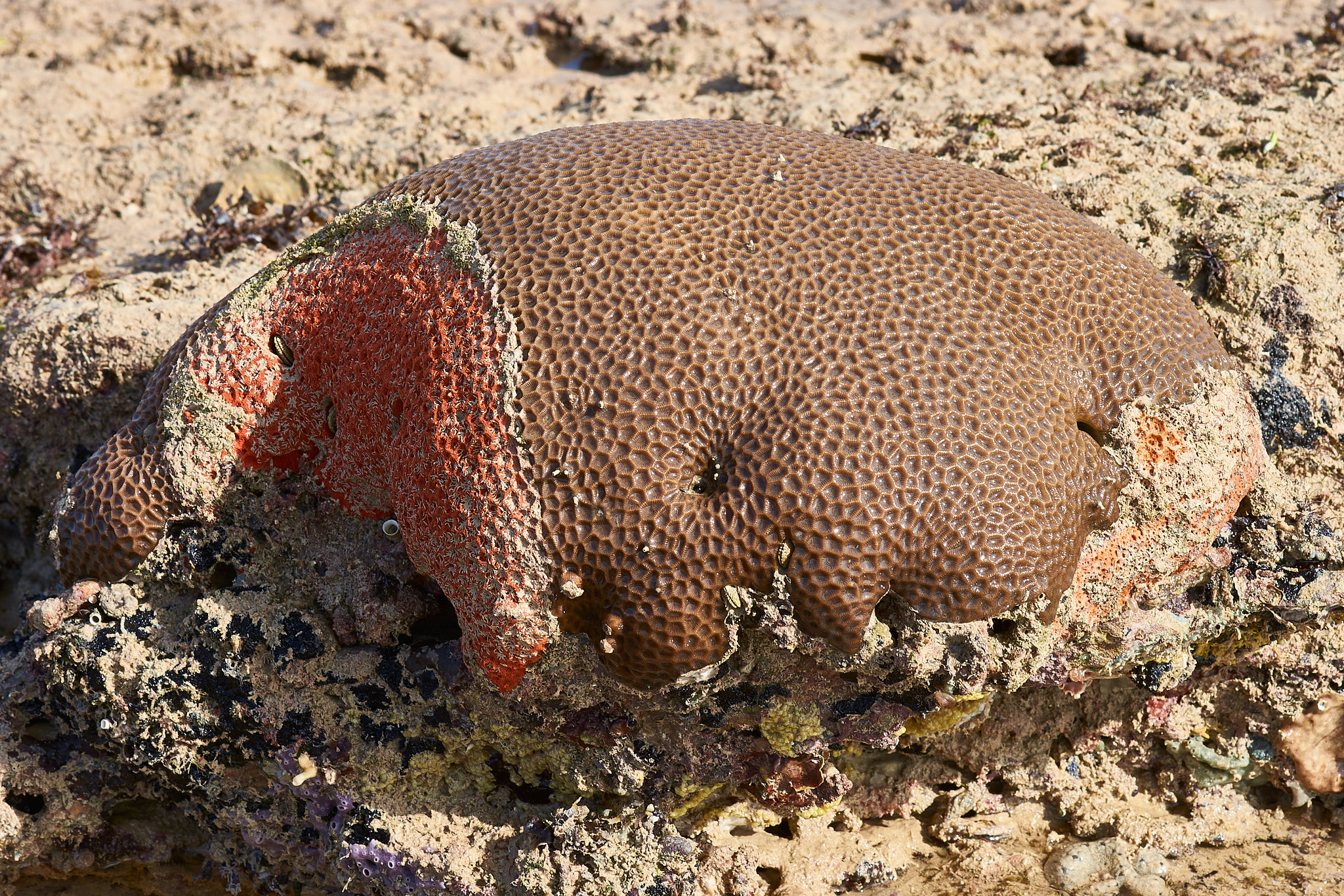
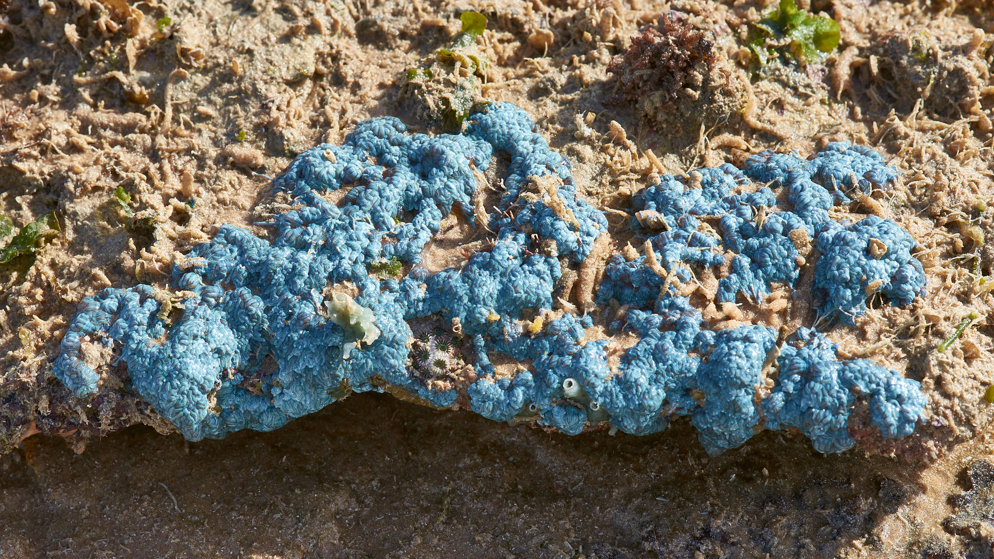
The last couple of mornings have been excellent times to explore the intertidal zone. The low water springs had uncovered territory not seen every day. I’ve come across Squirrelfish, Sergeant Fish and even an octopus in tidal pools. Corals, sponges and anenomes have been exposed, colourful, utterly fascinating and mostly a mystery. For the best viewing experience click on the first picture and wander through the gallery.
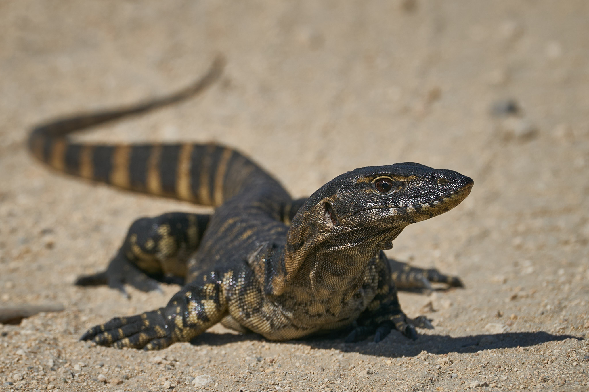
The last post featured birds at Streeters Jetty. I had company while I was there although I saw no sign of it. The area was closed for a few days. It was caught and turned out to be 3 meters long. It is now a resident at the Malcolm Douglas Wildlife Park. Some photos shamelessly filched off the internet …
I hope you enjoyed the gallery of birds that I risked life and limb to bring you. There may not be another for a while. The autofocus on my beautiful 200 to 600mm Sony lens has given up the ghost. An opportunity to buy a new lens! At least I’m trying to look at it that way.
It rained yesterday. Just a few millimeters. It was about 4.45 in the afternoon. It took a while to work out how to turn on the windscreen wipers it’s been so long. After the rain the temperature dropped to a mere 26°C. Overnight temperatures have been higher than that in recent days. It was too late and too little to avoid this being a record. Forget living memory. It is now the driest start to the wet since records began in 1939.
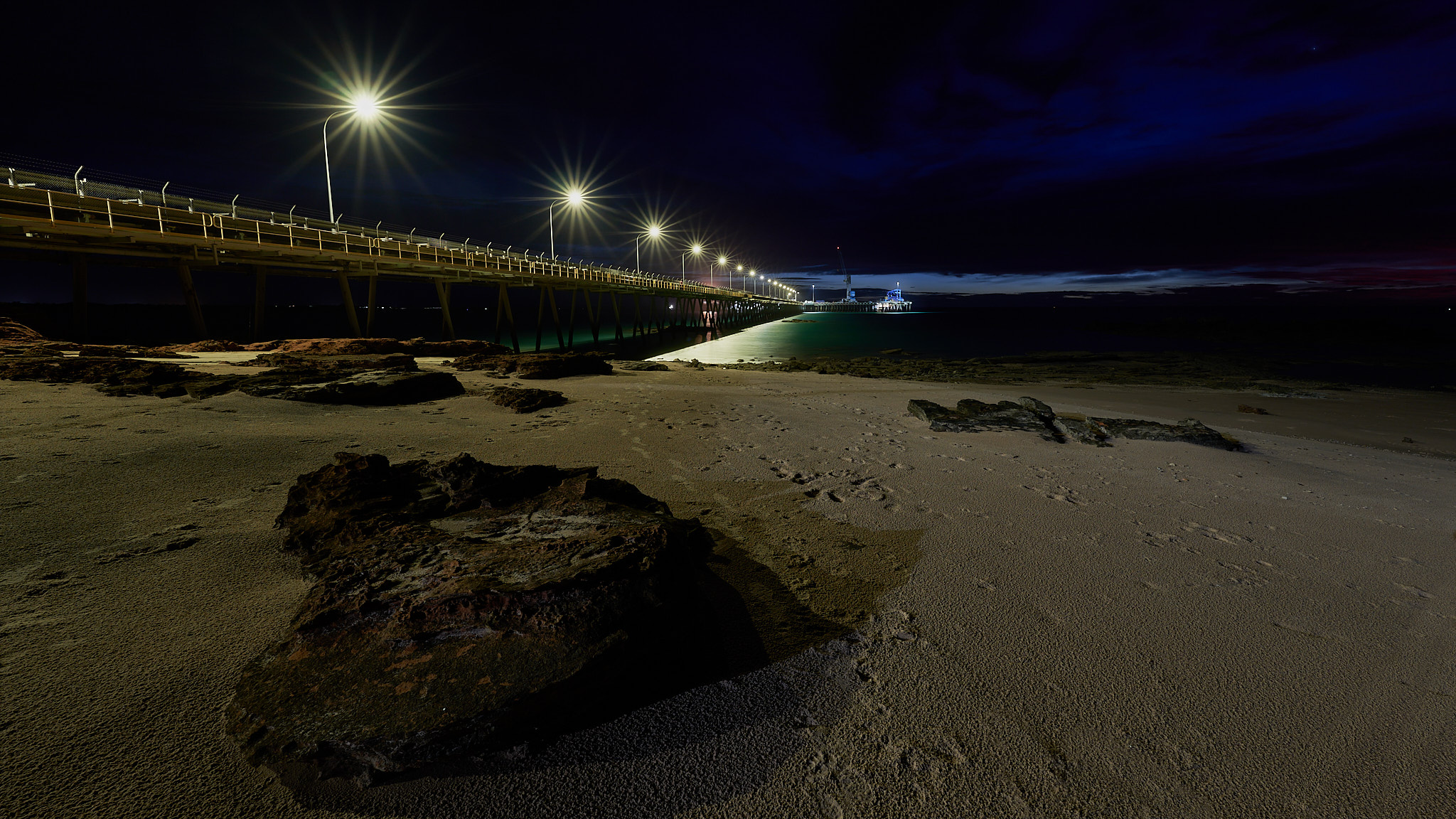
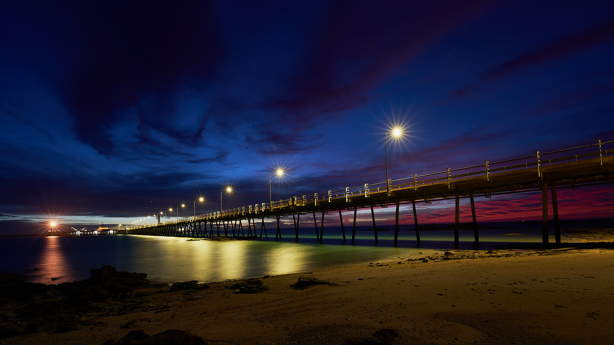
But at least we have cloud. I was out just prior to dawn. This was Town Beach.
I’m not trying to get a good finish. I’m talking about the weather. Broome’s average rainfall in December, January and February is 441mm (a little over 17 inches). We’ve had just under 29mm so far. January was the third lowest rainfall total on record. It’s the slowest start to the Wet season in living memeory (Yes, Dr John, several years at least.)
A cyclone or a decent tropical low can deliver sufficient rain in a single event to put us back on track – we may yet be cut off by flood – it’s just that no such event has hit us yet. My garden plants have their tongues hanging out.
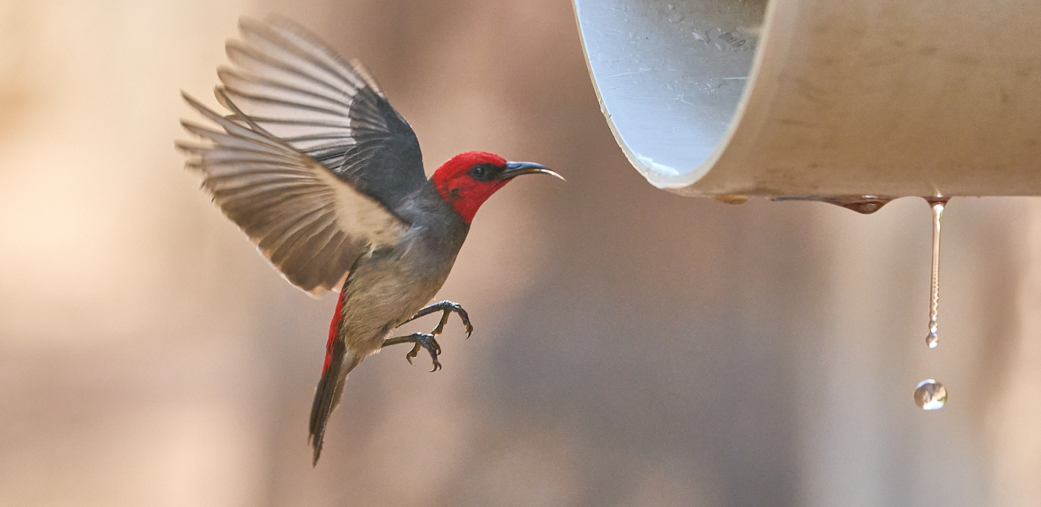
I know a place where an air conditioner serves fresh water straight into the mangroves. I was there this morning. The birds were queuing up.
Next stop after the coast was Northam home of the sublime Mute Swan …
and also the decision point. Two roads lead from Perth to Broome, an inland route 1970km or a coastal route 2368km.
The inland route has the advantage of being 400km shorter and in the event of a cyclone there would be a greater chance of the caravan staying on the ground. We’d have chosen the shorter route but it was closed by flood.
In particular, the Fortescue River near Newman was close to setting new records. The coastal route was open but what falls inland then sets off towards the sea. We decided to put in a couple of very long days in order to get north of the Fortescue and the De Grey.
There is a roadhouse overlooking the Fortescue River and we stopped for a yarn. A young lady working there had been looking for the water coming down for a couple of days but not a trickle so far. A local elder was of the view that the desert would swallow it all on the way and there’d be little or none to see. It just hadn’t rained for long enough. A trucky taking a break had caught the arrival of a flood in 2021 and recalled how impressive it was on that occasion. When we crossed the bridge there were just a few puddles to be seen.
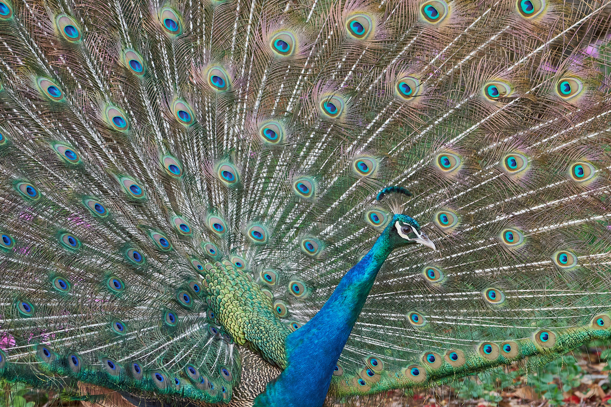
On the second long day we crossed the De Grey. It too was underwhelming. That night we stopped at the Sandfire Roadhouse. Home of the ridiculous Peafowl.
Last night we slept in our own bed. It was a bit on the warm side!
Because we made good time across the Nullarbor we have had four nights in the Great Southern region of WA. The first was on the edge of the Sterling Range National Park and then three on the Kalgan River just outside Albany. The birding has been excellent, Two Peoples Bay and Lake Seppings especially. My target species was Western Whipbird and, once again, I managed not to see it. Regional endemics such as Red-capped Parrot and Red-eared Firetail have been easier to find but not prepared to pose for me. Here are some of the photographic highlights …
Our decision not to travel north via the Stuart Highway then west through Fitzroy Crossing was a good one. Flooding has closed roads in a number of places and it will be a while before they reopen. Not that we are completely out of the woods. Our intended route was closed by fire a day or so ago near Newman. That problem is solved – the road is now closed by flood. Hopefully that will soon reopen. No cyclone brewing off the west coast presently. We head north tomorrow, only 2000km to go.