Birding and photography began for me in primary school but as quite separate activities. An uncle was a professional photographer and it was in his darkroom that I first saw the magic appear in the bottom of a dish, then be moved to the fixer and then get pegged up to dry. Quite where the birding came from is much harder to fathom, school friends perhaps. I put the two together during a period when I was getting out on pelagic trips regularly and it grew from there.
When I’m out birding the camera is around my neck but what I most like to do is wander around making a list of birds, taking photographs only opportunistically. Some days I don’t take a shot, others are really productive. I don’t go out to take a photo of one particular species but that’s not to say that there is not a target list tucked away in my head. A good shot of Gouldian Finch has been on that wish list for a long time.


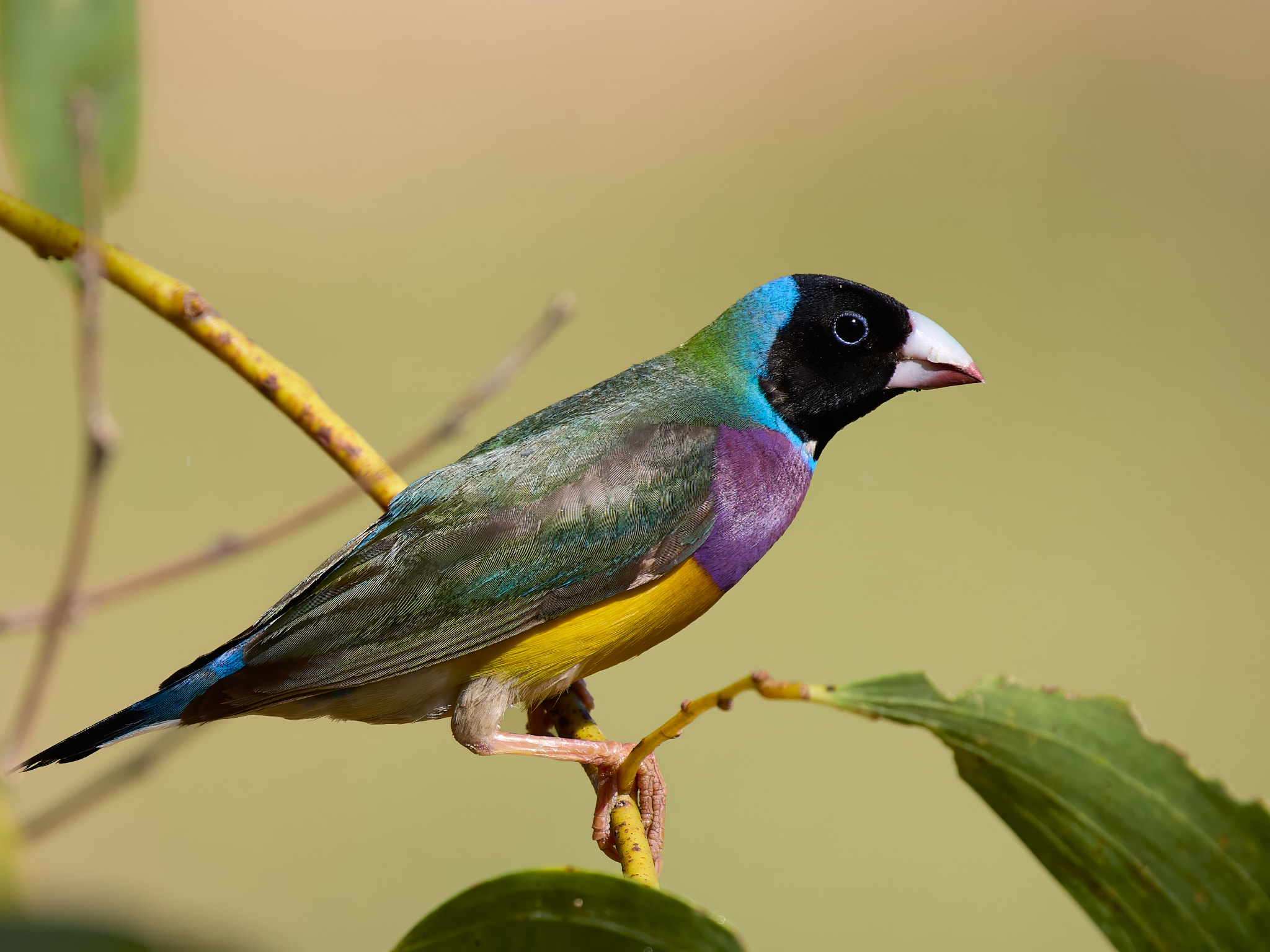
Gouldian Finch are found in grassy woodland across the top of Australia from the Dampier Peninsula in the west to Cairns in the east. They are not especially common or reliable. The juveniles are quite drab but the adults give the Many-colored Rush Tyrant a run for its money. And wait, there’s more. Their faces need not be black, there are red ones and gold ones usually all present in the same flock.