Capital of Queensland, 2.8 million souls, third most populous city in Australia. Perhaps the most pleasant of the state capitals, it retains some natural values but despite that it’s too congested, confusing and too bloody urban for me to actually reside in.
I’m sure normal visitors can find a great variety of wonderful and fulfilling things to do but let’s cut straight to the important thing …
Where to watch birds in Brisbane
Tinchi Tamba Wetland
Sandy Camp Road Wetlands
Nudgee Beach
Banks Street Reserve
Kalinga Park (Wooloowin)
There are many more but I can vouch for these spots.
We left Ingham in the rain but arrived at Finch Hatton in bright sunshine. The caretaker at the Show Grounds was complaining about the heat and we were pleased to take advantage of the shade offered by some large fig trees. Cane harvesting was under way with trucks bringing in cages of cut cane for transfer to the trains which are such an interesting feature of the sugar country.
Finch Hatton is a good base to visit Eungella National Park, Eungella Dam, Kinchant Dam, Finch Hatton Gorge and a new find for us, De Moleyns Lagoon. If you search Google Maps for it you will find it in two places. Being a lagoon the one with the blue patch associated with it is the one you want which didn’t stop my in-car navigation system from directing me straight across a cane field to the other one. I ignored the advice. The one true lagoon can be found by taking Brand Road to what appears to be its end at the Council Tip. Keep the tip on your right and continue on a gravel track to a locked gate. The astute bird watcher will quickly solve the problem posed by the gate and drive on to the water’s edge. It is worth the effort.
That night we went to bed to the sound of a raucous argument between a Little Red Flyingfox and a Ring-tailed Possum over who owned the figs above our heads. We woke the next morning to the equally raucous and persistent calls of a Channel-billed Cuckoo.
The next camp site was 213km south at St. Lawrence adjacent to another excellent wetland birding place.
Today we made another step down the Bruce Highway, crossed the Tropic of Capricorn near Rockhampton and tonight we are are camped at Tannum Sands near Gladstone. It feels so urban after our sojourn in the less densely populated north and northeast of the country.
Sugar, bananas, fewer people and slightly less rain than Innisfail. At nearby Lucinda you can see the longest pier in the southern hemisphere (5.76km, 3.58mi). Its purpose is to transport sugar from shore to ship, a 22 minute ride on a conveyor belt. Every source that I’ve consulted points out that it follows the curvature of the earth so is not flat, one end is 2m higher than the other. I am unsure what to make of this amazing revelation. Any structure more than 5km long has to come to some accommodation with the curvature of the earth. It would make good sense if the far end is lower than the land end (if that is the case) because that would reduce the energy required for transportation. Other than that I’m sure it seems flat at every point along its length.
From the town you can look out across the cane fields to the mountains of the Great Divide. At the moment they are shrouded in cloud. Somewhere up there is Wallaman Falls, it’s about a 50km ride on roads unsuitable for caravans. The falls are the longest single drop in Oz at 268 metres. A lookout gives an excellent view.
The upper stretches of Wallaman Falls Road run through rainforest protected in the World Heritage listed Wet Tropics. Traveling slowly gives a good chance to see and hear some rainforest birds including Noisy Pitta and the indomitable Cassowary. I was lucky enough to hear the Pitta on its pedestrian journey and find a Red-backed Buttonquail on the side of the road.
It is the surrounding high country that holds the naturalists interest. A trip to Paluma was on the itinerary but unfortunately heavy rain has done so much damage to the road that such a trip wasn’t viable.
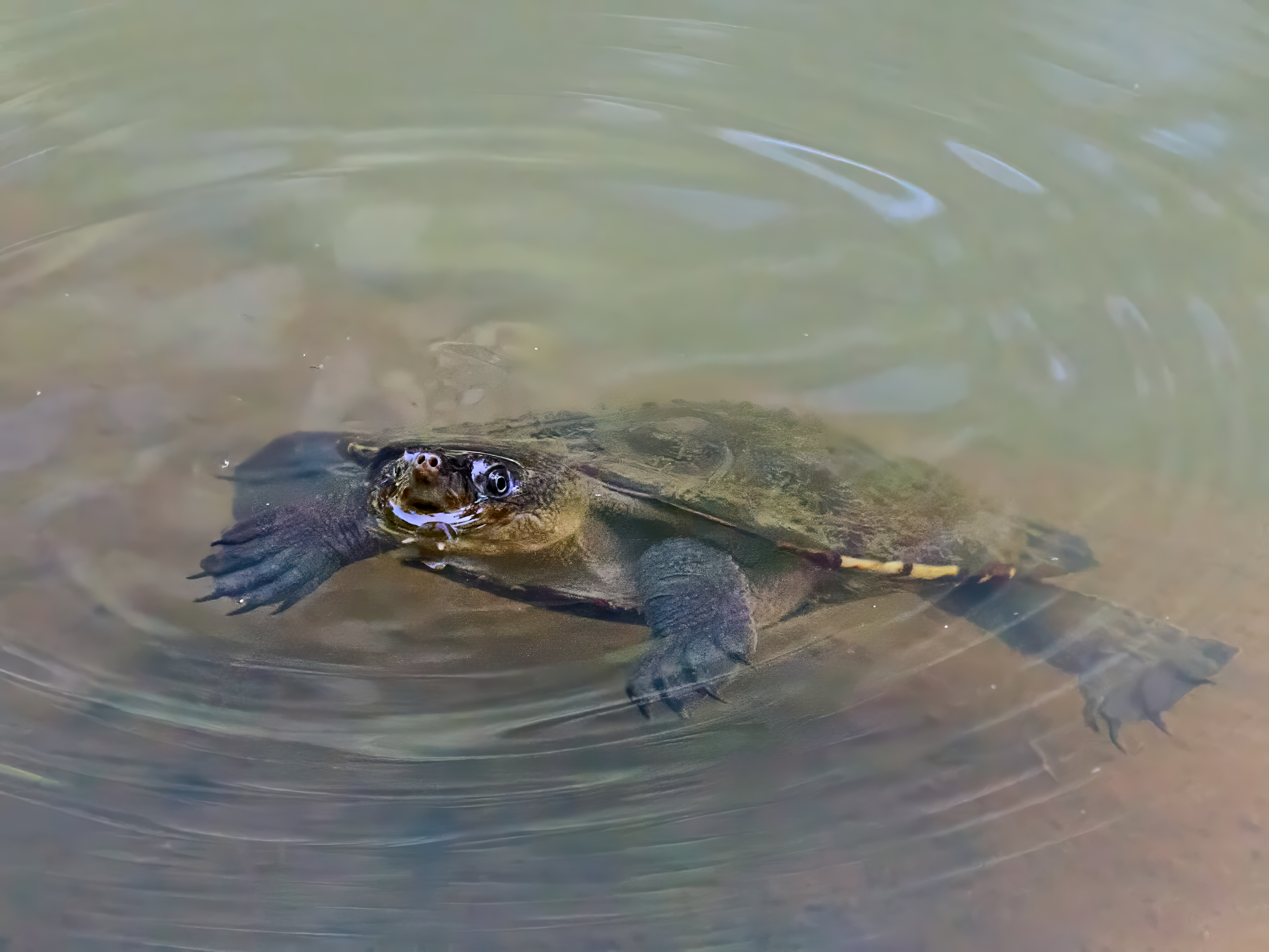
The Tyto Wetlands is on the edge of town and turns up a reasonable bird list.
Wallaman FallsRed-backed ButtonquailTurtle at TytoAustralasian Darter
Our sojourn in the Wet Tropics, Townsville to Cooktown and inland along the Dividing Range, is almost at an end. I must post a summary.
Innisfail, a little over 7000 people, sugar, bananas and rain. Largest town in the Cassowary Coast region. The highest rainfall in Australia is recorded on the summit of Mount Bartle Frere,1,611 metres (5285 feet). Innisfail is not far away and boasts of being the town with the highest rainfall in the country. The sky is blue at the moment.
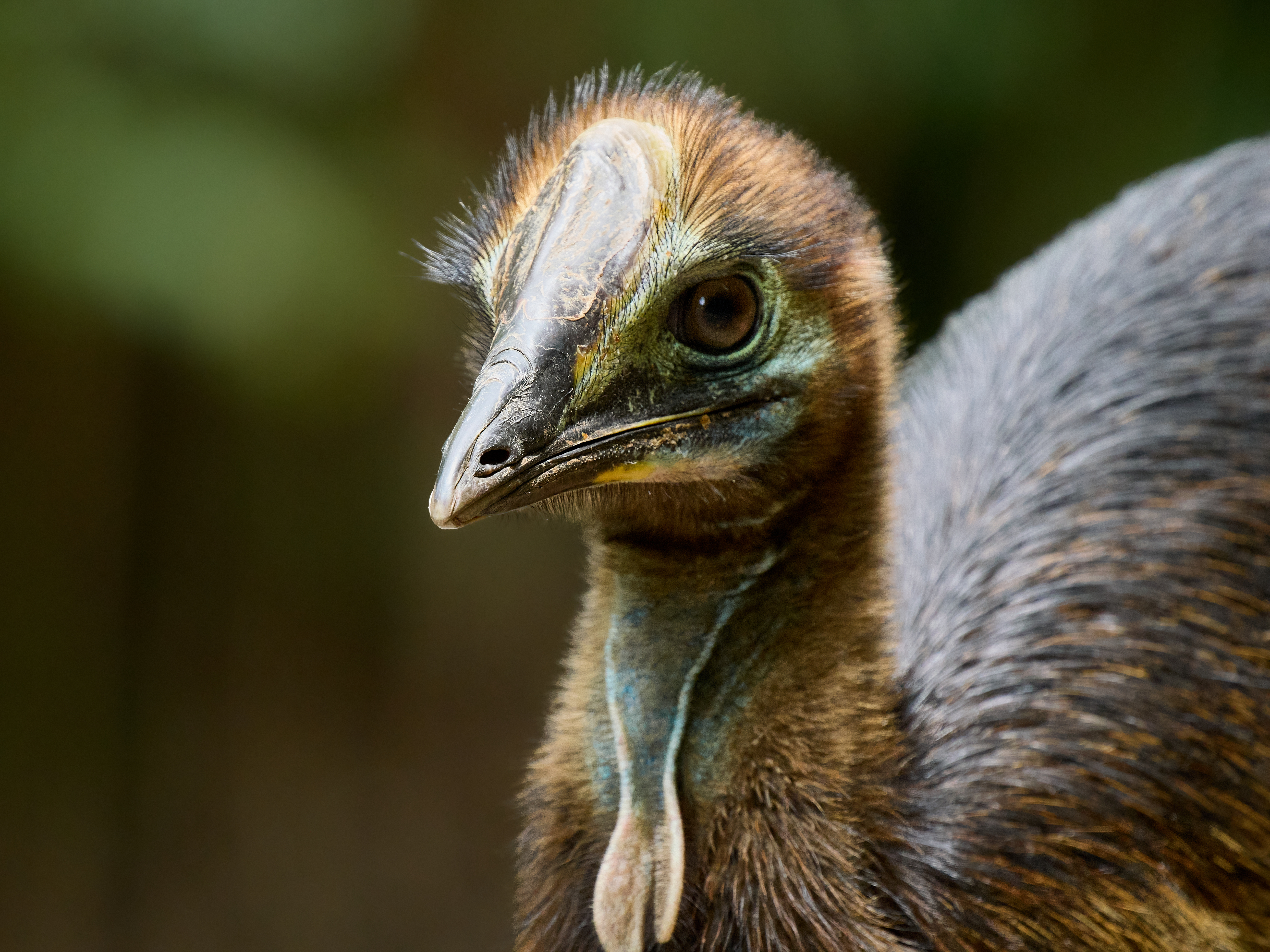
We have avoided seeing Cassowary on the trip so far. Missed by moments at Lake Eacham according to eye witness accounts, which were enthusiastically forthcoming once my camera and binoculars were evident, and missed out on the north side of the Daintree River where I have had success in the past. We have never failed on the Cassowary Coast. Friends tell me Mission beach but Innisfail is close to Etty Bay and Coquette Point which I have found reliable. (No dogs at Etty Bay).
The photos were taken at Coquette Point and on Cowley Beach Road. Found dad and two chicks at both places. Plus a single individual on Coquette Point Road. It is the male that builds the nest, incubates the eggs and then shepherds the youngsters for about nine months.
Cassowaries are dangerous. They are the heaviest Australian avian and can inflict nasty wounds with their feet. Don’t be carrying a sandwich when you meet one. Don’t set out to feed them (but do drop the sandwich and back off). I have a very long lens and was no where near as close as the photos imply.
The big city of far north Queensland. Cairns had a population of 169,312 people in the 2021 census but it seems to grow rapidly between every visit and will certainly be bigger now. And the traffic is crazy … good preparation for what’s to come down the coast.
Birding hot spots include the Centennial Lakes, Mount Whitfield, the Esplanade and Cattana Wetlands. It makes a good gateway to the Tablelands. Fly in, rent a car, two nights here and then escape the crowds.
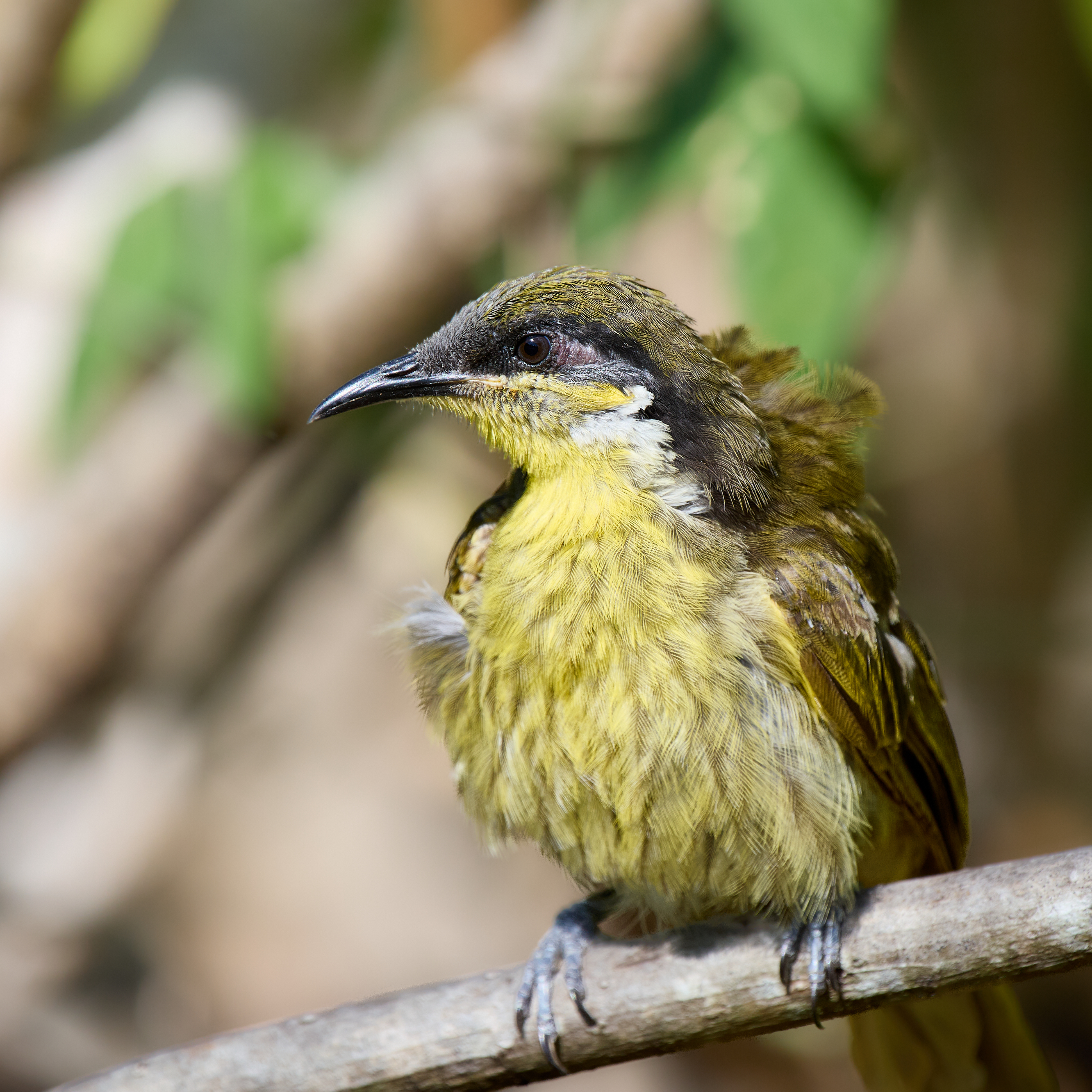
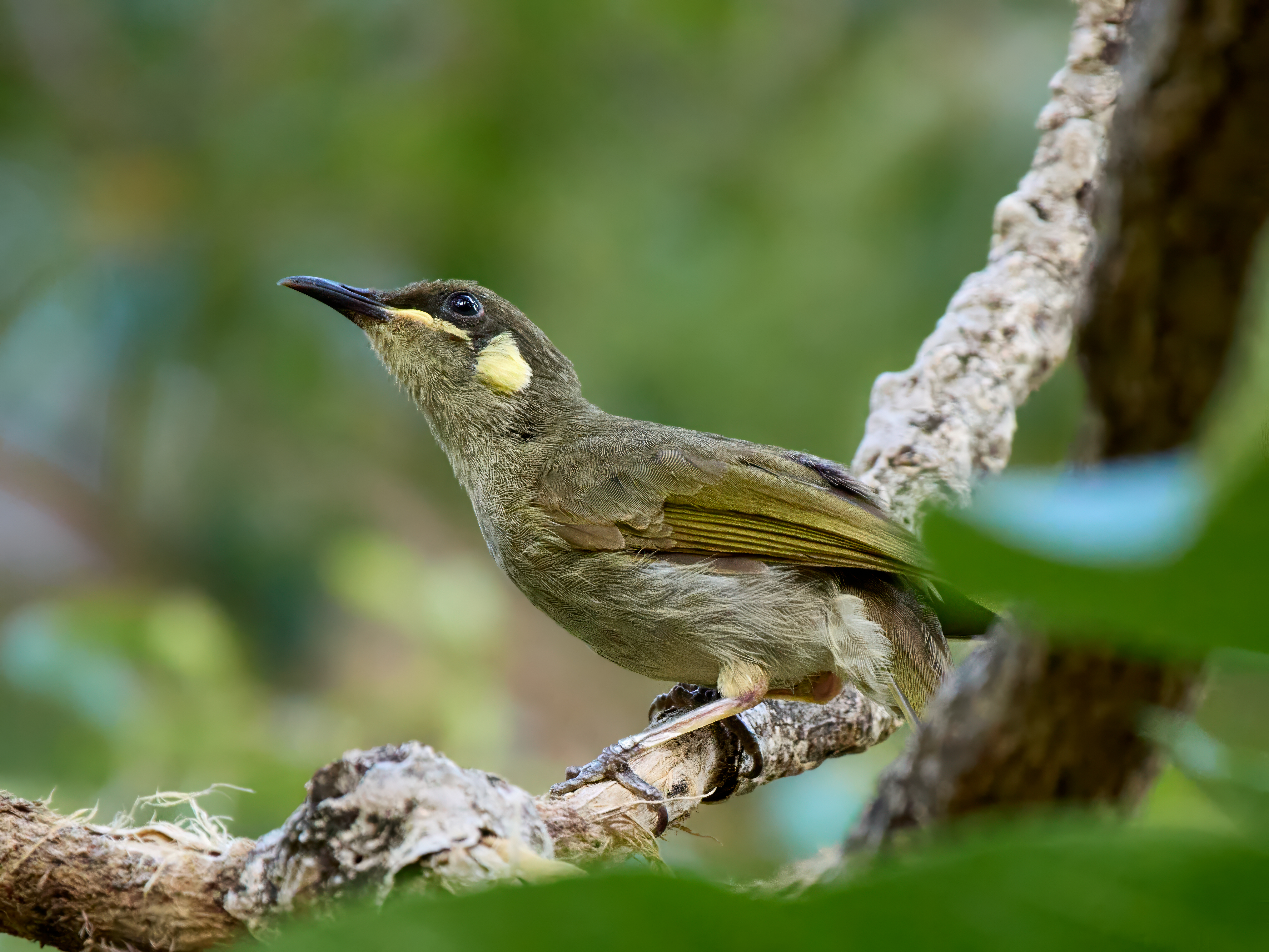
One very good reason to be here is the Varied Honeyeater. It’s fairly reliable on the Esplanade which is about the southerly limit of its range. It occurs in the odd spot up Cape York and then New Guinea. I had never managed a photo of them before but I noticed a couple of them anting in some leaf litter. They were chest to the ground with wings spread and appeared to be in ecstasy. When they’d finished they lingered in some low vegetation giving me a good chance to get the shot.
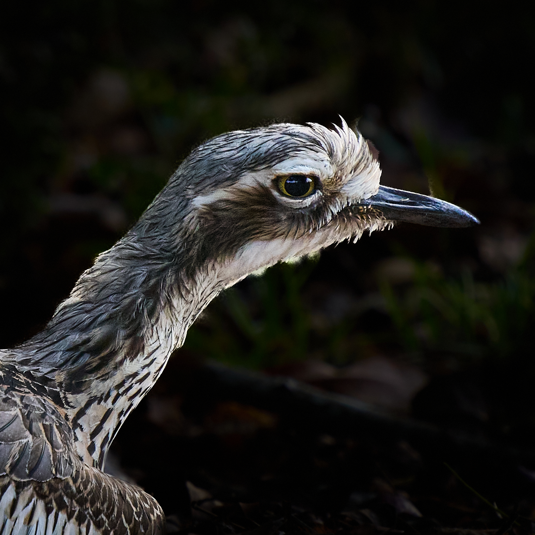
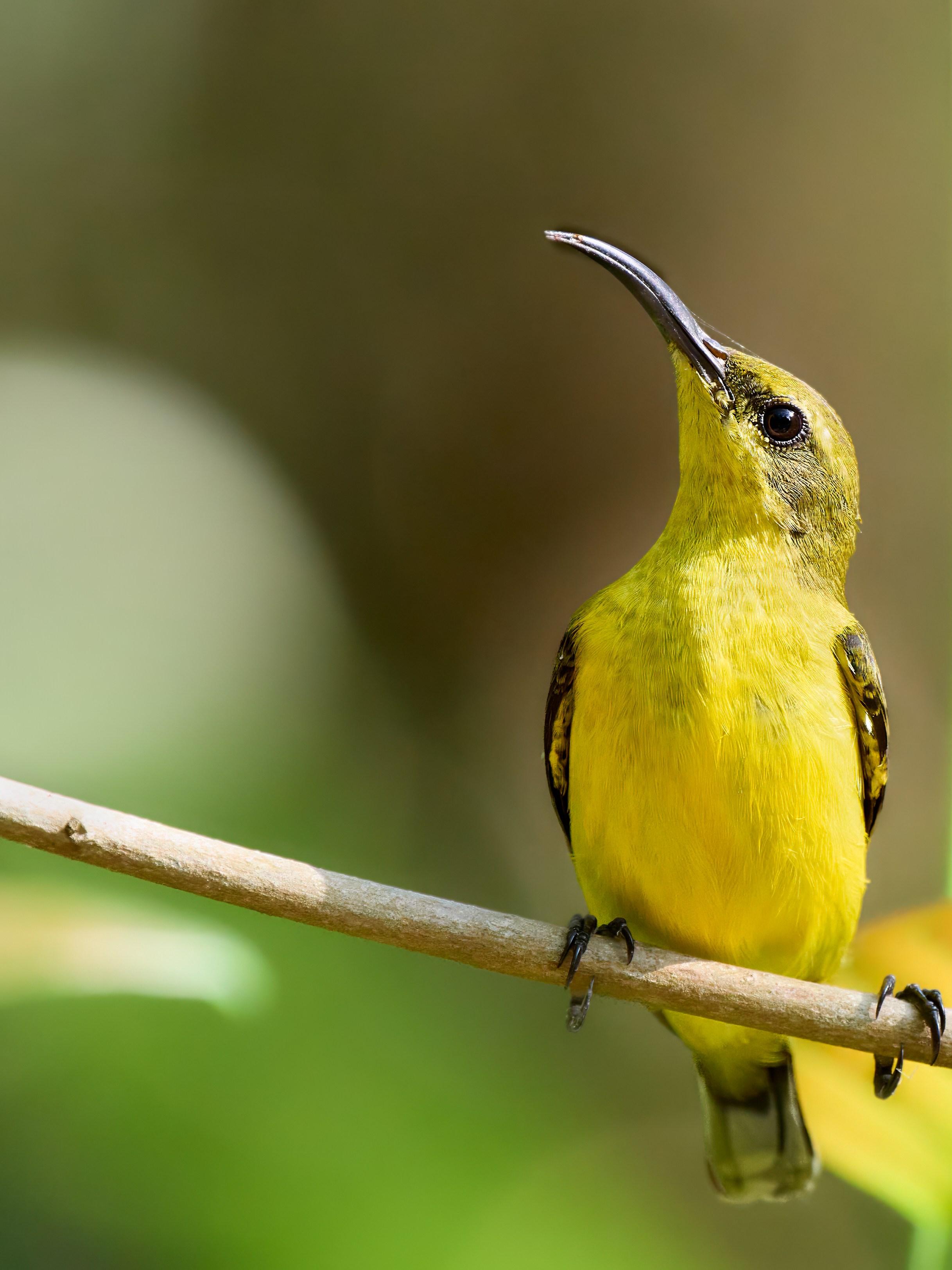
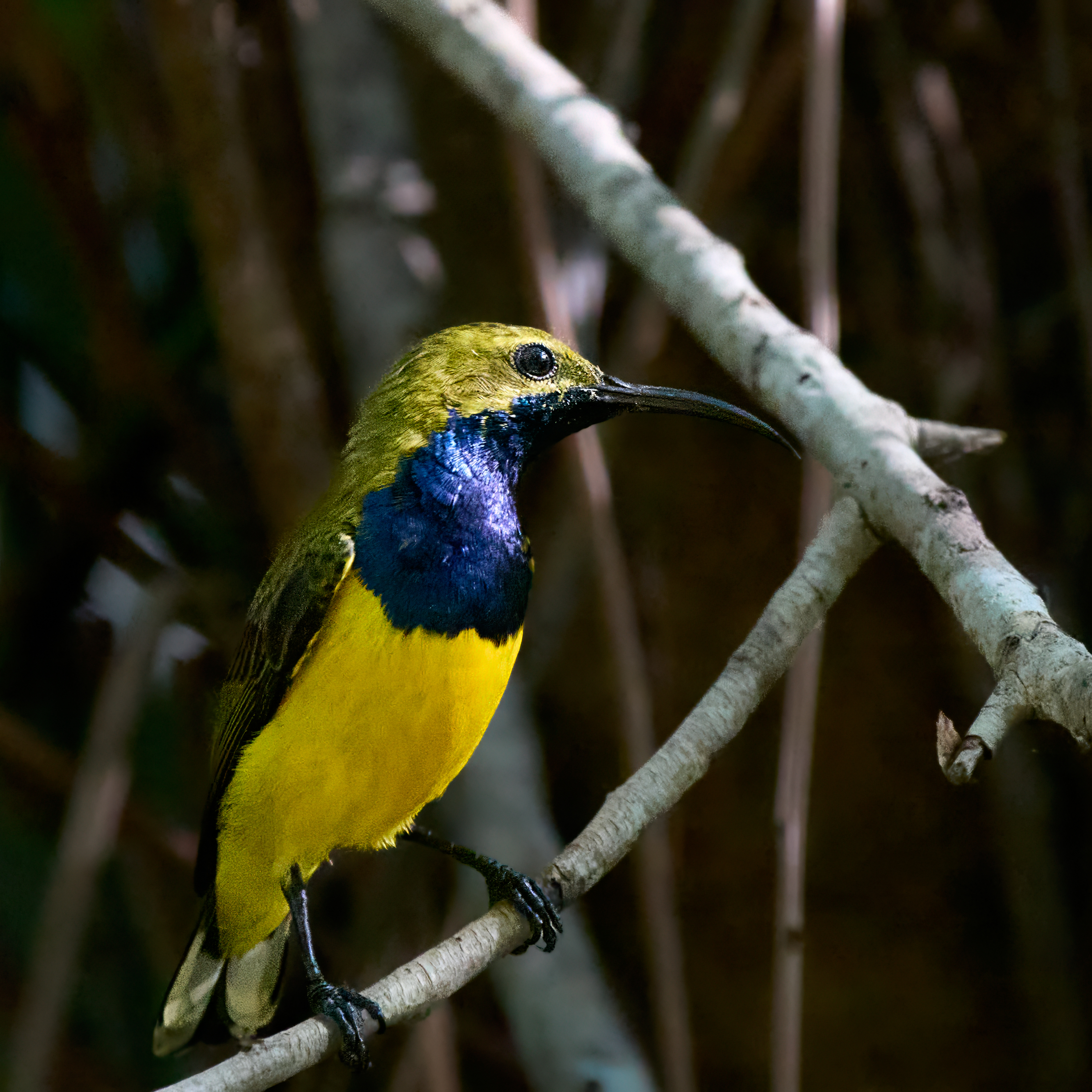
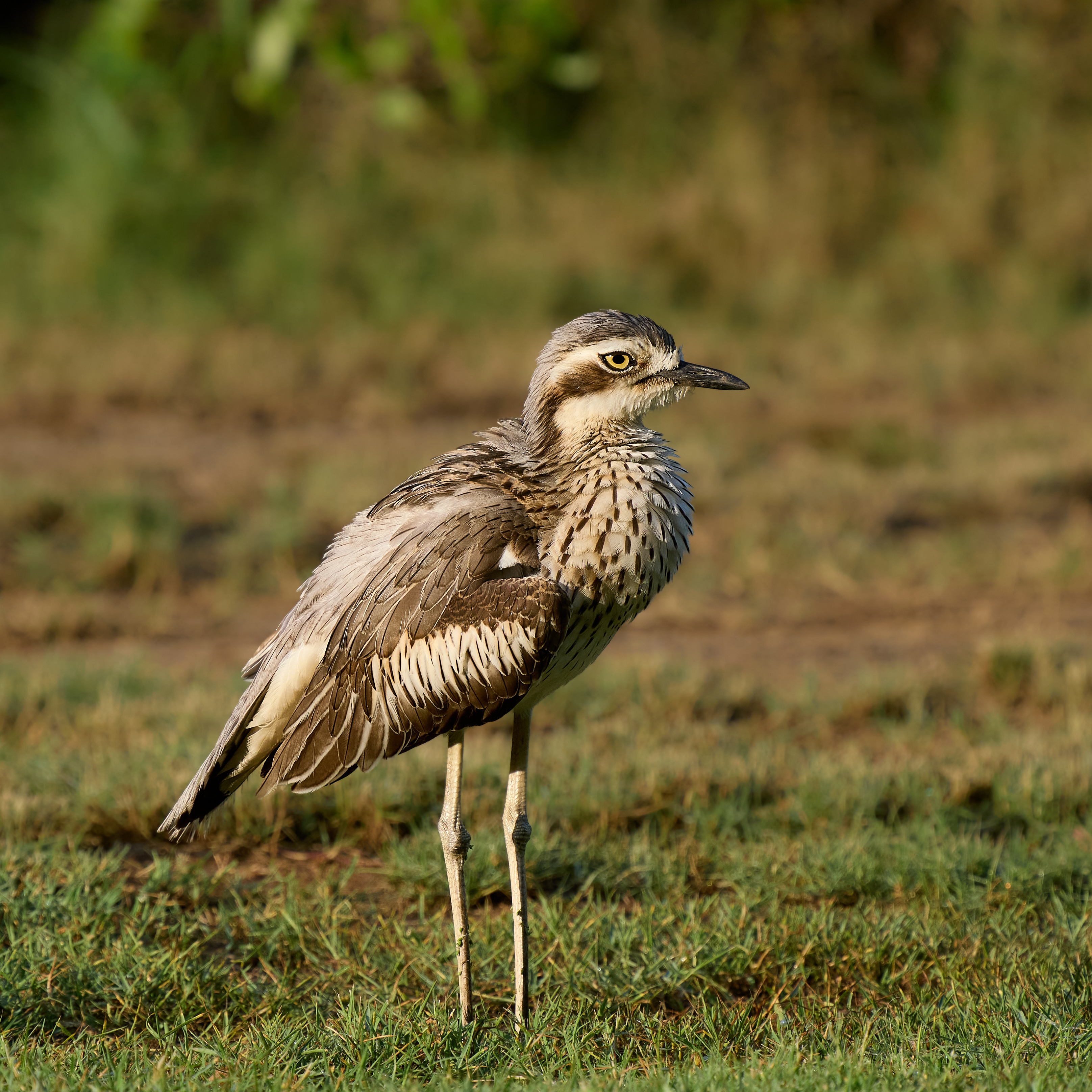
Yellow Orioles have a distinctive voice. Their three note call “Al Co Hol” is heard everywhere across the north of Oz from just east of Broome but usually they are hidden in the foliage or high in a tree. I photographed this one and the Sunbirds at Catana Wetland. Bush Stone-curlews are doing well in Queensland. We have had them visit the van on a number of evenings. I photographed this couple in the Centennial Gardens. Sadly they are not doing at all well in Victoria.
Next stop is Innisfail looking for the elusive Cassowary.
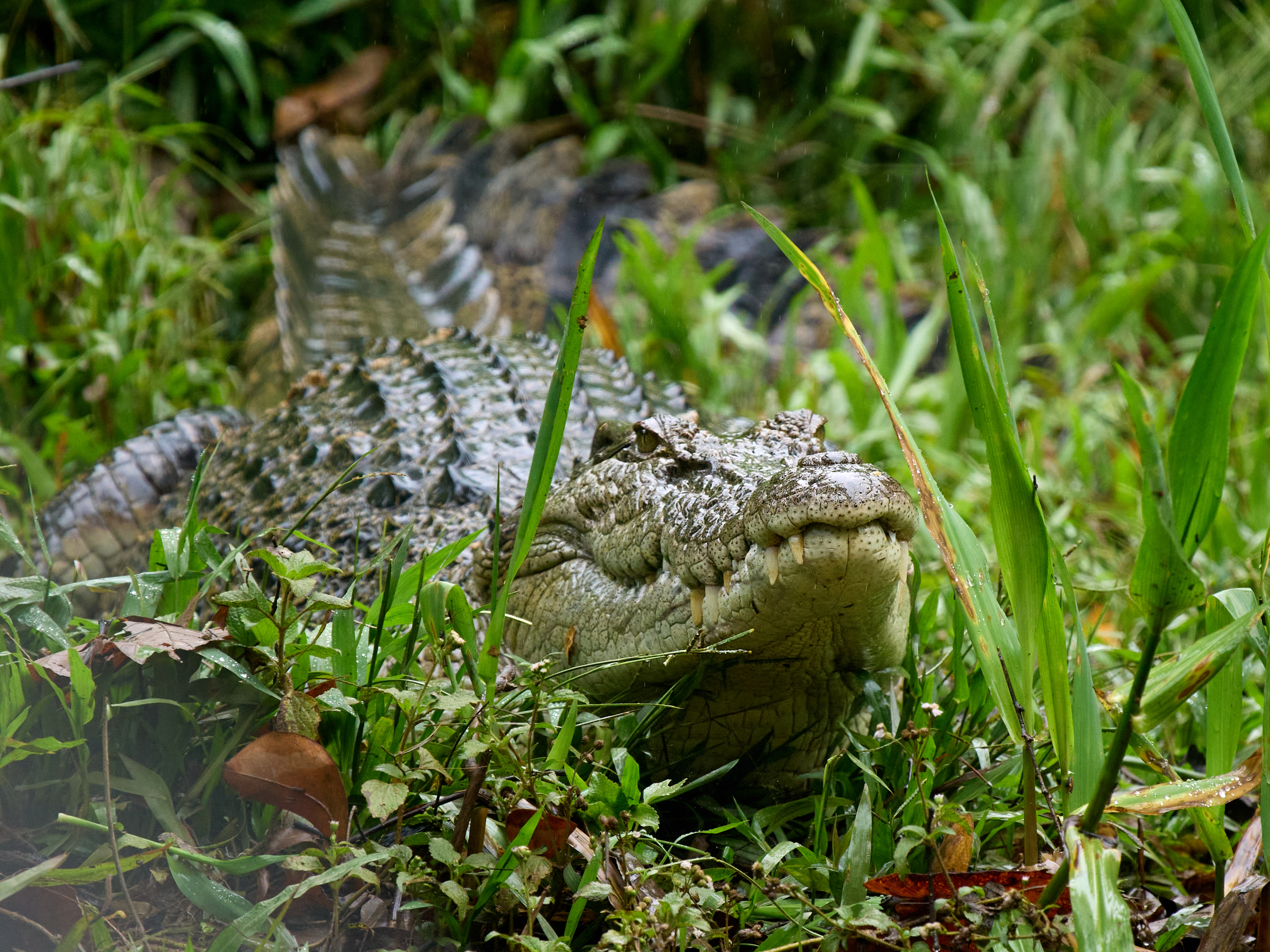
Years ago any trip to Far North Queensland meant a trip on the Daintree River with Chris Dahlberg. He had a great deal of charm, knowledge and a boat. His patter included a routine that never failed to amuse. He would spot something and say “Come with me” which was of course unavoidable when captive in a boat surrounded by crocodiles. When Chris gave it away there was a vacuum into which came a guy with a boat … bring your own knowledge and charm. But now there is a worthy successor in Murray Hunt and the Daintree Boatman Wildlife Tours. Depart at 0630 from the Daintree Village boat ramp. Murray knows his stuff.
The tour officially lasted two hours But Murray could not drag himself and us away from a big male crocodile on a cow carcass so we got a bonus half hour. My bird list reached 27 species including three very lovely additions to the year total. Why could they not have been found in the Woolworths car park?
Woolworth’s car park, Mossman, Qld. You can already tell this is going to be an anticlimax. Lonchura punctulata, Scaly-breasted Munia, a plastic (twitcher term for an introduced species, pejorative). Bird number 365 in 2025, a bird for every day of the year.
The camera wasn’t handy and the setting was nowhere as pretty as this. Photo shamelessly filched from eBird, All credit to Ayuwat Jearwattanakanok for a very fine shot taken in Thailand where the bird belongs.
From Cooktown we retraced our steps to Mount Molloy up on the tablelands. A hilly 227 km on good made road, enlivened on this occasion by a major bushfire near Palmer River. Traffic controls were in effect, a pilot vehicle led groups through at a decent pace but in one direction at a time. The fire was right up to the road with the Rural Fire Service in attendance. There was some delay but we were in capable hands. Big shout out to the Fireys and the traffic controllers for keeping us safe.
Our destination was Wetherby Station one of our favourite camping destinations in all of Oz. The station is owned and managed by John and Kathleen Colless. They run big black beautiful Brangus Cattle. The station was founded by William and Elizabeth Groves around 1878 and there is a fine old homestead and lovely gardens. The present owners have sustainability as a top priority. The cattle get plenty of grass but are kept out of the creeks and lagoons and the fencing around the main lagoon is designed to keep the modern scourge of feral pigs at bay while it is rehabilitated as a wooded swamp. Rifle and Spear Creeks run through the property which because of its location, climate and variety of habitats has an enormous bird list.
We spent two nights camped all by ourselves by Rifle Creek. It could easily have been more. (Certainly would have been if Mount Bloody Lewis was open). Birding in and around was good. We left on 364 species for the year. Bird number 6 in the count down was Cryptic Honeyeater. At number 5 – Scarlet Honeyeater, number 4 – Black-faced Monarch, a staggeringly beautiful bird in the forest gloom. Number 3 – Yellow Honeyeater, the label says it all. Number 2 – Fairy Gerygone, pretty enough. Number 1 cannot be far away. Please let it be worthy of the honour.
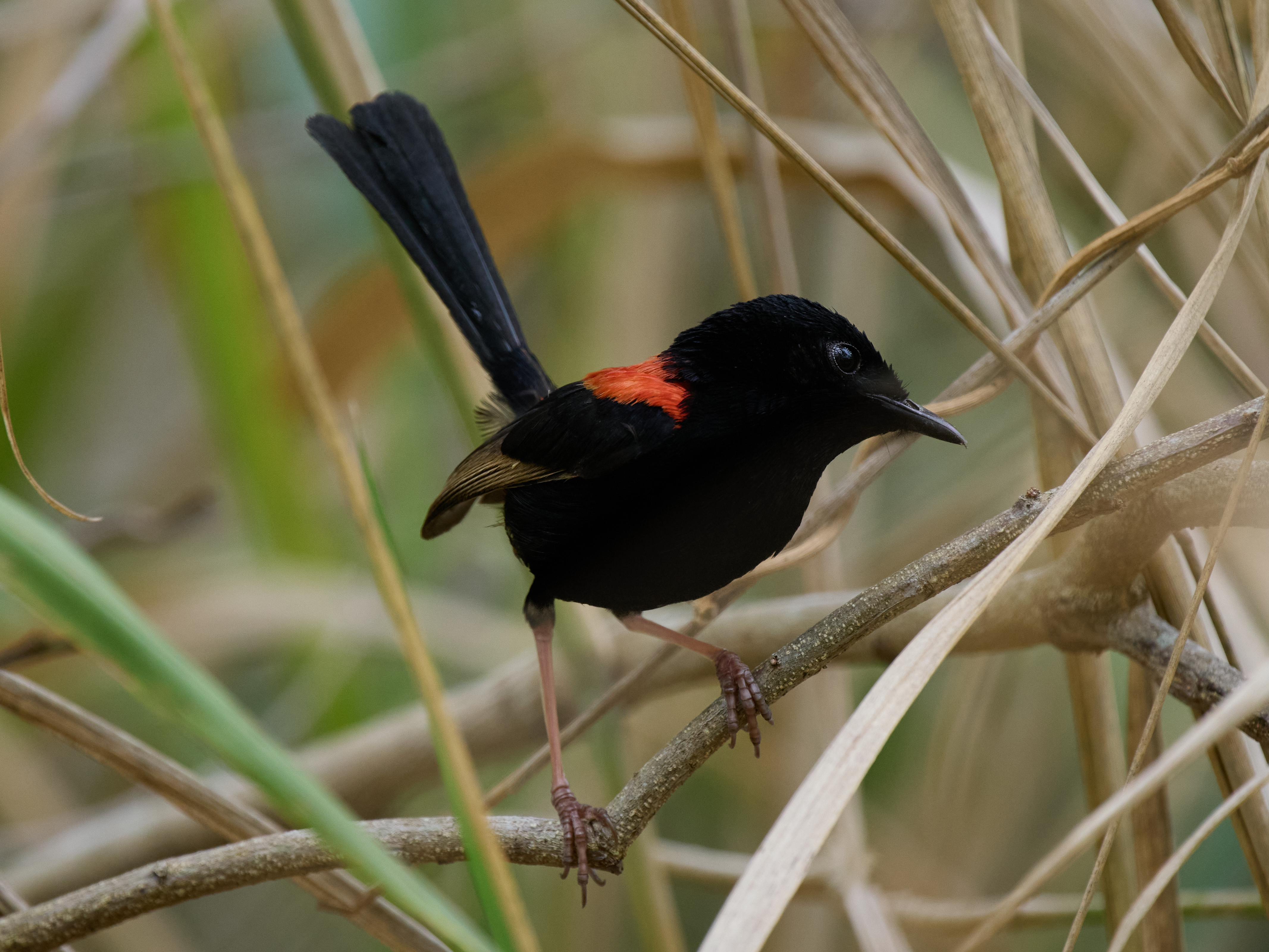
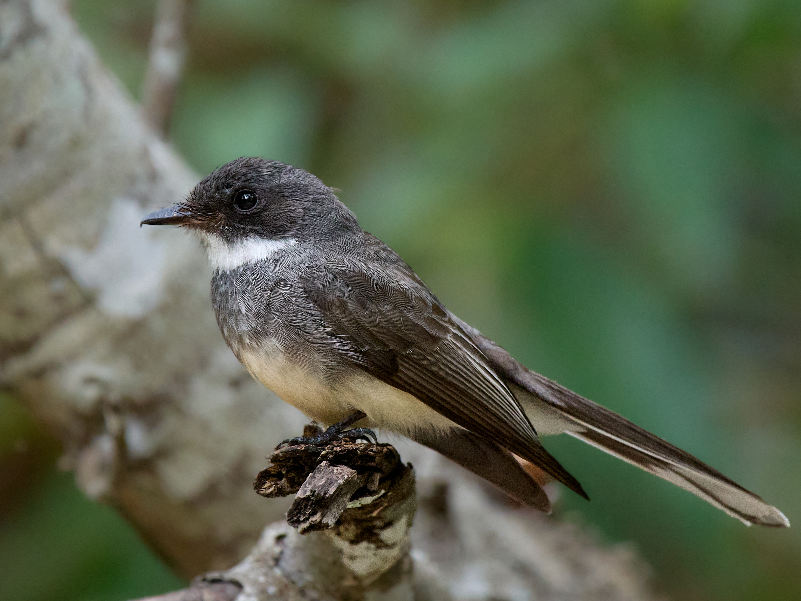
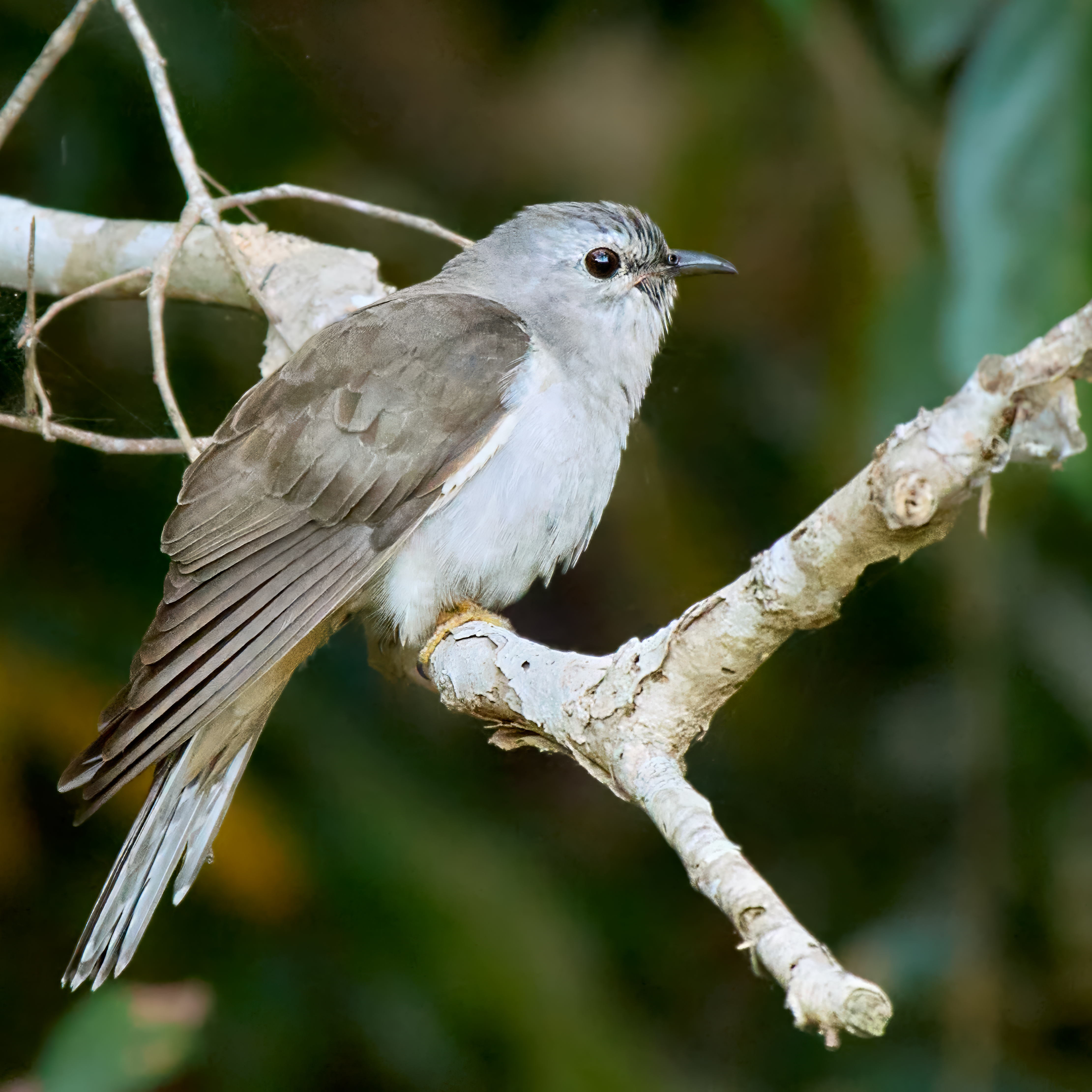
Red-backed FairywrenRed-backed FairywrenNorthern FantailSahul Brush CuckooBrown GerygonePale Yellow Robin
The last three birds were photographed within a few metres of our camp site.
On the 11th of June 1770 the bark Endeavour struck a reef. The ship was in serious trouble and needed to be beached urgently. The east coast of Australia stretched away behind her but no suitable place had been passed in a very long way. The situation was dire but to the captain’s great relief the mouth of a large river was not far ahead. She limped into its sheltered waters and a suitable beach was soon found to careen her.
It took seven very interesting weeks to repair and reprovision the ship. The residents and the visitors represented two vastly different cultures which, in this instance, rubbed along not entirely without friction but tolerably well. For the visiting scientists, Banks and Solander, this was their best chance to run amok in a virgin ecosystem. Among the many things collected was the word Kangaroo.
These days Cooktown is a town of about 2,800 people with a very decent hardware store not that I had a bark to repair but I did need to change a tap washer, fit a new Anderson plug and replace a dead compressor.
There is a very fine botanical garden here which has a Banks and Solander collection among many other things. The cafe opens at 8.30 am and serves a very nice breakfast. Coffee and poached eggs on the veranda, binoculars and camera at the ready. The birds enjoying the flowers in the cool hours of the tropical morning. Heaven.
The place on the Endeavour River where the Endeavour was beached is well marked. The Green Hill where James Cook RN stood and plotted his passage through the shoals is but a short steep car ride away (demanding walk though). The bird watcher can visit Keatings Lagoon, the lagoon we had to have, mangroves, rainforest and beaches. The history buff can visit the museum and then take the 30km drive to the historic Lion’s Den Hotel where the birdo will no doubt join them for a beer.
We spent three nights here. Bird number 7 in the countdown surrendered in the Botanic Gardens – Black Butcherbird, not colourful but a lovely call. Vicious beak.
The southern tablelands were good to me. The Calendar Game score jumped to 355. Time to move further north. It would be possible to hit 365 at Julatten with a day trip up Mount Lewis.
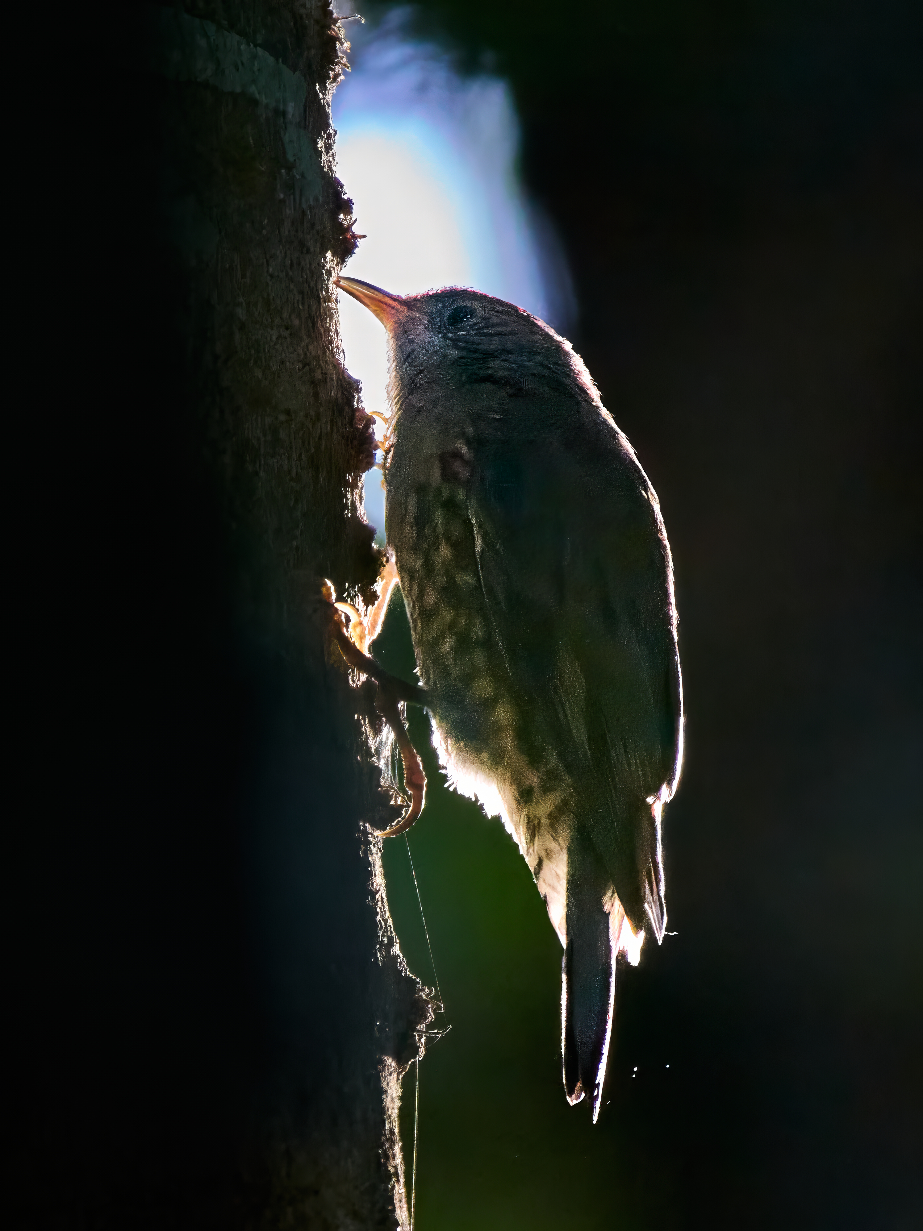
Photography in the rain forest is extremely hard. I’d show you photos of Eastern Whipbird if I could find the bird amongst the noise and a Musky Rat-Kangaroo loooking straight at me from two metres away if I could find it at all after upping the exposure in post. The little White-throated Treecreeper at least had the decency to move into a shaft of light.
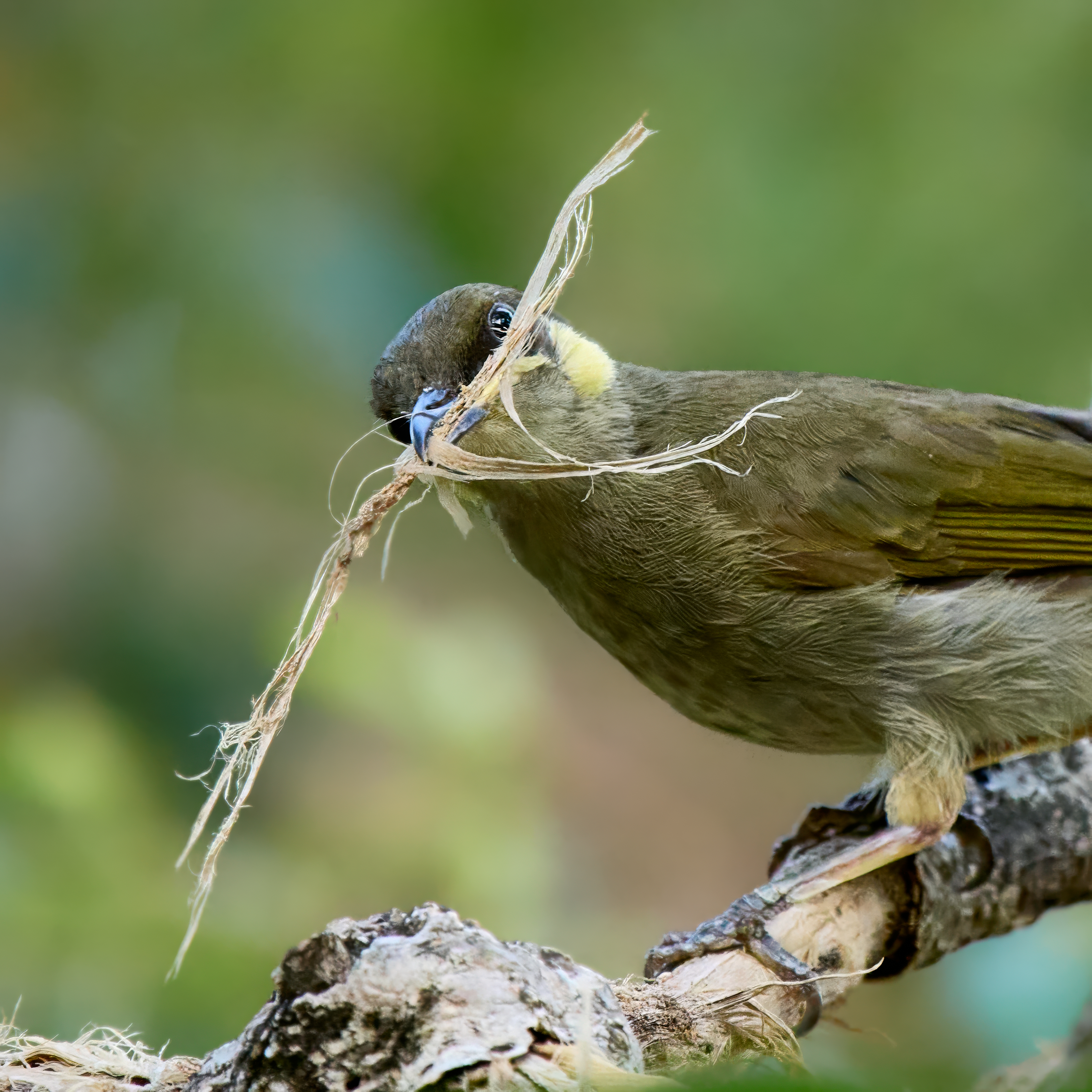
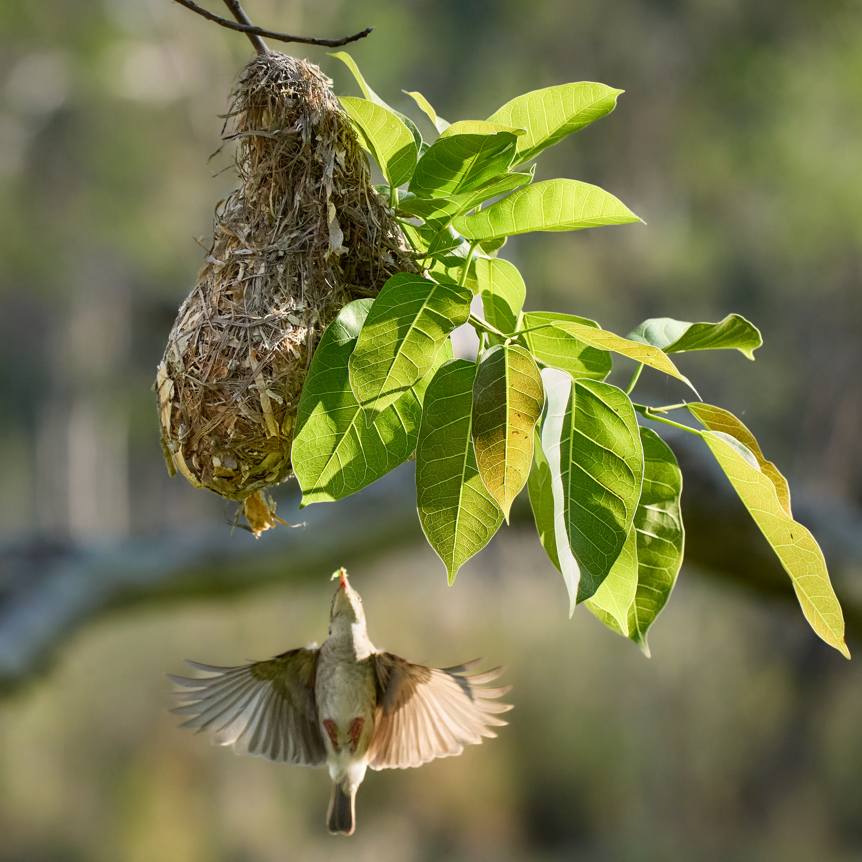
So we arrived in Julatten and quickly began the top ten countdown. At number ten we have Yellow-spotted Honeyeater. At nine Metallic Starling. Eight is Brown-backed Honeyeater with the added bonus of a photograph of an adult carrying food to the nest.
But Mount Lewis is closed. That’s National Parks for you. They can just shut the gate. Remember, Robert, it’s only a game. I’m not obsessed. The game will take a little longer. I hope I don’t have to fly to Tasmania before new year! It’s so bloody cold down there.