Rain …

It has been a dry old time in Victoria’s Goldfields. The wettest day last year was on January 18th when we were deluged with 49mm (2 inches). We had had 21mm nine days earlier. Since then it seemed to have forgotten how to rain. My neighbours are hand feeding sheep and, unless they have a good bore, are carting water every day to keep their stock alive. It’s hard work at the hottest time of the year. Australia is, and always has been, a tough place when el Niño comes to visit.

Bare paddock

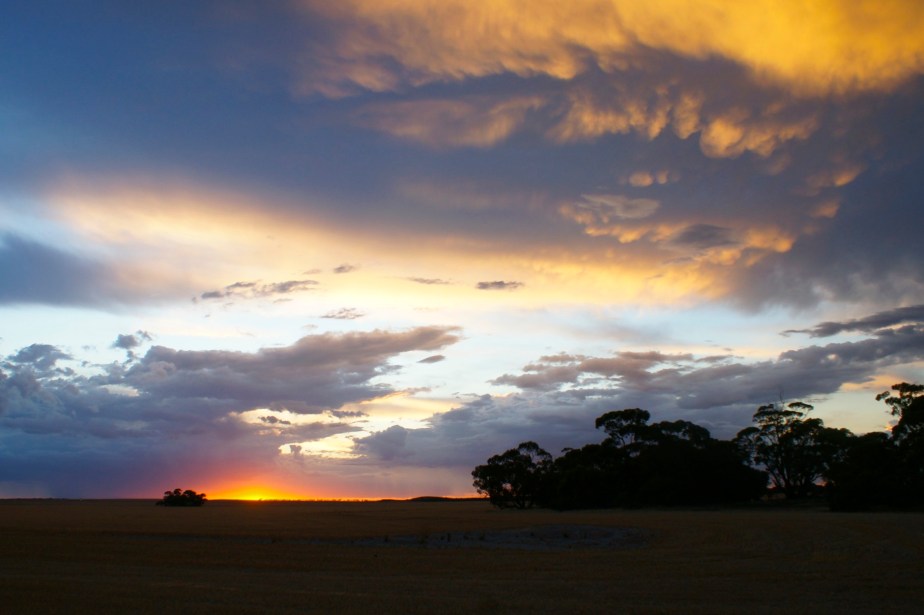
But there are wetter parts. The hills east of Melbourne are clothed in tall forest and in the gullies there are pockets of  genuine rainforest. Some cooler weather was forecast so what better time to visit. A few showers? Well, that would reduce the risk of bush fire. Fifty millimetres, could be uncomfortable in the tent.

I arrived in Australia in August many Augusts ago. I bought a sporty Mazda car with a rotary engine and I was keen to try it out. The ski season was in full swing, snow in Australia, not what I was expecting, must take a look. I took a long spin up the highway to just beyond Mansfield where the snow capped summit of Mount Buller could be seen. Wow. Where to now? I might add at this point, that in England, I had never had the opportunity to drive on a gravel road.

I consulted my brand new map of Victoria and found a road down the east side of Lake Eildon, through Jamieson, the A1 Mine Settlement, Woods Point and on to Marysville. From there it’s a shortish trip to the eastern suburbs of Melbourne. More interesting to make it a round trip, I thought, and set off.

The bitumen ran out. It was raining. It was getting late in the afternoon. It can’t be all that far, I thought.

Soon it was dark, the wind was howling, the rain was lashing down. I was traveling very slowly on a loose stony road that divided its time between climbing and descending steep hills and sharing  the valley bottom with a rapidly swelling river. The car was second hand, I hadn’t even checked whether I had a jack or a spare tyre. My way forward might be blocked by a fallen tree or the river in flood. So might my way back if I turned around. My heart was in my mouth. Jamieson to Marysville is 136 km (85 miles). Along the way a Wombat the size of a sheep wandered out into the road and stood looking at me. It could have been asking itself, “What the hell is he doing here?” Which is exactly what I was asking myself.

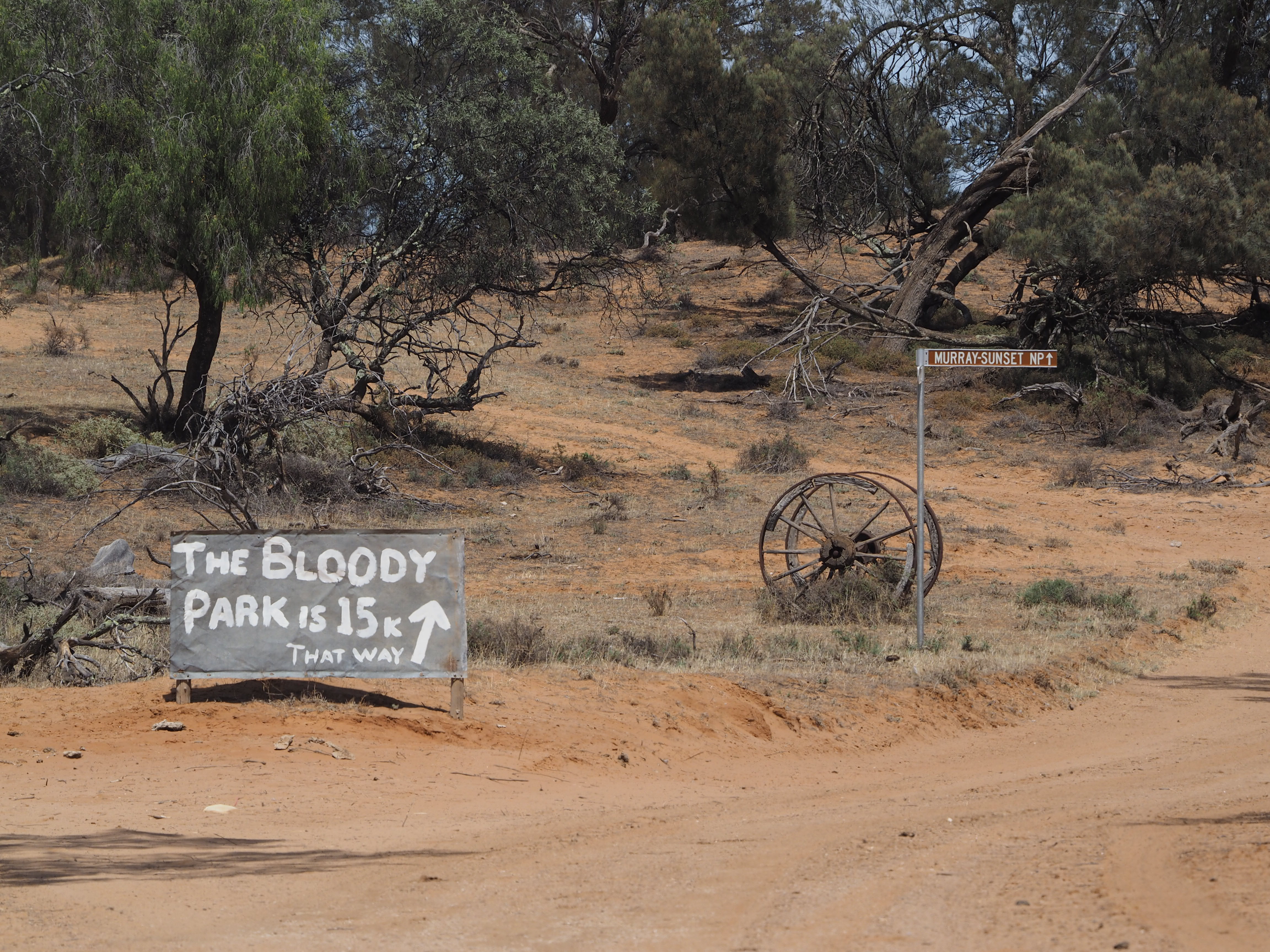
So there I was, a few days ago, camped at Woods Point, next to the Goulburn River, in the pouring rain. On the way there I had stopped to photograph the Noojee Trestle Bridge. A number of these fine old rail bridges survive, I find them very interesting …

Noojee Trestle

You can see that the area is much lusher than my neck of the woods, there’s even grass.

And tall trees …

Woods Point

it has crossed my mind that given my girth, if I was a tree I would be about a hundred metres tall.

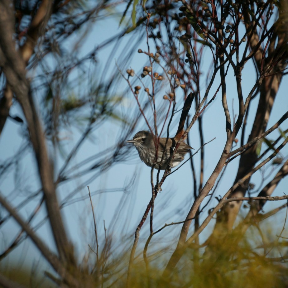
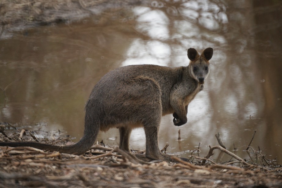
Meanwhile, outside my tent, a very damp Flame Robin was playing in the puddles.

Wet Flame Robin

The next morning there was nothing more than light showers. A short walk turned up some wreckage …

Old truck cabin

for a moment I thought it was my Mazda.

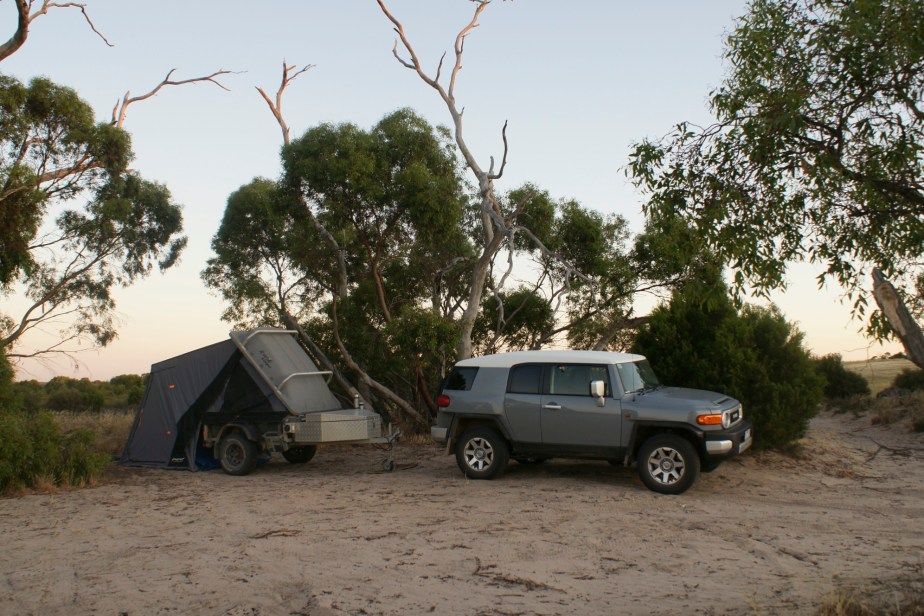
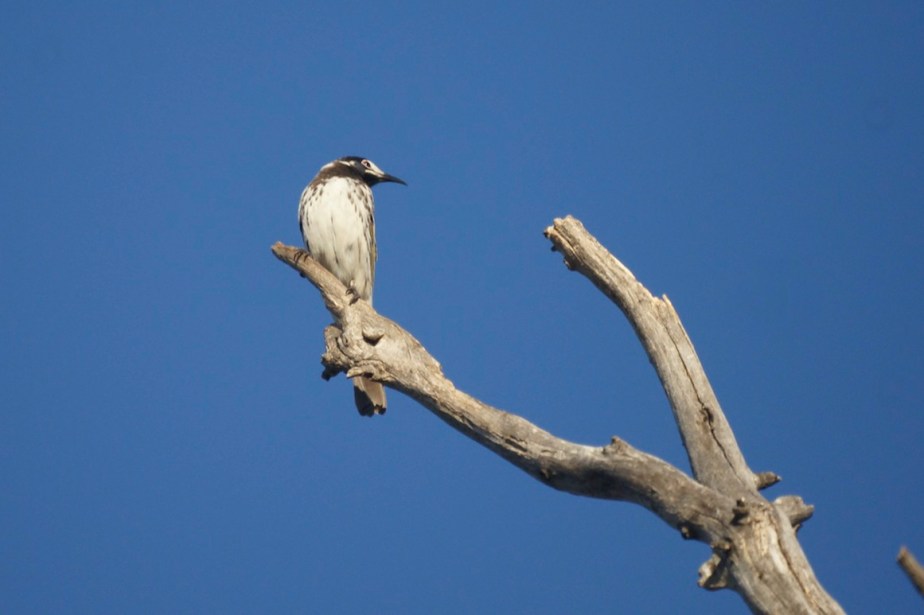
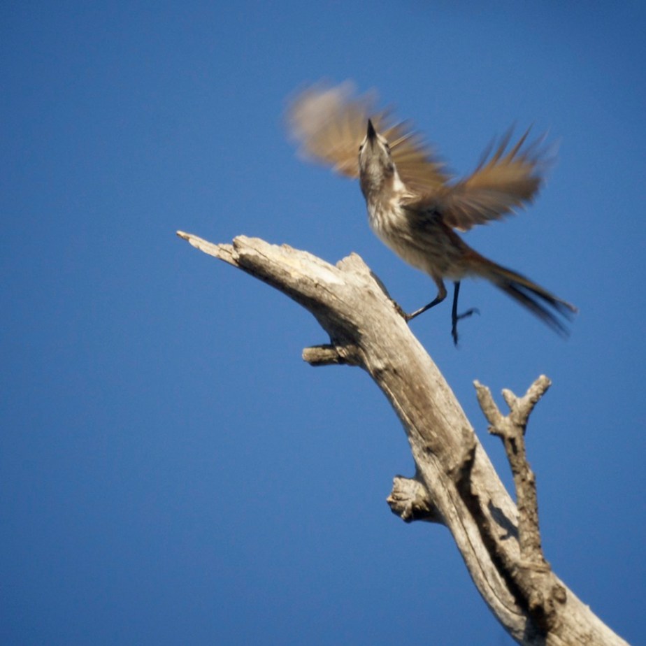
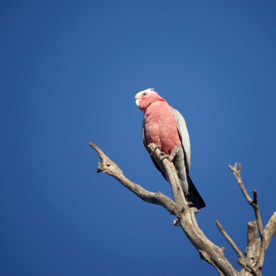
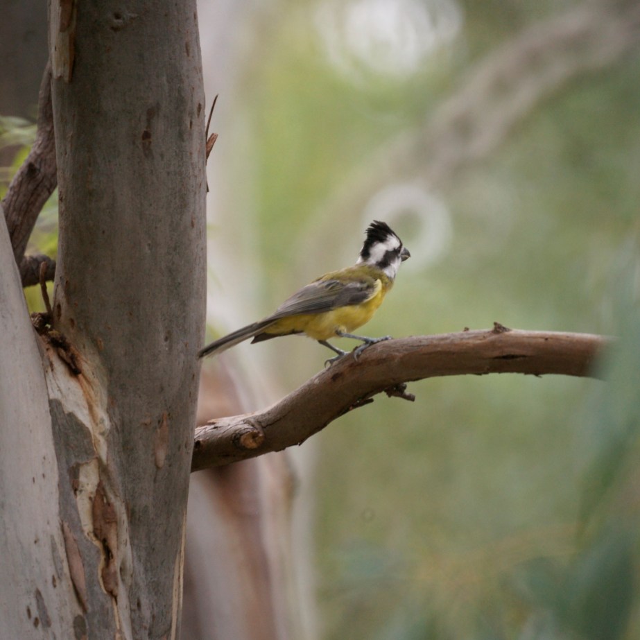
I added 20 more bird species to my year list, enjoyed recounting my first trip down this road and enjoyed the ride in my FJ Cruiser, too easy.

When I got home there was a very welcome 21mm in the rain gauge. May have to service the mower soon.

A Tale of Two Cities …

Not London and Paris but Warracknabeal and Brim.

They are not as far apart as London and Paris but the rivalry is just as intense and the Brim Silos have really heated it up.

You will find them out in the dry west of Victoria, sheep wheat country. Warracknabeal has a population of about 2 400 people, about half the population are descended from Harry Yambiak and are named Smith, Jones, Scott or Brown. The rest are named Avery. The second greatest moment in the town’s history was the birth of its most famous son, Nick Cave. The greatest moment was when he went to live somewhere else.

The Council thought that the town lacked a little zing so they came up with the notion of some civic art. What an achievement …

Waracka

It has never been accused of distracting passing drivers.

Twenty kilometres away is the little hamlet of Brim, population about 100 (261 at the last census but falling so fast 100 might be about right). The school closed in 2000, the pub closed in 2013. But when it comes to civic art they know how to do it …

Brim I P

… on a grand scale. Now that it’s completed it is a traffic hazard, the signs are out on the highway, the silos are being so frequently photographed that the image must be wearing away pixel by pixel.

Brim Silo

The big story now is who are they? Are they real? The artist is a Queenslander, is that Joe Bjelke-Peterson? The official line is that they should not be seen as individuals but as representatives of the local folk. Fortunately my Warracknabeal correspondent is able to shed a little light on the matter. She has kindly provided the following photos.

Brim ll

From which we learn that the subjects are real and none of them are Joe Bjelke-Peterson.

Even before completion the people in Warracknabeal knew they were being shown up in a big way. Here are some that have driven over there to display their silo envy …

SiloEnvy

Footnote. If you have never heard of Nick Cave or Joe Bjelke-Peterson there is absolutely nothing to be gained by looking them up.

Another Day in the Desert …

The south west of Victoria has a reasonable rainfall and fertile volcanic soils. Imaginatively named the Western District it is a rich agricultural area. Moving north rainfall diminishes and temperature increases. To the north of the Western District Victoria has its deserts. The sand was donated by South Australia during past ice ages brought by the  prevailing westerly winds.  These deposits are known as the Lowan sands. The Big Desert is in the middle, to the north is the Sunset Country, to the south the Little Desert. They are dry, they are hot in summer but they are all quite well vegetated.  Too well vegetated to be real deserts.

BigDesertLocale

I thought the Big Desert would be a good place to try out the new FJ Cruiser on the sand. Here it is with my trusty Pod Camper on the edge of the desert.

Desert Edge

The next day was a hot one. Birds were fairly scarce except for a patch where the Mallee Eucalypts were just bursting with blossom. I took a seat close by and photographed the incoming flock. The White-fronted Honeyeaters came in good numbers …

White-fronted Honeyeater

WFHand the ubiquitous Galah posed nicely …

Galah

I had to work a little harder for this one …

Shy Heathwren

This is the Shy Heathwren, Hylacola cauta. There is another species in the same genus, the Chestnut Rumped Heathwren, that is even harder to find. It has been said that the Chestnut-rumped Heathwren makes the Shy Heathwren look like a social butterfly.

A rewarding day, day’s end brought yet another treasure …

B D Sunset


The Mighty Murray …

Victoria lies in the south east of the Australian mainland. The colonies around it were given a degree of definition when Victoria was just the Port Phillip District of New South Wales. Tasmania, then van Deiman’s Land was separated from NSW in 1825 and was given virtually all the Bass Strait Islands even most of those that you can see from our most southerly point. Jibbed. (Tassie was renamed in 1856). South Australia happened into existence in 1834. Its eastern boundary was defined as the 141°E meridian (but a curious thing happened).

When Victoria was mooted the formula for its northern boundary was to start on the east coast at Point Howe, draw a line to the source of the nearest tributary of the Murray and then follow the left hand river bank until bumping into the South Australian border that already existed. Easy. So NSW got all the river, jibbed again, a Victorian needs a NSW fishing licence to fish from Victoria’s bank and where is the top of the bank in a flood, or where it has been altered. Wars have been fought over less. Anyway everyone knows that Victoria has none of the river.

And that popular view is wrong, South Australia’s turn to be jibbed. When their eastern border was surveyed between 1846 and 1850 it was set two minutes too far to the west. The mistake was discovered in 1868. Victoria was unwilling to give up the little slice of SA it had received by luck. The case ran for quite a while until the Privy Council ruled in favour of Victoria in 1914. For 10 km of river Victoria is on the left bank and South Australia is on the right and for that 10km the border runs right down the middle of the river. Ten kilometres of half a river is better than none. If you have a Victorian fishing licence you can use it here!

Even though Victorians have very little stake in it, it remains a mighty river 2,508 kilometres (1,558 mi) in length. It is joined by the Darling and together they drain about one seventh of Australia’s total land mass.

There is one little bit of the Murray that is of considerable interest to the Victorian birdwatcher, the Barmah Forest is the only place in Victoria where the Superb Parrot, essentially a denizen of the inland slopes of the Dividing range of NSW, deigns to cross the border. If you want it on your Victorian list you have to go to Barmah. If you will give me a few minutes I will search the internet and see if I can filch a photo of one …

277201

Once again it’s Graham Chapman that I’ve parasitised, I hope he will forgive me, it may help my cause if you visit his splendid site.

I spent a couple of days there just before Christmas. The Superb Parrot eluded me. The Yellow Rosella came to say hello. They are common in the Red Gum forest along the Murray and don’t wander far from there. Officially they are a subspecies of the Crimson Rosella but they rarely interbreed in the wild.

Yellow Rosella

Noisy Friarbirds share the same tastes in habitat. Some are resident but their numbers are boosted by a summer influx across the river.

Noisy Friar

I camped right on the bank. A pair of Azure Kingfishers were feeding three youngsters. They soon became fairly comfortable around me. It would not have been safe to leave sardines on the table.

Azure Kingfisher

A few minutes walk away I came upon this guy.

Koala

Not far from Paradise …

In summary of the recent trip. The Prado and I covered 8,820 km (5,512 miles). The binoculars were turned on some 271 species of bird, one of which they had never seen before. They were also trained on some of Australia’s quite unusual mammals including both Tree Kangaroos, Platypus and Spectacled Hare Wallaby.

Round Trip

Getting home to the drab and mundane, the humdrum, the ordinary might be a challenge, if a word of that were true. But it’s not, I have Platypus in the creek at the bottom of my back paddock, this guy was waiting for me a few metres from my front door …

EaGyK

This one was out on my driveway enjoying the summer sun …

Shingleback

I live not far from Paradise and I can get there by bus.

Near here

The First …

A new calendar game starts.

You are in the game on January first. To stay in the game you have to add at least one species of bird to your year list for each day elapsed. A big day on the first makes you safe for a while. If you fall behind the days elapsed you are out. The last one to go out is the winner or by reaching 366 (it’s a leap year) there could be any number of winners.

My total last year was 386. An insignificant achievement when compared to Sean Dooley’s 703 in 2004. Sean wrote a book about that year called The Big Twitch. I get an acknowledgement in the book, not, I suspect, because of my enormous assistance but rather so I would buy the book. It worked.

This morning I was out of the house at 6 am. It was 24°C (75°F) already and would become hot and windy. It’s been a dry old time. One of the local hot spots is, by coincidence, Dooley’s Road. It backs on to the Maryborough (Victoria) sewage treatment plant and has some much abused remnant vegetation and I visited the sewage ponds as well. Plus some local box ironbark forest. I chalked up 50 species including Crested Shriketit, Little Eagle and the elusive Freckled Duck. No point staying out after noon. Safe until mid February. The Crested Shriketit has a viscous little hook on the end of its bill that it uses to tear away bark to get at the insects underneath …

Crested Shriketit

Playing the game with mammals wouldn’t get me through January but I did see Eastern Grey Kangaroo and Swamp Wallaby. Many prefer the name Black Wallaby for the Swampie on the grounds that it has no preference for swamps which is very true, but nor is it black. The scientific name is Wallabia bicolor, the two coloured wallaby. Also untrue, it’s dark brown with rufous around the ears and a whitish stripe on the face, the tip of the tail is often white. The poor creature stands in need of an appropriate name.

Swamp Wallaby

By all means join the game. Wherever you are in the world. Post your tally in the comments, I look forward to hearing from you.

Time for me to get back to the thrilling account of my trip through the desert …


Frangible gates …

In the depths of the Clunes State Forest is a railway line. A forest track goes across it. Road traffic would never have been frequent. For reasons that would at first glance seem hard to fathom it was upgraded, presumably at great expense. Then to make sure it was safe gates were put across it. Now there is no traffic.

OLYMPUS DIGITAL CAMERA

In June 2007, a few kilometres north of Kerang, Victoria, a truck ploughed into a train killing 11 and injuring 23 others. The truck driver was charged with 11 charges of culpable driving and eight counts of negligently causing serious injury. On the face of it the case should have been a lay down misere, a professional driver familiar with the route propels his truck past the flashing lights into the side of a train at a rail crossing in perfect road conditions. Surely we can expect drivers not to do that.

Up steps the defence. The alternate theory of the crime was that the State of Victoria dunnit. Victoria’s rail crossings were unsafe. The jury bought it. The driver went free. I wonder if they would like to buy a bridge in NSW that I have for sale. Looks a bit like a coat hanger and yields an excellent return in tolls.

The good folk of Victoria now have 80 km speed limits anywhere near rail crossings.

This particular rail crossing is the only road access to a chunk of forest. There could be an emergency. Think about it, brain storm it. I’ve got an idea, let’s make the gates breakable.

Breakable, ooh, that could be an invitation to every hoon in the neighbourhood.

OLYMPUS DIGITAL CAMERA

So lets call them frangible they won’t know what that means. (My spell checker doesn’t).

Hope the signs are frangible, too.


Emerging from the bush …

A happy new year to all and sundry. I am full of optimism, it can’t be anywhere near as disastrous as Tim Blair predicts

I woke up to 2015 in Victoria’s Sunset country not far from this sign …

OLYMPUS DIGITAL CAMERA

This is the part of Australia that achieved fame when Apple Maps was launched. Version one directed people going to Mildura into the wilderness. The press made much of the prospect of people dying of thirst or succumbing to snake bite. I did neither but I did make an excellent start to my 2015 bird list.

A couple of people have taken on the challenge of the Calendar Game. I will post my progress from time to time, hopefully they will inform us all of their progress in comments. So far this year I have seen 110 species, so I’m safe until April 20th.

Summer is harsh. Weather is always a topic of conversation in Victoria because it changes frequently. The cycle runs from a hot north wind through a cold change from the west, a couple of cooler days then the wind turns northerly and things hot up again. The dramatic moment is the change itself, it can drop the temperature 15 degrees in half an hour. In summer that’s usually very welcome.

When it’s very hot and windy the fire risk is high. Fires tend to start during the northerly, all too often because some nutbag deliberately lights it. Initially the fire front travels south, burning embers often travel ahead on the wind, starting spot fires that make firebreaks ineffective. Despite reports that it travels faster than a speeding bullet the front is likely not to exceed 16–20 km/h. After five or six hours then the area affected will look like a relatively narrow triangle with its base in the south about 100 km from the apex at the fire’s origin.

The change arrives with a strong westerly wind, the fire front now becomes the eastern side, much longer than the southerly base. If the change is accompanied by heavy rain … great. In summer it often isn’t. In Victoria the loss of life and property is usually greater after the change.

The most recent weather cycle produced the fires in the Adelaide hills, South Australia, which has destroyed at least 26 houses, and fires in western and southern Victoria that have been less destructive. Looking west from my front gate the change looked like this …

OLYMPUS DIGITAL CAMERA

My fire plan is simple. There is a road leading south and another going east. Fire from the north, McGee goes south, fire from the west, McGee goes east.

But on a brighter note, my meanderings over the last couple of days have turned up some beautiful sights …

OLYMPUS DIGITAL CAMERA

The old trestle bridge at Archdale, and below a Rainbow Bee-eater at Newstead.

OLYMPUS DIGITAL CAMERA


Ah, Port Fairy …

Jewel of Victoria’s west coast.

I have the enormous luxury of spending a few days here.

OLYMPUS DIGITAL CAMERA

It is 290 km west of Melbourne where the River Moyne reaches the southern ocean. This coast was home to a small whaling industry from the 1830’s, a store opened here in 1839 and the Post Office in 1843. It is the home of Victoria’s oldest continuously licensed pub and some other fine heritage buildings. If it wasn’t for the sand on the beach and the better weather it could be an English seaside village.

It is still a working port. Less than a hundred metres from where I’m staying there is a guy making wicker cray pots on the deck of his fishing boat. A couple of days ago they were just a bundle of rods soaking in the river.

The tourist can walk along the wharf, take a stroll around Griffith’s Island, the early whaling base, or visit the koalas and emus at Tower Hill fifteen minutes drive away. Have lunch at Rebecca’s, tea at the Lemongrass Thai Restaurant and recharge the soul. They tell me the folk festival in March is not to be missed although it’s not my scene.

It is a splendid place for the bird watcher.

OLYMPUS DIGITAL CAMERA

The best place to stay is Doc’s at the Mill, right at the wharf and an easy walk into town or to the beach. The old flour mill was built in 1860, it’s the only three story building in town. It has had a colourful history itself, as you can see from the photo the third story is now wood. If you want to see the stone that used to be there you need to look at the tower of the Anglican church in Regent Street!

It has been converted to luxury accommodation with three bedrooms. Contact Langley’s  +61 3 5568 2899.