… and very cooperative Rail.
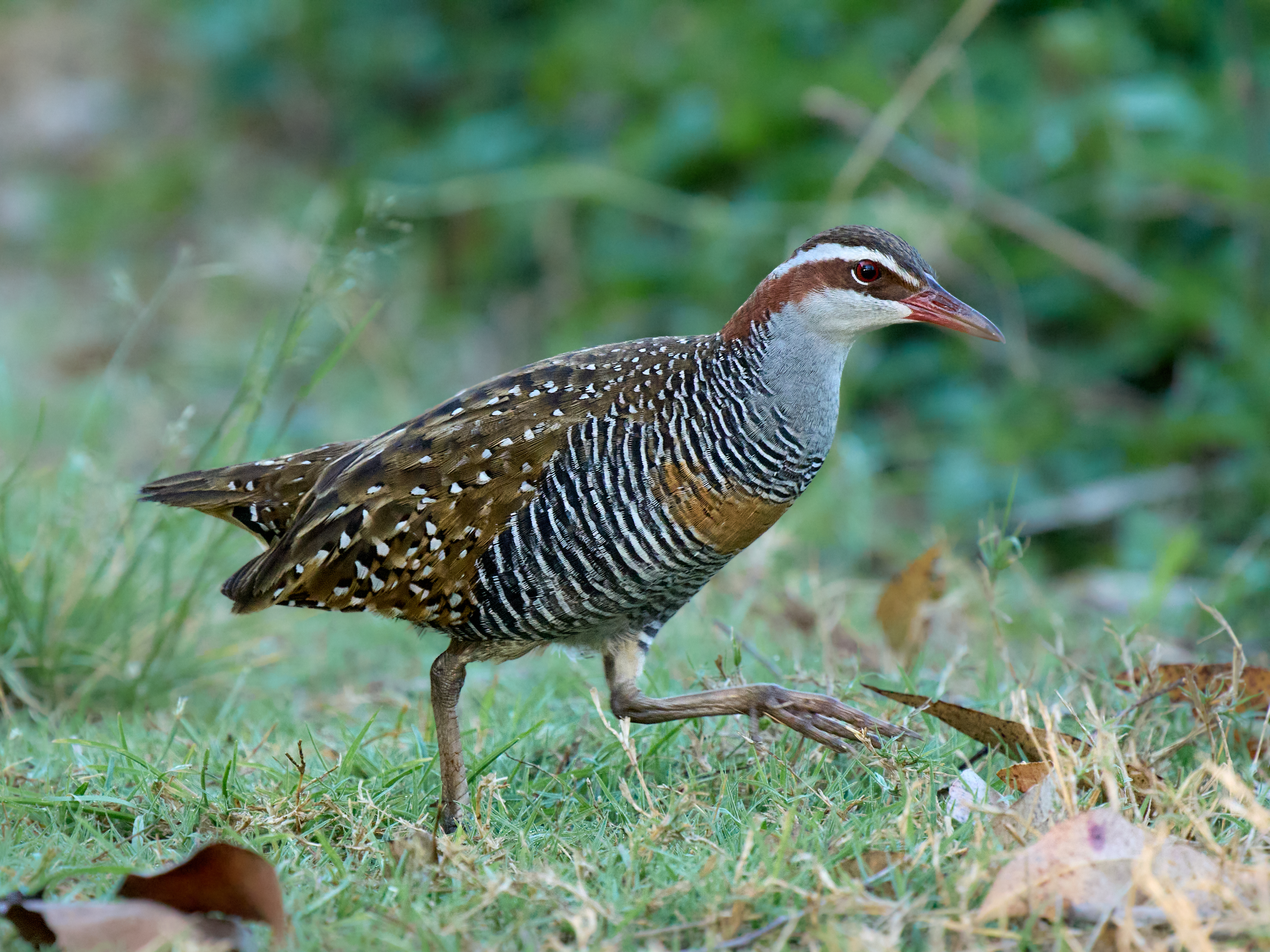


Widespread and not uncommon. Found in all Australian states, absent from the deserts. Also found in Indonesia, the Philipines, New Guinea and Pacific Islands. Usually in rank vegetation near water.
and pray that there's intelligent life somewhere out in space
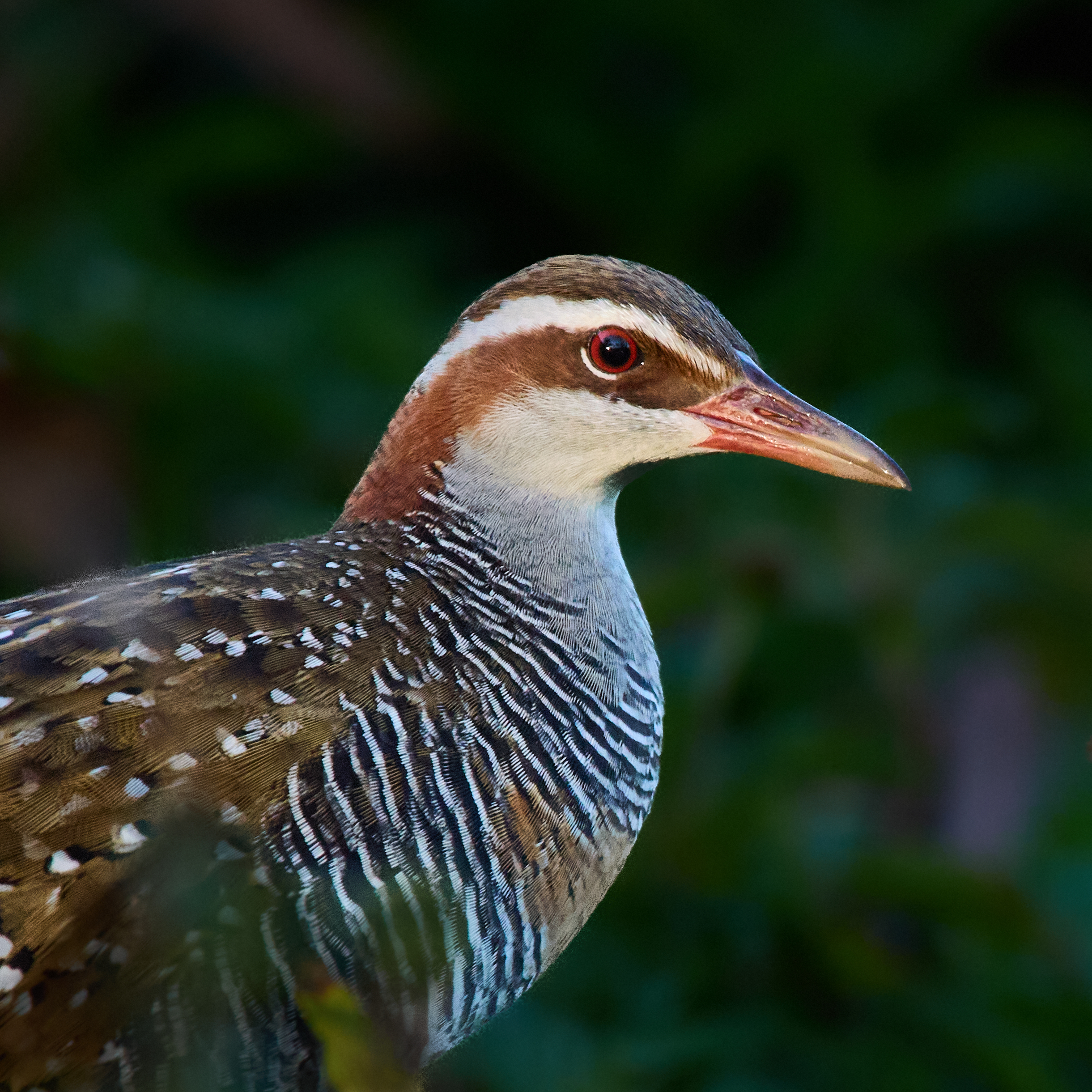
… and very cooperative Rail.
Widespread and not uncommon. Found in all Australian states, absent from the deserts. Also found in Indonesia, the Philipines, New Guinea and Pacific Islands. Usually in rank vegetation near water.
The Atherton Tableland is a different world from the thousands of kilometres of savanna just a short distance behind us. It’s cooler, it’s very much greener and it’s much more populated. It would once have been a forest. Now it’s scattered remnants separated by farmland. We are camped at Lake Eacham just outside the National Park. This is home for four nights.
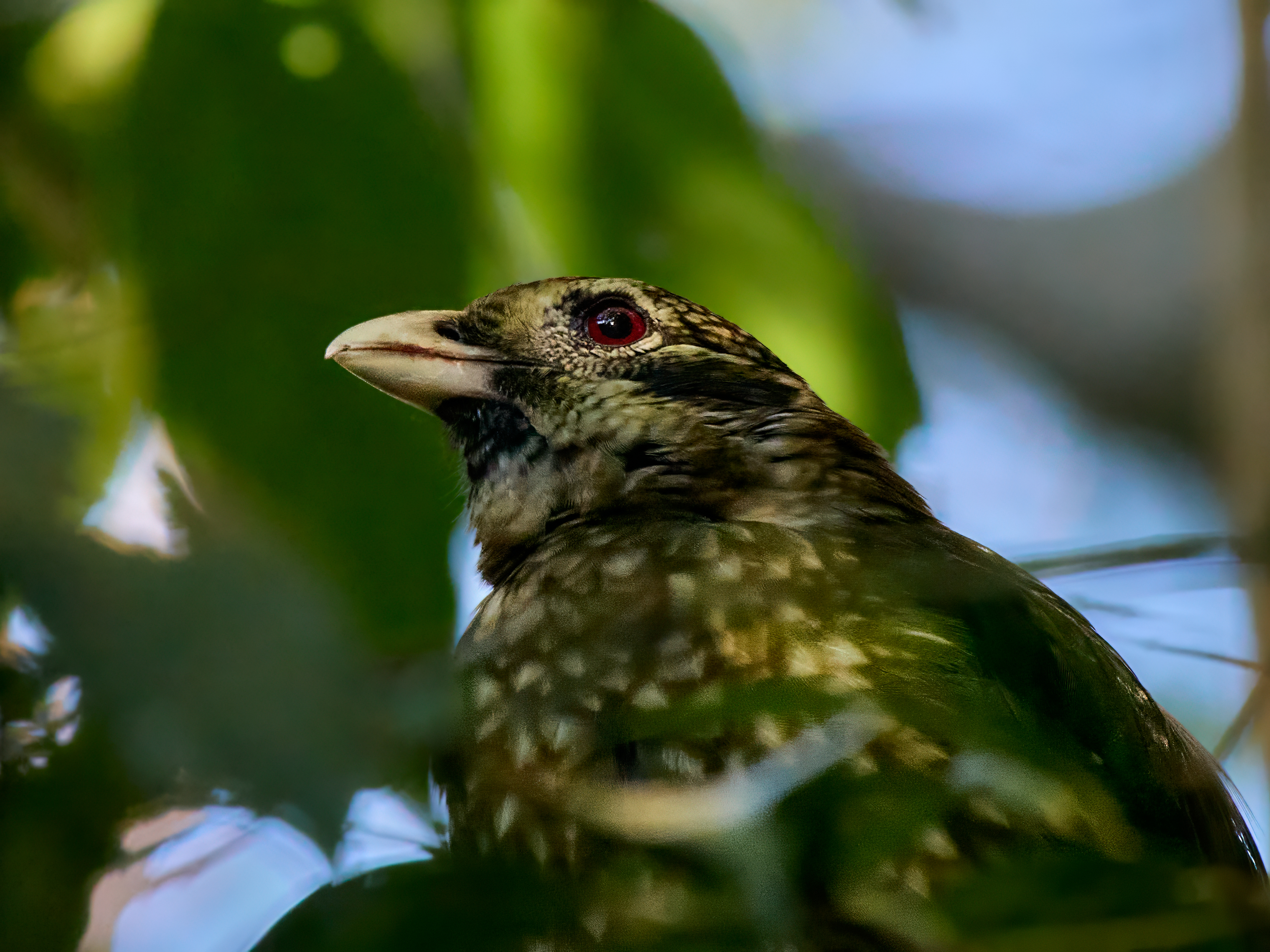
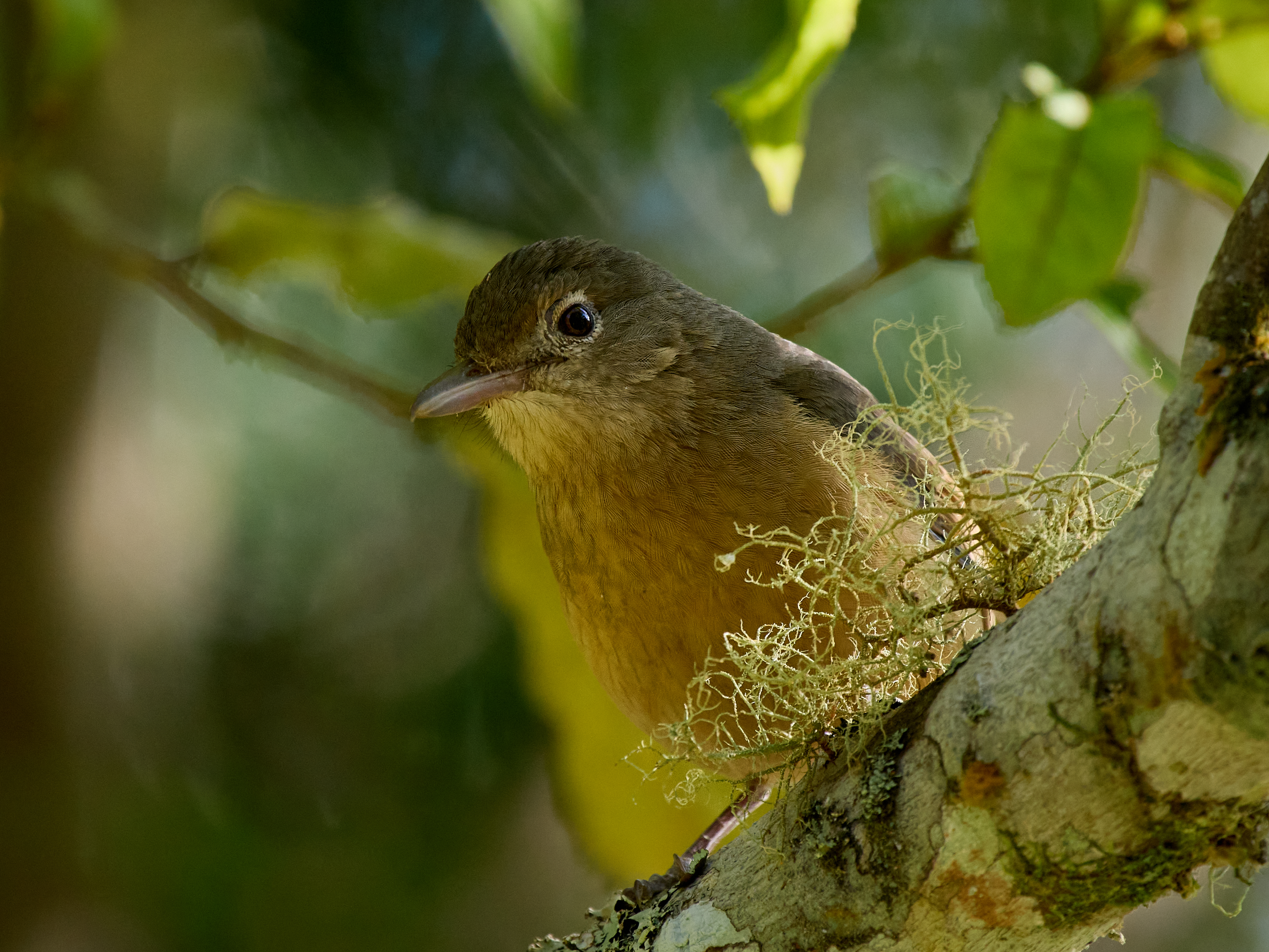
A short walk takes me into dense rain forest, the light hardly penetrates through the trees towering above. The birding is tough, done largely by ear. The photography is even tougher done largely without light! Bird density seems low but the variety is high. Lists are not long but there seems to be something new on every one.
The crater lakes are Lake Eacham and Lake Barrine. They formed when magma approached sufficiently close to the surface to turn the groundwater to steam producing explosions that created the craters now filled with water. These events were fairly recent. Barrine is the older forming about 17,300 years ago. Eacham formed about 9,130 years ago. Both are surrounded by lush rainforest and are National Parks.
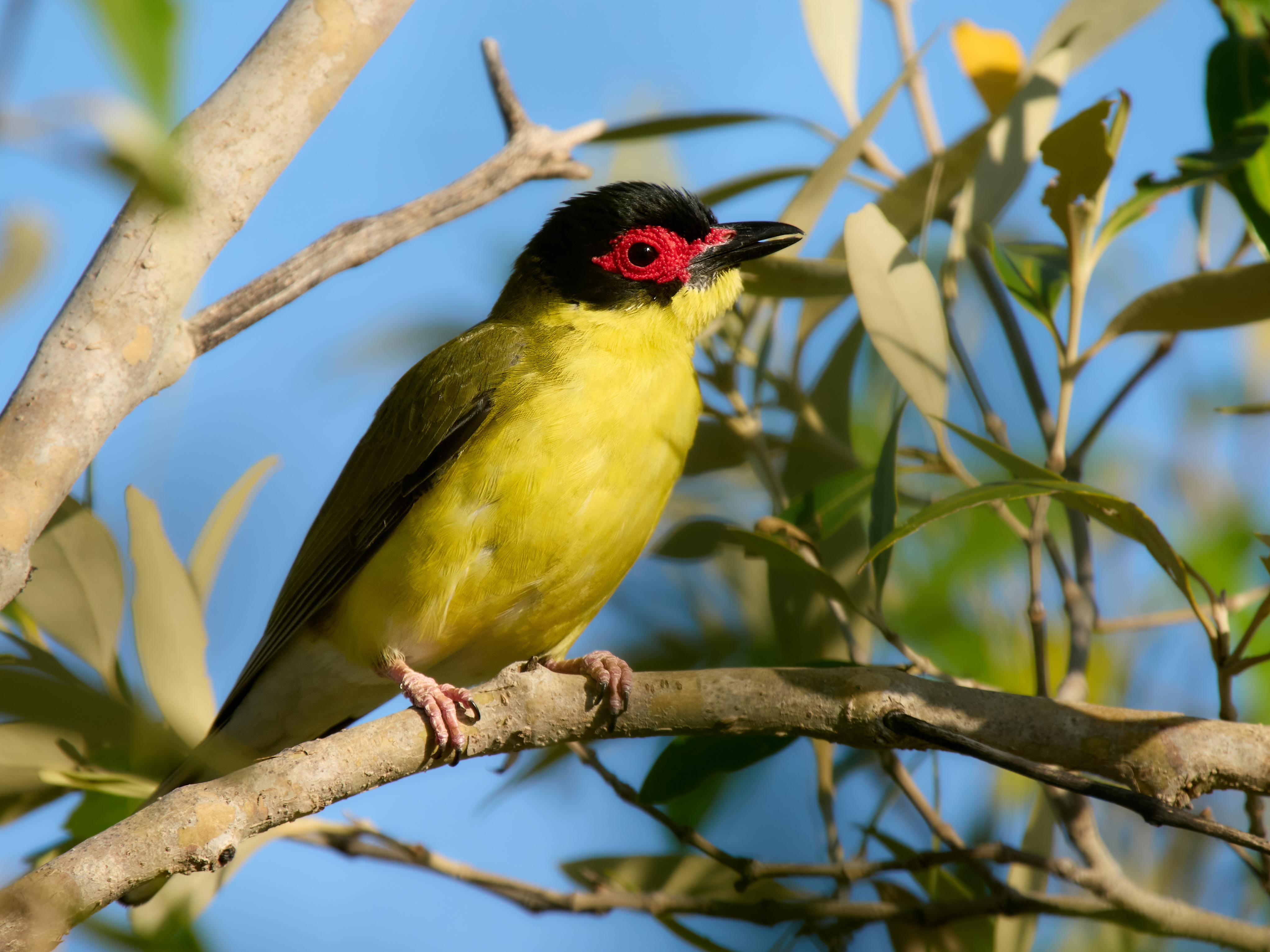
The wet tropics has 23 bird species that are either endemic or largely confined to the region. Nine of those species are only found at higher altitudes, essentially the Atherton Tableland. And there’s no shortage of more wide ranging species. Those tall trees are so inviting you can even find Kangaroos in the canopy. It is a very special place.


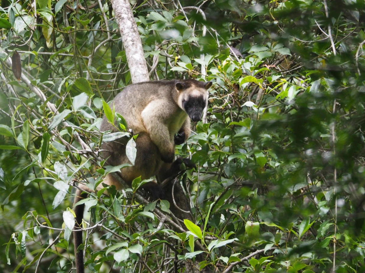
That’s Lumholtz’s Tree Kangaroo, very hard to spot during the day. I took this photo on a previous visit.
Karumba to Croydon an easy 224 km mostly on good dirt road. Croydon has a population of 215. Gold was discovered in 1885 by 1887 it was the fourth largest town in the colony of Queensland with 7,000 occupants. Gold was shipped out by train to Normanton, the railway still runs as a tourist venture, The Gulflander. Lake Belmore is a short drive from town, scenic and not bad for birding. Even better birding at Cemetery Swamp (called Croydon Lagoon on eBird). There is a caravan park or you can camp at the rodeo ground – get a permit at the visitor centre.
Croydon to Innot Hot Springs 379 km of made road although intermittently a single strip of asphalt shared with oncoming traffic.
The Savannah Way goes on another 145 km to Cairns but the savanna itself has just about run out. A new suite of birds is already intruding. Today introduced Pied Currawong, Crimson Rosella, Noisy Friarbird and Grey Butcherbird. Rainbow Lorikeets have replaced the Red-collared. Tomorrow we climb up onto the Atherton Tableland and the change will be even more dramatic. So this is where I will wind up the Savannah Way trip list.
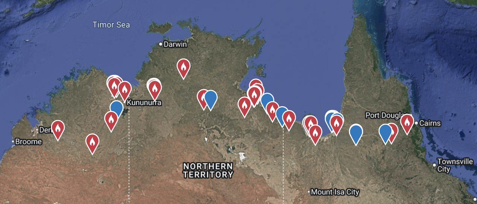
The trip meter reads 4350 km, that’s Broome to Innot Hot Springs and the running around at each stopping place. Each symbol on the map represents a place where I submitted a bird list. It adds up to 146 species in two weeks.
I know you are waiting with bated breath for news on the Calendar Game. The trip has added five species to the year list, now at 335. Twenty-nine to get and only three month to do it. I’m feeling confident.
I shall now go and luxuriate in the hot spring water.
Tomorrow begins a new phase, the Atherton Biogeographic Region with Cooktown and Cairns thrown in.
Leichardt’s Falls to Karumba is 224 km on a mixture of good dirt road and bitumen. Nearing Normanton you cross paths with the Burke and Wills expedition and you can visit their most northerly camp site, camp 119. Burke, Wills, Grey and King spent three days here in February 1861. Burke and Wills pushed further north, reached the tidal zone of the Gulf but were halted by mangroves without seeing the sea.
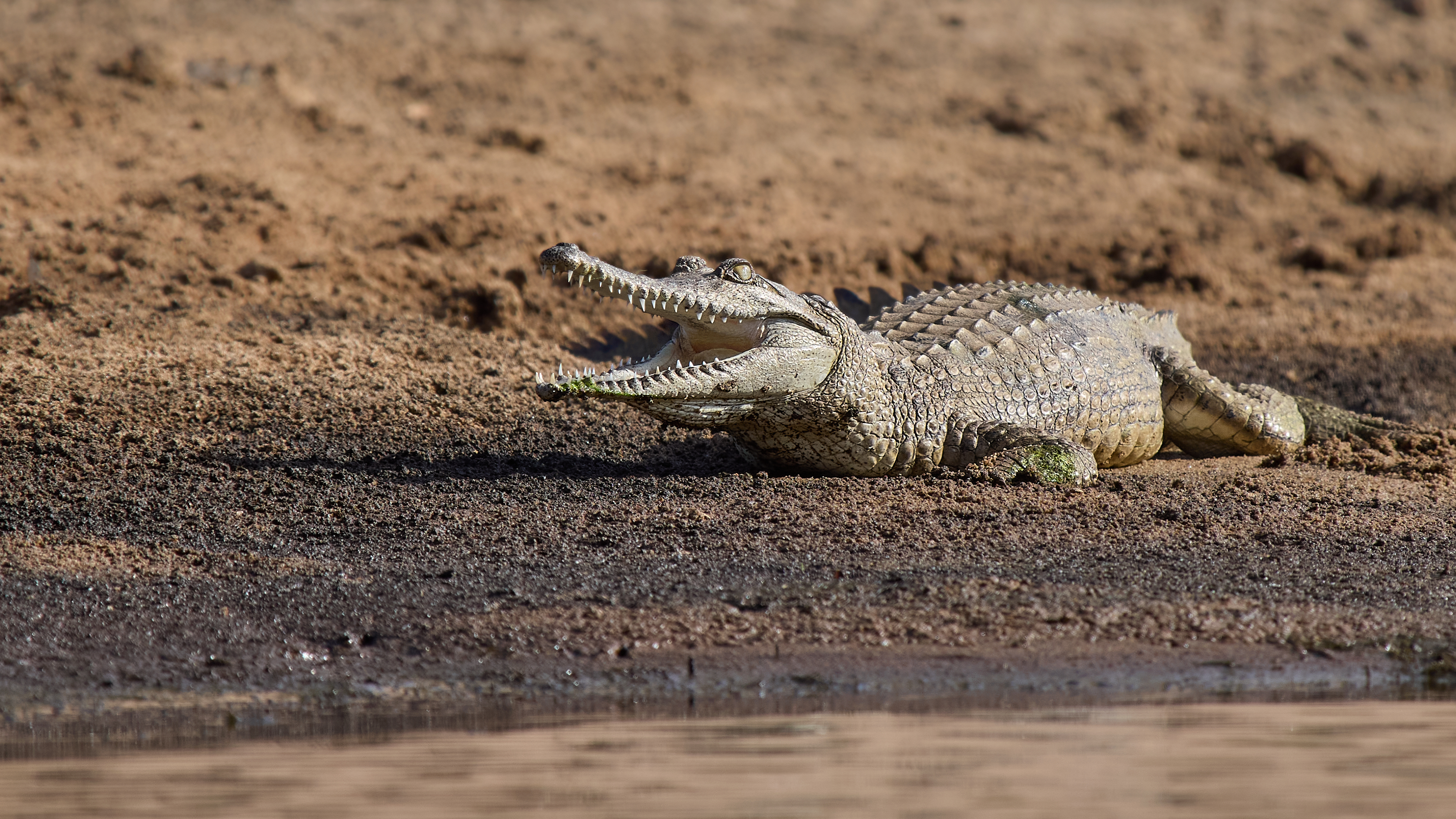
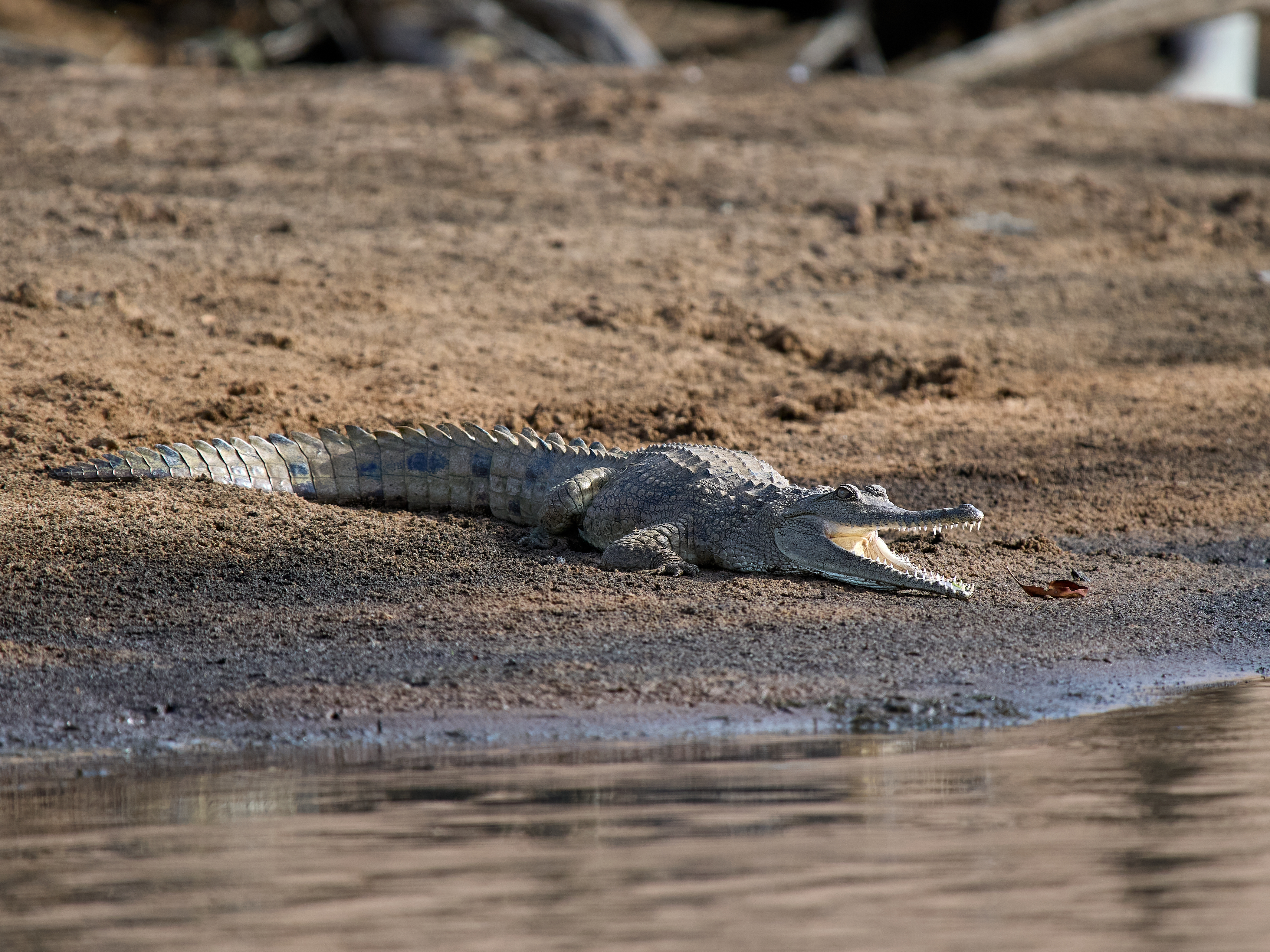
As Burke and Wills found, the gulf is well protected by mangroves and mud. Karumba is the only seaside resort on the Gulf. There is even a beach, of sorts. Swimming is not advised. There is no shortage of large salt water crocodiles here. Birders and fishermen are better off staying at the point rather than in town. We favour the Sunset Caravan park but expect to be cheek by jowl with your neighbours. We could have had a conversation with the five adjacent vans without anybody getting out of bed this morning.
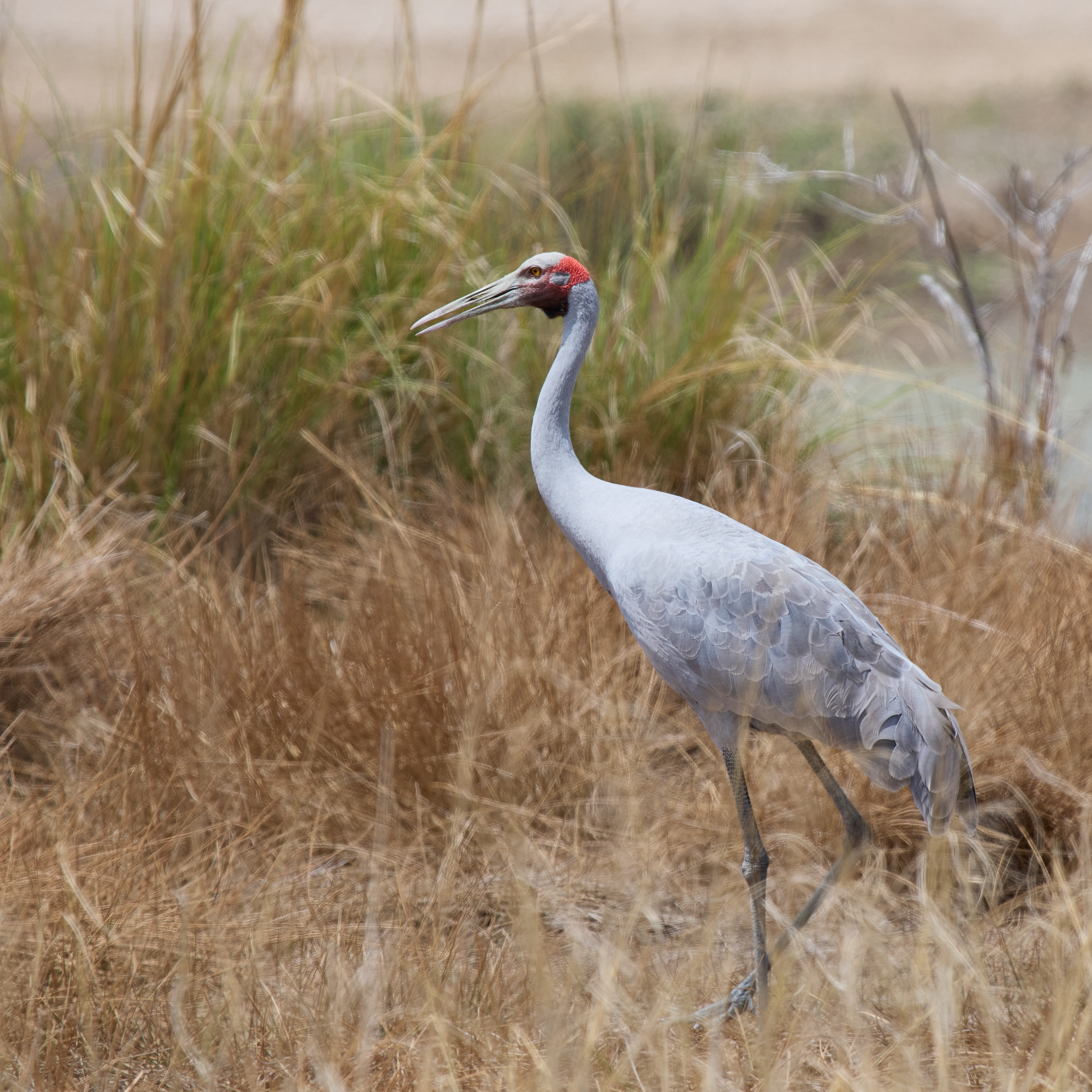
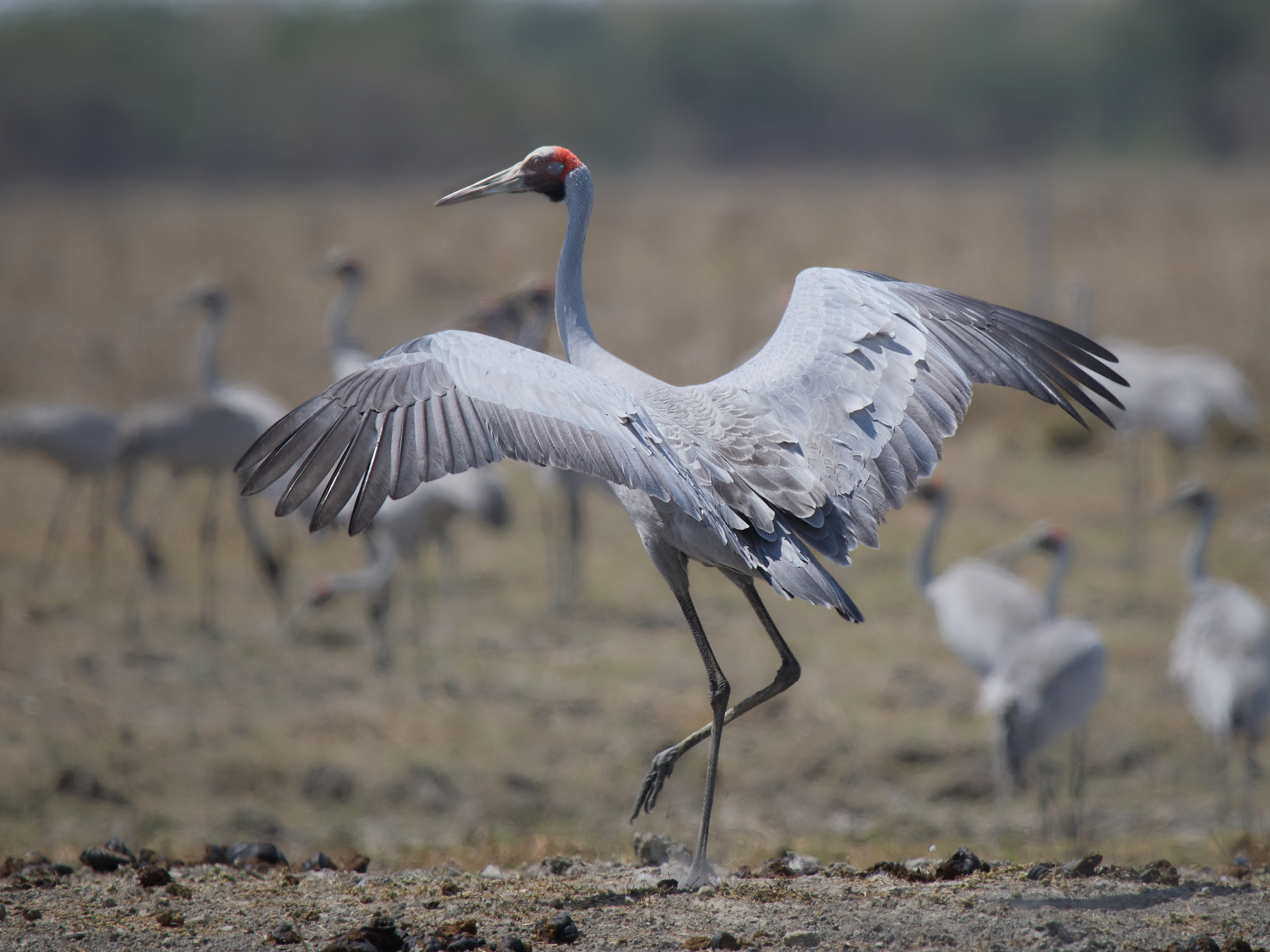
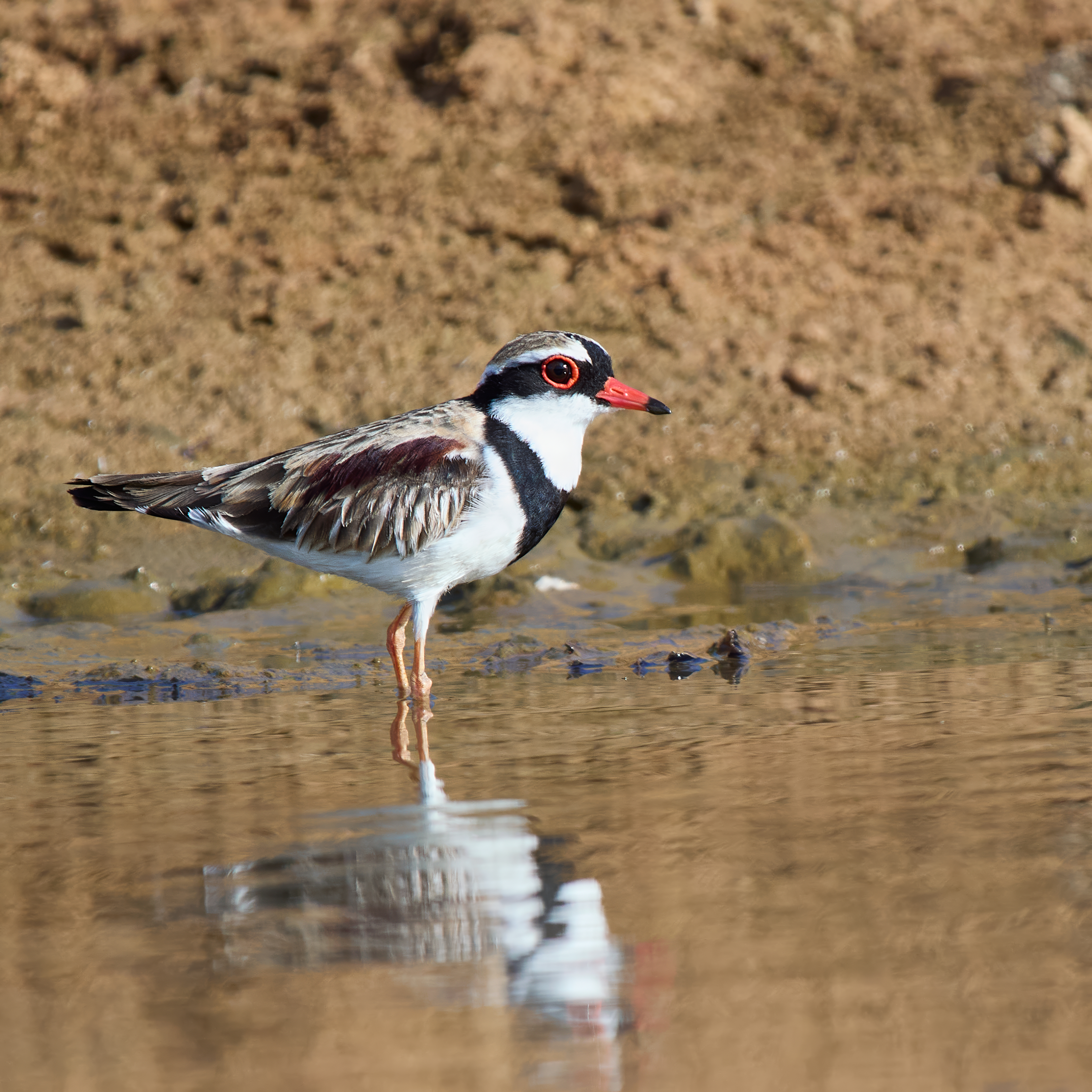
The birding is rich. We saw hundreds of Brolga between Normanton and Karumba. Among them there are a small number of Sarus Crane (about 3%). They are a slightly different shade of grey and the red band on the head extends down the neck. They seem more skittish than Brolga and so far I haven’t managed a photo that I am prepared to publish! There are plenty of mangroves and some accessible wetlands.


Tea at the Sunset Tavern this evening.
We are again in the footsteps of a great explorer, although we are going in the opposite direction. This time it’s Ludwig Leichardt. On his first expedition he and his party left Brisbane in 1844 and after traversing the Gulf of Carpentaria arrived at Port Essington (Darwin’s predecessor) in 1846. He’d been given up for dead by then. His third expedition has not yet been completed. He was last seen on 3 April 1848. I like to think he’s still out there exploring.

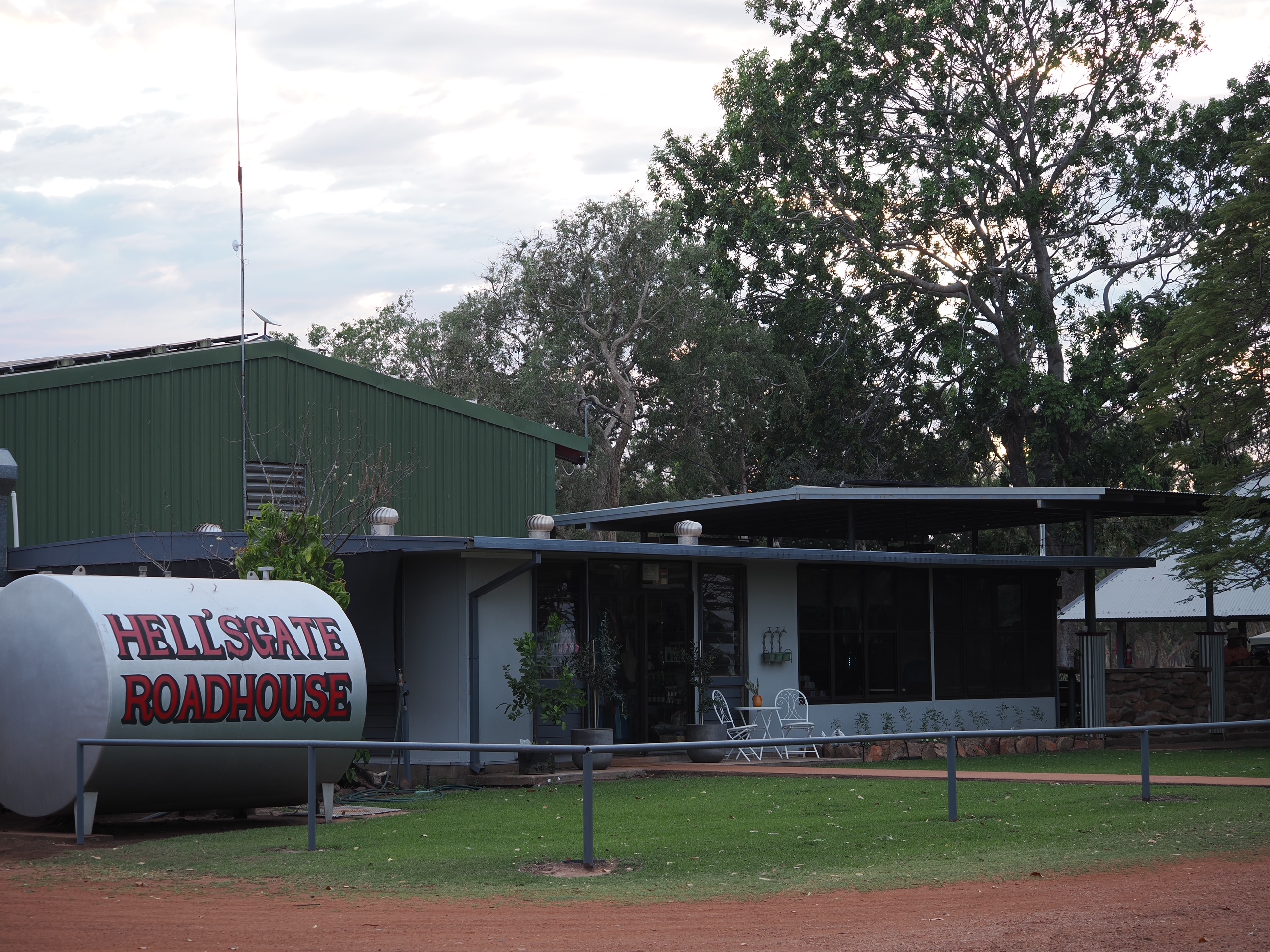
The journey from Hells Gate Roadhouse to Leichardt’s Falls was 249 km on a mixture of good dirt road and some made road. Easy driving in the main.
The scenery at the camp site is magnificent even though this late in the dry there is water above the falls and water below the falls but no water going over the falls. We had it all to ourselves. Access is via a downhill sandy track to a rocky area on the canyon edge. Easy. Egress is via the same track which suddenly seemed sandier and steeper. Less easy.
Getting to the water entails a fairly steep climb down the cliff on foot. I sat quietly at the water’s edge with my camera and was rewarded for my efforts.


Great-crested Grebe is rare at this location. They don’t roost in trees and they can barely shuffle along on land. They are either in the air or in the water. I couldn’t find it the following morning.
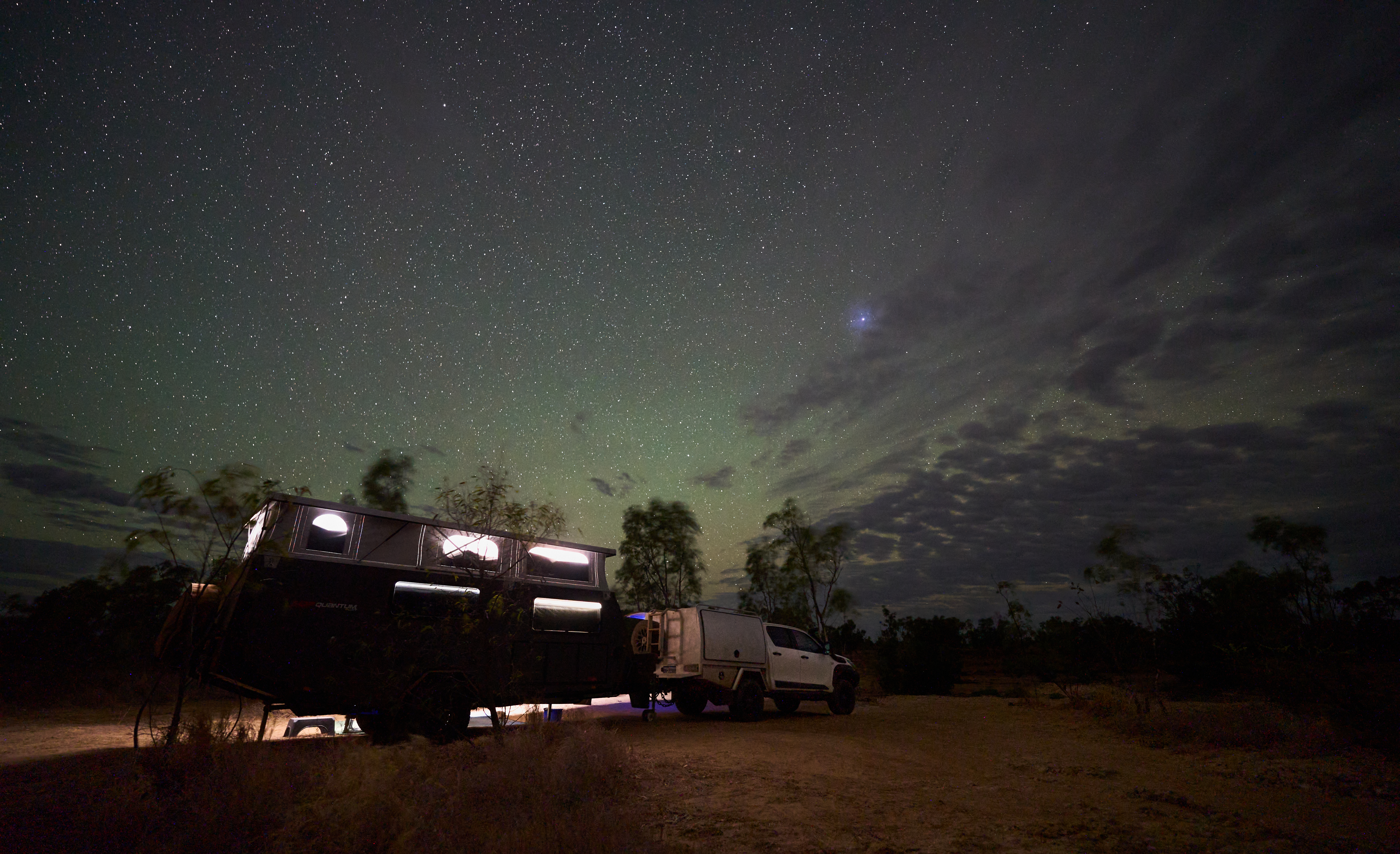
It wasn’t a great night for Milky Way photography, too much cloud and very windy. But hey, that’s not the only subject available …
We spent two nights at Borroloola. The first afternoon a caravan arrived and we got into conversation with the owner. Typical travelers tales. Where have you come from? Oh, that’s the way we’re going. How was the road?
The road, he said, was bloody awful, the bull dust had him fighting the steering wheel, the dips were ferocious, the corrugations were bone jarring. Would we like a look in the van?
It was a scene of devastation. The drawers and their contents were strewn across the floor. Red dust lay on everything. His car was in no better condition, the rear window was broken, red dust covered the interior. He was quite upbeat about the situation. He had survived the battle. Among the fragments of celebration he did mention 80 kph, getting airborne and that he never reduced his tyre pressures. It caused us some concern. For us, not him.
When it was our turn Gayle prepared the inside of the van with great care. When we got to the dirt road I let the tyres down 25% all round and we proceeded at moderate speed. 317 km to go. The creek crossings were mainly dry, the dips in and out were taken slowly. The bulldust was avoidable or manageable at modest speed. The corrugations were corrugations, choose the quietest route and vary speed to suit. Conditions varied with the underlying substrate, some sections were rocky, some sandy. There were two wet creek crossings and a couple of puddles to negotiate.
We had intended to take two days for the journey but progress was better than expected and at lunch time we moved the goal posts and went all the way to Hell’s Gate. No damage. No dust. No drama.
Nothing like hell or its gates. A pleasant campsite by a bore fed pond. The odd Agile Wallaby and Antilopine Walleroo passing by.
I’m looking out at the fading orange predawn glow, under a mackerel sky. It’s pleasantly warm. I am but a speck in the universe. Borroloola … We’ll be on our way in a couple of hours to Hell’s Gate via Robinson River. Still on National Highway 1 but the next section is unsealed and from what we’ve heard quite exciting.
The road here from Daly Waters was easily managed. It’s in the process of becoming splendid and while that’s happening its 390 km of two lane highway, one lane highway and kilometre after kilometre of dirt sidetrack. You reach the McArthur River mine about 70 km from Borroloola. The road is good from there on. The mine is owned by Glencore. Lead and Zinc ore goes from there to Bing Bong on the Gulf of Carpentaria by quad road train hence the good road. There is a lookout tower at Bing Bong. You can see the loading facility, there is otherwise nothing for the tourist, no shops, no accommodation. About 5 km of stony track away is Mule Creek where you can launch a tinny or fish from the bank (watching out for crocodiles, of course.)

Borroloola has a population of about 800, 75% are aboriginal, the Yanyuwa people. There is a school, a couple of fuel outlets and stores. The caravan park is pleasant, good facilities including a shop and a swimming pool and very friendly management. There are a couple of boat ramps for people wanting to fish the McArthur River. It once had a remarkable library, a story in itself – see wikipedia.
King Ash bay is an alternative camp site. Very suitable for the fishermen and women.
Before leaving Broome and after updating the Calendar Game score I added White-browed Crake to the year’s tally so left Broome on 330. The banks of the McArthur River yielded two more species, the Lemon-bellied Flyrobin and the Buff-sided Robin. The count down to 365 is on. I also had success with Crimson Finch in the Pandanus. Not far from town I found an Australian Bustard.


285 km, sealed road. Via Katherine, a real town with a supermarket and everything. Population about 6000. And a change of explorer. It has been Gregory for the last few days. Now it’s time to tip the hat to John McDouall Stuart.
Daly Waters is a pub with a campground attached. At lunch time it has a population of about 55, by tea time that’s 555. Stuart conferred the name on a chain of springs that he found on his third attempt to reach the north coast, 1861–62. The overland telegraph arrived in 1872. The town was founded in 1927. The pub got its license in 1938. There is a WWll airstrip. At the moment it seems like one of the worst places I have ever stayed. It may seem better after a few beers.
And it did.
The pizza was good too. Donkeys, horses and goats wandered among the crowd outside the pub. With them came the Apostlebirds, Gayle’s favourite bird. We have been in the territory since a little west of Katherine but this is our first contact this trip. They are bold, aggressive, hissy and unloveable. They come in groups, I hesitate to say by the dozen. If you are unwise enough to catch one the remainder attack.


The last few days we have been on the country traversed by the extraordinary Kimberley pioneers, the Duracks. Patsy and Michael drove a good sized mob of cattle and horses, leaving Thylungra, Queensland, in 1879. Nearly three years and 4,800 km later they arrived in WA where Lake Argyle has now been created. Their homestead was taken down stone by stone and rebuilt on high ground before the lake filled.
Manbulloo Homestead has good natural values, a shady campsite and good facilities. A track takes you to the Katherine River. You can pat the goats, play with the donkey and watch the cows being fed. They have a couple of Turkeys, that I hope will survive Christmas, named Camilla and Charles. Sweet.
Northern parts of Australia are steeped in WWll history. Broome and Darwin were subjected to Japanese air raids. There is a memorial to the Nackeroos, essentially lookouts trained for geurrilla resistance, on the escarpment above Timber Creek. WWll airstrips dot the countryside. And Manbulloo has its own small share commemorated on an information board.
There is a military tale concerning Chinese Whispers run amok that has the punchline “Send three and fourpence we’re going to a dance”. Apocryphal I was certain … until I saw this photograph showing a squad rehearsing its dance moves with the choreographer out front.
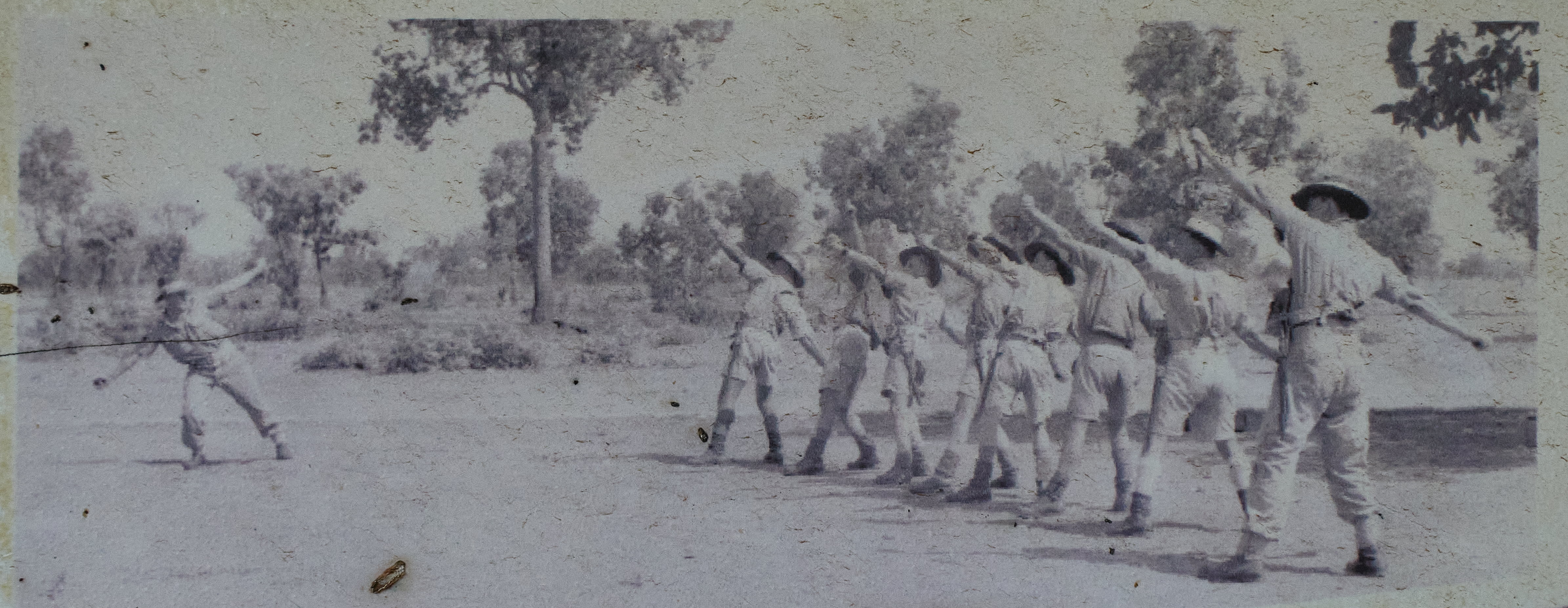
I know, wrong war. The earliest version seems to have been published in 1914 under the title “Altered in Transit” in the “Temperance Caterer” periodical of London and various similar variations followed. Credit Quote Investigator for that bit of intelligence.
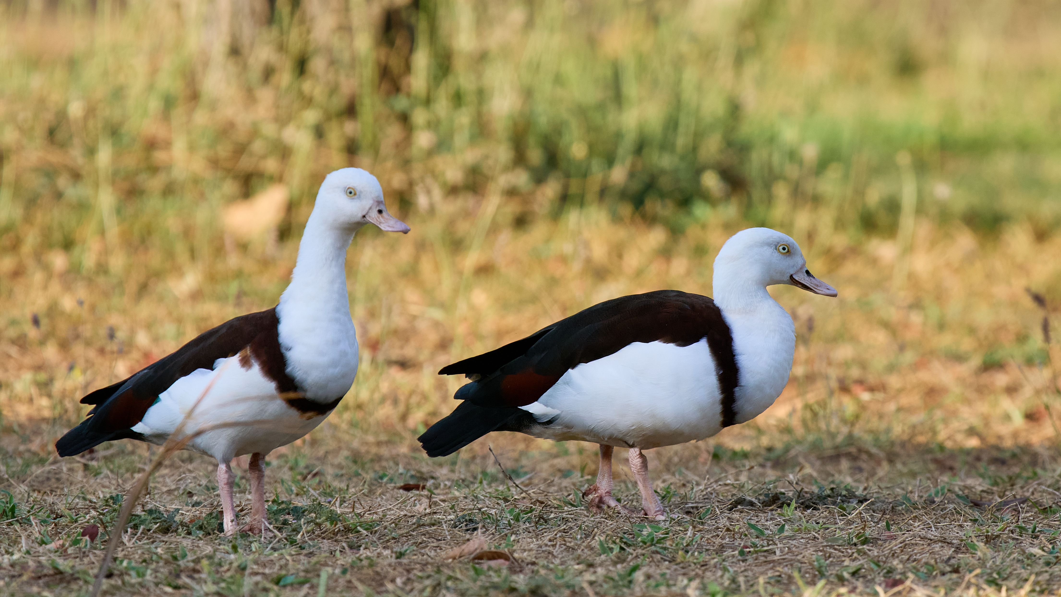
Torresian Imperial Pigeons and Yellow Orioles were calling during the day. Bush Stone-curlews were wailing during the night but the only bird lining up for a photograph was the Radjah Shelduck.


Over two days. First night Timber Creek. 327 km, all sealed. Population 278 slightly more than half are Aboriginal. Augustus Charles Gregory and a party explored the area in 1855 and bestowed the name Timber Creek on one of the creeks. That was adopted for the name of the settlement when the opening of a police station put the “town” on the European map in 1898.
Gregory’s party included Baron Sir Ferdinand Jacob Heinrich von Mueller, a bit of a botanist. Well perhaps the most important of Australia’s pioneering botanists. It was he that described and named Adansonia gregorii, the Boab. (And for one of my faithful readers it was he that described and named the genus Macadamia.)
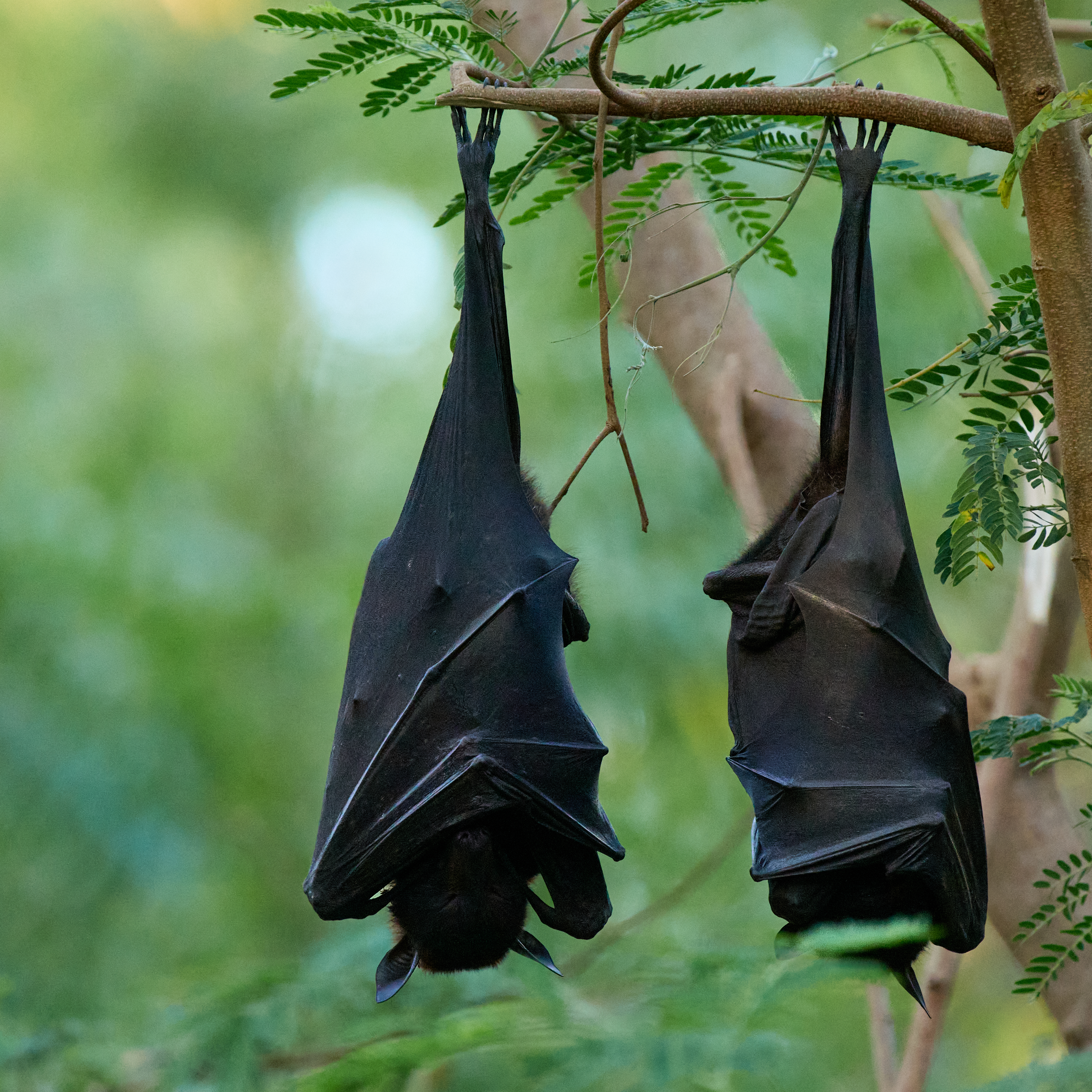
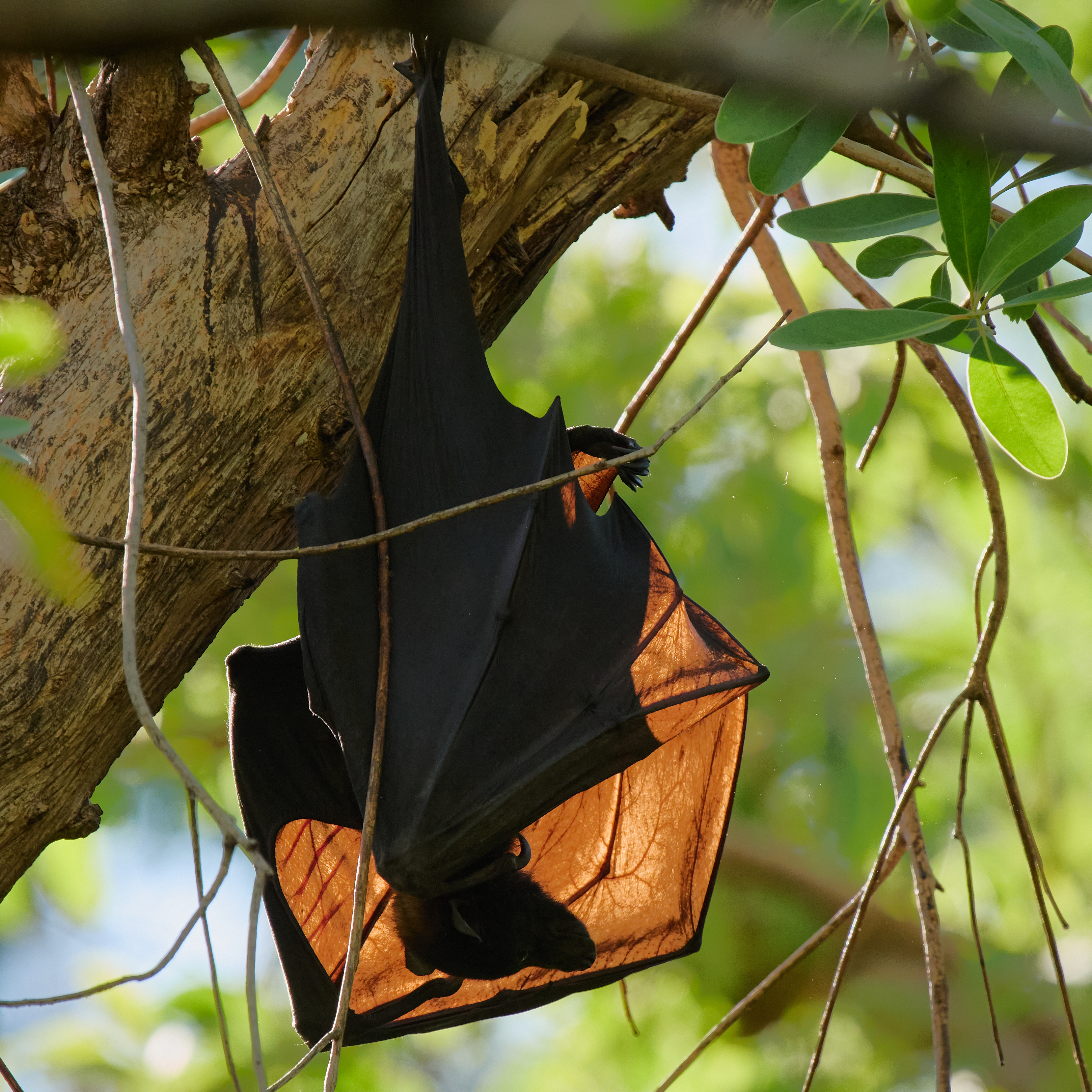
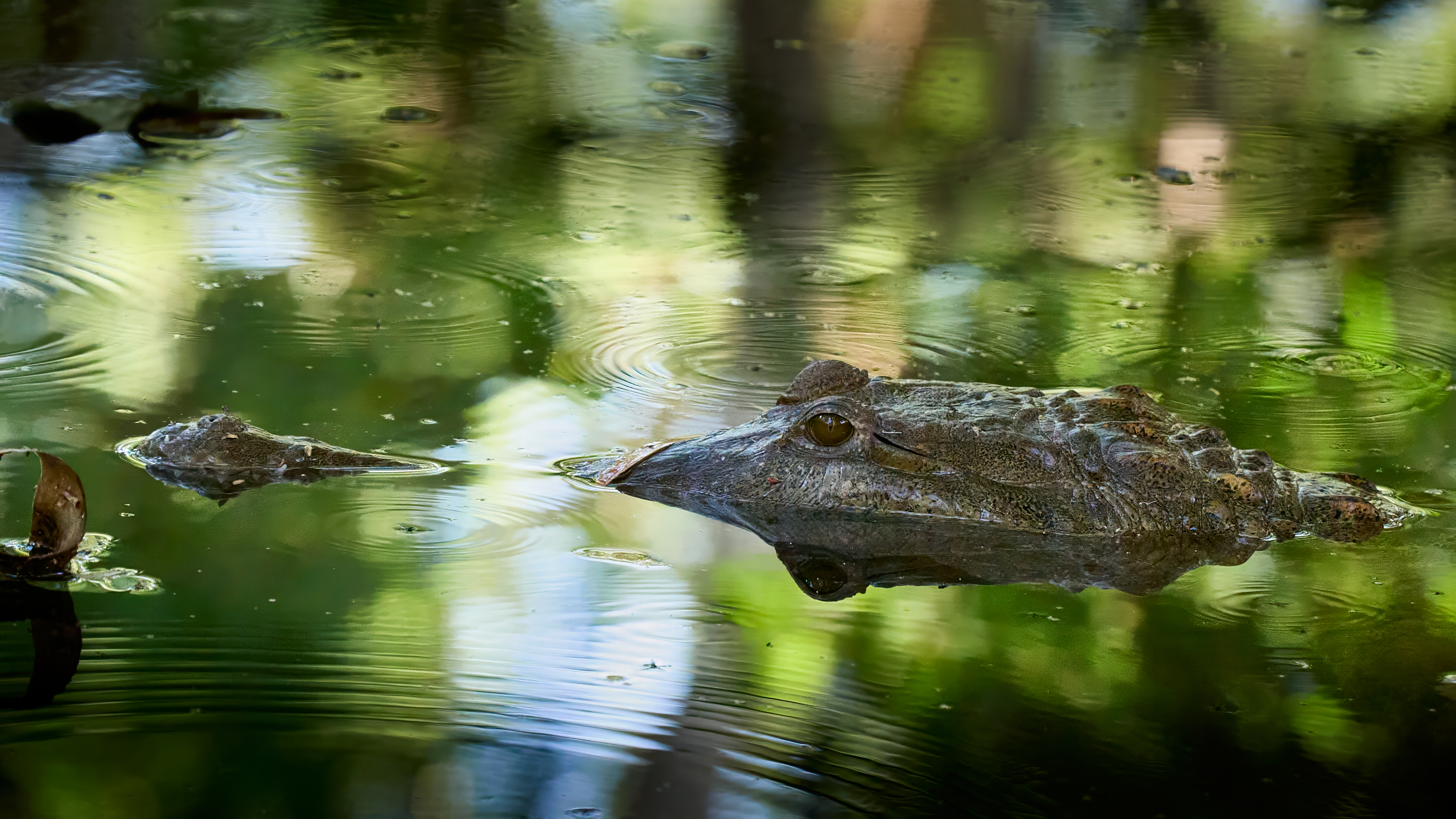
The camp ground is behind the well-stocked store. There is a swimming pool, a creek at the bottom of the garden and plenty of shady trees. There are freshwater crocodiles in the creek and a large Flying Fox camp overhanging the creek.


The camp ground, the airstrip, the race course and Policeman’s Point on the Victoria River are well known birding spots. The airstrip can be very productive but alas fire had been through and for the time being it will be quiet.
Timber Creek to Katherine is 289 km, all sealed. We are camped at Manbulloo (the local aboriginal name of the Crested Pigeon) about 10 km short of Katherine, on the bank of the Katherine River. The campsite is well shaded which is much appreciated as the temperature hits 37°C (98.6°F).
