Wetherby …

From Cooktown we retraced our steps to Mount Molloy up on the tablelands. A hilly 227 km on good made road, enlivened on this occasion by a major bushfire near Palmer River. Traffic controls were in effect, a pilot vehicle led groups through at a decent pace but in one direction at a time. The fire was right up to the road with the Rural Fire Service in attendance. There was some delay but we were in capable hands. Big shout out to the Fireys and the traffic controllers for keeping us safe.

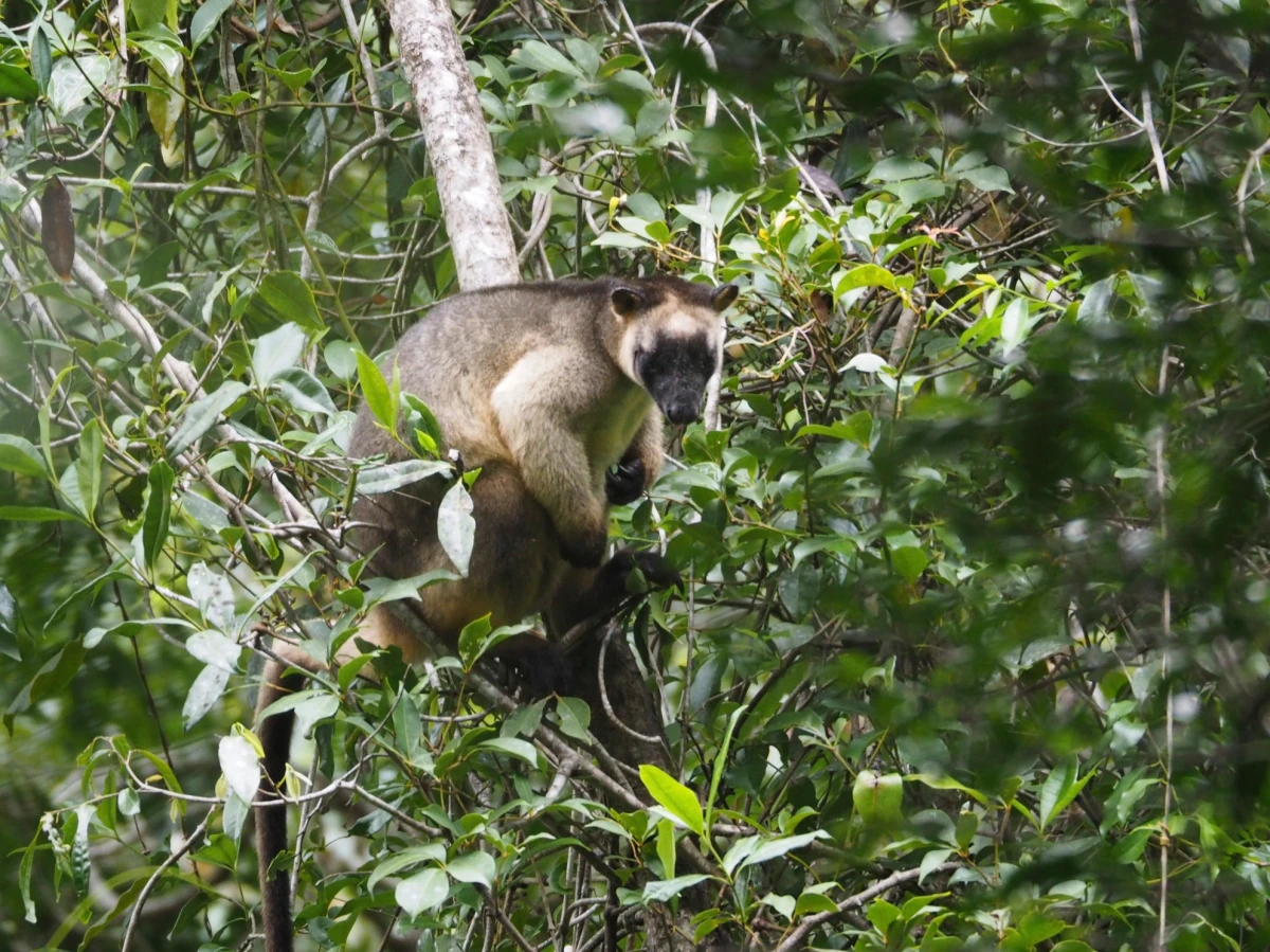
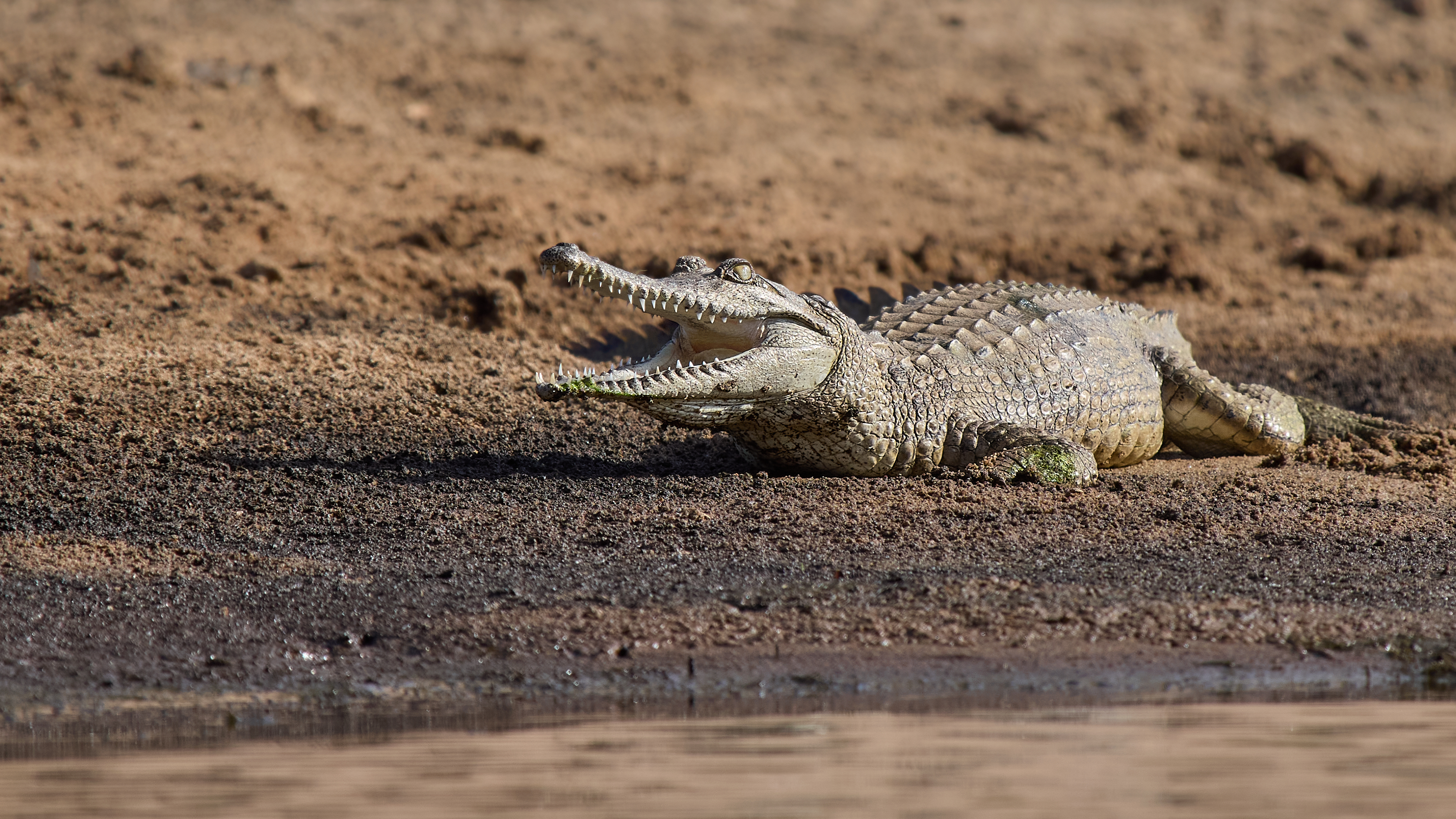
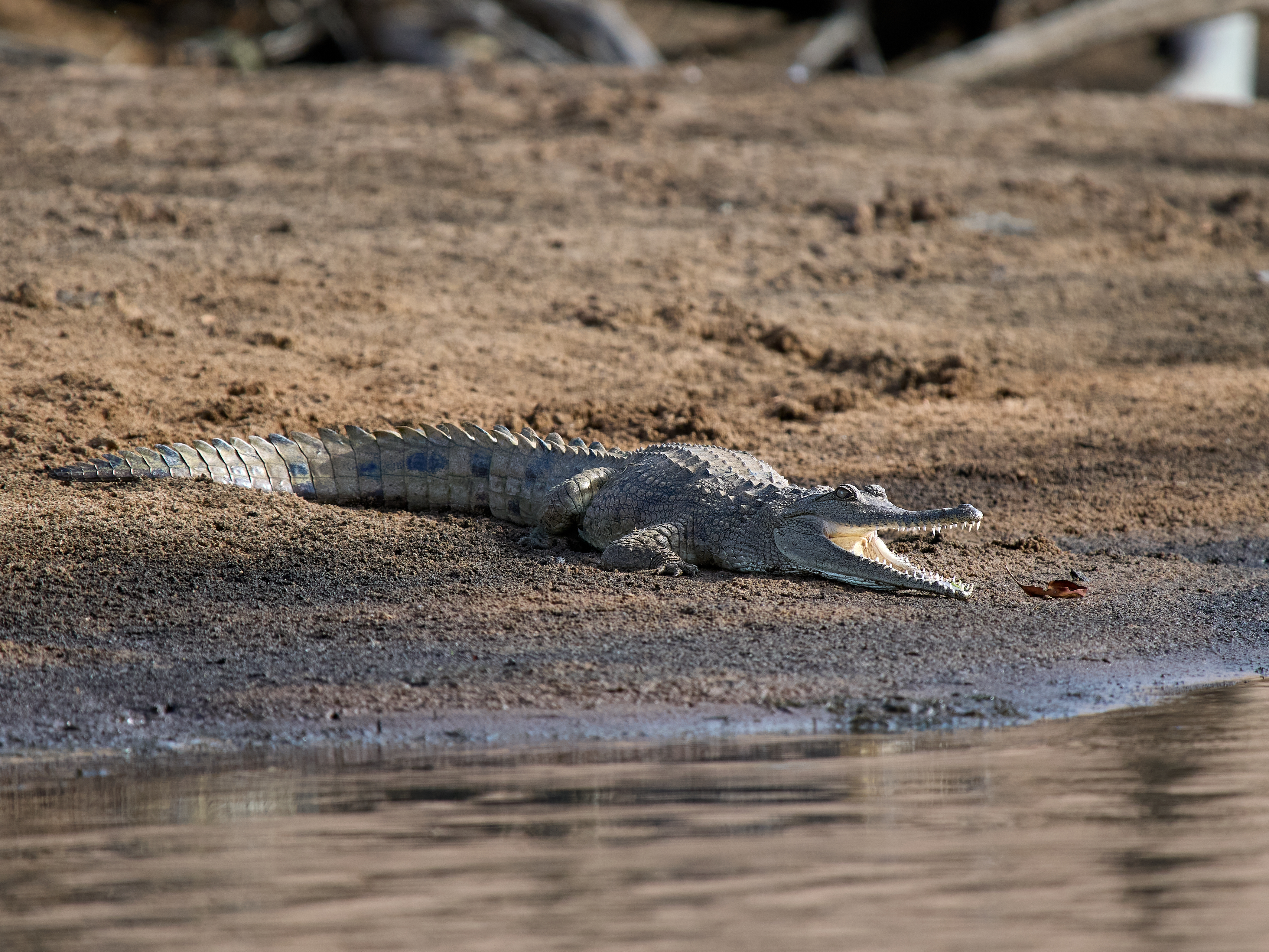
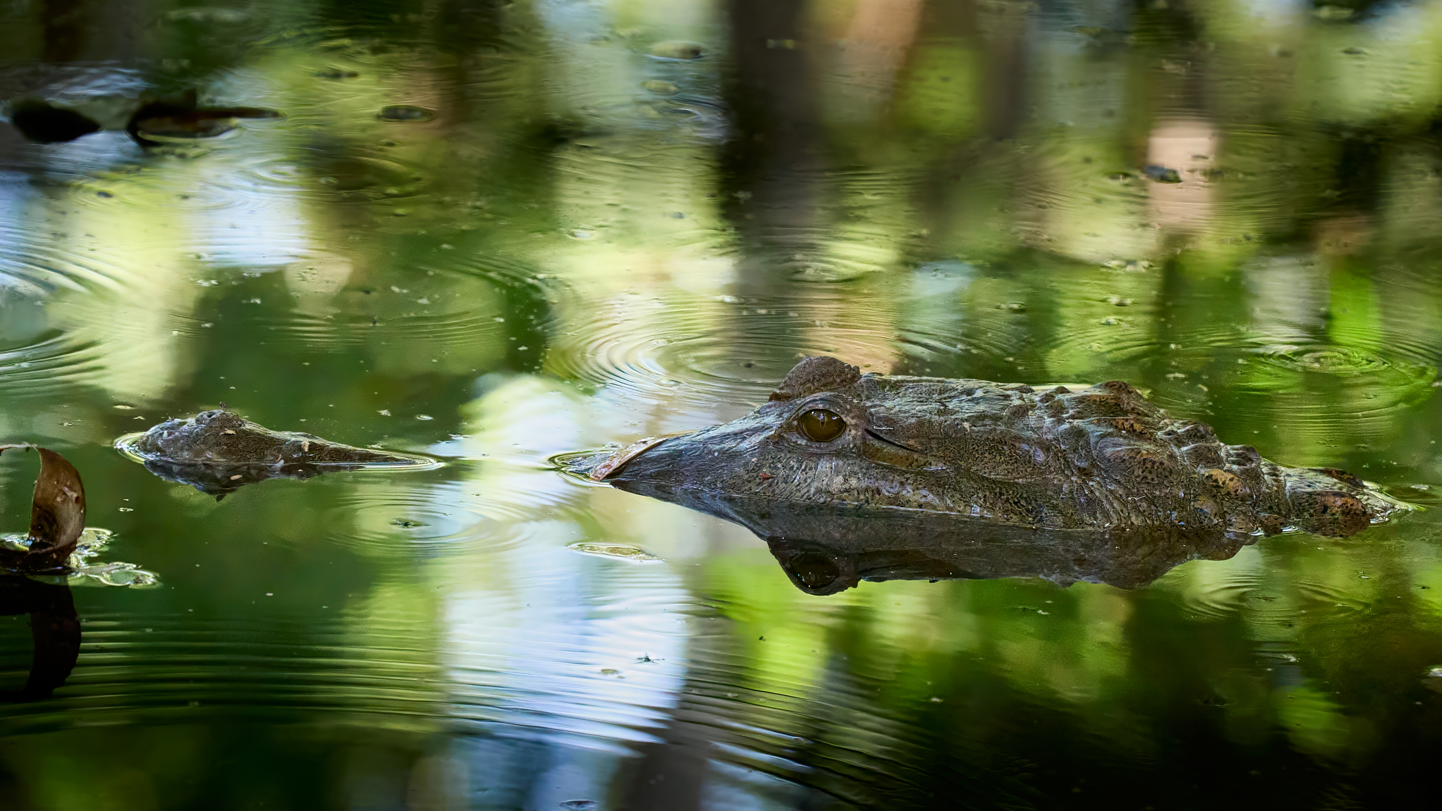
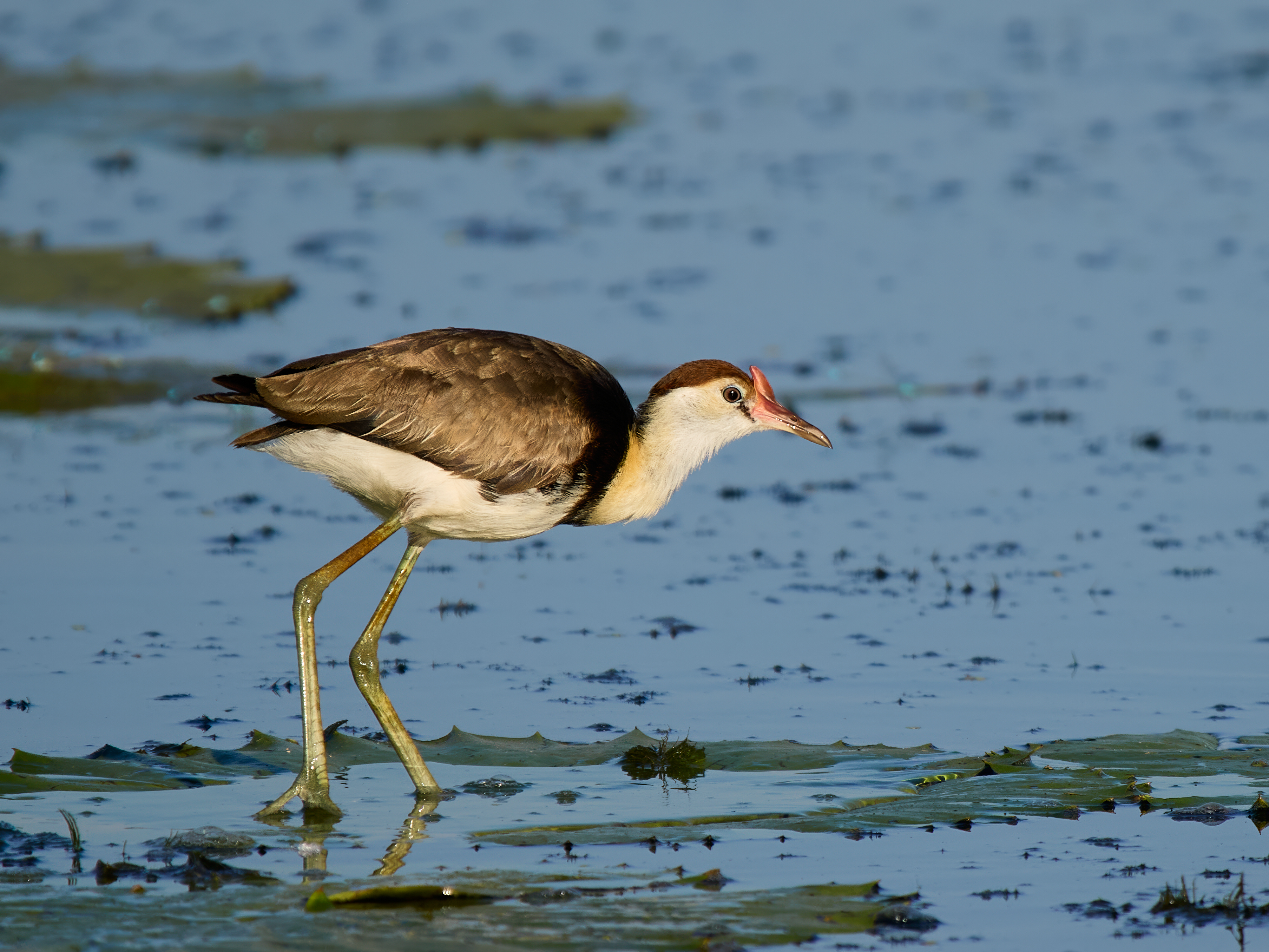
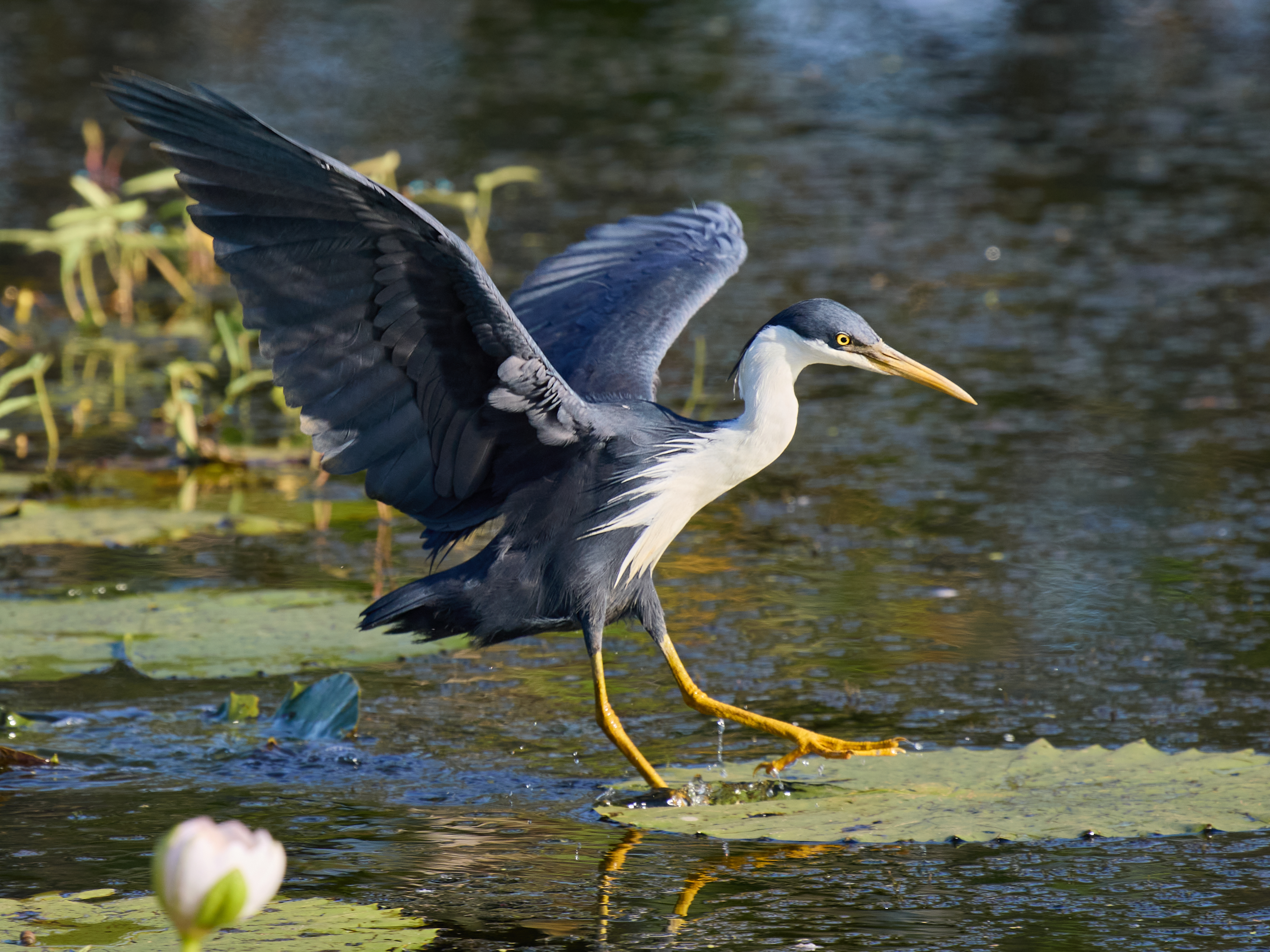
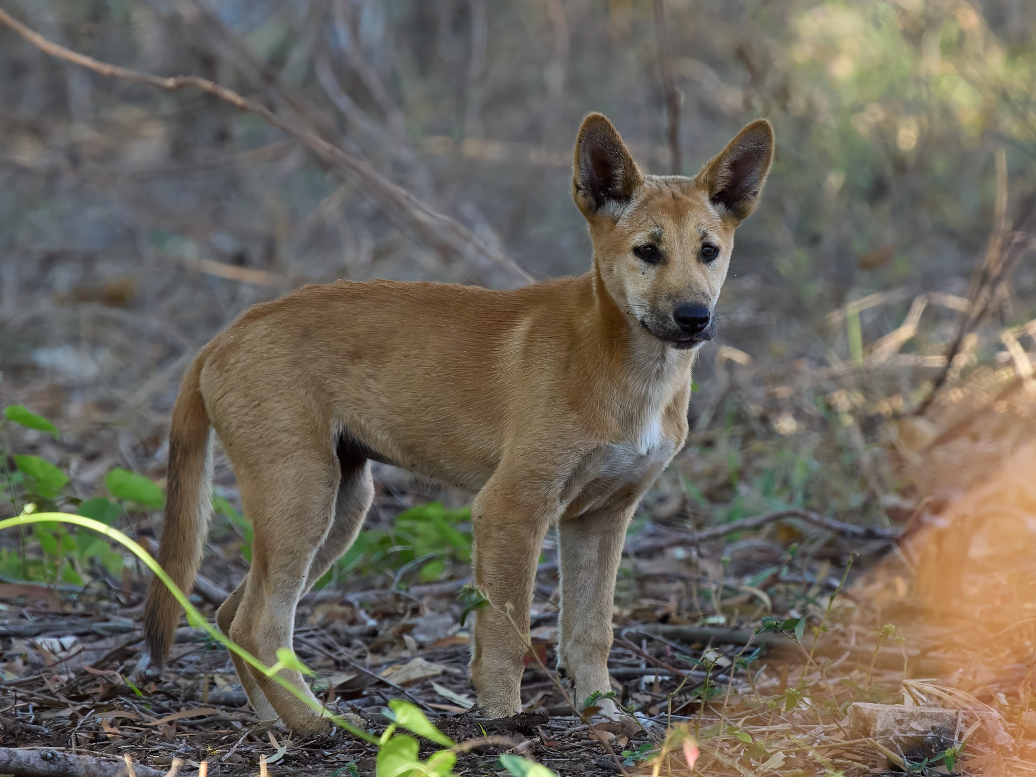
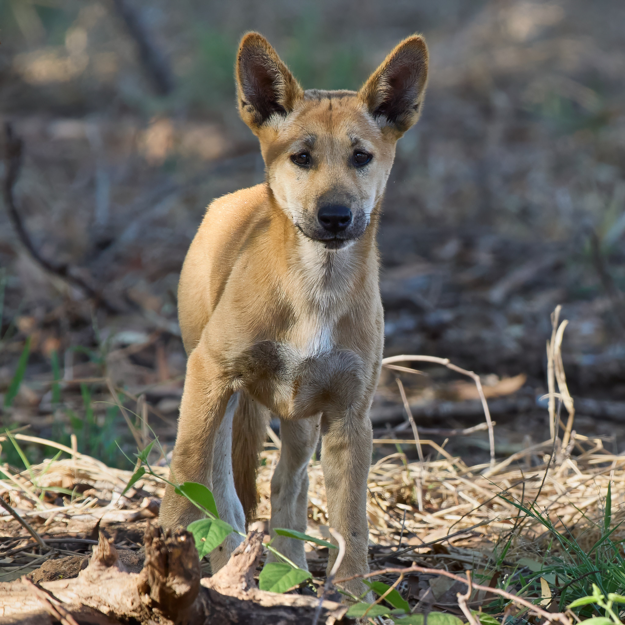
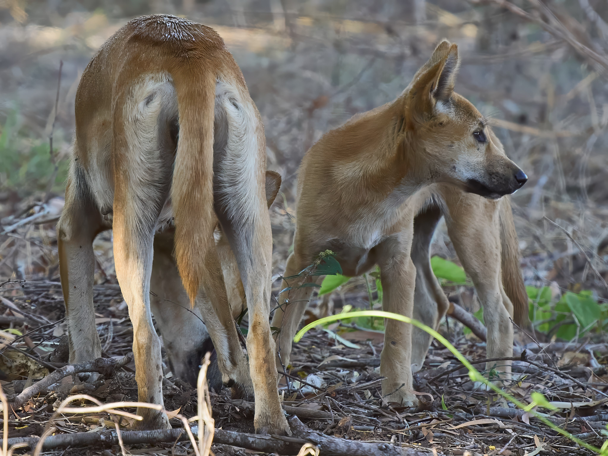
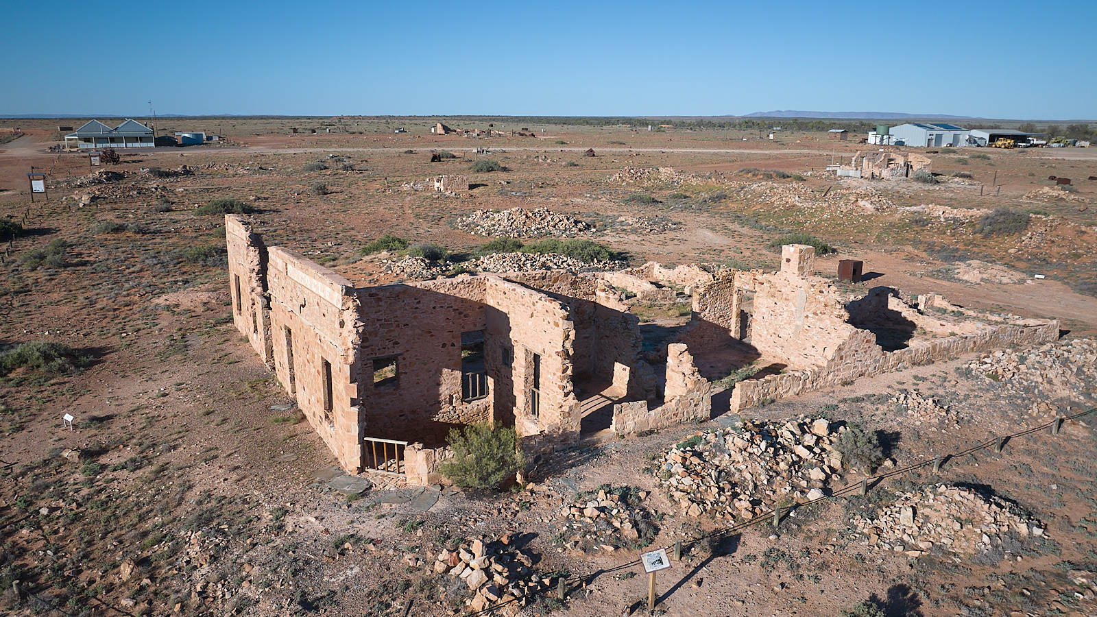
Our destination was Wetherby Station one of our favourite camping destinations in all of Oz. The station is owned and managed by John and Kathleen Colless. They run big black beautiful Brangus Cattle. The station was founded by William and Elizabeth Groves around 1878 and there is a fine old homestead and lovely gardens. The present owners have sustainability as a top priority. The cattle get plenty of grass but are kept out of the creeks and lagoons and the fencing around the main lagoon is designed to keep the modern scourge of feral pigs at bay while it is rehabilitated as a wooded swamp. Rifle and Spear Creeks run through the property which because of its location, climate and variety of habitats has an enormous bird list.

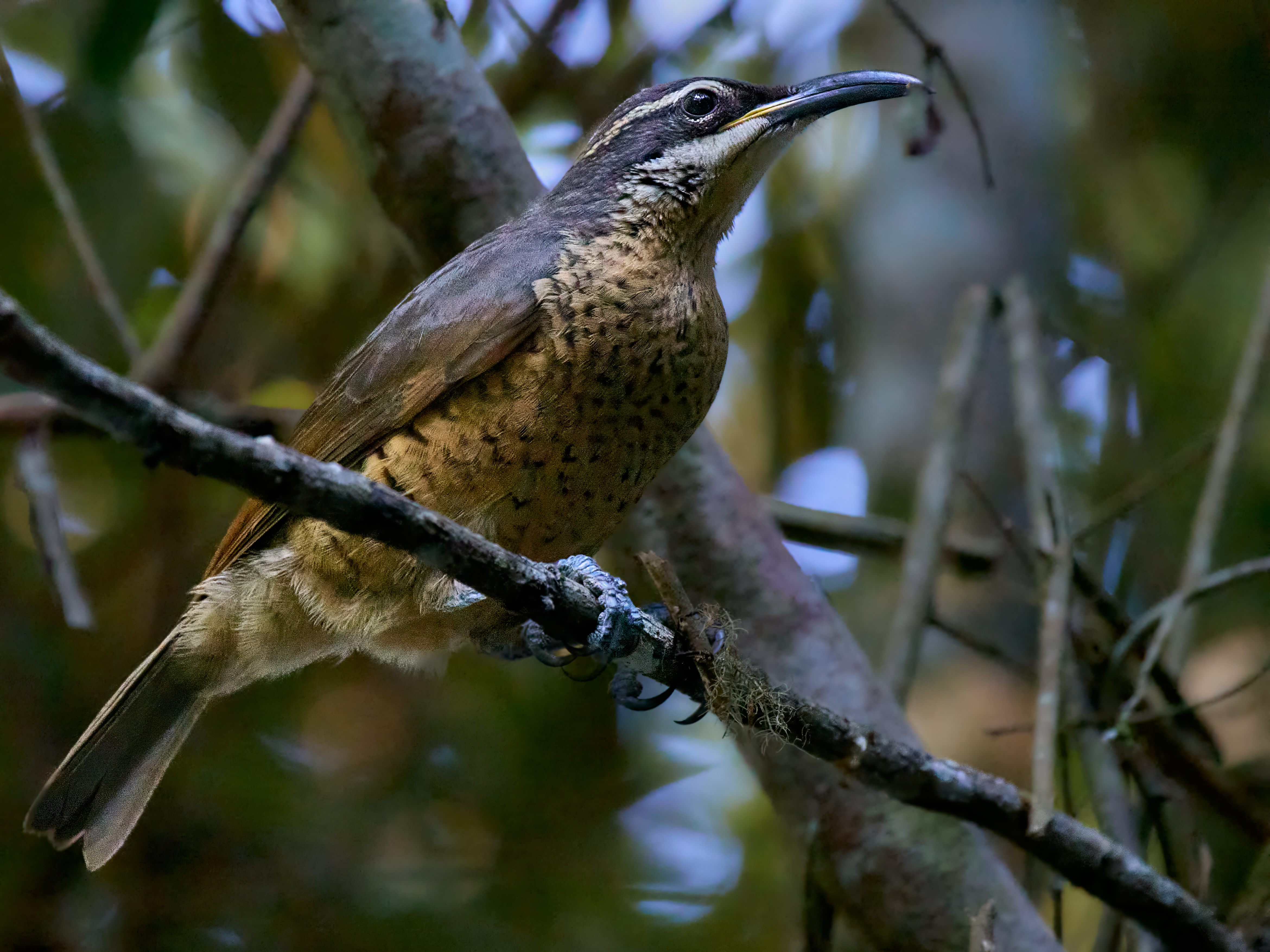
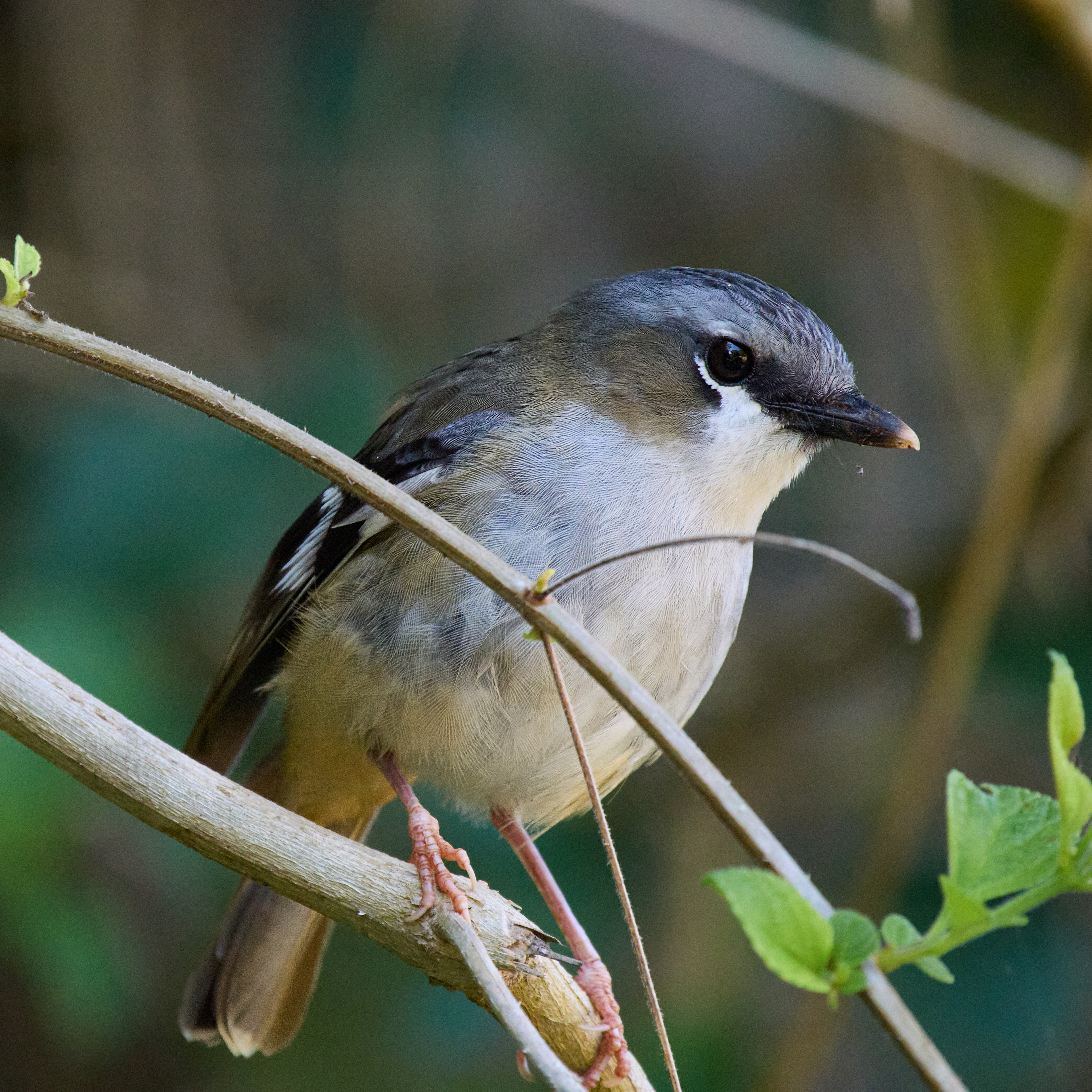
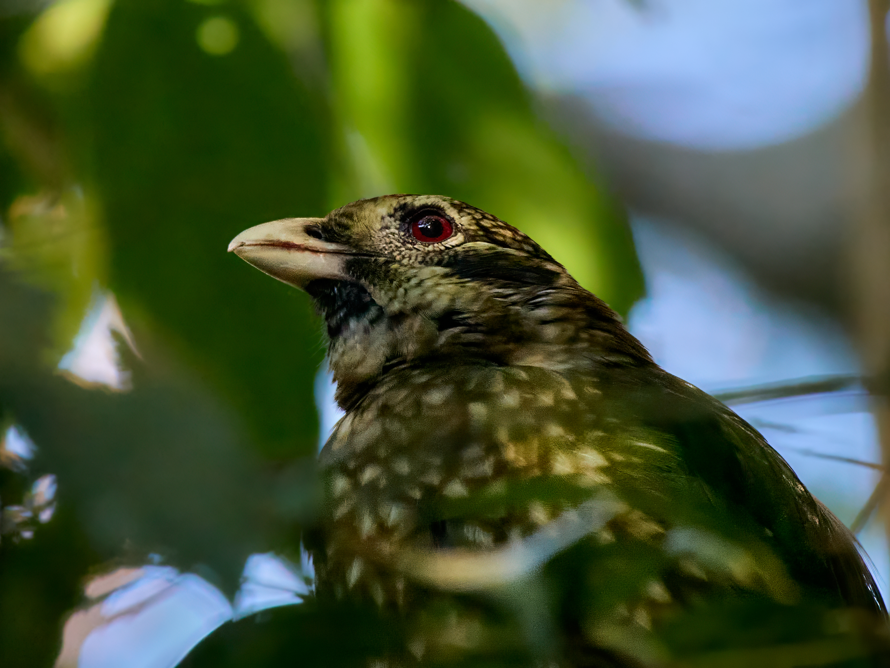
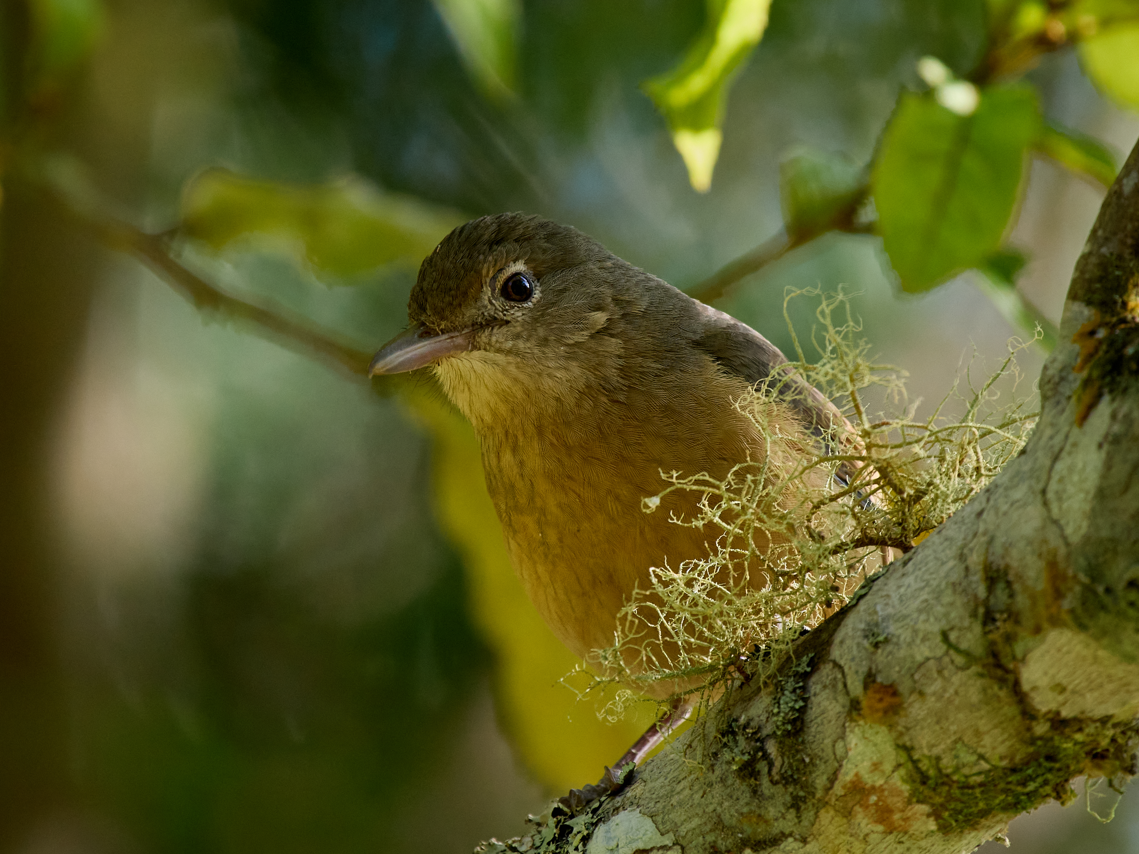
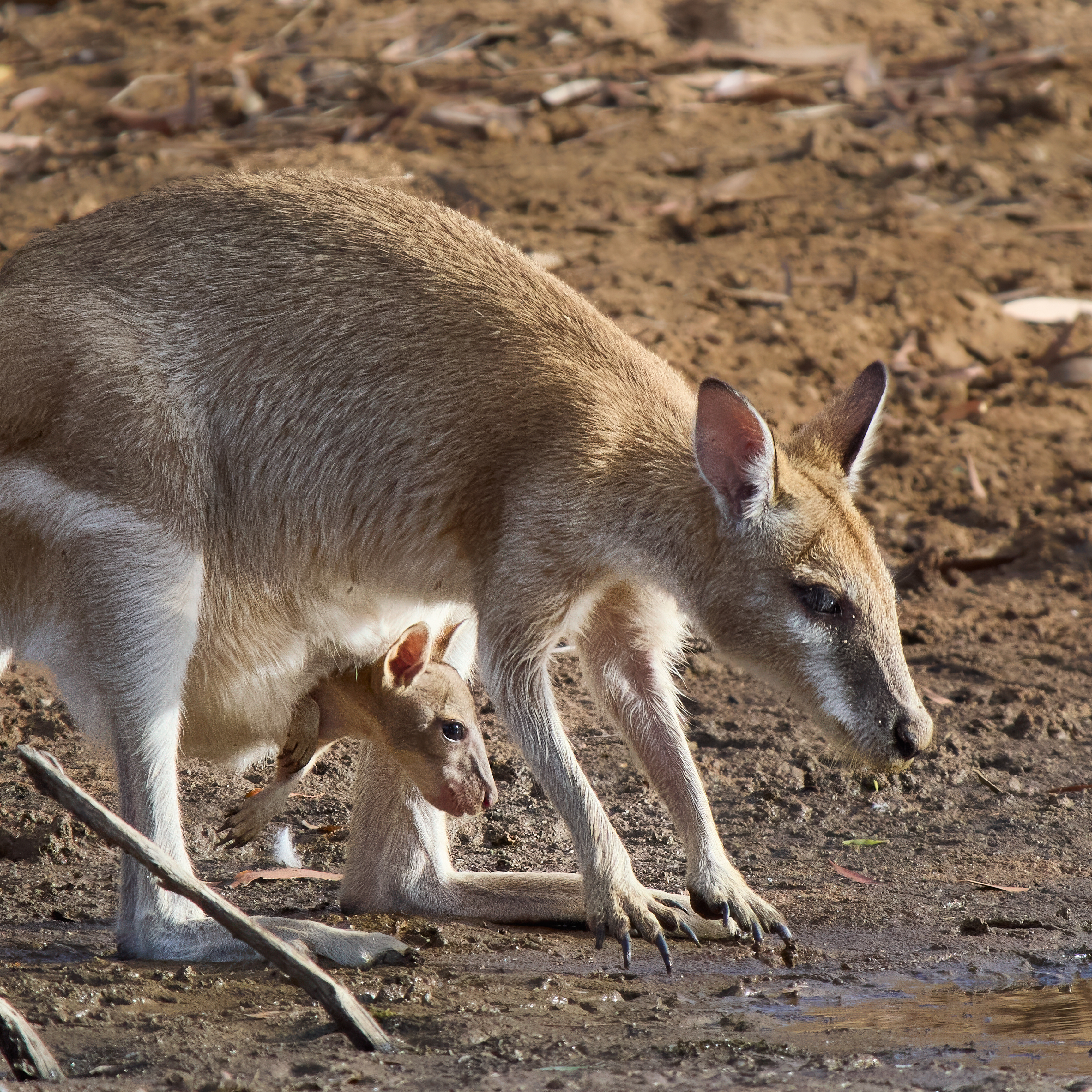
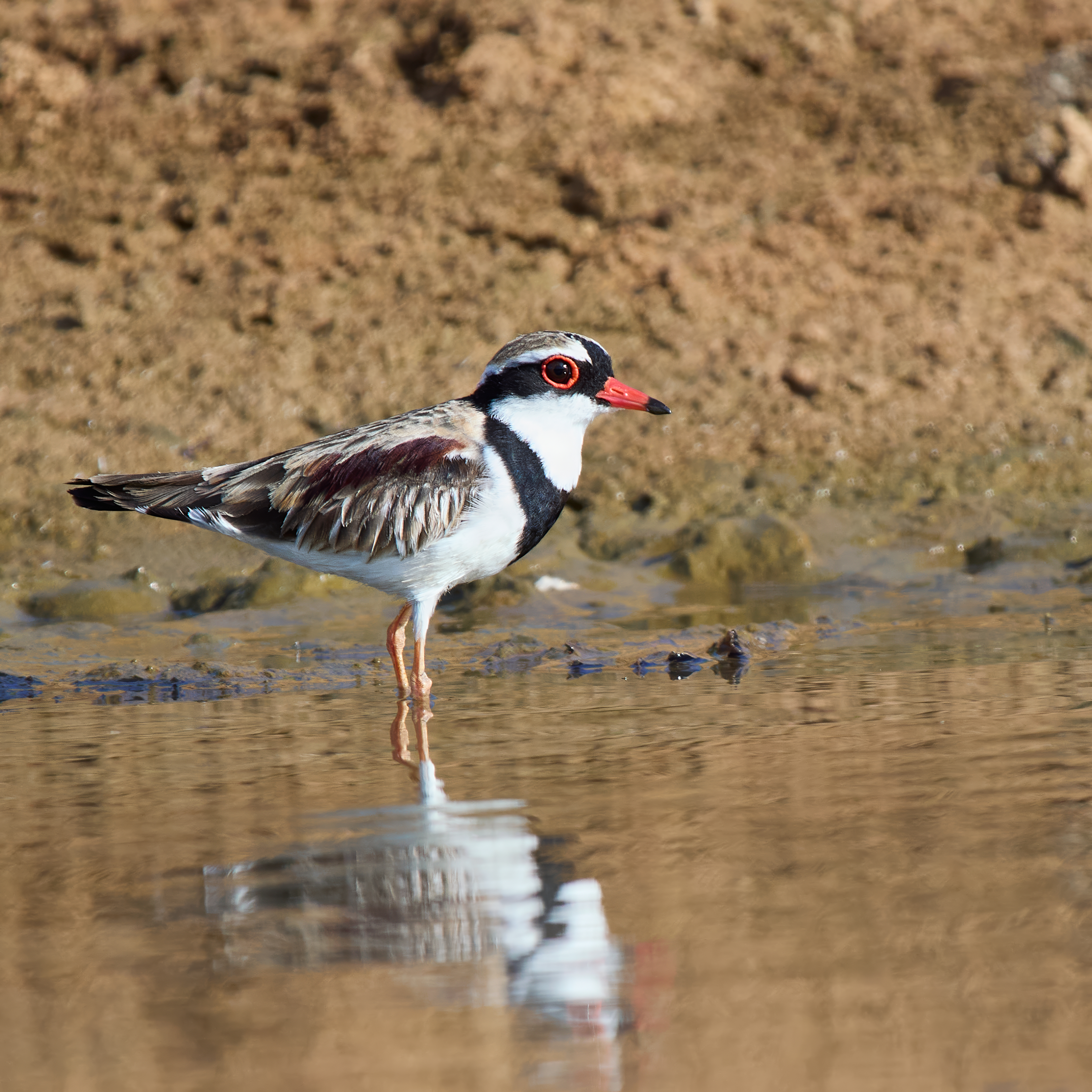
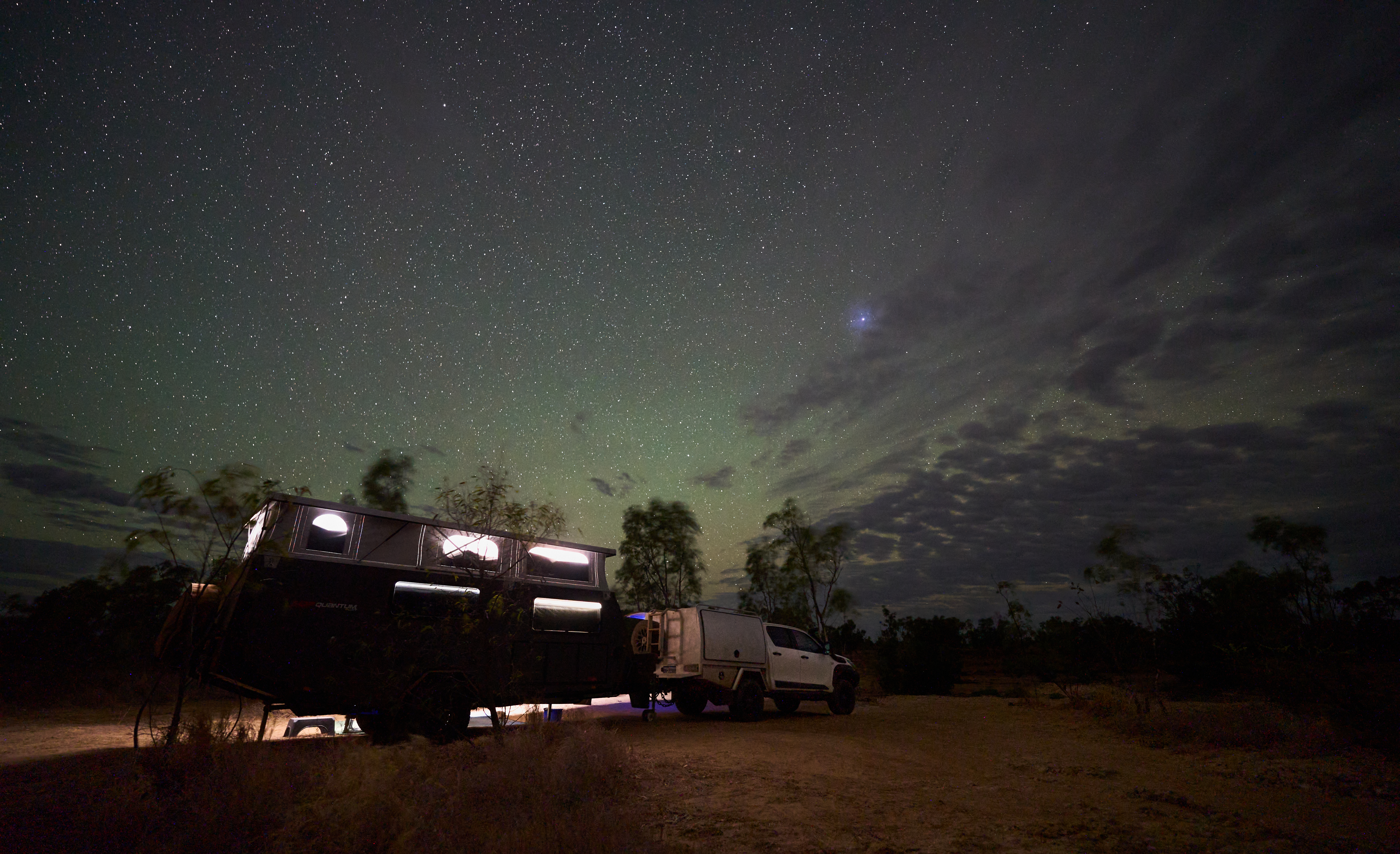
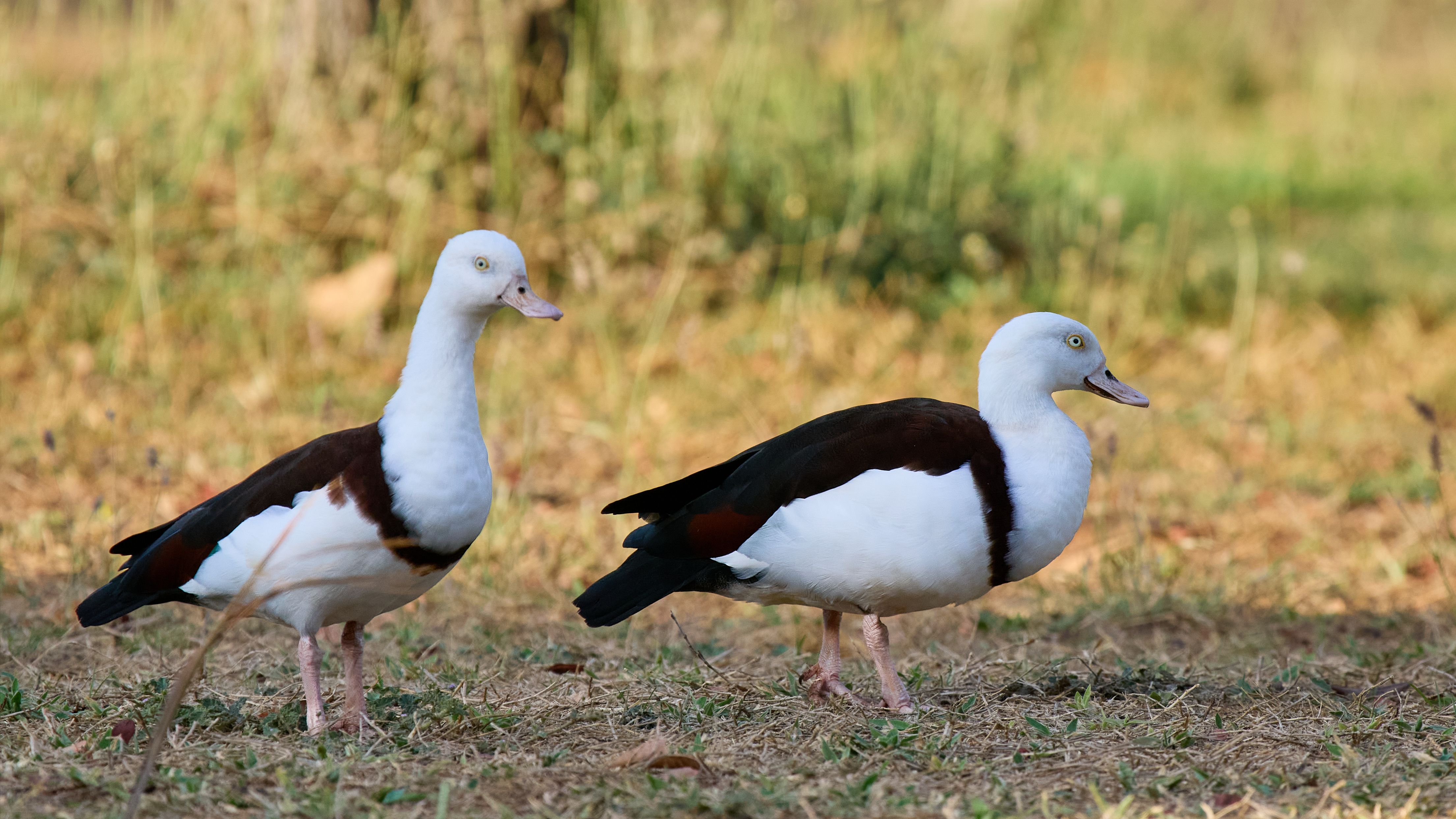
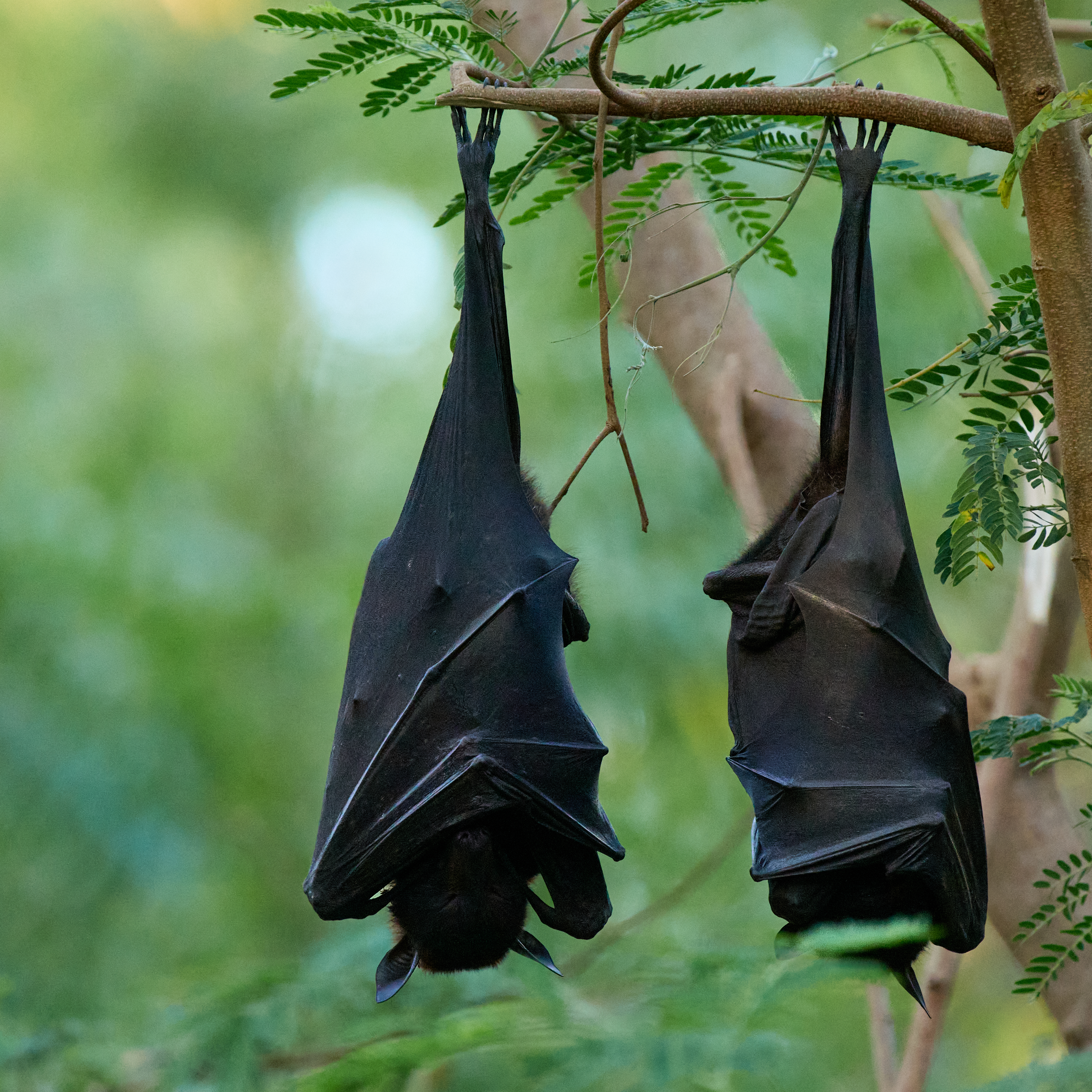
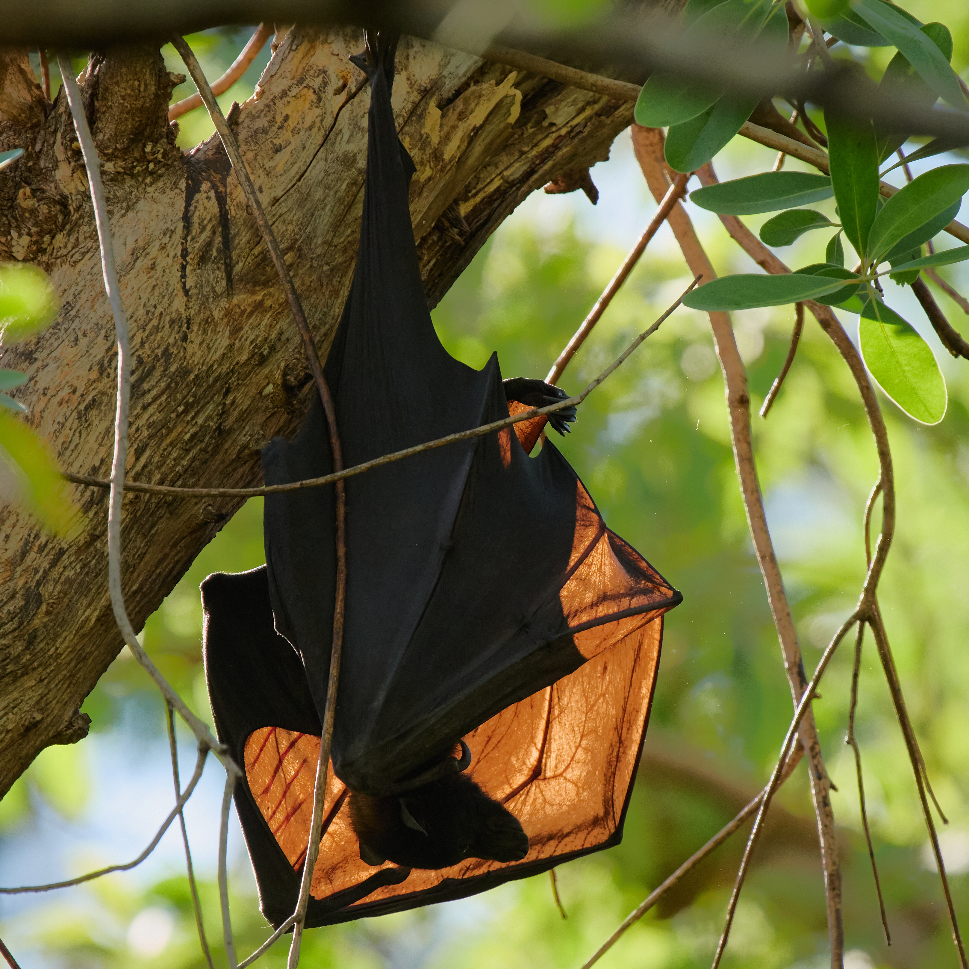
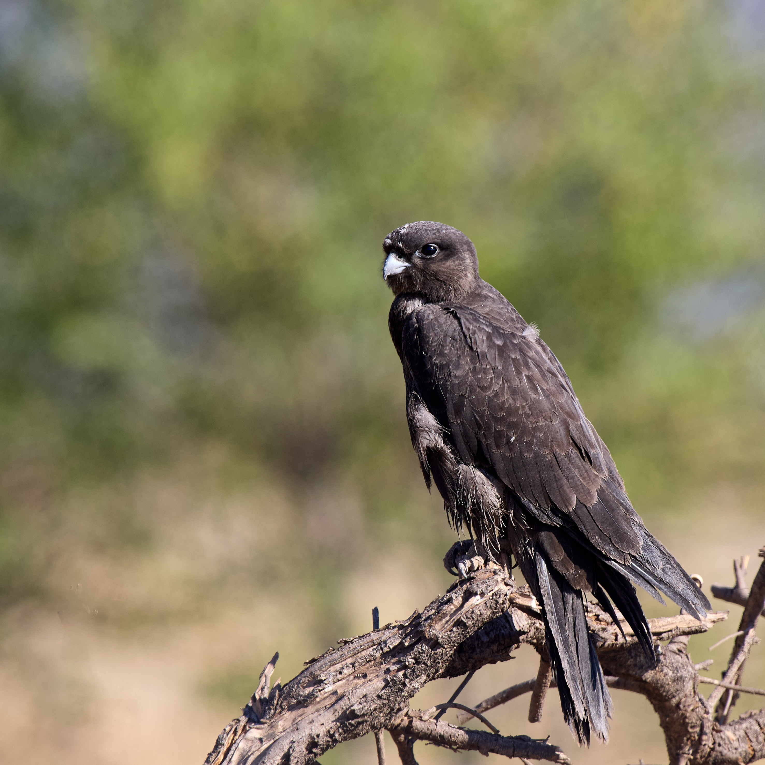
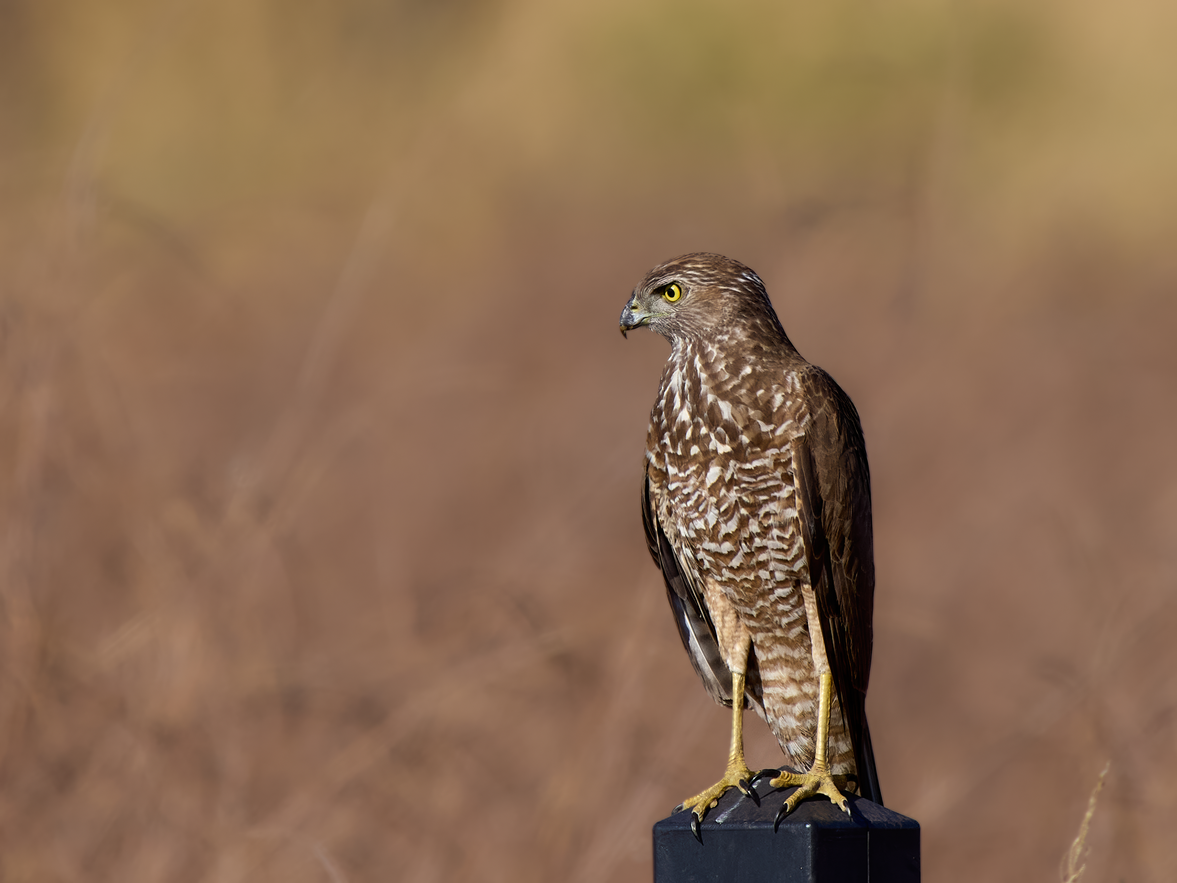
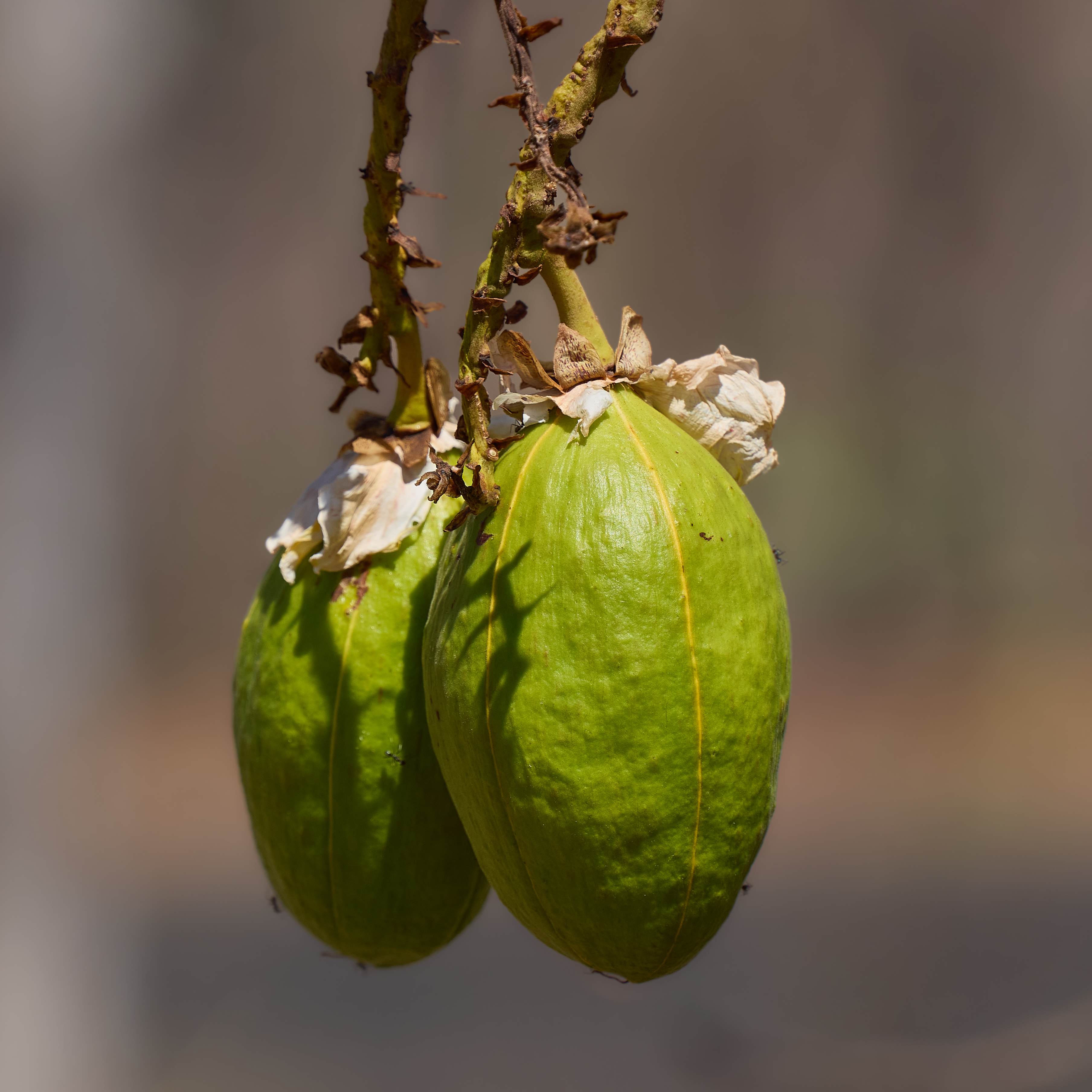
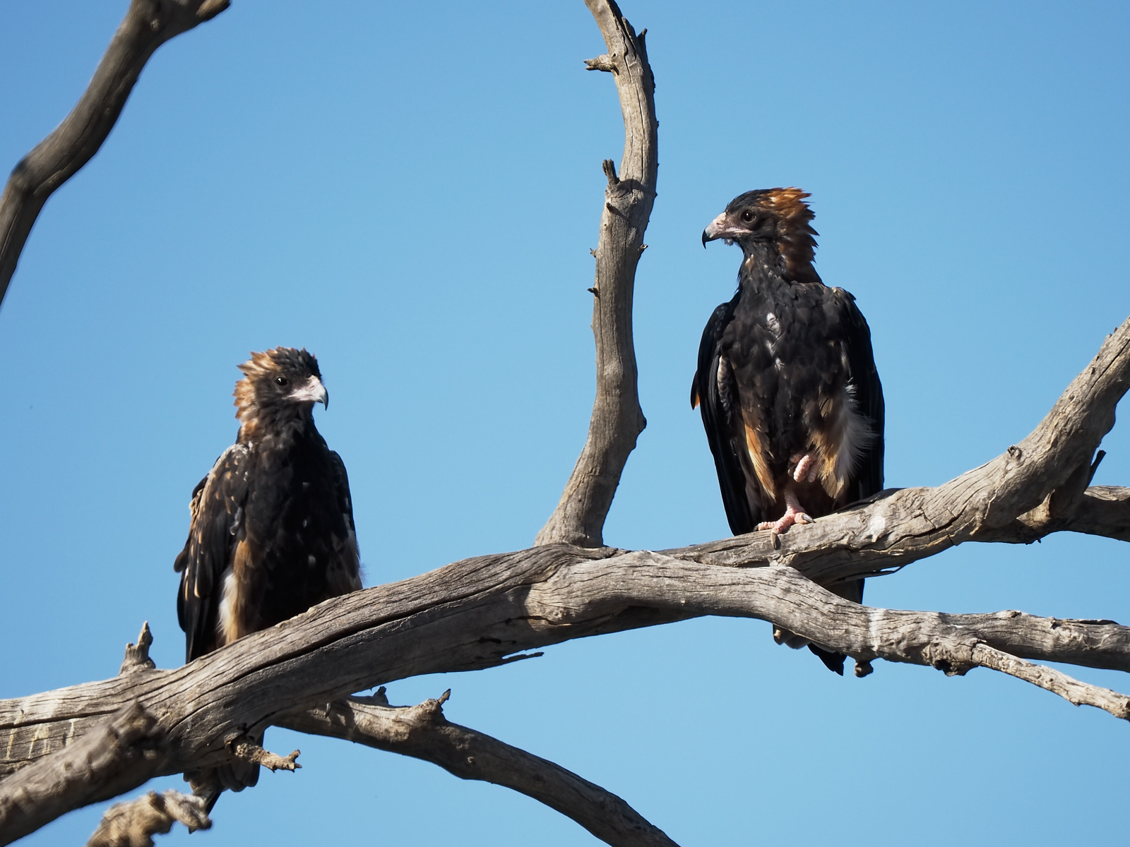
We spent two nights camped all by ourselves by Rifle Creek. It could easily have been more. (Certainly would have been if Mount Bloody Lewis was open). Birding in and around was good. We left on 364 species for the year. Bird number 6 in the count down was Cryptic Honeyeater. At number 5 – Scarlet Honeyeater, number 4 – Black-faced Monarch, a staggeringly beautiful bird in the forest gloom. Number 3 – Yellow Honeyeater, the label says it all. Number 2 – Fairy Gerygone, pretty enough. Number 1 cannot be far away. Please let it be worthy of the honour.

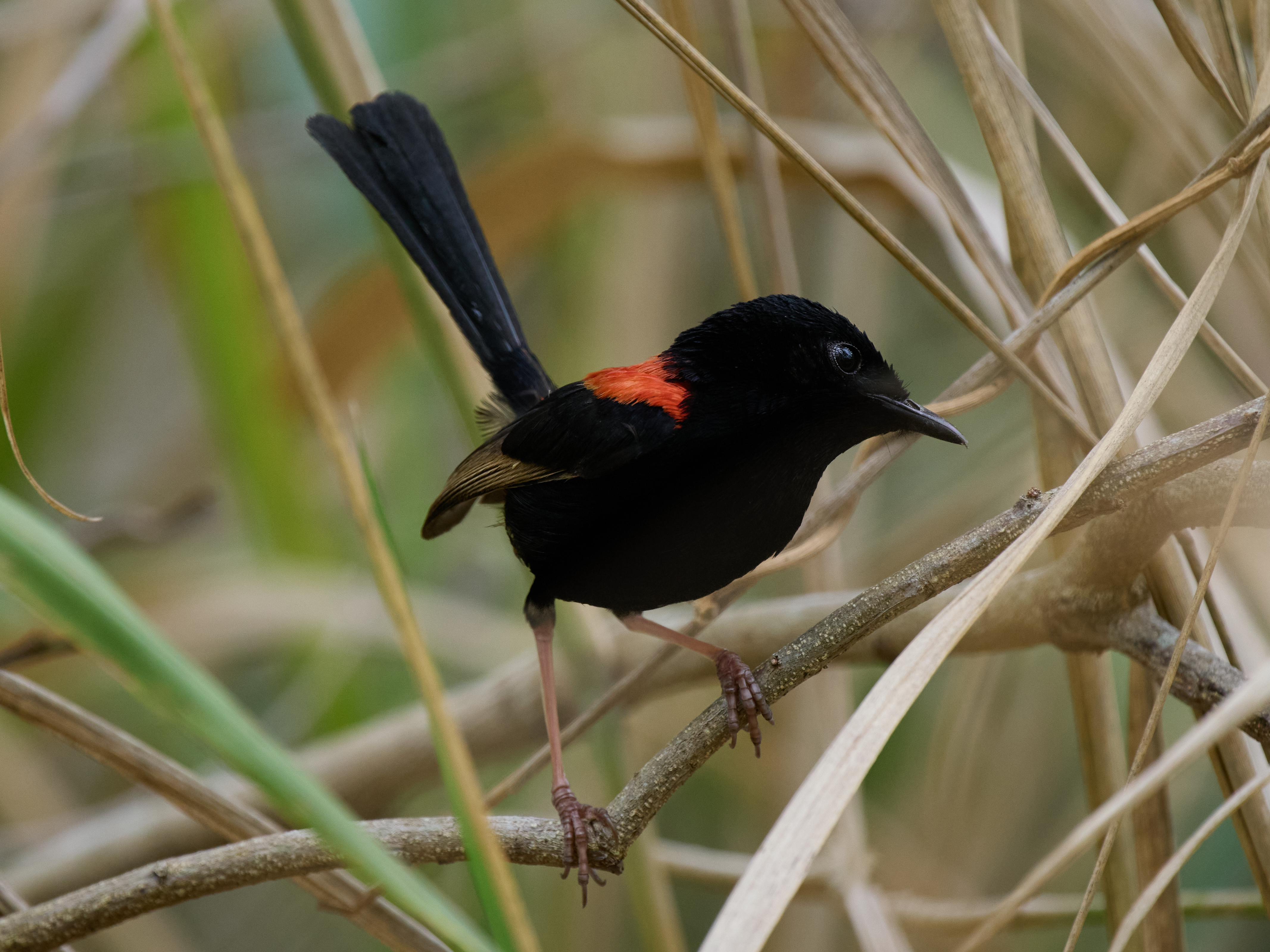
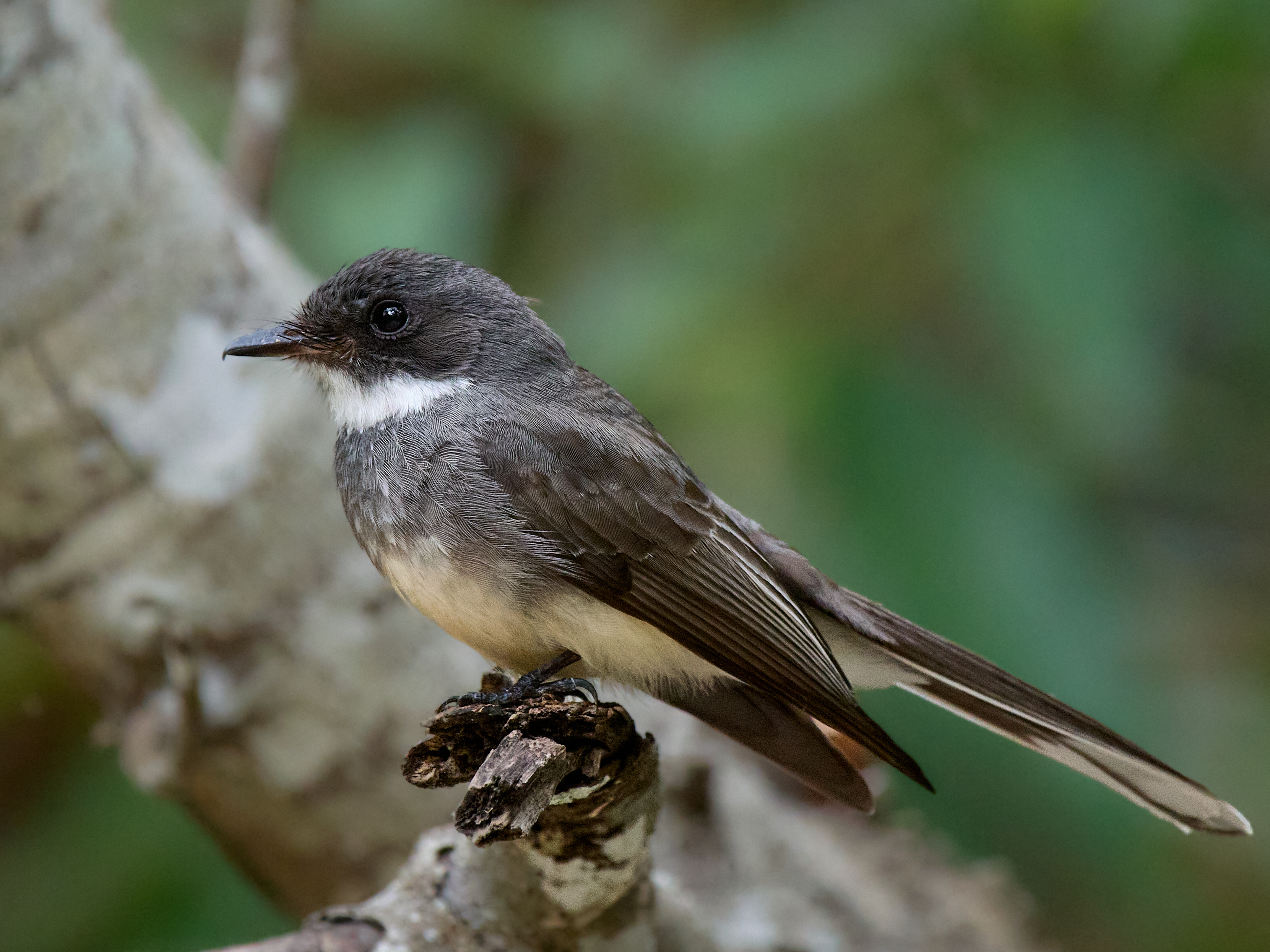
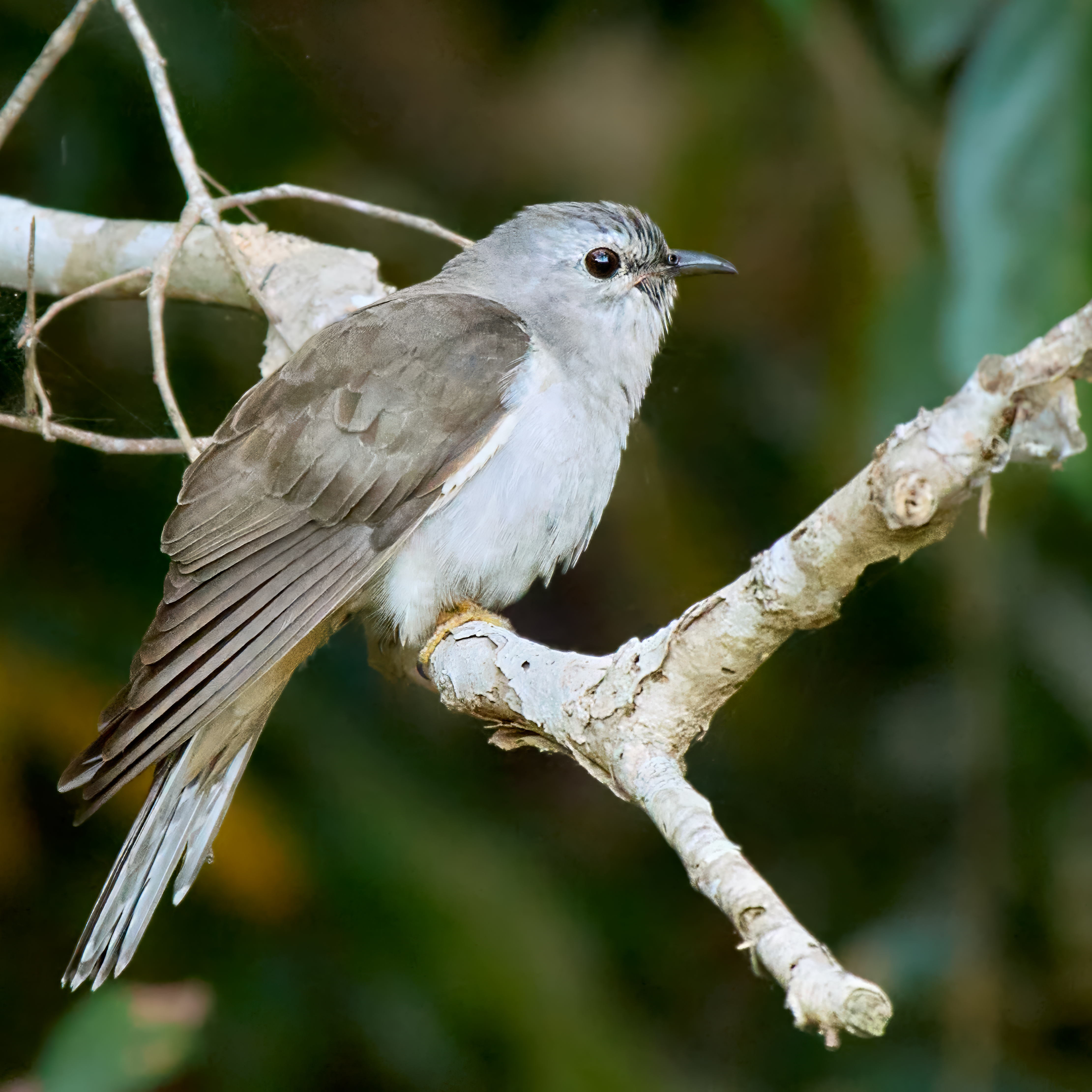
The last three birds were photographed within a few metres of our camp site.

The link you need Wetherby.

Crater Lakes …

The Atherton Tableland is a different world from the thousands of kilometres of savanna just a short distance behind us. It’s cooler, it’s very much greener and it’s much more populated. It would once have been a forest. Now it’s scattered remnants separated by farmland. We are camped at Lake Eacham just outside the National Park. This is home for four nights.

A short walk takes me into dense rain forest, the light hardly penetrates through the trees towering above. The birding is tough, done largely by ear. The photography is even tougher done largely without light! Bird density seems low but the variety is high. Lists are not long but there seems to be something new on every one.

The crater lakes are Lake Eacham and Lake Barrine. They formed when magma approached sufficiently close to the surface to turn the groundwater to steam producing explosions that created the craters now filled with water. These events were fairly recent. Barrine is the older forming about 17,300 years ago. Eacham formed about 9,130 years ago. Both are surrounded by lush rainforest and are National Parks.

The wet tropics has 23 bird species that are either endemic or largely confined to the region. Nine of those species are only found at higher altitudes, essentially the Atherton Tableland. And there’s no shortage of more wide ranging species. Those tall trees are so inviting you can even find Kangaroos in the canopy. It is a very special place.

That’s Lumholtz’s Tree Kangaroo, very hard to spot during the day. I took this photo on a previous visit.

Leichardt’s Falls …

We are again in the footsteps of a great explorer, although we are going in the opposite direction. This time it’s Ludwig Leichardt. On his first expedition he and his party left Brisbane in 1844 and after traversing the Gulf of Carpentaria arrived at Port Essington (Darwin’s predecessor) in 1846. He’d been given up for dead by then. His third expedition has not yet been completed. He was last seen on 3 April 1848. I like to think he’s still out there exploring.

The journey from Hells Gate Roadhouse to Leichardt’s Falls was 249 km on a mixture of good dirt road and some made road. Easy driving in the main.

The scenery at the camp site is magnificent even though this late in the dry there is water above the falls and water below the falls but no water going over the falls. We had it all to ourselves. Access is via a downhill sandy track to a rocky area on the canyon edge. Easy. Egress is via the same track which suddenly seemed sandier and steeper. Less easy.

Getting to the water entails a fairly steep climb down the cliff on foot. I sat quietly at the water’s edge with my camera and was rewarded for my efforts.

Great-crested Grebe is rare at this location. They don’t roost in trees and they can barely shuffle along on land. They are either in the air or in the water. I couldn’t find it the following morning.

It wasn’t a great night for Milky Way photography, too much cloud and very windy. But hey, that’s not the only subject available …

Hell’s Gate …

We spent two nights at Borroloola. The first afternoon a caravan arrived and we got into conversation with the owner. Typical travelers tales. Where have you come from? Oh, that’s the way we’re going. How was the road?

The road, he said, was bloody awful, the bull dust had him fighting the steering wheel, the dips were ferocious, the corrugations were bone jarring. Would we like a look in the van?

It was a scene of devastation. The drawers and their contents were strewn across the floor. Red dust lay on everything. His car was in no better condition, the rear window was broken, red dust covered the interior. He was quite upbeat about the situation. He had survived the battle. Among the fragments of celebration he did mention 80 kph, getting airborne and that he never reduced his tyre pressures. It caused us some concern. For us, not him.

When it was our turn Gayle prepared the inside of the van with great care. When we got to the dirt road I let the tyres down 25% all round and we proceeded at moderate speed. 317 km to go. The creek crossings were mainly dry, the dips in and out were taken slowly. The bulldust was avoidable or manageable at modest speed. The corrugations were corrugations, choose the quietest route and vary speed to suit. Conditions varied with the underlying substrate, some sections were rocky, some sandy. There were two wet creek crossings and a couple of puddles to negotiate.

We had intended to take two days for the journey but progress was better than expected and at lunch time we moved the goal posts and went all the way to Hell’s Gate. No damage. No dust. No drama.

Nothing like hell or its gates. A pleasant campsite by a bore fed pond. The odd Agile Wallaby and Antilopine Walleroo passing by.

Manbulloo …

Manbulloo Homestead has good natural values, a shady campsite and good facilities. A track takes you to the Katherine River. You can pat the goats, play with the donkey and watch the cows being fed. They have a couple of Turkeys, that I hope will survive Christmas, named Camilla and Charles. Sweet.

Northern parts of Australia are steeped in WWll history. Broome and Darwin were subjected to Japanese air raids. There is a memorial to the Nackeroos, essentially lookouts trained for geurrilla resistance, on the escarpment above Timber Creek. WWll airstrips dot the countryside. And Manbulloo has its own small share commemorated on an information board.

There is a military tale concerning Chinese Whispers run amok that has the punchline “Send three and fourpence we’re going to a dance”. Apocryphal I was certain … until I saw this photograph showing a squad rehearsing its dance moves with the choreographer out front.

I know, wrong war. The earliest version seems to have been published in 1914 under the title “Altered in Transit” in the “Temperance Caterer” periodical of London and various similar variations followed. Credit Quote Investigator for that bit of intelligence.

Torresian Imperial Pigeons and Yellow Orioles were calling during the day. Bush Stone-curlews were wailing during the night but the only bird lining up for a photograph was the Radjah Shelduck.

Wyndham to Katherine …

Over two days. First night Timber Creek. 327 km, all sealed. Population 278 slightly more than half are Aboriginal. Augustus Charles Gregory and a party explored the area in 1855 and bestowed the name Timber Creek on one of the creeks. That was adopted for the name of the settlement when the opening of a police station put the “town” on the European map in 1898.

Gregory’s party included Baron Sir Ferdinand Jacob Heinrich von Mueller, a bit of a botanist. Well perhaps the most important of Australia’s pioneering botanists. It was he that described and named Adansonia gregorii, the Boab. (And for one of my faithful readers it was he that described and named the genus Macadamia.)

The camp ground is behind the well-stocked store. There is a swimming pool, a creek at the bottom of the garden and plenty of shady trees. There are freshwater crocodiles in the creek and a large Flying Fox camp overhanging the creek.

The camp ground, the airstrip, the race course and Policeman’s Point on the Victoria River are well known birding spots. The airstrip can be very productive but alas fire had been through and for the time being it will be quiet.

Timber Creek to Katherine is 289 km, all sealed. We are camped at Manbulloo (the local aboriginal name of the Crested Pigeon) about 10 km short of Katherine, on the bank of the Katherine River. The campsite is well shaded which is much appreciated as the temperature hits 37°C (98.6°F).

Wyndham …

The most northerly town in Western Australia, population 941, slightly more than half Aborigines. Founded as a port to serve the Halls Creek goldfields in 1886, it kicked on on the back of meat processing and export until the 1960s. It’s now a pleasant sleepy hollow with some iron ore passing through the port.

The Wyndham caravan park gets a tick of approval. It doesn’t have quite the natural values of Parry’s Creek Farm but for an urban van park it is well above average. Spinifex Pigeons walking around the campsite can’t be bad! Gouldian Finch are also on the list but weren’t in evidence during our stay.

Parry’s Lagoon is one of my favourite wetlands and did not disappoint.

A couple of raptors gave me a chance with the camera.

I mentioned the Kapok Trees in the last post. It’s not the real Kapok that was used to stuff pillows in the olden days. Its Cochlospermum fraseri, given the same common name because the seed pods are stuffed with similar cotton-like fibres. When the flowers are out it’s time to collect Freshwater Crocodile eggs, I don’t think the occupational health and safety officer will be impressed. It’s found in the Kimberley and Top End of NT. Large shrub to small tree.

Dingo …

“My men saw two or three beasts like hungry wolves, lean like so many skeletons, being nothing but skin and bones”.

William Dampier recorded this observation from his voyage of 1699 and you can count the ribs on most wild Dingos without any trouble at all. How apt that I should take these photographs of mum and her pup on the Dampier Peninsula, not far from Cygnet Bay.

Magnificent though they are they are just domestic dogs although some people would make it much more complicated. Make it Canis familiaris dingo if you must but they belong fair and square in the dog clade along with all the other breeds. They came on boats, with people, about 3500 years ago and probably spread quickly across most of Australia, perhaps within a century. When the poms rocked up in Sydney in 1788 they found the aboriginal folk had companion animals which in the local language were called Dingos. They are also very capable of surviving in the bush without their companion animals which call themselves humans. Which means they have had a lengthy period being shaped by their environment rather than selective breeding. Hence the beautiful conformation. Built for power, agility and speed. I love’em.

On any other continent they would be considered mesopredators but since it’s the biggest predator we’ve got it is by default our apex predator. But give it its due, it can take down our biggest native herbivore, the Red Kangaroo, and a pack will give it ago with a horse or Water Buffalo if need.

Prior to the Dingo’s arrival the Australian mainland was home to the Thylacine and the Tasmanian Devil and of course since their arrival stupid white people have introduced cats and foxes. There is much debate as to the role played by the Dingo in the disappearance of the former and their influence on the latter. Toss into the mix the fact that Dingos and graziers don’t get along and our regulators have a difficult time working out just what to do with them. Yes they are considered native animals in all states. In most states they are protected inside National Parks and largely persecuted outside. In Western Australia they are not protected anywhere. Tasmania missed out on Dingos but you may import one provided you first get a permit. Once there the law regards it as a dog. You may keep one as a pet in Victoria. You must have a permit and you may not breed them except with another Dingo.

How did they cross the sea? The genetic evidence makes it very likely that Aborigines island hopped to Australia about 50,000 years ago and they have remained genetically distinct until very recent times. So I think we can dismiss the idea of a recent Aboriginal immigration bringing their hunting companions with them. However, Timor is just 500km from the Kimberley coast, Sulawesi about 1000km. At its narrowest point Torres Strait is only 150km wide. Sea levels 3500 years ago were little different from today.

Sulawesi was home to the Macassan sailors who were well documented seasonal visitors to Australia’s northern shores from at least 1700 gathering sea cucumber for sale to Chinese merchants. There is no shortage of possible origins of island hoppers a couple of millennia earlier who may have intentionally or unintentionally found their way to Australia with their pets on board. Pets that were sufficiently domesticated to share close quarters with people during the crossing.

Jellyfish …

A trip to the beach in the last few weeks has revealed a massive influx of jellyfish (and tourists). These particular jellyfish (and many of the tourists) have a distinct red colouration.

The third shot was achieved by getting in the water and shooting upwards including the reflection from the surface.

Calling, once again, on the amazing resource that is iNaturalist I believe that this is Crambione mastigophora common enough in the Indian Ocean and known to “bloom” from time to time. The dome grows to about 15cm in diameter. They feed on invertebrates and small fish. When prey come in contact with those tentacles they are stung and then transferred to the mouth under the dome.

The common name given by iNaturalist is Sea Tomato but that is shared by some other critters including a sea anemone in the Mediterranean. Elsewhere I have found it called Tomato Jellyfish which I think a better choice.

Farina …

The Flinders was as dry as a chip. We took the scenic route through the Parachilna Gorge – not as scenic as Glass Gorge but gentler on the trailer. Then north up the Outback Highway. There was some green pick after Leigh Creek, then some surface water and by the time we pulled into Farina actual grass and even some mud. And by all accounts there’s a lot more of that ahead of us.

This route north brings you face to face with history, John McDouall Stuart followed by the Overland Telegraph, then the Ghan, the birth and death of little towns like Farina. How could you not love this country?

A number of things had conspired to draw people north from Adelaide. As dry as it is, cattle and sheep can be grazed in the hinterland. The railway provided a good way to transport them to market. The telegraph and the railway provided employment. And of course, at the time it was thought that the rain would follow the plough. Plant your crops and the rain would come, a theory promoted by scientists of the day such as the noted American climatologist Cyrus Thomas. The settlement here was founded in 1878 as Government Gums. Its name was changed to Farina to reflect the intention to grow wheat. It grew to reach a peak population of approximately 600 in the late 1800s. It was the rail head for a time. In its heyday, the town had two hotels (the Transcontinental and the Exchange) and an underground bakery, a bank, two breweries, a general store, an Anglican church, five blacksmiths, a school and a brothel. Wild oats were sewn but no wheat was grown. All that remains today are the ruins and the cemetery.

It’s a great camp site and an excellent spot for birding. Inflation has hit, the fee is now $10 per person per night, a 100% increase in 9 years. The bakery has been restored and is in action during the winter months when the camp is busy. At the moment we have it almost to ourselves.