The desert …

Min Min Way

Let any man lay the map of Australia before him, and regard the blank upon its surface, and then let me ask him if it would not be an honourable achievement to be the first to place foot in its centre.

Wrote Charles Sturt, who left Adelaide in 1844 with 11 horses; 30 bullocks; 1 boat and carriage; 1 horse dray; 1 spring cart; 3 drays, 200 sheep; 4 kangaroo dogs; 2 sheep dogs … and an inexplicable tendency to switch between commas and semicolons in the one list. He was the leader of a group of 16 men. They were the first to put their shoes in many places but other feet had always preceded theirs and they fell short of the geographic centre of Australia by 150 miles.

This was Sturt’s third, and final, major foray. The party was in the field 18 months, they had to contend with extremes of drought, near starvation and heat that burst their thermometers. One, Mr Poole, died of scurvy. They were the first Europeans to reach the heart, some would later say the dead heart, of the Lake Eyre basin.

We may find it a little odd that he would take a boat on such an excursion but his prior expeditions had entailed considerable journeys on the Murray and Darling Rivers and he was exploring at a time when people still expected to find an inland sea or at least the Australian equivalent of a Nile or Mississippi.

Sturt was a great bushman, a very determined explorer and distinguished, too, by treating the aborigines that he encountered with respect and consideration. He also brought most of his men back alive.

A little to the north of Blackbraes National Park, Mark and I had already crossed the tracks of Ludwig Leichhardt and Augustus Charles Gregory. In 1844 Leichhardt had travelled from the vicinity of Brisbane north west across the base of Cape York, continuing beneath the Gulf of Carpentaria and then north to the settlement of Port Essington (not far from modern day Darwin). From there he had sailed back to Brisbane by boat. Augustus Charles Gregory’s 1855-56 expedition did the boat ride first. From near where Leichhardt finished his land journey Gregory headed south west and following a river that he named in honour of Charles Sturt. His most westerly point on that expedition is now known as Lake Gregory. He then followed Leichhardt’s route back east to Gladstone. Both of these explorers led later expeditions.

The map that Sturt thought so blank has a little more written on it these days but there is still room to write the names of pretty small places in pretty large letters. Mark and I drove into the desert via the Min Min Way. We intersected the track of other exploring parties before we met with Sturt’s. One, of course, is the track of Burke and Wills. Sixteen years after Sturt set off from Adelaide Burke’s expedition left Melbourne with the intention of crossing the entire continent south to north. In that Burke was entirely successful although he intended to follow that with another crossing north to south.

We also crossed the 1858 track of Augustus Charles Gregory. Sturt discovered and bestowed the European name on Cooper’s Creek. Gregory, who obviously had high regard for Sturt, travelled from south east Queensland to Adelaide via Cooper’s Creek.

Burke and Wills ensured that Cooper’s Creek would hold an enduring place in Australian history by dying on its banks.

At some point we must also have crossed the track of Leichhardt’s 1848 expedition that left Queensland intending to cross the continent east to west. None of the seven men that set out ever returned, their track and where they perished is unknown.

Desert Sky

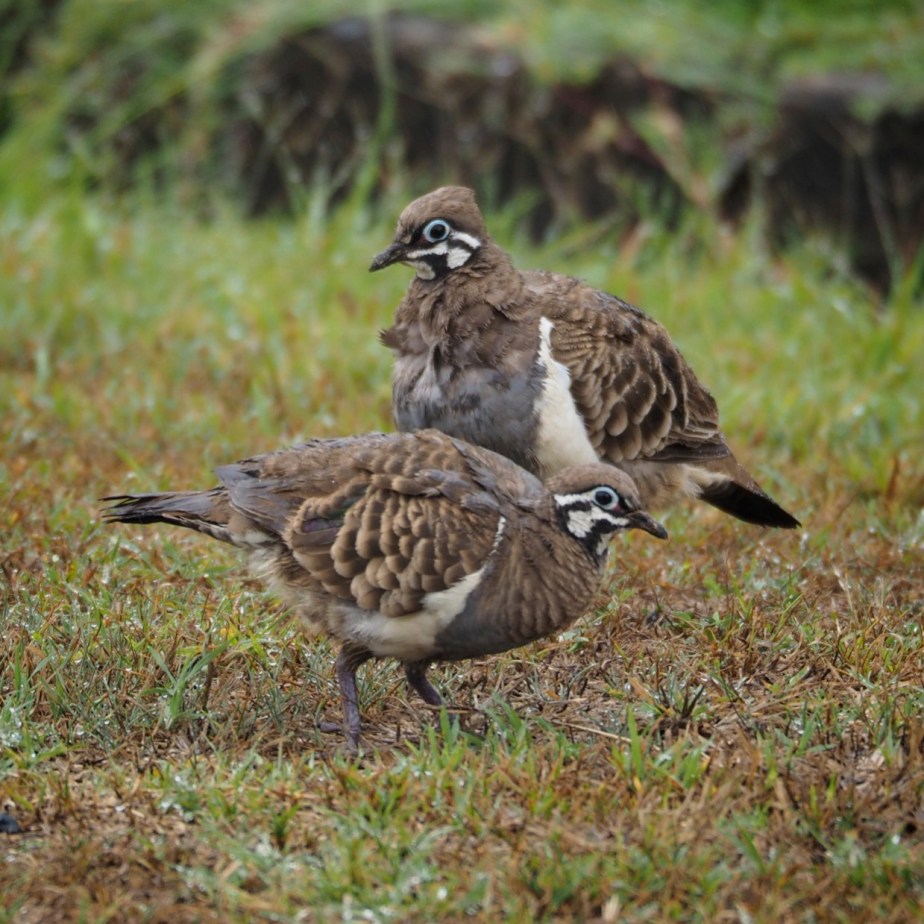
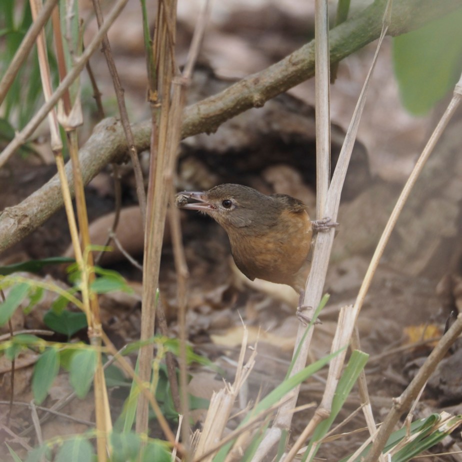
We were travelling in an air-conditioned 4WD with a fridge full of beer, well, almost full, there was some food as well. Our intention was to spend a few days looking for the world’s most venomous snake, the Inland Taipan Oxyuranus microlepidotus. This is found on the deeply cracking black soils of the Diamantina and Cooper Creek drainage systems, more often in the cracks than on the surface. It preys on the Long-haired Rat. The principle vegetation on the black soil is Lignum and that is home to the much sought after Grey Grasswren which we had both seen before but would have been very happy to see again.

So we spent most of our time floundering around Lignum bushes, camera at the ready, sweat running down our backs, trying to beat the flies away from our faces, one foot down a crack, the other raised in readiness for the next crack and in imagination, at least, every crack containing a Taipan. And that was absolute luxury when compared to the explorers who showed us the way out there.

“Don’t you want to photograph the Taipan?” asked Mark.

“Of course I do”, says I.

“Then why have you got the telephoto lens on?”

“Because I’d rather photograph the world’s most venomous snake at a distance”.

Don’t hold your breath waiting for the photographs of snake or grasswren. We saw neither. So I shall say no more of them. I will concentrate on the scenery between lignum swamps and tales of the great explorers.

Blackbraes …

Having turned our heads to the south west our first step took us to Blackbraes National Park. Once again we would make a fleeting visit to a spot that really deserved a lengthier stay.

Blackbraes is a remote park on a dirt highway, close to the middle of the base of Cape York. Head west from there into the gulf country, the gulf in question being the Gulf of Carpentaria. East would take you to the Great Dividing Range and subsequently the coast at Townsville. Given the nature of the road, after heavy rain you ain’t heading anywhere for a while.

The park is above 800 metres altitude (~2,500 feet) and therefore a little cooler and wetter than the surrounding area. It is a mosaic of dry woodland, rocky outcrops and open grassy plains. The camp site is 20 km from the park gate adjacent to dam wall that has produced an extensive shallow wetland. More information can be found <HERE>. You need to book and pay for your camp site online prior to your visit and I wish you every success in dealing with the Queensland parks website.

Around and about we caught up with some ground dwelling birds including the Australian Bustard …

Aussie Bustard

Squatter pigeon …

Squatter Pigeon

Ground Cuckoo-shrike …

Ground CS

During the afternoon we came across a tree that looked like an apartment block for Greater Glider, lots of hollows with signs of wear and tear at the openings and numerous scratch marks on the trunk. So we staked it out at dusk and waited and waited and … nothing came out.

So we cruised around slowly with the spotlight until we found a Spectacled Hare Wallaby a new and exciting addition to my mammal list. As well we met a few pairs of Rufous Bettong. One was happy to pose for a photo but didn’t give me time to arrange studio lighting …

Rufous Bettong

Mount Lewis …

Jewel of the wet tropics, every Australian bird watcher makes a pilgrimage here.

Mt Lewis

Cooktown was our furthest north, we took the easy way from there via Lakeland. Two nights spent at Wetherby Station, a splendid place to camp, gave us a full day up the mountain.

To get there head north from Julatten on the Mossman-Mount Molly Road, turn left at the Highlander Tavern and follow the aptly named Mount Lewis Road as far as you want to go. The road is narrow and steep but in dry conditions it can be handled by 2WD vehicles, after rain the verges become very slippery and it becomes fairly easy to get stuck.

Most visitors head for a clearing which is the famous site for the Blue-faced Parrot-finch. It is also a good spot for Mountain Thornbill. There is some parking here and a foot path that leads up hill away from the clearing into forest that is home to such mythical and highly desirable creatures as Tooth-billed Bowerbird, Spotted Catbird …

Spotted Catbird

Chowchilla, Bower’s Shrike-thrush, Atherton Scrubwren, Grey-headed Robin, Golden Bowerbird and Fernwren …

Fernwren

This little beauty was calling loudly right at my feet.

You can follow the track up and around to the left to a dam where you might add a cormorant or heron to your rainforest list. There was once a much visited Golden Bowerbird bower here but it is no longer tended.

Back at the car you can continue on the road for quite a ways until the road ends at a beaten up corrugated iron shelter. An old logging track heads off slightly to the right at the end of the road. This can be followed on foot although it becomes a little more overgrown with each passing year. And of course the birding is good along the Mount Lewis road itself. Beware of the stinging trees, remember, heart-shaped leaves with little hairs, often insect-eaten, contact equals months of pain. Progress off the roadside or the paths that I’ve mentioned is made difficult by the dense bush and the Wait-a-whiles, very spiky vines that grab your clothing or your skin and are reluctant to let you go. With typical Aussie humour they are often called lawyer vines.

As you wander about look out for Boyd’s Forest Dragon. This is a lizard that is often found quite stationary, a few metres up a tree trunk. It has a body up to about six inches in length (150 mm) plus a tail that is about twice that.

Mt Lewis is also home to some mammals that have a very limited distribution such as the Lemuroid Possum and the Daintree River Ringtail Possum, so we awaited nightfall at the end of the road and then slowly spotlighted down the hill. Our reward was a splendid view of a Daintree River Ringtail.

Around and about …

We spent a few days in the Cooktown region. Overall it was a very productive time from a wildlife perspective. The sighting of Bennett’s Tree Kangaroo was the crowning moment. If you are considering a visit, some of the places to include are the McIvor River, Mt Webb National Park, Keatings Lagoon, Black Mountain and Little Annan Gorge.

The McIvor River can be reached at a couple of spots, the easier place is via a bitumen road. On the way from Cooktown to Hopevale turn left 10 km prior to Hopevale in the direction of Laura. There is a second crossing not far downstream from there  that can be reached via a dirt track from Hopevale airstrip or from the crossing on the made road via a commercial plantation a little further in the direction of Mt Webb. Good birding in pockets of riverine rainforest can be had at both.

Flowering tree

There are no real facilities at Mt Webb but you can get off the main road and poke around. We saw White-eared and Black-winged Monarch here, the latter is a summer migrant to Cape York and this is just about its southerly limit. I photographed this Little Shrike-thrush here …

Little Shrike-thrush

Also had good views of an Amethystine Python which I was about to photograph when the Black-winged Monarch flew by. I chased it and ended up without good photos of either. A snake in the hand or a bird in the bush?

A little further north on the east side of the road you can explore a heathy area that looks productive.

There are foot paths and a hide at Keating’s lagoon. It was good for water birds and is surrounded by some dry forest that yielded Silver-crowned Friarbird and other passerines. Magpie Geese …

Magpie Goose

Our main target at Black Mountain and Little Annan Gorge was Godman’s Rock Wallaby but in that we were unsuccessful.


Flying-foxes …

We wandered around Cooktown in the early afternoon. In the mangroves along the Endeavour river we found a large camp of Flying-foxes. As far as we could tell there were two species present, Little Red Flying-fox and the larger Black Flying-fox.

Flying-foxes feed mainly on nectar and fruit rather than insects and do not use echo-location. They are capable of long journeys on the wing and it is not unusual for them to cover 50 km a night.

People are rather mixed in their response to these creatures. They do harbour a virus that can be infect humans, although transmission is a rare event. The camps tend to be rather smelly and noisy.  And some people just find them particularly creepy. The aborigines ate them and it is said that they are very tasty.

We met a guy whose response was one that we had not encountered previously. He had wandered out of the RSL with a beer in hand, clearly not his first for the day. It is an inescapable fact that some of the males sport very impressive gonads. This was something that our gentleman was very keen to discuss. In fact, in making a comparison with his own, it seemed that he felt considerably inferior. I suspect that the next logical step, dropping his trousers so that passers-by could make their own comparison, was only a beer or two away.


Cooktown …

There was a time when every Australian child knew that Captain Cook discovered Australia. Not exactly true, of course, but quite possibly more than today’s school children know about the early days of the European influx that led to our modern society.

Jimmy

James Cook was born at Marton in Yorkshire in 1728. He was a bright lad of humble origins. The family moved to Great Ayton where his father became a farm manager. His father’s employer paid for young Jimmy to go to school.

Cook’s career at sea began in the merchant navy as an apprentice on a coal carrier. He studied diligently those subjects that he would need to take charge of his own ship, mathematics, navigation and astronomy, and at the end of his three year apprenticeship passed his exams. Three years later he was promoted to mate. Soon after that he passed up the chance to take command of a collier to join the Royal Navy.

That was a move that saw him starting at the bottom all over again. In 1755 Able Seaman Cook joined HMS Eagle. By 1757 Cook was master of The Pembroke. This was a time of war. The Seven Years War (1755 – 1764) has as good a claim to being a world war as any subsequent war. It pitted Britain against France with virtually all of Europe aligned with one side or the other and dragging in their colonies notably Canada.

It was during this war that General Wolfe surprised and defeated the French on the Plains of Abraham outside Quebec City, a pivotal moment in Canadian history. To put the troops in position to launch the attack it was necessary to navigate up the tricky St Lawrence River. A three month siege preceded the battle during which time Cook on The Pembroke surveyed and mapped the river. And it was Cook that led the troop carrying flotilla into place.

Cook went on to survey and map the Newfoundland Coast.

By the conclusion of the war Cook’s talent as a map maker combined with his obvious competence put him in good stead with The Admiralty. Meanwhile the Royal Society was urging a voyage of exploration in the direction of the much anticipated Terra Australis (necessary to balance the great land mass of the Northern Hemisphere and keep the globe from toppling off its axis). They proposed that Alexander Dalrymple, a noted geographer, be in command. The First Lord of the Admiralty’s response was that he’d rather cut a hand off than have a civilian in charge of a navy ship. Cook was acceptable to both these august bodies.

First step was Tahiti to observe the transit of Venus. Which was duly observed on a clear night on June 3rd 1769. After which our James opened a sealed envelope revealing the rest of his super secret instructions, essentially search the Pacific.

Early October saw him arrive in New Zealand, the first European visit since being discovered by Abel Tasman in 1642. Cook mapped the entire coastline, discovering in the process that the North and South Islands are separated by what is now known as Cook Strait. One of his few errors was not recognising that Stuart Island is similarly separated from South Island.

Having completed his task in New Zealand Cook had a problem. He could discover nothing by heading north west and returning home via The Cape of Good Hope. It was late autumn, his ship was not fit to take a southerly route to round Cape Horn. He outlined his thinking in his Journal and determined …

… upon Leaving this Coast to steer to the Westward until we fall in with the East Coast of New Holland, and then to follow the direction of that Coast to the Northward

Europeans had been bumping into the north and west coasts of Australia aka New Holland since 1606 (Janszoon on The Duyfken). For almost all the rest of the century the Dutch pretty much had a monopoly on the place accumulating quite a list of discoveries. It was 1699 before the poms got involved, William Dampier exploring the west coast and collecting the first botanical specimens to reach the scientific establishment.

The north east extremity of Australia is Torres Strait. That was put on the map in 1606 by Luis Váez de Torres who wrote of “very large islands, and more to the south“. The south east extremity was put on the map by Tasman in 1642. Cook set out to join the dots.

Landfall was well south on the coast on Friday 20th April. Cook named it Point Hicks after the his Lieutenant (a Stepney lad and therefore a cockney like me). Proceeding north Cook discovered Botany Bay and Port Jackson, subsequently the place where Sydney was founded, (according to Melbournians the largest of Cook’s mistakes). Then even further north to the Great Barrier Reef and after bumping into that off Cape Tribulation to the mouth of Endeavour River where he repaired his ship.

The repairs took seven weeks. While they were in progress the scientists went collecting. One of the most important things they brought back was a word garnered from the local aboriginal people, gangurru, which we spell a little differently these days.

This is the place where Cooktown now stands, which is where you can find the statue shown above.

It is a small tropical town, only recently discovered by tourists and not overly commercialised. It is a delightful place to visit just as it is but for me it ranks as one of the most significant historical sites that we have.

Adventures at Shipton’s Flat …

The wet tropics are famous for being wet. Even here, though, there are drier times and wetter times. The wet season had not yet arrived. Lewis and Charlie were working hard to keep their cattle fed. Lewis was cutting grass along the road and fetching it home to hand feed some of the more pampered animals while Charlie was walking others all over the district, an old Aussie tradition referred to as using the long paddock.

At the end of a hard days work Charlie was more than happy to take us spotlighting. Our targets were any of a number of possum species that are found only in that particular neck of the woods. So off we went, on foot and off trail. After about 45 minutes we were examining some very promising scratch marks around the lower parts of some tree trunks when the back of my right hand came in contact with the leaves of a Dendrocnide moroidies.

Stinging Tree

They are more popularly known as the Stinging Tree or Gympie Bush. Note the heart shaped leaves covered in fine hairs. This illustration was shamelessly filched from KrackersWorld. The plant is a pioneer that loves to grow in disturbed places such as alongside tracks. Small plants are as unpleasant as the larger ones maybe more so.

The pain was immediate, intense and persistent. Within half an hour the lymph nodes in my armpit were sore and swollen. The pain overnight prevented much in the way of sleep. Charlie was most apologetic … initially. This soon gave way to war stories about the numerous occasions on which he had been stung and what I could look forward to because this is no passing inconvenience. For any where up to 18 months hot, cold, getting wet or knocking the affected part causes pain. It is now five weeks since that momentary contact. The flow of cold air over my hand on the steering wheel is enough to cause severe pain.

Interestingly, although the pain is reminiscent of a burn there is no visible injury to the tissues.

Back at camp Charlie poured vinegar over my hand. This was as good an approximation of the recommended treatment as we could manage. Better would have been the application of a solution of 10-15% hydrochloric acid in water, followed by waxing the area to remove the stinging hairs.

If you’re heading to this region it is well worth knowing what these plants look like. They are often quite insect eaten when they look like <this>. The Cape Tribulation Research Station page is an excellent source of further information. Kids are particularly vulnerable. Long pants, closed shoes and dire warnings about wandering off the track are all useful preventative measures.

The following day it was Lewis’s turn to give up his time. He took us birding and then we switched our attention to a very special mammal. Both the brothers have an encyclopedic knowledge of the natural world around them. Their conversation is peppered with the scientific names of the plants, frogs, birds and lizards. They know every bird call, when each plant will flower and what will visit them when they do. After showing us a goodly collection of Honeyeaters and calling up a Barking Owl we set off in search of Bennett’s Tree Kangaroo. It took some finding but we got it. We had about an hour of hard going over steep and trackless terrain in hot weather. Then we had to retrace our steps. On the way there I was buoyed by the chase, on the way back all I could think of was a long cool drink. Unlike the Lumholz Tree Kangaroo on Mount Hypipamee this guy did not present himself in the open for a photo session, but just to prove it was really there …

Bennett's T K

Honest, look carefully, it’s right in the middle.

The Bloomfield Track …

We left Sauce Worcester at the Daintree Village jetty with smiles on our faces and retraced our tyre prints to the Daintree Ferry. The next leg of our journey would be on the notorious Bloomfield Track.

Bloomfield Track

The ferry is a cable barge affair that takes a maximum of 27 vehicles, the wait generally takes longer than the crossing especially in the high tourist season. A two way crossing currently costs $25 for a car.

It wasn’t particularly busy when we reached the pay box. The not at all unattractive and possibly a little bored lady on duty gave us a cold reading.

“G’day”, said  the ticket psychic casting her eye over the Prado and camper trailer armour-plated with mud from the Paluma range.

“Hi”,

“You’ll be wanting a one way ticket … ?”

“Yes please …” and I was about to ask how the track was holding up,

“Yeah, no” she said, “You guys’ll have no trouble”.

Across the ferry you run straight into the perfect collision of rainforest with commercial reality, a tropical paradise subdivided into 5 acre blocks … but you can buy great ice-cream. Drive carefully Cassowaries have little road sense. All of this is soon behind you. From Cape Tribulation on it’s the real deal.

The Bloomfield Track was bulldozed through the rainforest in 1984 against fierce opposition from the conservation lobby. The state government were on a mission to develop the local economy. As is typical of the way we do things here in Oz the federal government followed up by nominating the area for world heritage listing. This was achieved against fierce opposition from the state government, logging is now forbidden.

Now, on a good day, you can drive your 4WD from Daintree to Cooktown in a leisurely few hours. Your alternative is the far longer inland route via Mt. Molloy and Lakeland on the sealed Mulligan Highway. On a bad day you can get stuck, check road conditions at the link in the paragraph above before setting out.

The first tourist to get into a scrape at Cape Tribulation was Jimmy Cook on June 10th 1770. The nearby Endeavour Reef is named after his ship, the Cape is named to reflect his appreciation of the pristine wilderness.

A Google search for the track will leave the uninitiated totally confused. Should you drive it or not. Take courage, my friend, do it. What could possibly go wrong?

It crosses the Donovan and Cowie ranges and is steep in places. Most of the significant river crossings now have bridges but your tyres will get wet, they will cope. If the track is open and your vehicle is 4WD you’ll wonder what the fuss was about and if you get stuck stay with the vehicle there’ll be someone along soon. Tell them that I said they would help you.

Quite where we would stay at the other end of the track had not been determined in advance. But we had a strategy. Our first stop would be the Lion’s Den, we didn’t take the dog.

Lions Den

No Dogs

As a student the biologist you see walking a reasonably straight line out of the hotel took a vacation job at a tourist lodge a little north of here on Cape York. When it finished the young man was introduced to some folks in Cooktown with similar interests in the natural world. The introduction was nice and formal … “Tell them Joe sent you”. So he did, it was the start of a chain of similar introductions. Ultimately he found himself being delivered by the mail lady to a farm at Shipton’s Flat. No one knew he was coming or who he was. Brothers Lewis and Charlie made him welcome, gave him a place to stay and fed him. They took time out from the daily grind to show him around and when the mail lady came the following week he bade farewell.

The farm is off grid, the exact address forgotten, the phone number lost. Only one thing to do, head for the pub. The barmaids were extremely good looking and were dressed very appropriately for the tropics. The guy on the stool next to us had the remarkable knack of ordering a drink that had to be retrieved from beneath the bar immediately in front of us and was from the property right next to Lewis and Charlie. Such blessings, beer, cleavage, information.

When we got to the farm we were made welcome. Mark reminded them of the circumstances of his previous visit but they had made a much greater impression on him than he had on them. They did remember the mail lady who it seems had moved to the remote south some years before, the remote south being anywhere further than Cairns. We were invited into the house for tea and biscuits. It was a typical Queenslander house, raised on stilts to catch the breeze. It was built of rainforest timber that would now cost a king’s ransom. No internet, no air conditioning, in fact no electricity, they used bottled gas to cook and run the refrigerator. On the wall was a beautiful photograph of a stream running through a rainforest. Mark had taken the photo on the Bloomfield Track and sent it to them to thank them for their hospitality.


Daintree River …

One of my favorite memories from previous trips to the wet tropics is birding with Chris Dahlberg. On seeing some interesting bird he would say “Come with me …”, and of course we would, we were after all confined to a small boat. Chris has moved on to another phase of his life but one can still take an early morning cruise on the Daintree River with Sauce Worcester at the helm.

It is essential to book in advance, cruises leave from the jetty right in the Daintree village. In theory cruises last for two hours but Mr Worcester is very generous with his time. He takes you up stream and down and pokes around in the little creeks. Some much sought-after birds like Little Kingfisher, Black Bittern and Great-billed Heron are quite often seen on the cruise and Sauce is pretty good at getting you in the right place for a photo. You will finish the trip with a good list.

Here is a Black Butcherbird, not radiantly attractive to look at and of less than endearing manners, it is an aggressive nest predator, but it does have a lovely voice.

Black Butcherbird

The Azure Kingfisher, on the other hand has better manners and is delightful to look at. Its voice is a rather depressing and monotonous kek …

Azure Kingfisher

And this guy is rarely heard and something of a struggle to see …

 Papuan Frogmouth

It’s in there somewhere. It is a Papuan Frogmouth, they feed at night. Unlike owls their feet are weak, they capture prey ranging from large insects to small mammals by seizing them in their beaks. During the day they do a very good impersonation of a branch. This one is sitting on a nest, a flimsy construction of sticks. It’s the male that sits during the day, the sexes alternate at night.

One often sees some very impressive crocodiles on the cruise but November is not a good time for them. It is mating season, none are sitting out lazing the day away, the large males are patrolling their territories and everything else is hiding from them.

Parting of the ways …

We greeted the new day with heavy hearts, the lovely Gayle would be leaving us today.

Bird watching would not be totally neglected but our most important tasks today would be to get her to the airport on time and to resupply for the next leg of the trip. An early morning stroll in the Barron Gorge National Park was more sombre than usual.

Between us and Cairns Airport was the Cattana Wetlands and there was just enough time to do them justice. From Speewah it is a fairly steep descent to the coastal strip at Smithfield  just north of Cairns. Right at the roundabout then left at the next one takes you towards Yorkeys Knob. Third road on the left is Dunne Road and will take you to the gate, avoid the temptation to take Cattana Road it will not take you to the gate.

There are a number of ponds, a boardwalk, picnic facilities and even a bird hide or two. It’s not been open to the public for very long but the recently planted trees are big enough now to give a reasonably natural feel to the place.

A male Green Pygmy Goose was reasonably approachable …

Green Pygmy Goose

as was this even more attractive Comb-crested Jacana …

Comb-crested Jacana

We disturbed a Lace Monitor along one of the tracks which promptly ran up a tree. They always head for the other side of the trunk, you can sometimes get a photo by staying still and having a companion go around to the other side although by the time you’ve done that it may be way up high …

Lace Monitor

… and while you’re looking in the trees, look out for these …

Ant Plant

They are Myrmecophytes or Ant Plants. There is quite a diverse array of them, this particular type, in the family Rubiacaea, provides a dwelling place in that bulbous base that ants inhabit. The technical term for such structures is domatia. In return the ants keep leaf eating insects away. You can see from the photo that these are growing on another tree and have rather palatial domatial swellings. They are  therefore tuberous epiphytic rubiaceous myrmecophytes, any of which might come in handy at your next trivia night.

By the time I’d finished explaining all this to Gayle she was quite ready to hop on the plane.

And so to the Smithfield Shopping Mall to resupply … at Dan Murphy’s bottle shop.