Birdsville …

Hot on the heels of the explorers came the settlers. The rangelands will carry sheep and cattle. The stocking rate is extremely low but there’s plenty of country. Rainfall is fickle, the good years can give rise to optimism that fries all too quickly in the dry years that follow.

Birdsville came into being as Diamantina Crossing in 1881. Its reason for existence was simple, before the foundation of the Commonwealth of Australia the individual colonies thought it necessary to protect their economies with tariffs. Birdsville is on a droving route used to take northern cattle to southern markets and located just north of the South Australia – Queensland border. It was there to collect taxes.

Tax collecting is thirsty work. It had three hotels and a cordial factory. The population in 1900 was over 300. Its role as a tax collector ceased at Federation in 1901. It was downhill after that, at least for a while.

Not far to the west in the Simpson Desert is Sturt’s furthest north, reached in September 1845 …

We had penetrated to a point at which water and feed had both failed … The spinifex was close and matted, and the horses were obliged to lift their feet straight up to avoid its sharp points. From the summit of a sandy undulation close upon our right, we saw that the ridges extended northwards in parallel lines beyond the range of vision, and appeared as if interminable. To the eastward and westward they succeeded each other like the waves of the sea. The sand was of a deep red colour, and a bright narrow line of it marked the top of each ridge, amidst the sickly pink and glaucous coloured vegetation around.

After Sturt it was the turn of the surveyors.  Augustus Poeppel marked the point where Queensland, South Australia and New South Wales meet. He was in error by 300 metres. The error was corrected four years later by Larry Wells. Then in 1886 David Lindsay penetrated deep into the desert from the west.

To that point no european had gone in one side and come out the other. Ted Colson put that right in May 1936. He set out from his cattle station on the west of the desert with an aboriginal companion, Peter Ains, and five camels, followed the 26th parallel to Birdsville, had a beer in the pub and four days later turned around and crossed the desert again.

Cecil Madigan came next leading a scientific expedition, again on camels but by a more northerly route.

Nowadays the explorers come by 4WD. The first to cross the Simpson by car was Reg Sprigg with the wife and kids. It was September 1962. Since then Birdsville’s fortunes have improved. Thousands come for the races, the bold drive up via the Birdsville Track, the intrepid come across the Simpson. We all make a point of stopping here …

Birdsville Hotel


Burke and Wills …

Victoria gained independence from New South Wales in 1851. Gold was discovered very soon after. The rush filled Melbourne with new arrivals and as quickly emptied it of able bodied workers. In the 1850’s the place was a disaster, but the money rolled in and by 1860 it was Marvelous Melbourne. The gentlemen of the Philosophical Institute were sure the colony was capable of doing great things.

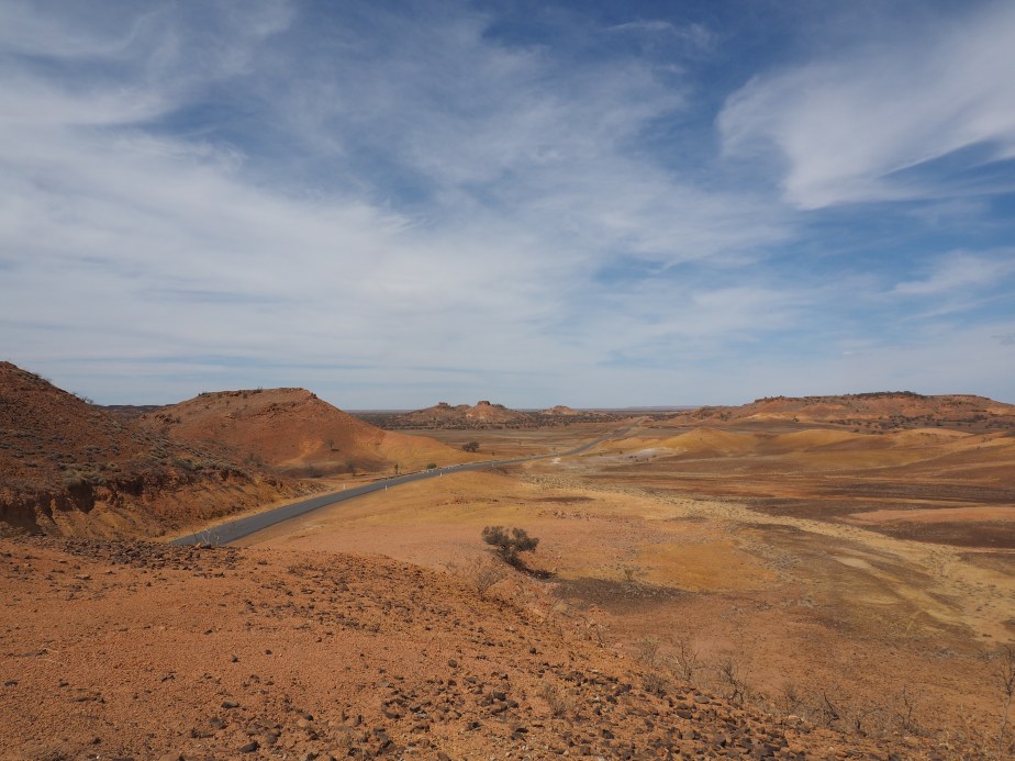
Off to the west, another colony was on less secure ground. South Australia, far more than the eastern states, is hemmed in by the desert. If, as they suspected, they were confined to a fertile island their prospects for expansion were very limited. Exploration to the north of Adelaide was mainly driven by the hope that new pastures would be discovered. There was also the prospect that Adelaide could become the destination of the newly proposed overland telegraph system that might connect the settled parts of Australia with Asia and the world.

South Australia had an established explorer of the highest reputation, one John McDouall Stuart. Stuart had been with Sturt on his last expedition and then made his name leading small, fast-travelling sorties to the west of Sturt’s track.

The Philosophical gentlemen of Melbourne were honoured with a Royal Charter in 1859 and their Institute became the Royal Society of Victoria. They became even more certain that great things could be done, among them perhaps the first overland crossing of the continent. Committees went to work, money was raised, the Victorian Exploring Expedition came into being, advertisements were placed for a leader and one was appointed.

The expedition was by turns a farce and a tragedy.

On August 20th 1860 26 camels, 23 horses, 19 men and 6 wagons departed Royal Park, Melbourne and managed to cover 11 km. The leader was Robert O’Hara Burke. He had no prior experience of exploration, had no prior experience with camels and could not determine longitude or latitude from astronomical sightings. George Landells was second in command and the camel expert. William John Wills, a young surveyor, was sent along to tell Burke where he was. Tempers were a little frayed in the chaos of departure, some men were dismissed, others appointed right there in Royal Park.

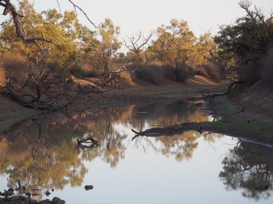
The expedition was the best equipped ever, or so it was claimed. There was, in fact, a mountain of equipment to be transported. At that time the edge of the settled districts was at Menindie (now spelt Menindee) on the Darling River, about 800 km to the north of Melbourne.  Cooper’s Creek had been put on the map by Charles Sturt and later visited by Augustus Charles Gregory. That’s another 800 km. Beyond that was unknown territory.

B&W Map

Plan A seems to have been to transport the supplies to form a base camp at Cooper’s Creek. The nature of some of the equipment and the qualifications of some of the personnel implies that Plan A also included a scientific survey of the ground covered, on the other hand Burke was sent on his way with summer coming and exhorted to make all haste, Stuart was in the field and this was to be a race. Plan A was very vague.

The first problem was to shift the mountain of equipment with the means of transport provided. This need not have been a problem at all. Burke had turned down an offer to carry his supplies to Menindie by paddle steamer via the Murray and Darling Rivers for patriotic reasons. This was a Victorian Expedition, it would not be traveling via South Australia!

Instead it traveled very slowly overland, running up considerable over budget expenditure and accompanied by unrest among the troops. It took 56 days to get to Menindie where Landells, second in command and camel expert was fired. In the ensuing argument Burke challenged him to a duel which Landells had the sense to decline. Of the 19 men that left Royal Park 11 had resigned or been dismissed. Eight men had been hired along the way and five of these had also departed. Mr Burke was not a gifted commander.

Burke decided that carrying the mountain of equipment any further was simply beyond the transport at his disposal. Menindie became the base camp. On October 19th 1860 16 camels, 19 horses and 10 men set out for the Cooper. The question regarding race and science was neatly resolved. The scientists and their equipment were left behind. Wills had been promoted to second in command and had to go on because no one else could work out where they were. Also in the forward group was William Wright. Until recently he had managed the nearby Kinchega sheep station. Burke met him in Menindie’s most prominent establishment, Thomas Paine’s Hotel, just days earlier.

Progress was good, recent rain meant there was no shortage of water. They had covered 250 km in 10 days. Burke was impressed with Mr Wright and promoted him to third in command and sent him back to Menindie to bring up further supplies to the Cooper. Thirteen days later Burke established his advanced base camp on the Cooper.

William Wright arrived back in Menindie with a number of problems. He had no written orders, the leader of the party in Menindie would not accept his authority, the local traders would not extend him credit, Burke had for some time been writing rubber cheques. Burke had the best of the horses and camels. There was simply no way to transport tons of goods up to the Cooper. The meat that had come with the expedition had spoiled and would need to be replaced. It would be more than two months before the resupply party would set off.

After about a month at the Cooper Burke divided his party again. On December 16th Burke, Wills, John King and Charley Gray set off with six camels, one horse and 90 days worth of provisions. William Brahe was left in charge of the depot with orders from Burke to remain three months and a suggestion from Wills that he might stay a little longer. Burke expected that Wright would arrive in the interim with further supplies.

After Burke’s death he was hailed a hero. Close scrutiny has led to the verdict that he was more the bumbling buffoon. He was born in Ireland in 1820. He had an imposing physique and an easy going charm. His first career was in the Austrian military and initially successful. It came to an inglorious end when skipping town to evade his gambling debts caused him to be absent without leave. Subsequently he had been a well-liked policeman in the Victorian goldfields. At the time he set off  from Royal Park he was pursuing an actress half his age, he left behind a rubber cheque for £96 and a debt at the Melbourne Club of £18 5s 3d. The first 45 days after departing the Cooper were probably the most successful period of his entire life.

Forty five days into 90 days supplies Burke reached Augustus Charles Gregory’s 1856 track across the Gulf of Carpentaria. He had joined the dots. He had supplies to take him home. The coast however was still 200 km away.

He pressed on. This time he was gambling with lives.

The party reached the Flinders River and made camp 119 on its banks. The water was salty and rose and fell just enough to show that they were in the upper reaches of a tidal estuary. The scrub was too dense for the camels to be of use. The next day Burke and Wills pressed on, Gray and King stayed with the camels. The duo were able to get to a point about 20 km from the sea before mangrove swamps became too much even for them and they turned back.

On February 13th 1861 the gulf party left camp 119 and headed south. The Cooper was 1500 km away, 60 days had elapsed of the 90 for which they were provisioned.

At Cooper’s Creek Brahe and three companions were sitting in the shade of a coolibah tree, supplies for them were dwindling, relations with the local aborigines were difficult. The expeditioners had taken possession of a significant resource and had worn out their welcome. The aborigines had taken possession of any item small enough to be carried and they, too, had worn out their welcome. William Wright would have been very welcome but had not turned up.

Wright was at Torowoto between Mutawinjee and the Cooper and making very slow progress. The wet season of the previous year had made reaching the Cooper relatively easy. This year was dry and it was by now mid-summer. A few days later they reached the limit of the available surface water and were trapped for twenty days. Dysentry and malnutrition were becoming a problem.

Charley Gray was the largest of the men with Burke. On equal rations he was the first to die. Prior to his death he had been caught taking food and had been chastised by Burke. Exactly how physically and whether that contributed to his death is unknown. The other three made it back to the depot on Cooper’s Creek after noon on April 21st. The ashes of the campfire were still warm, Brahe and the depot party had left that very morning having stayed there for four months. They had every reason to suppose that the northern party had either perished or having reached the gulf gone east rather than return south. They had buried a cache of food under the coolibah and carved the instruction “Dig” in its trunk. The tree still stands …

The Dig Tree

At the same time Wright was 150 km further south, his party had left Menindie three months earlier and was in desperate straits.  Before long five of his men would be dead from malnutrition. Along the way they had been attacked by a party of aborigines and found it necessary to open fire. One aborigine was presumed killed. Once again the conflict was over access to water equally vital to residents and interlopers. The interlopers were better armed.

Burke, Wills and King dug and replenished their supplies. They had two exhausted camels left. Chasing the depot party seemed beyond them. Burke decided to try to follow Gregory’s route down the Cooper and Strzelecki Creeks to Mount Hopeless and thence to Adelaide. It was indeed a hopeless proposition. They placed their notes in the trunk that Brahe had left for them and reburied it. They made no marks on the coolibah that would inform of their presence and set off south west.

Brahe going south met Wright coming north. The pair returned to the Cooper. Found no evidence of Burke’s return, saw no reason to dig, and headed south again.

The trio on the Cooper eventually realised that they were not going to walk out. Assistance from the local aborigines was their only hope and to some extent it was forthcoming.

Wills returned alone to the dig tree and deposited his diary there. He was unaware that Wright and Brahe had been there whilst he was further west. He returned to his companions only to find that Burke had spoiled relations with the aborigines by firing his revolver over the head of a young man who had helped himself to a piece of oil cloth. He repeated the trick soon after when the locals offered him some fish and nets. The aborigines then kept away. Burke had also had an accident whilst cooking. The subsequent fire had destroyed most of their remaining possessions.

The trio was left to subsist on nardoo, a plant that was readily available but which needed to be prepared properly prior to eating.  They had been introduced to nardoo by the aborigines but were ignorant of the correct process for its preparation. It was Wills that weakened and died first, then Burke. King had done nothing to make himself unpopular with the aborigines and one man was not so great a burden. He was taken care of by the local people.

Back in Melbourne people began to wonder where the expedition had got to, no one more vocally than Dr W J Wills father of William Wills. The august gentlemen of the Royal Society were eventually stirred into action and in June formed committees to see what could be done. The result was no fewer than five relief expeditions setting out from all quarters of the compass. King was rescued. The bodies of Burke and Wills were brought back to Melbourne and were the stars of Victoria’s first state funeral. More than 11,000 km of difficult terrain were covered by the relief expeditions and not one further life was lost. This exploring business was not so dangerous if you knew what you were doing.

In 1862 John McDouall Stuart became the second person to lead a party from the south coast to the north. He made it back again. The overland telegraph was built along the route he established, Adelaide, Alice Springs, Darwin. The latter remains the only substantial town on Australia’s north coast. If Google maps is consulted on the route to take from Melbourne to Darwin it will take you to Adelaide and then follow Mr Stuart’s route north. The gentlemen of the Royal Society would be horrified.


The desert …

Min Min Way

Let any man lay the map of Australia before him, and regard the blank upon its surface, and then let me ask him if it would not be an honourable achievement to be the first to place foot in its centre.

Wrote Charles Sturt, who left Adelaide in 1844 with 11 horses; 30 bullocks; 1 boat and carriage; 1 horse dray; 1 spring cart; 3 drays, 200 sheep; 4 kangaroo dogs; 2 sheep dogs … and an inexplicable tendency to switch between commas and semicolons in the one list. He was the leader of a group of 16 men. They were the first to put their shoes in many places but other feet had always preceded theirs and they fell short of the geographic centre of Australia by 150 miles.

This was Sturt’s third, and final, major foray. The party was in the field 18 months, they had to contend with extremes of drought, near starvation and heat that burst their thermometers. One, Mr Poole, died of scurvy. They were the first Europeans to reach the heart, some would later say the dead heart, of the Lake Eyre basin.

We may find it a little odd that he would take a boat on such an excursion but his prior expeditions had entailed considerable journeys on the Murray and Darling Rivers and he was exploring at a time when people still expected to find an inland sea or at least the Australian equivalent of a Nile or Mississippi.

Sturt was a great bushman, a very determined explorer and distinguished, too, by treating the aborigines that he encountered with respect and consideration. He also brought most of his men back alive.

A little to the north of Blackbraes National Park, Mark and I had already crossed the tracks of Ludwig Leichhardt and Augustus Charles Gregory. In 1844 Leichhardt had travelled from the vicinity of Brisbane north west across the base of Cape York, continuing beneath the Gulf of Carpentaria and then north to the settlement of Port Essington (not far from modern day Darwin). From there he had sailed back to Brisbane by boat. Augustus Charles Gregory’s 1855-56 expedition did the boat ride first. From near where Leichhardt finished his land journey Gregory headed south west and following a river that he named in honour of Charles Sturt. His most westerly point on that expedition is now known as Lake Gregory. He then followed Leichhardt’s route back east to Gladstone. Both of these explorers led later expeditions.

The map that Sturt thought so blank has a little more written on it these days but there is still room to write the names of pretty small places in pretty large letters. Mark and I drove into the desert via the Min Min Way. We intersected the track of other exploring parties before we met with Sturt’s. One, of course, is the track of Burke and Wills. Sixteen years after Sturt set off from Adelaide Burke’s expedition left Melbourne with the intention of crossing the entire continent south to north. In that Burke was entirely successful although he intended to follow that with another crossing north to south.

We also crossed the 1858 track of Augustus Charles Gregory. Sturt discovered and bestowed the European name on Cooper’s Creek. Gregory, who obviously had high regard for Sturt, travelled from south east Queensland to Adelaide via Cooper’s Creek.

Burke and Wills ensured that Cooper’s Creek would hold an enduring place in Australian history by dying on its banks.

At some point we must also have crossed the track of Leichhardt’s 1848 expedition that left Queensland intending to cross the continent east to west. None of the seven men that set out ever returned, their track and where they perished is unknown.

Desert Sky

We were travelling in an air-conditioned 4WD with a fridge full of beer, well, almost full, there was some food as well. Our intention was to spend a few days looking for the world’s most venomous snake, the Inland Taipan Oxyuranus microlepidotus. This is found on the deeply cracking black soils of the Diamantina and Cooper Creek drainage systems, more often in the cracks than on the surface. It preys on the Long-haired Rat. The principle vegetation on the black soil is Lignum and that is home to the much sought after Grey Grasswren which we had both seen before but would have been very happy to see again.

So we spent most of our time floundering around Lignum bushes, camera at the ready, sweat running down our backs, trying to beat the flies away from our faces, one foot down a crack, the other raised in readiness for the next crack and in imagination, at least, every crack containing a Taipan. And that was absolute luxury when compared to the explorers who showed us the way out there.

“Don’t you want to photograph the Taipan?” asked Mark.

“Of course I do”, says I.

“Then why have you got the telephoto lens on?”

“Because I’d rather photograph the world’s most venomous snake at a distance”.

Don’t hold your breath waiting for the photographs of snake or grasswren. We saw neither. So I shall say no more of them. I will concentrate on the scenery between lignum swamps and tales of the great explorers.

Blackbraes …

Having turned our heads to the south west our first step took us to Blackbraes National Park. Once again we would make a fleeting visit to a spot that really deserved a lengthier stay.

Blackbraes is a remote park on a dirt highway, close to the middle of the base of Cape York. Head west from there into the gulf country, the gulf in question being the Gulf of Carpentaria. East would take you to the Great Dividing Range and subsequently the coast at Townsville. Given the nature of the road, after heavy rain you ain’t heading anywhere for a while.

The park is above 800 metres altitude (~2,500 feet) and therefore a little cooler and wetter than the surrounding area. It is a mosaic of dry woodland, rocky outcrops and open grassy plains. The camp site is 20 km from the park gate adjacent to dam wall that has produced an extensive shallow wetland. More information can be found <HERE>. You need to book and pay for your camp site online prior to your visit and I wish you every success in dealing with the Queensland parks website.

Around and about we caught up with some ground dwelling birds including the Australian Bustard …

Aussie Bustard

Squatter pigeon …

Squatter Pigeon

Ground Cuckoo-shrike …

Ground CS

During the afternoon we came across a tree that looked like an apartment block for Greater Glider, lots of hollows with signs of wear and tear at the openings and numerous scratch marks on the trunk. So we staked it out at dusk and waited and waited and … nothing came out.

So we cruised around slowly with the spotlight until we found a Spectacled Hare Wallaby a new and exciting addition to my mammal list. As well we met a few pairs of Rufous Bettong. One was happy to pose for a photo but didn’t give me time to arrange studio lighting …

Rufous Bettong

Mount Lewis …

Jewel of the wet tropics, every Australian bird watcher makes a pilgrimage here.

Mt Lewis

Cooktown was our furthest north, we took the easy way from there via Lakeland. Two nights spent at Wetherby Station, a splendid place to camp, gave us a full day up the mountain.

To get there head north from Julatten on the Mossman-Mount Molly Road, turn left at the Highlander Tavern and follow the aptly named Mount Lewis Road as far as you want to go. The road is narrow and steep but in dry conditions it can be handled by 2WD vehicles, after rain the verges become very slippery and it becomes fairly easy to get stuck.

Most visitors head for a clearing which is the famous site for the Blue-faced Parrot-finch. It is also a good spot for Mountain Thornbill. There is some parking here and a foot path that leads up hill away from the clearing into forest that is home to such mythical and highly desirable creatures as Tooth-billed Bowerbird, Spotted Catbird …

Spotted Catbird

Chowchilla, Bower’s Shrike-thrush, Atherton Scrubwren, Grey-headed Robin, Golden Bowerbird and Fernwren …

Fernwren

This little beauty was calling loudly right at my feet.

You can follow the track up and around to the left to a dam where you might add a cormorant or heron to your rainforest list. There was once a much visited Golden Bowerbird bower here but it is no longer tended.

Back at the car you can continue on the road for quite a ways until the road ends at a beaten up corrugated iron shelter. An old logging track heads off slightly to the right at the end of the road. This can be followed on foot although it becomes a little more overgrown with each passing year. And of course the birding is good along the Mount Lewis road itself. Beware of the stinging trees, remember, heart-shaped leaves with little hairs, often insect-eaten, contact equals months of pain. Progress off the roadside or the paths that I’ve mentioned is made difficult by the dense bush and the Wait-a-whiles, very spiky vines that grab your clothing or your skin and are reluctant to let you go. With typical Aussie humour they are often called lawyer vines.

As you wander about look out for Boyd’s Forest Dragon. This is a lizard that is often found quite stationary, a few metres up a tree trunk. It has a body up to about six inches in length (150 mm) plus a tail that is about twice that.

Mt Lewis is also home to some mammals that have a very limited distribution such as the Lemuroid Possum and the Daintree River Ringtail Possum, so we awaited nightfall at the end of the road and then slowly spotlighted down the hill. Our reward was a splendid view of a Daintree River Ringtail.

Around and about …

We spent a few days in the Cooktown region. Overall it was a very productive time from a wildlife perspective. The sighting of Bennett’s Tree Kangaroo was the crowning moment. If you are considering a visit, some of the places to include are the McIvor River, Mt Webb National Park, Keatings Lagoon, Black Mountain and Little Annan Gorge.

The McIvor River can be reached at a couple of spots, the easier place is via a bitumen road. On the way from Cooktown to Hopevale turn left 10 km prior to Hopevale in the direction of Laura. There is a second crossing not far downstream from there  that can be reached via a dirt track from Hopevale airstrip or from the crossing on the made road via a commercial plantation a little further in the direction of Mt Webb. Good birding in pockets of riverine rainforest can be had at both.

Flowering tree

There are no real facilities at Mt Webb but you can get off the main road and poke around. We saw White-eared and Black-winged Monarch here, the latter is a summer migrant to Cape York and this is just about its southerly limit. I photographed this Little Shrike-thrush here …

Little Shrike-thrush

Also had good views of an Amethystine Python which I was about to photograph when the Black-winged Monarch flew by. I chased it and ended up without good photos of either. A snake in the hand or a bird in the bush?

A little further north on the east side of the road you can explore a heathy area that looks productive.

There are foot paths and a hide at Keating’s lagoon. It was good for water birds and is surrounded by some dry forest that yielded Silver-crowned Friarbird and other passerines. Magpie Geese …

Magpie Goose

Our main target at Black Mountain and Little Annan Gorge was Godman’s Rock Wallaby but in that we were unsuccessful.


Flying-foxes …

We wandered around Cooktown in the early afternoon. In the mangroves along the Endeavour river we found a large camp of Flying-foxes. As far as we could tell there were two species present, Little Red Flying-fox and the larger Black Flying-fox.

Flying-foxes feed mainly on nectar and fruit rather than insects and do not use echo-location. They are capable of long journeys on the wing and it is not unusual for them to cover 50 km a night.

People are rather mixed in their response to these creatures. They do harbour a virus that can be infect humans, although transmission is a rare event. The camps tend to be rather smelly and noisy.  And some people just find them particularly creepy. The aborigines ate them and it is said that they are very tasty.

We met a guy whose response was one that we had not encountered previously. He had wandered out of the RSL with a beer in hand, clearly not his first for the day. It is an inescapable fact that some of the males sport very impressive gonads. This was something that our gentleman was very keen to discuss. In fact, in making a comparison with his own, it seemed that he felt considerably inferior. I suspect that the next logical step, dropping his trousers so that passers-by could make their own comparison, was only a beer or two away.


Cooktown …

There was a time when every Australian child knew that Captain Cook discovered Australia. Not exactly true, of course, but quite possibly more than today’s school children know about the early days of the European influx that led to our modern society.

Jimmy

James Cook was born at Marton in Yorkshire in 1728. He was a bright lad of humble origins. The family moved to Great Ayton where his father became a farm manager. His father’s employer paid for young Jimmy to go to school.

Cook’s career at sea began in the merchant navy as an apprentice on a coal carrier. He studied diligently those subjects that he would need to take charge of his own ship, mathematics, navigation and astronomy, and at the end of his three year apprenticeship passed his exams. Three years later he was promoted to mate. Soon after that he passed up the chance to take command of a collier to join the Royal Navy.

That was a move that saw him starting at the bottom all over again. In 1755 Able Seaman Cook joined HMS Eagle. By 1757 Cook was master of The Pembroke. This was a time of war. The Seven Years War (1755 – 1764) has as good a claim to being a world war as any subsequent war. It pitted Britain against France with virtually all of Europe aligned with one side or the other and dragging in their colonies notably Canada.

It was during this war that General Wolfe surprised and defeated the French on the Plains of Abraham outside Quebec City, a pivotal moment in Canadian history. To put the troops in position to launch the attack it was necessary to navigate up the tricky St Lawrence River. A three month siege preceded the battle during which time Cook on The Pembroke surveyed and mapped the river. And it was Cook that led the troop carrying flotilla into place.

Cook went on to survey and map the Newfoundland Coast.

By the conclusion of the war Cook’s talent as a map maker combined with his obvious competence put him in good stead with The Admiralty. Meanwhile the Royal Society was urging a voyage of exploration in the direction of the much anticipated Terra Australis (necessary to balance the great land mass of the Northern Hemisphere and keep the globe from toppling off its axis). They proposed that Alexander Dalrymple, a noted geographer, be in command. The First Lord of the Admiralty’s response was that he’d rather cut a hand off than have a civilian in charge of a navy ship. Cook was acceptable to both these august bodies.

First step was Tahiti to observe the transit of Venus. Which was duly observed on a clear night on June 3rd 1769. After which our James opened a sealed envelope revealing the rest of his super secret instructions, essentially search the Pacific.

Early October saw him arrive in New Zealand, the first European visit since being discovered by Abel Tasman in 1642. Cook mapped the entire coastline, discovering in the process that the North and South Islands are separated by what is now known as Cook Strait. One of his few errors was not recognising that Stuart Island is similarly separated from South Island.

Having completed his task in New Zealand Cook had a problem. He could discover nothing by heading north west and returning home via The Cape of Good Hope. It was late autumn, his ship was not fit to take a southerly route to round Cape Horn. He outlined his thinking in his Journal and determined …

… upon Leaving this Coast to steer to the Westward until we fall in with the East Coast of New Holland, and then to follow the direction of that Coast to the Northward

Europeans had been bumping into the north and west coasts of Australia aka New Holland since 1606 (Janszoon on The Duyfken). For almost all the rest of the century the Dutch pretty much had a monopoly on the place accumulating quite a list of discoveries. It was 1699 before the poms got involved, William Dampier exploring the west coast and collecting the first botanical specimens to reach the scientific establishment.

The north east extremity of Australia is Torres Strait. That was put on the map in 1606 by Luis Váez de Torres who wrote of “very large islands, and more to the south“. The south east extremity was put on the map by Tasman in 1642. Cook set out to join the dots.

Landfall was well south on the coast on Friday 20th April. Cook named it Point Hicks after the his Lieutenant (a Stepney lad and therefore a cockney like me). Proceeding north Cook discovered Botany Bay and Port Jackson, subsequently the place where Sydney was founded, (according to Melbournians the largest of Cook’s mistakes). Then even further north to the Great Barrier Reef and after bumping into that off Cape Tribulation to the mouth of Endeavour River where he repaired his ship.

The repairs took seven weeks. While they were in progress the scientists went collecting. One of the most important things they brought back was a word garnered from the local aboriginal people, gangurru, which we spell a little differently these days.

This is the place where Cooktown now stands, which is where you can find the statue shown above.

It is a small tropical town, only recently discovered by tourists and not overly commercialised. It is a delightful place to visit just as it is but for me it ranks as one of the most significant historical sites that we have.

Adventures at Shipton’s Flat …

The wet tropics are famous for being wet. Even here, though, there are drier times and wetter times. The wet season had not yet arrived. Lewis and Charlie were working hard to keep their cattle fed. Lewis was cutting grass along the road and fetching it home to hand feed some of the more pampered animals while Charlie was walking others all over the district, an old Aussie tradition referred to as using the long paddock.

At the end of a hard days work Charlie was more than happy to take us spotlighting. Our targets were any of a number of possum species that are found only in that particular neck of the woods. So off we went, on foot and off trail. After about 45 minutes we were examining some very promising scratch marks around the lower parts of some tree trunks when the back of my right hand came in contact with the leaves of a Dendrocnide moroidies.

Stinging Tree

They are more popularly known as the Stinging Tree or Gympie Bush. Note the heart shaped leaves covered in fine hairs. This illustration was shamelessly filched from KrackersWorld. The plant is a pioneer that loves to grow in disturbed places such as alongside tracks. Small plants are as unpleasant as the larger ones maybe more so.

The pain was immediate, intense and persistent. Within half an hour the lymph nodes in my armpit were sore and swollen. The pain overnight prevented much in the way of sleep. Charlie was most apologetic … initially. This soon gave way to war stories about the numerous occasions on which he had been stung and what I could look forward to because this is no passing inconvenience. For any where up to 18 months hot, cold, getting wet or knocking the affected part causes pain. It is now five weeks since that momentary contact. The flow of cold air over my hand on the steering wheel is enough to cause severe pain.

Interestingly, although the pain is reminiscent of a burn there is no visible injury to the tissues.

Back at camp Charlie poured vinegar over my hand. This was as good an approximation of the recommended treatment as we could manage. Better would have been the application of a solution of 10-15% hydrochloric acid in water, followed by waxing the area to remove the stinging hairs.

If you’re heading to this region it is well worth knowing what these plants look like. They are often quite insect eaten when they look like <this>. The Cape Tribulation Research Station page is an excellent source of further information. Kids are particularly vulnerable. Long pants, closed shoes and dire warnings about wandering off the track are all useful preventative measures.

The following day it was Lewis’s turn to give up his time. He took us birding and then we switched our attention to a very special mammal. Both the brothers have an encyclopedic knowledge of the natural world around them. Their conversation is peppered with the scientific names of the plants, frogs, birds and lizards. They know every bird call, when each plant will flower and what will visit them when they do. After showing us a goodly collection of Honeyeaters and calling up a Barking Owl we set off in search of Bennett’s Tree Kangaroo. It took some finding but we got it. We had about an hour of hard going over steep and trackless terrain in hot weather. Then we had to retrace our steps. On the way there I was buoyed by the chase, on the way back all I could think of was a long cool drink. Unlike the Lumholz Tree Kangaroo on Mount Hypipamee this guy did not present himself in the open for a photo session, but just to prove it was really there …

Bennett's T K

Honest, look carefully, it’s right in the middle.